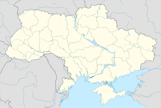
Ternopil Oblast
Western Ukrainian oblast with Eurasia's longest cave and 34 castles.

Ternopil Oblast is a province (oblast) of Ukraine, located in the western part of the country. Its administrative center is the city of Ternopil, through which flows the Seret River, a tributary of the Dniester. The oblast is notable for its extensive cave systems, including the longest cave in Eurasia, and for its historical role as a contested borderland between various empires and states.
Quick Facts
- Official Name
- Ternopilska oblast
- Nicknames
- uk · Тернопілля (uk · Ternopillia), uk · Тернопільщина (uk · Ternopilshchyna)
- Settlement Type
- Oblast
- Flag Alt
- Flag of Ternopil Oblast
- Shield Alt
- Coat of arms of Ternopil Oblast
- Parts Type
- Largest cities
- Parts Style
- para
- Seat Type
- Administrative center
- Seat
- Ternopil
- Leader Title
- Governor
- Leader Name
- Taras Pastukh
Facts from the source article.
Lore & Background
Ternopil Oblast was created during World War II, on December 4, 1939, when the Soviet Union replaced the Polish voivodeship division with the existing Soviet administrative division. The oblast was established primarily from the Tarnopol Voivodeship, with small parts from the Volhynian Voivodeship (e.g., the Kremenets area). During the Nazi invasion of the Soviet Union, Ternopil became a site of fierce fighting due to its importance as a rail transportation hub. Under German occupation, the region (except its Volhynian portion) became part of the District of Galicia under the General Government. After the war, most ethnic Poles in the region were forcibly relocated to Poland, and Soviet authorities encouraged ethnic Russians to settle in the area, though western Ukraine remained considerably less Russian than eastern Ukraine.
Reader's Guide
Ternopil Oblast holds significance as a region of complex historical affiliations, having been part of the Principality of Galicia-Volhynia, the Kingdom of Poland, the Polish–Lithuanian Commonwealth, the Habsburg monarchy, the Russian Empire, the Second Polish Republic, and the Soviet Union before becoming part of independent Ukraine in 1991. Its geography features the Podilian Upland, the Dniester Canyon, and over 100 discovered caves, with Optymistychna Cave being the longest in Eurasia and fifth-longest in the world. The oblast contains 34 castles, with Zbarazh Castle noted for its 17th-century standoff between Bohdan Khmelnytsky's troops and the Polish–Lithuanian Commonwealth army. Twenty percent of its land is chernozem soil. The oblast's creation during World War II and its subsequent demographic changes reflect the broader upheavals of 20th-century Eastern European history.
Did You Know?
- Optymistychna Cave, at 267 km, is the longest cave in Eurasia and the fifth-longest in the world.
- The Dniester Canyon, passing through the oblast, stretches for 250 km and is considered one of the wonders of Ukraine.
- Ternopil Oblast has over 100 discovered caves, believed to be only 20% of all possible caves in the region.
- The oblast was originally named Tarnopol Oblast when established on December 4, 1939.
More in Ukrainian Oblasts 1-24
Spotted an error? Know more?
Reader corrections go straight into our review queue. Suggest an edit · How this site is sourced