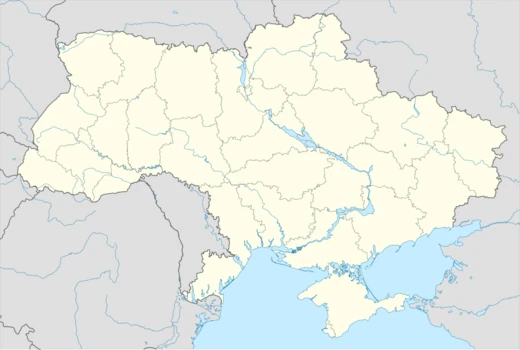
Luhansk Oblast
Easternmost Ukrainian oblast, site of prolonged conflict since 2014.

Luhansk Oblast is the easternmost province of Ukraine, established in 1938. It is located in the Donbas region and has been a focal point of conflict since 2014, when Russian-backed separatists declared the Luhansk People's Republic, leading to war with Ukrainian forces. During the 2022 Russian invasion, the oblast came almost entirely under Russian occupation, with heavy fighting continuing in some areas.
Quick Facts
- Nicknames
- Eastern gate of Ukraine, dawn of Ukraine, uk · Луганщина / (uk · Luhanshchyna), uk · Лугань (uk · Luhan)
- Settlement Type
- OblastAnnexed by Russia as Luhansk People's Republic
- Shield Alt
- Coat of arms of Luhansk Oblast
- Parts Type
- Largest cities
- Parts Style
- para
- Established Title
- Established
- Established Date
- 3 June 1938
- Seat Type
- Administrative center
- Seat
- Luhansk (de jure) / Sievierodonetsk (de facto, 2014–2022)
- Leader Title
- Governor
Facts from the source article.
Lore & Background
Luhansk Oblast was created in 1938 as Voroshylovhrad Oblast from parts of Donetsk Oblast and Kharkiv Oblast. During World War II, the region was occupied by Nazi Germany in 1942 and liberated in 1943. It bore the name Voroshilovgrad Oblast until 1958 and again from 1970 to 1991. In the December 1991 referendum, 83.86% of votes in the oblast supported Ukrainian independence.
In April 2014, pro-Russian separatists occupied the administrative building in Luhansk and declared the Luhansk People's Republic (LPR). A disputed referendum on separation from Ukraine was held on 11 May 2014, not recognized by any government. The war in Donbas followed, with insurgents controlling the southern third of the oblast, including the city of Luhansk, forcing most government functions to move to Sievierodonetsk.
During the 2022 Russian invasion, Russian forces entered the oblast on 22 February 2022 and by 3 July 2022 controlled all cities. In late September 2022, Russia declared the annexation of the entire oblast, though this remains internationally unrecognized. Russian-backed officials have periodically claimed the capture of the last Ukrainian-held areas, though Ukraine has consistently denied these claims.
Reader's Guide
Luhansk Oblast holds significance as a key region in the Donbas, Ukraine's industrial heartland, and as a central theater of the Russo-Ukrainian conflict since 2014. Its contested status—partially controlled by Russian-backed separatists from 2014 and almost entirely occupied by Russia after 2022—illustrates the broader geopolitical struggle over Ukraine's sovereignty. The oblast's administrative center, Luhansk, and major cities like Sievierodonetsk and Lysychansk witnessed some of the most intense battles of the war. The internationally unrecognized annexation by Russia in September 2022 underscores the ongoing dispute. The region's history, from its Soviet-era origins as Voroshilovgrad Oblast to its role in the Katyn massacre site at Starobilsk, adds layers to its legacy. The oblast's geography, straddling the Siversky Donets river and bordering Russia, has made it a strategic prize. Despite Russian claims of full control, Ukraine has denied these assertions, and fighting has continued in western parts of the region.
Did You Know?
- Luhansk Oblast was originally established in 1938 as Voroshylovhrad Oblast, named after Soviet official Kliment Voroshilov.
- The oblast has the longest segment of Ukraine's international border with Russia, totaling 746 km.
- In a December 2014 survey, 84.1% of the oblast's population (excluding insurgent-controlled areas) did not support joining Russia.
- The highest point in the oblast is Mohyla Mechetna, at 367 meters, part of the Donetsk Ridge.
Geography & Physical Landscape
Nestled in the far eastern reaches of Ukraine, Luhansk Oblast stretches 250 kilometres from north to south and 190 from east to west, encompassing 26,700 square kilometres—roughly 4.42 percent of the nation's total land area. The region commands the longest stretch of Ukraine's international frontier with Russia, a 746-kilometre boundary that touches three Russian oblasts: Belgorod to the north, Voronezh to the northeast, and Rostov to the east. Within Ukraine, it abuts Kharkiv Oblast on the western side and Donetsk Oblast to the south, placing it entirely within the broader Donbas region. The Siversky Donets River carves a west-to-east path through the heart of the oblast, effectively dividing it into two halves. South of the river, the land rises along the Donetsk Ridge, whose summit at Mohyla Mechetna reaches 367 metres. North of the waterway, the terrain flattens into the Starobilsk Plain, which gradually transitions into the Central Russian Upland as one travels further northward.
Soviet Origins & Wartime Turmoil
Formed in 1938 when the larger Donetsk Oblast was divided, the new province was christened Voroshilovgrad Oblast in honour of Soviet military leader Kliment Voroshilov. It would keep that name until 1958, then briefly carry the Luhansk title before reverting to Voroshilovgrad from 1970 until the collapse of the Soviet Union in 1991. The region's wartime history is marked by successive occupations and brutal violence. After the Soviet invasion of Poland, Starobilsk hosted a prisoner-of-war camp where Polish captives were later killed in the 1940 Katyn massacre. Nazi Germany seized the area in late 1942 during the Case Blue offensive aimed at Stalingrad, and German military administration governed the region due to its proximity to active frontlines. The Soviet counter-offensive known as Operation Little Saturn brought the region back under Red Army control in spring 1943, with full liberation from German forces achieved by that summer. In the December 1991 independence referendum, a decisive 83.86 percent of the oblast's voters backed Ukraine's Declaration of Independence.
The 2014 Separatist Uprising
In the wake of Russia's annexation of Crimea in early 2014, pro-Russian militants seized the oblast's administrative building in Luhansk on 8 April. After a brief attempt to establish a Luhansk Parliamentary Republic collapsed, the separatists proclaimed the Luhansk People's Republic on 27 April and held a widely disputed referendum on 11 May. No government recognised the vote; the European Union and the United States labelled it illegal and fraudulent. The resulting Donbas war left the insurgents in control of the southern third of the oblast, including the capital city itself. In response, the Ukrainian government relocated most administrative functions to Sievierodonetsk, which was recaptured in July 2014, and universities in occupied zones shifted to cities such as Starobilsk and Rubizhne. A December 2014 survey by the Kyiv International Institute of Sociology revealed that only 5.7 percent of the oblast's population supported joining Russia, while 84.1 percent opposed the idea—though the insurgent-held areas were excluded from the poll.
Full-Scale Invasion & Ongoing Occupation
Before the 2022 full-scale Russian invasion, the oblast was home to an estimated 2,102,921 people. Russian ground forces crossed the border into the already occupied portion of the region on 22 February 2022, and two days later pushed into government-controlled territory across the line of contact. By 26 May, Russian troops held all but five percent of the oblast. The fiercest fighting of the eastern offensive came in May and June 2022 during the battles for Sieverodonetsk and Lysychansk, widely regarded as among the most intense engagements of the campaign. By 3 July, Russian and allied forces controlled every city in the region. In late September 2022, Moscow declared the annexation of the entire oblast alongside three others, a move that remains internationally unrecognised. Russian-backed officials later claimed in July 2025 that the last Ukrainian-held pockets had fallen, a statement repeated in April 2026 and denied by Kyiv. Heavy combat, however, has continued in parts of the oblast.
More in Ukrainian Oblasts 1-24
Spotted an error? Know more?
Reader corrections go straight into our review queue. Suggest an edit · How this site is sourced