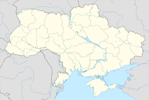
Dnipropetrovsk Oblast
Prydniprovya — Land by the Dnieper

Dnipropetrovsk Oblast is an oblast in Ukraine, established on 27 February 1932. Its administrative center is Dnipro. The largest cities include Dnipro, Kryvyi Rih, Kamianske, and Nikopol. The oblast is nicknamed Prydniprovya ("Land by the Dnieper").
Quick Facts
- Official Name
- Dnipropetrovska oblast
- Nickname
- Prydniprovya ("Land by the Dnieper")
- Settlement Type
- Oblast
- Flag Alt
- Flag of Dnipropetrovsk Oblast
- Shield Alt
- Coat of arms of Dnipropetrovsk Oblast
- Parts Type
- Largest cities
- Parts Style
- para
- Established Title
- Established
- Established Date
- 27 February 1932
Facts from the source article.
Lore & Background
Historically, Dnieper Ukraine comprised territory that roughly corresponded to the area of Ukraine within the expanding Russian Empire. Ukrainians sometimes call it Great Ukraine (Velyka Ukraina). This region is tightly entwined with the history of Ukraine and is considered the heart of the country.
Reader's Guide
The oblast has several colleges and universities, including Dnipro State Medical University, Alfred Nobel University, Oles Honchar Dnipro National University, Dnipro Polytechnic, State Chemical Technology University of Ukraine, Dnipro Institute of Infrastructure and Transport, Prydniprovska State Academy of Civil Engineering and Architecture, Dnipro State University of Internal Affairs, National Metallurgical Academy of Ukraine, Dnipro Medical Institute of Conventional and Alternative Medicine, Dniprovskyi State Technical University, Kryvyi Rih National University, Kryvyi Rih State Pedagogical University, and Kryvyi Rih State University of Economics and Technology. The region houses the Ukrainian Premier League football club FC Dnipro. Kryvyi Rih was home to the football team Kryvbas Kryvyi Rih. FC Hirnyk Kryvyi Rih is a club based in Kryvyi Rih. SC Kryvbas is a professional basketball club. Dnipro-Arena has a capacity of 31,003 people and hosted a 2010 FIFA World Cup qualification game. Dnipropetrovsk has a regional federation within Ukrainian bandy and Rink Bandy Federation. Petrykivka painting, originating from the village of Petrykivka, is included in the UNESCO Representative List of the Intangible Cultural Heritage of Humanity.
Did You Know?
- The oblast is named after the Communist leader of Ukraine Grigory Petrovsky and is thus to be renamed.
- Ukrainian (67.0%) and Russian (31.9%) are both used, with Russian more common in cities and Ukrainian dominant in rural communities.
- The region possesses major deposits of iron ore and other metallurgical ores.
- ArcelorMittal Kryvyi Rih is the largest private company by revenue in Ukraine.
- Notable people from the oblast include Leonid Brezhnev, Leonid Kuchma, Yulia Tymoshenko, Volodymyr Zelensky, and Oksana Baiul.
Industrial Heartland of Eastern Europe
Dnipropetrovsk Oblast stands as Ukraine's most critical industrial province, a distinction rooted in the extraordinary mineral wealth of its Dnieper Upland. The region holds major deposits of iron ore, manganese, granite, graphite, brown coal, and kaolin, resources that have shaped its economic identity for generations. At the center of this industrial landscape lies Kryvbas, widely regarded as the principal iron ore region of all Eastern Europe. Named after the city of Kryvyi Rih, this mining base stretches across the southwestern portion of the oblast and spills into small adjacent areas of the neighboring Kirovohrad and Kherson oblasts. To harness these vast reserves, several large-scale mining enterprises were established during the mid-twentieth century, the majority concentrated in Kryvyi Rih itself. That city holds a remarkable geographic distinction: it is the longest urban settlement in Europe, spanning roughly 67 kilometers in a straight line from one extremity to the other. The steel industry built atop Kryvbas's iron ore has made the oblast not merely a Ukrainian industrial pillar but a continental one, anchoring the region's identity in heavy manufacturing and resource extraction.
A Land Written in Deep Time
The geological story of Dnipropetrovsk Oblast stretches across nearly the entire history of Earth. Much of the territory sits within the Ukrainian Shield, while the northern reaches and the far eastern edge fall within the southeastern margin of the Dnipro-Donets depression. Rock formations in the region span the archaea, the Proterozoic, the Paleozoic, the Mesozoic, and the Cenozoic eras, making it a living archive of planetary evolution. One of the most striking features is the Ternivsky meteorite crater near the town of Terny. Measuring 11 kilometers in diameter, it is estimated to be 280 plus or minus 10 million years old, placing its formation in the Permian period. Remarkably, the crater is not exposed at the surface; it lies buried beneath younger sedimentary layers. The Black Sea Lowland occupies roughly half the oblast's territory on the west bank of the Dnieper, while the Dnieper Upland rises on the eastern side, harboring the mineral deposits that would later define the region's industrial character. The oblast covers 31,974 square kilometers, about 5.3 percent of Ukraine's total land area, stretching 300 kilometers from east to west and 130 kilometers from north to south.
Cossacks, Fortresses, and the Forging of a Region
Long before modern administrative boundaries, the Dnieper corridor through this region was a theater of cultural and military upheaval. Slavic settlements first appeared along its banks between the sixth and eighth centuries, and during the era of Kievan Rus' the river served as a vital trade artery linking the Baltic to Constantinople along the route called 'from the Varangians to the Greeks.' In the fifteenth century, after the Grand Duchy of Lithuania pushed Tatar tribes from the right bank, the Nogai and the Crimean Khanate moved in, drawing their shared border along the Dnieper itself. Into this volatile landscape emerged the Cossacks, armed free men answering to no feudal lord, who came to dominate the area and took the name Zaporozhian Cossacks from the lands south of the rapids. Their raids and the broader conflict turned the Pontic steppe into what contemporaries called the 'Wild Fields.' In 1635 the Polish government erected the Kodak fortress above the Dnieper Rapids, but Cossacks under Ivan Sulyma seized and burned it within days. Rebuilt in 1638 by French engineer Guillaume Le Vasseur de Beauplan, the fort fell to the Zaporozhians in 1648 and was demolished under the Treaty of the Pruth in 1711.
Imperial Reorganization and the Birth of Modern Dnipro
The eighteenth century brought sweeping imperial reorganization to the region. Under the Treaty of Pereyaslav in 1654, the territory had entered the sphere of influence of the Moscow-based Tsardom of Russia, but it was not until the late 1770s that the landscape was fundamentally reshaped. In 1774 Prince Grigori Potemkin was appointed governor of Novorossiysk Governorate, and following the destruction of the Zaporozhian Sich in 1775, he launched a program of founding new cities and attracting foreign settlers. The city of Yekaterinoslav, the precursor to present-day Dnipro, was established in 1776, though not at its current site but at the confluence of the Samara and Kil'chen' rivers at Loshakivka, north of the Dnieper. In December 1796, Emperor Paul I re-established the Novorossiysk Governorate, and by 1802 the province was split into the Kherson, Yekaterinoslav, and Taurida governorates, with Yekaterinoslav serving as the capital of its own province. The oblast as a formal administrative unit was not created until 27 February 1932, when it was carved out of the existing territorial structure. Today it carries a population of roughly 3.1 million, with about four-fifths concentrated in major urban centers including Dnipro, Kryvyi Rih, Kamianske, Nikopol, and Pavlohrad.
More in Ukrainian Oblasts 1-24
Spotted an error? Know more?
Reader corrections go straight into our review queue. Suggest an edit · How this site is sourced