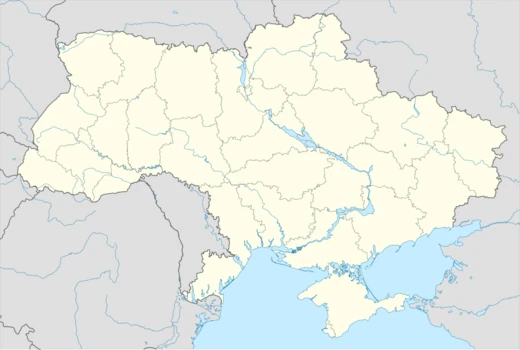
Khmelnytskyi Oblast
Oblast in western Ukraine, created in 1937.

Khmelnytskyi Oblast is a province in western Ukraine, covering portions of the historical regions of western Podolia and southern Volhynia. Created in 1937 as Kamianets-Podilskyi Oblast, it was renamed in 1954 after its administrative center was renamed Khmelnytskyi. The oblast has a population of around 1,228,829 (2022 estimate) and is known for its diverse geography, including the Podolian Upland and the Tovtry range.
Quick Facts
- Official Name
- Khmelnytska oblast
- Nickname
- uk · Хмельниччина (uk · Khmelnychchyna)
- Settlement Type
- Oblast
- Flag Alt
- Flag of Khmelnytskyi oblast
- Shield Alt
- Coat of arms of Khmelnytskyi oblast
- Established Title
- Established
- Established Date
- 22 September 1937
- Seat Type
- Administrative center
- Seat
- Khmelnytskyi
- Leader Title
- Governor
- Leader Name
- Serhii Tiurin
Facts from the source article.
Lore & Background
Khmelnytskyi Oblast was created on September 22, 1937, as the Kamianets-Podilskyi Oblast out of border okruhas of Vinnytsia Oblast. Its administrative center was initially Kamianets-Podilskyi until March 1941, when it moved to Proskuriv. During World War II, from 1941 to 1944, the territory was under Nazi Germany occupation and part of the Reichskommissariat Ukraine. Following the Kamenets-Podolsky pocket in spring 1944, Soviet troops removed the German occupation. In 1954, Proskuriv was renamed Khmelnytskyi, and the oblast was renamed accordingly.
Reader's Guide
Khmelnytskyi Oblast holds significance as a region that bridges the historical areas of Podolia and Volhynia. Its creation in 1937 and subsequent renaming reflect Soviet administrative changes. The oblast's geography includes the highest point in the region, Mount Velyka Buhaikha, and the Dniester Reservoir as its lowest point. Demographically, the oblast is predominantly Ukrainian-speaking, with a 2022 population of about 1.23 million. Its legacy includes a shift from Russification to Ukrainization after 1991, with recent measures strengthening the Ukrainian language in public life.
Did You Know?
- The oblast was originally called Kamianets-Podilskyi Oblast until 1954.
- Its highest point is Mount Velyka Buhaikha at 409 meters above sea level.
- The Dniester River valley is the lowest point in the oblast at 121 meters.
- According to the 2001 census, ethnic Ukrainians made up 93.9% of the population.
Geography & Topography
Stretching across 20,600 square kilometres—about 3.4 percent of Ukraine's total land area—Khmelnytskyi Oblast occupies a distinctive position in the country's western quadrant. Measuring 220 kilometres north to south and 120 east to west, the province sits between the 48th and 50th parallels of north latitude. What makes its geography particularly striking is the near-even split between two historic cultural zones: the northern half belongs to Volhynia, home to smaller settlements like Iziaslav, Starokostiantyniv, and Shepetivka, while the southern half falls within Podolia, where the more developed cities of Khmelnytskyi and Kamianets-Podilskyi anchor the landscape. Topographically, the central belt is defined by the Podolian Upland, rising between 270 and 370 metres. The Volyn highland to the northwest reaches 329 metres, while the Polissia zone to the north stays lower at 200 to 250 metres. The southwestern corner is crossed by the Tovtry range, whose peak, Mount Velyka Buhaikha, marks the oblast's highest point at 409 metres. At the opposite extreme, the Dniester Reservoir in the far south dips to just 121 metres. The water network is extensive: 120 rivers of at least 10 kilometres thread through the territory, led by the Dniester and the Southern Buh, along with tributaries and Dnieper-basin rivers. Nearly 1,900 ponds and reservoirs dot the landscape, the largest being Shchedrivske at 12.58 square kilometres.
Historical Formation & Wartime
Khmelnytskyi Oblast was formally established on September 22, 1937, when the Soviet government carved the Proskuriv and Kamianets-Podilskyi border okruhas out of Vinnytsia Oblast and reconstituted them as the Kamianets-Podilskyi Oblast. For its first few years, the province's administrative heart was the city of Kamianets-Podilskyi. However, in March 1941, just months before the German invasion, the centre of government was relocated to the smaller city of Proskuriv. The outbreak of World War II upended everything: between 1941 and 1944 the entire territory fell under Nazi occupation and was absorbed into the Reichskommissariat Ukraine, specifically the Wolhynien und Podolien general district. Liberation came in the spring of 1944, when Soviet forces broke through the Kamenets-Podolsky pocket as part of the larger Proskurov-Chernovtsy operation, restoring the oblast to its original borders. The region's identity was reshaped once more on February 4, 1954, when Proskuriv was officially renamed Khmelnytskyi in honour of Bohdan Khmelnytskyi. The oblast itself soon followed suit, shedding its Kamianets-Podilskyi name and adopting the Khmelnytskyi designation that persists to this day.
Administrative Structure & Governance
Today, Khmelnytskyi Oblast is divided into three raions, or administrative districts, encompassing a total of 13 cities, 24 towns, and more than 1,417 villages. The subnational governance framework also includes 60 hromadas—local community units that form the grassroots layer of Ukrainian administration. The oblast's single administrative centre is the city of Khmelnytskyi, which also serves as the seat of the Khmelnytskyi Regional Council, the body that oversees local governance across the province. The governor of the oblast holds the position of Regional Council speaker and is appointed by the President of Ukraine, linking the regional administration directly to the national executive. Geographically, the oblast is bordered by five neighbouring provinces: Rivne to the northwest, Zhytomyr to the northeast, Vinnytsia to the east, Chernivtsi to the south, and Ternopil to the west. The two historic halves of the region carry different urban character. The Volhynian north clusters around smaller, historically significant towns such as Iziaslav, Starokostiantyniv, and Shepetivka, while the Podolian south is anchored by the larger, more economically developed cities of Khmelnytskyi and Kamianets-Podilskyi.
Demographics & Language
Khmelnytskyi Oblast's population stood at approximately 1,228,829 according to the 2022 estimate, though earlier figures from 2004 recorded 1,401,140 residents, ranking the province 13th by population in Ukraine. The population density works out to roughly 69.5 people per square kilometre. The ethnic composition, as recorded in the 2001 census, is overwhelmingly Ukrainian at 93.9 percent, with ethnic Russians accounting for 3.6 percent and ethnic Poles for 1.6 percent. The gender balance tilts noticeably toward women: 770,900 females (53.9 percent) compared with 659,900 males (46.1 percent). Urban and rural populations are almost evenly split, with 729,600 residents (51 percent) living in cities and 701,200 (49 percent) in the countryside. Demographic pressures are significant: pensioners number 453,800, representing 31.7 percent of the population, while the birth rate of 8.3 per 1,000 residents falls well below the death rate of 16.1 per 1,000. On the linguistic front, the Soviet-era Russification campaign left a visible mark: between the 1970 and 1989 censuses, the share of native Ukrainian speakers in the oblast gradually declined while the proportion of Russian speakers rose, a trend that reflected broader patterns across the Ukrainian SSR.
More in Ukrainian Oblasts 1-24
Spotted an error? Know more?
Reader corrections go straight into our review queue. Suggest an edit · How this site is sourced