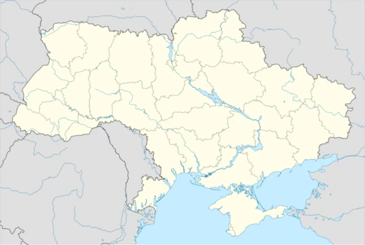
Kirovohrad Oblast
Central Ukrainian oblast with a contested name and rich Cossack history.

Kirovohrad Oblast, often called Kirovohradshchyna, is a province in central Ukraine. Its capital is the city of Kropyvnytskyi. The region is the country’s second least populated oblast, after Chernivtsi. In 2019, Ukraine’s Constitutional Court approved renaming it Kropyvnytskyi Oblast (sometimes referred to as Kropyvnychchyna), but this change has not yet taken effect. The largest cities are Kropyvnytskyi, Oleksandriia, Znamianka, and Svitlovodsk.
The province covers 24,600 square kilometers. The town of Dobrovelychkivka marks the geographical center of Ukraine. Most of the area lies within historic Right-bank Ukraine and Zaporizhzhia, while its western edges belong to historic Podolia.
The earliest known inhabitants of these lands were the Scythians. During the Kyivan Rus’ period, the East Slavic Ulichi tribe lived here. After the Battle of Blue Waters freed the former Kyivan Rus’ from Tatar control, and the principalities of Kyiv, Pereyaslav, and Chernihiv united with the Grand Duchy of Lithuania, the southeastern borders needed protection from the Crimean Khanate—a steppe remnant of the Golden Horde that emerged in the late 15th century. To guard this frontier, Dmytro Vyshnevetsky established the first Zaporozhian Sich on Khortytsia Island, giving rise to the Ukrainian Cossacks. The Zaporozhians founded many villages in what is now Kirovohrad Oblast. From 1569, the territory was part of the Kingdom of Poland within the Polish–Lithuanian Commonwealth. From the 15th to the 18th centuries, these lands were ruled by the Ukrainian Cossacks of the Hetmanate and the Zaporozhian Sich.
After the Russian government crushed the Cossacks and imposed serfdom in the late 18th century, the area came under direct Russian control. In 1752, the territory of New Serbia was established, with its capital at Novomyrhorod. During the 1800s, the noble Skarżyński family owned most of the land and played a key role in regional development, focusing on agriculture and opening a school in Migeya dedicated to farming.
The oblast was created on January 10, 1939, as part of the Ukrainian SSR, formed from the northern raions of Mykolaiv Oblast. Before that, its territory mostly belonged to Kherson Governorate (with a smaller part in Podolia Governorate) until 1925. Earlier, in 1918, there were plans for a Ukrainian administrative division that would have split the area among the lands of Nyz, Pobozhia, and Cherkasy. During Soviet repressions, over 40,000 residents were killed. In World War II, the oblast was under Nazi occupation from 1941 to 1944 and was liberated during the Kirovograd offensive. In 1954, the oblast lost some raions to the newly formed Cherkasy Oblast but later that year gained western raions from Odesa Oblast.
From 1939 to 2016, the administrative center was called Kirovohrad, named after Sergei Kirov, the First Secretary of the Leningrad City Committee of the Communist Party. Under decommunization laws, the city was renamed Kropyvnytskyi on July 14, 2016. The oblast itself kept its name because it is specified in the Constitution of Ukraine, and renaming requires a constitutional amendment by the Verkhovna Rada. On June 20, 2018, the parliamentary committee on state building backed the renaming proposal. In February 2019, the Constitutional Court ruled the bill constitutional. The local Oblast Council supported the change in March 2021, but the process stalled in parliament. In September 2022, the council asked the Verkhovna Rada to speed things up. In August 2025, Oleksandr Alfiorov, head of the Ukrainian Institute of National Memory, stated that constitutional changes for both Kirovohrad and Dnipropetrovsk Oblasts are planned but can only be implemented after martial law ends.
According to the 2001 census, ethnic Ukrainians made up 90.1% of the population, and ethnic Russians 7.5%. The same census showed Ukrainian as the native language for nearly 89% of residents. Ukrainian dominated in all city and town councils and in the vast majority of village councils. Russian was dominant in six village councils, five of which had a Ukrainian-speaking minority of over 20%. All these Russian-speaking councils were surrounded by Ukrainian-speaking ones. During the Soviet era, Russification caused the share of Ukrainian speakers to decline between the 1970 and 1989 censuses, while Russian speakers increased. Ukrainian remains the only official language across the entire oblast.
Quick Facts
- Official Name
- Kirovohradska oblast
- Nickname
- uk · Кіровоградщина (uk · Kirovohradshchyna)
- Settlement Type
- Oblast
- Flag Alt
- Flag of Kirovohrad Oblast
- Shield Alt
- Coat of arms of Kirovohrad Oblast
- Parts Type
- Largest cities
- Parts Style
- para
- Established Title
- Established
- Established Date
- 10 January 1939
- Seat Type
- Administrative center
- Seat
- Kropyvnytskyi
- Leader Title
- Governor
Facts from the source article.
Lore & Background
The lands of modern Kirovohrad Oblast were first inhabited by Scythians. During the Middle Ages, the East Slavic tribe of Ulichis lived here. After the Battle of Blue Waters, the region became part of the Grand Duchy of Lithuania, and later the Zaporozhian Cossacks founded many villages in the area. From 1569, the territory was part of the Kingdom of Poland within the Polish–Lithuanian Commonwealth, and from the 15th to 18th centuries it was under the rule of the Ukrainian Cossacks of the Hetmanate and Zaporozhian Sich. In 1752, the territory of New Serbia was founded with its capital in Novomyrhorod. In the 1800s, the noble Skarżyński family owned most of the land and emphasized agricultural development, opening a school in Migeya.
Reader's Guide
Kirovohrad Oblast holds significance as a region that encapsulates key transitions in Ukrainian history: from Scythian and Kyivan Rus' settlements, through Cossack self-rule, to incorporation into the Russian Empire and later the Soviet Union. Its administrative center, Kropyvnytskyi, was renamed in 2016 as part of decommunization, but the oblast's name remains unchanged pending a constitutional amendment. The oblast is notable for containing the geographical center of Ukraine at Dobrovelychkivka. Its demographic profile shows a strong Ukrainian ethnic majority, and language surveys indicate a steady shift toward Ukrainian usage in daily life and education since independence. The region also suffered heavily during Soviet repressions, with over 40,000 residents killed, and was under Nazi occupation from 1941 to 1944.
Did You Know?
- The city of Dobrovelychkivka is the geographical center of Ukraine.
- Over 40,000 residents of the region were killed during Soviet repressions.
- The oblast was created on January 10, 1939, primarily from parts of Odesa, Dnipropetrovsk, and Poltava oblasts.
- In 2019, the Constitutional Court of Ukraine approved renaming the oblast to Kropyvnytskyi Oblast, but the change is not yet implemented.
More in Ukrainian Oblasts 1-24
Spotted an error? Know more?
Reader corrections go straight into our review queue. Suggest an edit · How this site is sourced