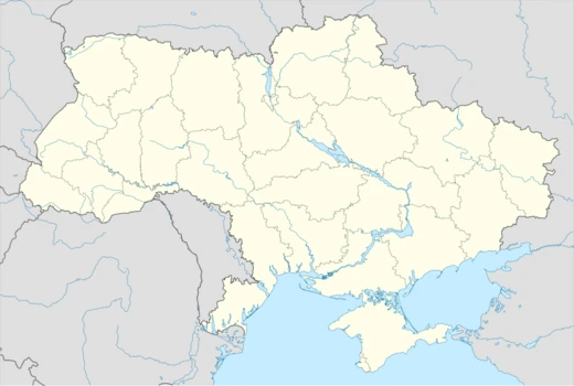
Mykolaiv Oblast
Oblast in southern Ukraine, site of major Holocaust killings.

Mykolaiv Oblast is a province (oblast) of Ukraine, with its administrative center in the city of Mykolaiv. It is historically significant as a region of shifting borders and diverse cultural influences, and it was a major site of the Holocaust during World War II.
Quick Facts
- Official Name
- Mykolaivska oblast
- Nickname
- uk · Миколаївщина (uk · Mykolaivshchyna)
- Settlement Type
- Oblast
- Flag Alt
- Flag of Mykolaiv Oblast
- Shield Alt
- Coat of arms of Mykolaiv Oblast
- Parts Type
- Largest cities
- Parts Style
- para
- Seat Type
- Administrative center
- Seat
- Mykolaiv
- Leader Title
- Governor
Facts from the source article.
Lore & Background
Mykolaiv Oblast was established within Soviet Ukraine in 1937. Historically, its territory was ruled by Scythia, ancient Greeks, the Khazars, the Mongol Empire, the Grand Duchy of Lithuania, the Crimean Khanate, the Ottoman Empire, and the Russian Empire. A historically disputed tripoint of the Polish–Lithuanian Commonwealth, the Ottoman Empire, and Russia is sometimes claimed at present-day Pervomaisk, but the actual tripoint was located near the Dniester River.
Jewish communities developed in the region during the Russian Empire, when it was part of the Pale of Settlement. The city of Mykolaiv, founded in 1789, had a large Jewish community. In 1829, the Russian government prohibited most Jews from residing there due to its naval base status, but restrictions were removed in 1866. By 1897, Jews made up 21.8 percent of Mykolaiv's population. Under Soviet rule, traditional institutions were restricted, and by 1939, 25,280 Jews lived in Mykolaiv.
During World War II, the territory was divided between German and Romanian occupation zones. In the Romanian-administered Transnistria Governorate, Golta County became a major center of mass murder. The largest killing camp was Bogdanovka, where around 40,000–55,000 Jews were confined and tens of thousands murdered starting December 1941. At Domanovka, about 18,000 Jews were murdered by February 1942. The Red Army recaptured the region in spring 1944.
Reader's Guide
Mykolaiv Oblast's significance lies in its role as a crossroads of empires and a site of profound tragedy during the Holocaust. The region's history reflects the shifting borders of Eastern Europe, from ancient Greek colonies to the Russian Empire and Soviet Ukraine. The Jewish communities that flourished there were largely destroyed during World War II, with the oblast containing some of the most notorious killing sites of the Holocaust, including Bogdanovka, Domanovka, and Akhmechetka. These camps, operated by Romanian authorities and German units, resulted in the deaths of tens of thousands of Jews, as well as Roma deportees. The postwar period saw a return of Jewish survivors, but Soviet restrictions and later emigration led to a decline in population. During the 2022 Russian invasion, the oblast was partially occupied but largely remained under Ukrainian control after Russian forces were repulsed at Voznesensk and Mykolaiv. The oblast's legacy is one of resilience and remembrance, with its history serving as a testament to the human cost of war and persecution.
Did You Know?
- At Bogdanovka, around 40,000–55,000 Jews from Odesa and surrounding areas were confined, and tens of thousands were murdered starting on 21 December 1941.
- Romanian authorities deported an estimated 25,000 Roma to Transnistria, including locations in and around Golta County, of whom at least 11,000 died.
- During the 2022 Russian invasion, Russian forces were repulsed at Voznesensk, and their attempt to capture Mykolaiv failed.
Identity & Demographics
Mykolaiv Oblast, known affectionately in Ukrainian as Mykolaivshchyna, is a province of Ukraine whose administrative heart is the city of Mykolaiv. The oblast's population stood at roughly 1,091,821 according to the 2022 estimate, making it a region of considerable human density for a single province. The capital city, first established in 1789, grew into a significant port and shipbuilding center, anchoring the oblast's economic and cultural life. The region stretches along the Southern Bug river, a waterway that has long shaped settlement patterns, trade, and the movement of peoples through the territory. The very name Mykolaivshchyna carries a sense of rooted belonging, distinguishing the oblast not merely as an administrative unit but as a community of place with its own linguistic and cultural resonance within the broader Ukrainian landscape.
Ancient & Medieval Layers
The territory encompassed by modern Mykolaiv Oblast has served as a contested crossroads for millennia. A remarkable succession of powers claimed dominion over the land, including the Scythians, ancient Greek colonists, the Bulgar polity of Old Great Bulgaria, the Khazar Khaganate, Kipchak nomads, the Mongol Empire, the Grand Duchy of Lithuania, the Crimean Khanate, the Ottoman Empire, the Kingdom of Poland, and ultimately the Russian Empire. Two settlements stand out as enduring witnesses to this layered past. Ancient Olbia, a Greek colonial foundation on the Black Sea coast, testifies to Hellenic ambition reaching into the steppe. The late medieval port of Ochakiv, by contrast, represents a later era of commercial and strategic importance. Together they bookend a span of history in which the oblast's landscape absorbed Greek, nomadic, Turkic, and Slavic influences, all of which remain embedded in the geography and memory of a single Ukrainian province.
Pervomaisk: The Tripoint City
No location within the oblast more vividly captures the region's geopolitical complexity than Pervomaisk, the oblast's second-largest city. During the late 17th and 18th centuries, the site occupied the precise tripoint where the borders of the Polish-Lithuanian Commonwealth, the Ottoman Empire, and the Russian Empire met. The modern city is a physical amalgamation of three distinct settlements that once belonged to rival empires: the Polish town of Bohopol, the Russian town of Olviopol, and the Ottoman settlement of Holta, later known as Golta. Each community brought its own religious traditions, administrative customs, and cultural practices into a shared urban space. This origin makes Pervomaisk a living monument to an era when three great powers pressed against one another along the northern Black Sea shore, their competing territorial claims crystallized in the very neighborhoods and streets of a single city that endures today.
Jewish Community & the Holocaust
The Jewish presence in Mykolaiv and the wider oblast was a defining element of regional social life for over a century. After the Russian Empire lifted its 1829 ban on Jewish residence in the naval port, the community grew from 8,325 in 1880 to over 20,000 by 1897, sustaining synagogues, schools, and charitable societies. By 1939 the population reached 25,280. The devastation of World War II shattered this community almost entirely. German forces occupied Mykolaiv in August 1941, and by September roughly 7,000 Jews were murdered near the city. West of the Southern Bug, the territory fell under Romanian control as part of Transnistria, where Golta County became a center of mass killing. At Bogdanovka, Domanovka, and Akhmechetka, tens of thousands of Jews from Odesa, Bessarabia, Bukovina, and local communities were confined, starved, and systematically murdered between late 1941 and early 1942. The prewar community of more than 25,000 was largely annihilated.
More in Ukrainian Oblasts 1-24
Spotted an error? Know more?
Reader corrections go straight into our review queue. Suggest an edit · How this site is sourced