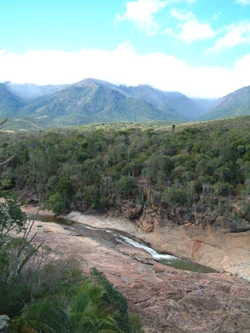
Tsingy de Bemaraha Strict Nature Reserve
UNESCO site with sharp limestone formations and unique wildlife.

Tsingy de Bemaraha Strict Nature Reserve sits near Madagascar’s western coast, in the Melaky Region. It earned UNESCO World Heritage status in 1990 for its distinctive landscape, intact mangrove forests, and populations of wild birds and lemurs. The reserve is known for its needle-like limestone spires rising above cliffs that overlook the Manambolo River. These razor-sharp rock formations can slice through gear and skin, making travel across them extremely hazardous. The name “Tsingy” comes from a local term meaning “the place where one cannot walk barefoot.”
In 1997, the southern part of the protected area was redesignated as Tsingy de Bemaraha National Park, while the northern section remained a strict nature reserve. The boundaries were last updated in 2011. Tourists can reach the national park by road from Morondava, a town 150 kilometers to the south. Limited access is also possible from Antsalova, which is reachable by plane from Antananarivo or Mahajanga.
Quick Facts
- Iucn Category
- Ia
- Location
- Melaky Region, Madagascar
- Nearest City
- Antsalova
- Established
- 31 December 1927
- Governing Body
- Madagascar National Parks
Facts from the source article.
Lore & Background
The reserve's name 'Tsingy' comes from a local word meaning 'the place where one cannot walk barefoot,' referring to the incredibly sharp limestone formations that can cut through equipment and flesh easily, making traversing them extremely difficult. The southern end of the protected area was changed into Tsingy de Bemaraha National Park in 1997, while the northern end remains a strict nature reserve. Borders were most recently adjusted in 2011.
Reader's Guide
Tsingy de Bemaraha Strict Nature Reserve holds significance as a UNESCO World Heritage Site recognized in 1990 for its unique geography, preserved mangrove forests, and wild bird and lemur populations. Its needle-shaped limestone formations above cliffs over the Manambolo River create a landscape that is both visually striking and physically treacherous. The reserve's legacy includes the establishment of the Tsingy de Bemaraha National Park in 1997, which opened the southern portion to tourism while the northern end remains strictly protected. Tourists can access the national park by road from Morondava, 150 km south, or by limited access from Antsalova, reachable by plane from Antananarivo or Mahajanga. The reserve exemplifies Madagascar's distinctive dry deciduous forests and contributes to global understanding of karst topography and endemic species conservation.
Did You Know?
- The word 'Tsingy' means 'the place where one cannot walk barefoot' in a local language.
- The reserve was listed as a UNESCO World Heritage Site in 1990.
- The southern end became Tsingy de Bemaraha National Park in 1997.
- The limestone formations can cut through equipment and flesh easily.
More in National parks of Madagascar 1-24
Spotted an error? Know more?
Reader corrections go straight into our review queue. Suggest an edit · How this site is sourced