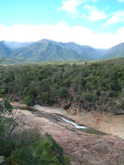
Marojejy National Park
A protected area of rainforest and massif in northeastern Madagascar.

Paul Atkinson · CC BY-SA 3.0
Marojejy National Park lies in northeastern Madagascar’s Sava region, centered on the Marojejy Massif—a mountain chain that peaks at 2,132 meters and covers 55,500 hectares. In 1952, the area was set aside as a strict nature reserve, open only to research scientists. It was opened to the public in 1998 when it became a national park, and in 2007 it was inscribed as part of the Rainforests of the Atsinanana World Heritage Site.
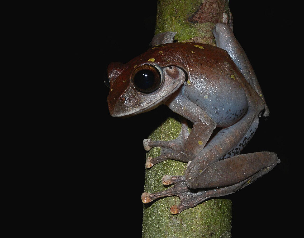
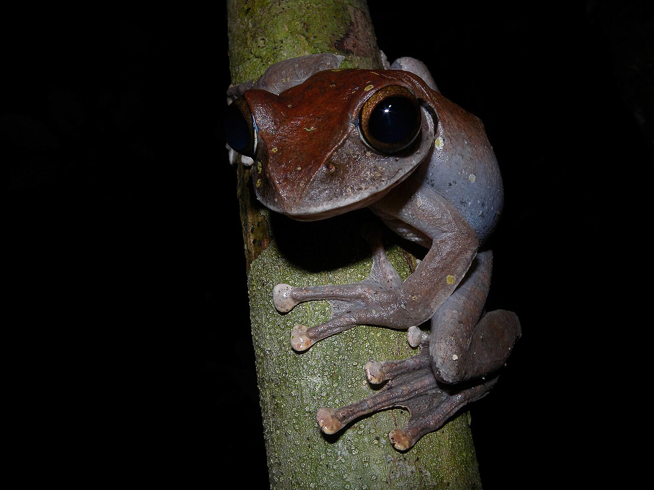
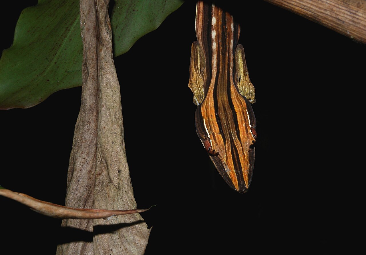
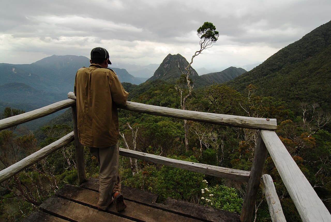
The massif’s rugged terrain and wide range of elevations create distinct habitats that shift quickly with altitude. Lower slopes support warm, dense rainforest; higher up, shorter forests give way to cloud forest; and near the peaks, the only undisturbed mountain scrub left in Madagascar remains. The eastern side, which receives more rain, offers better growing conditions than the western side. This diversity fuels high biodiversity: at least 118 bird species, 148 reptile and amphibian species, and 11 lemur species live in the park. Among them, the silky sifaka is listed among the world’s 25 most endangered primates, and the helmet vanga is considered the park’s iconic bird.
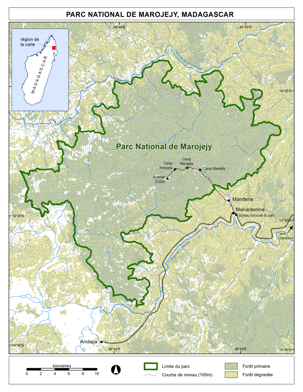
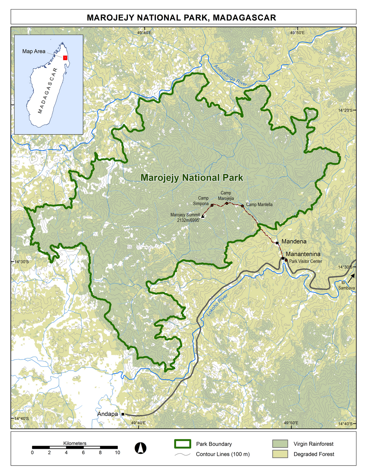
A single path leads from the park entrance to the summit, with three camps along the route. Camp Mantella sits at 450 meters in lowland rainforest, Camp Marojejia at 775 meters at the transition to montane rainforest, and Camp Simpona at 1,250 meters in the middle of montane rainforest. From Camp Simpona, a 2-kilometer trek to the summit takes four to five hours.
The park’s natural beauty and rich biodiversity—including critically endangered silky sifakas—have drawn praise from the New York Times and Smithsonian Magazine. A global consortium of conservation organizations, including the Lemur Conservation Foundation, Duke Lemur Center, and Madagascar National Parks, works to promote research and conservation in Marojejy and neighboring reserves. They also run community-based initiatives to reduce poaching and selective logging, encouraging local communities to adopt afforestation and silviculture as sustainable alternatives to mining, slash-and-burn agriculture, and wood collection.
**History** Marojejy National Park lies in northeastern Madagascar between the towns of Andapa and Sambava, stretching about 32 kilometers east to west and 22 kilometers north to south, centered on the Marojejy Massif.
Quick Facts
- Iucn Category
- II
- Location
- Sava region, Madagascar
- Nearest City
- Andapa and Sambava
- Area
- 55500 ha
- Governing Body
- Madagascar National Parks
- World Heritage Site
- 2007
Facts from the source article.
Lore & Background
The massif was first ascended in 1937 by L.-J. Arragon, but not geologically described until French botanist Jean-Henri Humbert explored it in 1948. Humbert collected 4,039 dried plant specimens over five months between November 1948 and November 1950, and later published the book 'A Marvel of Nature' in 1955, calling the massif the most impressive range in Madagascar. Largely due to his enthusiasm, Marojejy was set aside as a strict nature reserve in 1952, allowing only research scientists access.
In 1998, the reserve was converted into a national park and opened to the public. Since its establishment as a national park, the park's area has consistently been cited as 55,500 hectares, with no documented renegotiation of its boundaries. Illegal logging and trafficking of hardwoods, especially after the 2009 political crisis, posed serious threats to the park's forests and wildlife.
Reader's Guide
Marojejy National Park is significant for its rich biodiversity and unique habitats, ranging from lowland rainforest to mountain scrub. It hosts at least 118 bird species, 148 reptile and amphibian species, and 11 lemur species, including the critically endangered silky sifaka, listed among 'The World's 25 Most Endangered Primates'. The helmet vanga is considered the park's iconic bird. Conservation organizations such as the Lemur Conservation Foundation, Duke Lemur Center, and Madagascar National Parks have promoted research and community-based initiatives to mitigate poaching and logging, encouraging afforestation and silviculture as alternatives to mining and slash-and-burn agriculture. The park's rugged topography and elevation changes create diverse habitats that transition quickly, with the eastern side receiving more rain and supporting better plant growth. One path leads from the entrance to the summit, with three camps along the route: Camp Mantella, Camp Marojejia, and Camp Simpona, the latter serving as a base for the summit trek.
Did You Know?
- The park was originally set aside as a strict nature reserve in 1952, largely due to the enthusiasm of French botanist Jean-Henri Humbert.
- At least 118 species of bird, 148 species of reptile and amphibian, and 11 species of lemur are known to occur within the park.
- In 2006, the Park Logistics Coordinator was fired for moving boundary markers and selling 9 ha of park land to a local farmer.
- The park's size was adjusted to 55,500 ha in 2010 after a new demarcation.
The Long Road to Discovery
For decades, the Marojejy Massif remained largely untouched by formal scientific inquiry. While the 1929 Franco-Anglo-American Zoological Mission surveyed neighboring peaks in the region, the massif itself went unexamined until 1937, when L.-J. Arragon of Madagascar's Geographic Service climbed Marojejy Est. His visit was purely cartographic—he conducted no biological fieldwork. The true turning point came in 1948, when French botanist Jean-Henri Humbert, already experienced from exploring African mountain ranges, set his sights on Madagascar's northeast. Between November 1948 and November 1950, Humbert spent five months in the field, gathering 4,039 dried plant specimens for herbarium study. His 1955 publication, "A Marvel of Nature," declared the massif the most impressive mountain range on the entire island, citing its sheer scale, extraordinary floral diversity, and remarkably pristine condition. His passionate advocacy was instrumental in convincing authorities to designate the area a strict nature reserve in 1952, restricting access to research scientists alone.
A Shifting Shield: Protection and Threat
The legal status of Marojejy has evolved dramatically over seven decades. Initially designated as a strict nature reserve in 1952, the area was accessible only to research scientists. A 1966 government decree reaffirmed this protected status and fixed the boundaries using 89 reference points, yielding an estimated area of 60,150 hectares. For nearly half a century, the massif remained effectively closed to the general public. That changed in 1998, when the reserve was reclassified as a national park spanning 55,500 hectares, opening its trails to visitors and ecotourism. The park's international standing reached a zenith in 2007, when it was inscribed as part of the Rainforests of the Atsinanana World Heritage Site. Yet the celebration proved short-lived. Illegal logging, the trafficking of valuable hardwoods, and the destabilizing 2009 political crisis in Madagascar prompted UNESCO to place the Atsinanana forests on the World Heritage in Danger list in 2010, signaling that the protection Marojejy had enjoyed for decades remained fragile and contested.
A Living Mosaic of Habitats
The Marojejy Massif's rugged topography and wide elevation range produce a remarkable vertical gradient of ecosystems. At lower altitudes, warm and dense rainforest blankets the slopes. As one climbs, the vegetation transitions into shorter montane forests, then into mist-shrouded cloud forest, and finally, near the 2,132-meter peaks, into what is believed to be the only remaining undisturbed mountain scrub in all of Madagascar. The eastern face of the range receives substantially more rainfall than the western side, creating noticeably richer growing conditions and greater plant diversity on that flank. This habitat heterogeneity supports extraordinary biodiversity: at least 118 bird species, 148 reptile and amphibian species, and 11 lemur species have been documented within the park. Among them, the silky sifaka (Propithecus candidus) is so threatened that it appears on the "World's 25 Most Endangered Primates" list, while the helmet vanga (Euryceros prevostii) has become the park's emblematic avian symbol. Publications in the New York Times and Smithsonian Magazine have highlighted the site as a place where dense jungly rainforests and sheer cliffs shelter plants and animals found nowhere else on Earth.
People, Pressure, and the Path Forward
The relationship between Marojejy and its surrounding human communities has been fraught with tension. When boundaries were first drawn in 1952, two families already lived within the reserve; they were initially tolerated under strict conditions but eventually expelled for violations. By the late 1980s and into 1993, broader local communities—many of whom did not understand why a vast, resource-rich area was off-limits—began clearing the reserve's outer edges for vanilla and coffee plantations. In 1993, WWF and Madagascar's water and forestry service renewed enforcement, evicted remaining residents, and renegotiated access agreements. Today, a global consortium including the Lemur Conservation Foundation, Duke Lemur Center, and Madagascar National Parks works across Marojejy, Anjanaharibe-Sud, and Antanetiambo to advance research and conservation. Their community-based programs aim to counter poaching and selective logging by promoting afforestation and silviculture as sustainable alternatives to mining, slash-and-burn agriculture, and wood collection. For trekkers, the reward is a route threading through three camps—Mantella at 450 meters, Marojejia at 775, and Simpona at 1,250—before a final two-kilometer push to the summit that can take four to five hours.
Gallery
Frequently Asked Questions
What is Marojejy National Park?
It is a protected mountain-and-rainforest area in the Sava region of northeastern Madagascar, built around the Marojejy Massif that climbs to 2,132 meters. The park covers 55,500 hectares of varied forest habitat.
How did Marojejy National Park come to be?
The land was first set aside in 1952 as a closed research reserve accessible only to scientists. It was opened to the public and reclassified as a national park in 1998, and later received UNESCO World Heritage designation in 2007 as part of the Rainforests of the Atsinanana group.
Why is Marojejy National Park considered special?
Its steep elevation gradient compresses multiple distinct forest zones—warm lowland rainforest through cooler montane woodland—into a single compact massif. This rapid habitat shift supports an exceptional concentration of endemic and rare species.
What is the highest elevation in Marojejy National Park?
The summit of the Marojejy Massif reaches 2,132 meters (about 6,995 feet) above sea level, making it one of the highest points on the island.
Where exactly is Marojejy National Park located?
It sits in the Sava region of northeastern Madagascar, within the broader eastern (Atsinanana) rainforest belt. The park occupies roughly 55,500 hectares—about 214 square miles—of rugged mountainous terrain.
More in National parks of Madagascar 1-24
Spotted an error? Know more?
Reader corrections go straight into our review queue. Suggest an edit · How this site is sourced