
Plitvice Lakes National Park
A UNESCO World Heritage site of cascading tufa lakes and waterfalls.

Thomas Dahlstrøm Nielsen · CC BY-SA 4.0
Plitvice Lakes National Park is one of the oldest and largest national parks in Croatia, founded in 1949. It was inscribed on the UNESCO World Heritage list in 1979 for its outstanding series of tufa lakes, caves, and connected waterfalls. The park is located in the mountainous karst area of central Croatia, near the border with Bosnia and Herzegovina, and covers 296.85 km².
Quick Facts
- Other Name
- hr · Nacionalni park Plitvička jezera hr · plîtʋitse · pron
- Location
- Lika-Senj County, Karlovac County, Croatia
- Area
- 296.85 km2
- Elevation
- 367 m
- Visitors Num
- 1,492,994
- Visitors Year
- 2024
- Governing Body
- Javna ustanova Nacionalni park Plitvička jezera
Facts from the source article.
Lore & Background
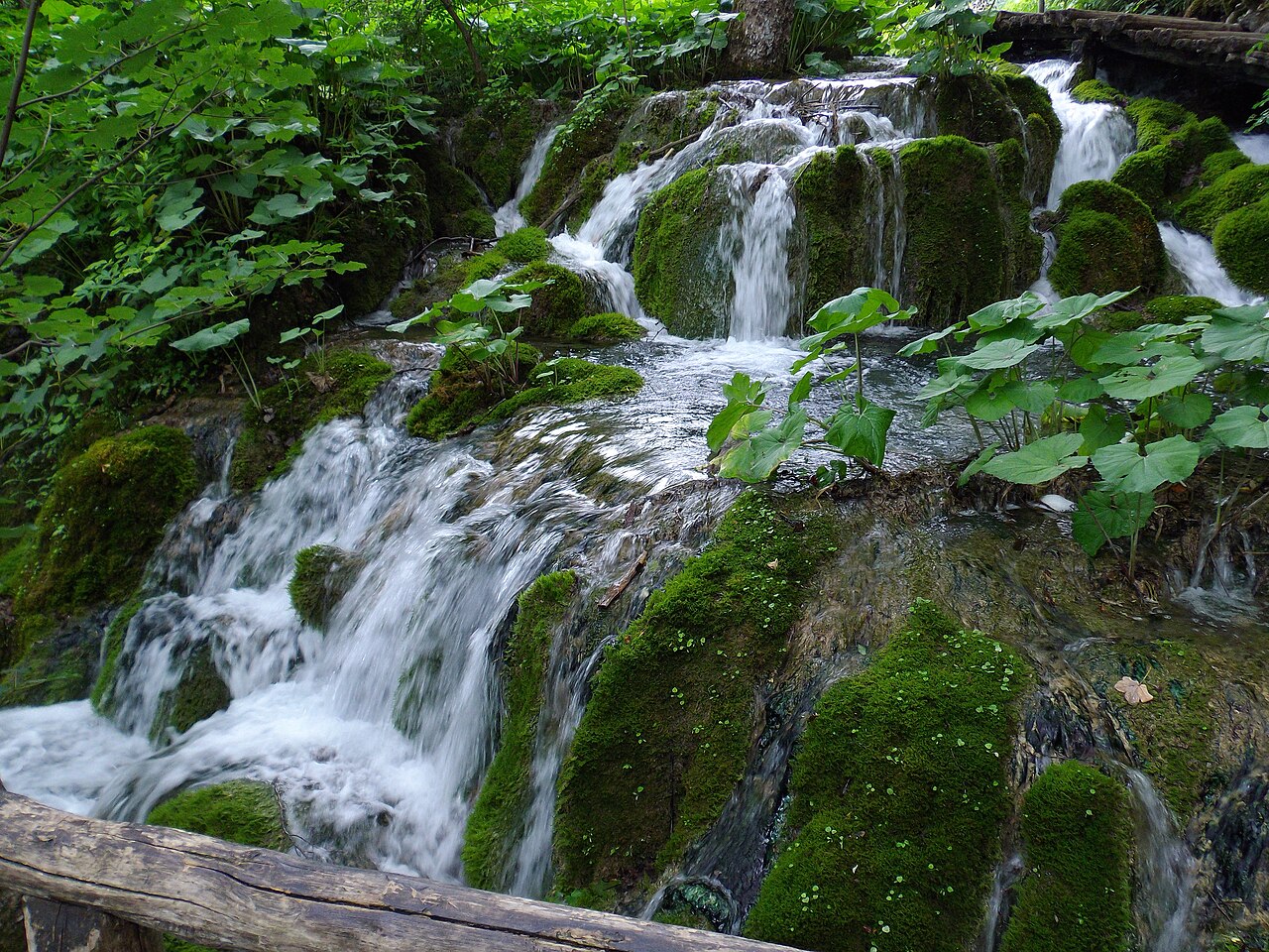
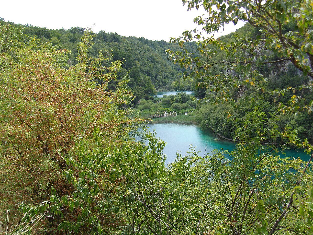
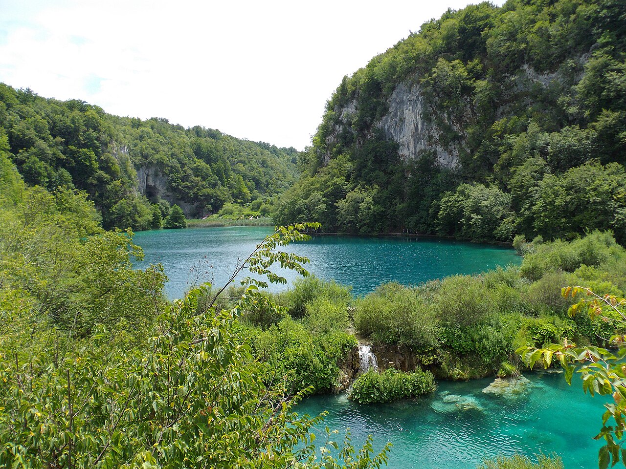
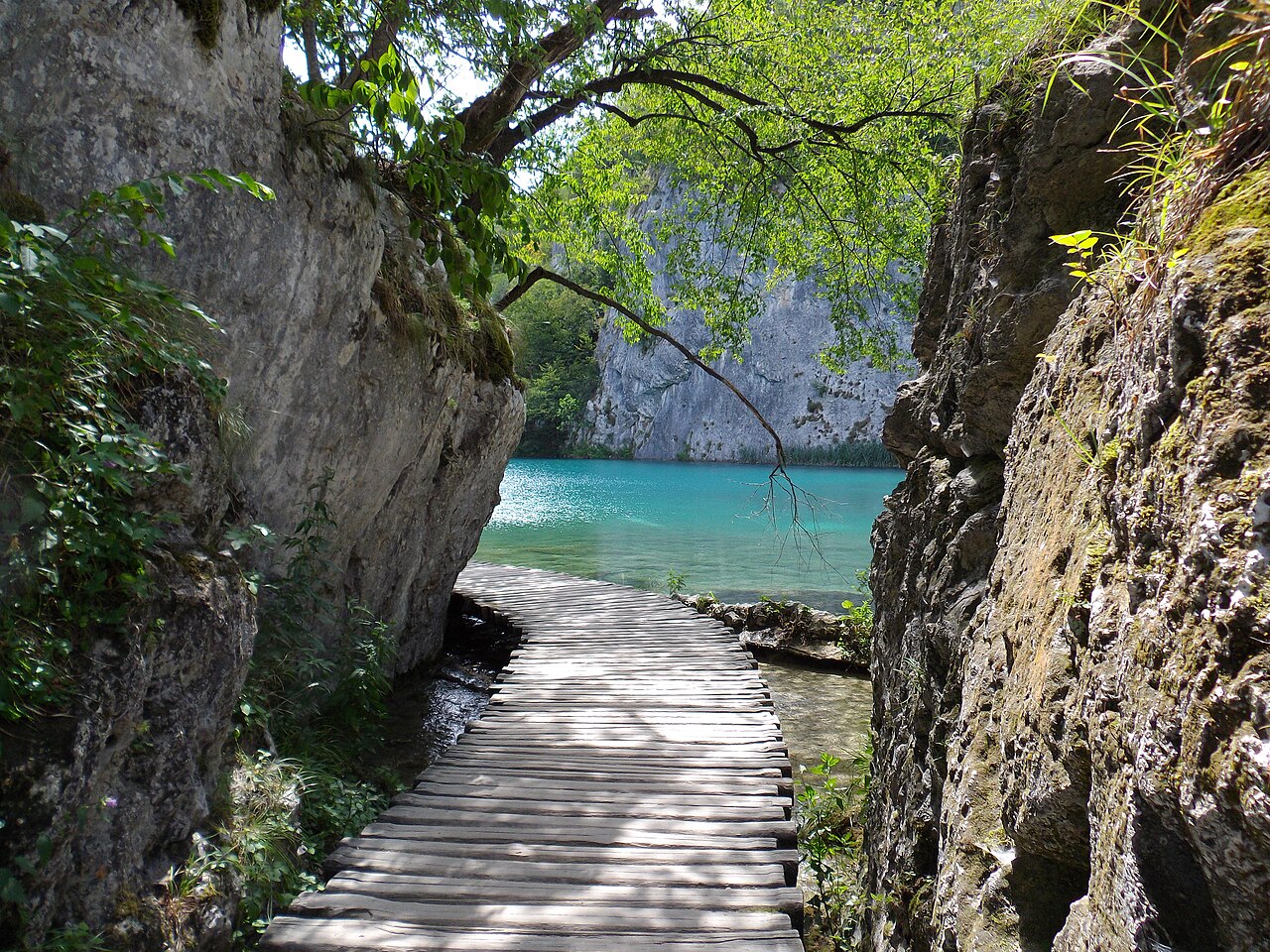
The name Plitvice was first recorded in 1777 by priest Dominik Vukasović, derived from Croatian words for shallow basins formed by natural phenomena. The lakes are arranged in cascades, with water changing limestone over centuries to create travertine barriers that continuously grow. The park's lakes are renowned for colors ranging from azure to green, grey, or blue, changing with mineral content and sunlight.
The park sits on the Plitvice plateau, surrounded by three mountains of the Dinaric Alps: Lička Plješivica, Mala Kapela, and Medveđak. The underground consists of dolomite rock in the Upper Lakes and limestone in the Lower Lakes. The lakes originate from the confluence of Bijela Rijeka and Crna Rijeka. Tufa formation began after the last ice age, about 12,000 to 15,000 years ago, with barriers growing up to 1 cm yearly.
Reader's Guide
Plitvice Lakes National Park is significant as a UNESCO World Heritage site and one of Croatia's oldest national parks, showcasing a unique karst landscape of sixteen terraced lakes connected by waterfalls. The park's tufa formations, created by centuries of limestone dissolution and sedimentation, are a key geological phenomenon. The lakes' vivid colors, varying with mineral and organism content, attract global attention. The park also serves as a vital north–south road link between the Croatian inland and the Adriatic coast. Its biodiversity is influenced by a 912 m elevation difference and surrounding forested mountains. The ongoing growth of travertine barriers demonstrates active geological processes, with tufa sedimentation at Lake Kozjak dating back 6,000 to 7,000 years. The park's management is under national jurisdiction due to its location across two counties.
Did You Know?
- The two largest lakes, Prošćansko jezero and Kozjak, cover about 80% of the total water body area.
- The name Plitvice was first mentioned in a 1777 document by priest Dominik Vukasović.
- Tufa barriers grow up to 1 centimeter in height each year.
- The park's elevation ranges from 367 m at the Korana river bridge to 1279 m at Seliški vrh.
The Living Architecture of Tufa
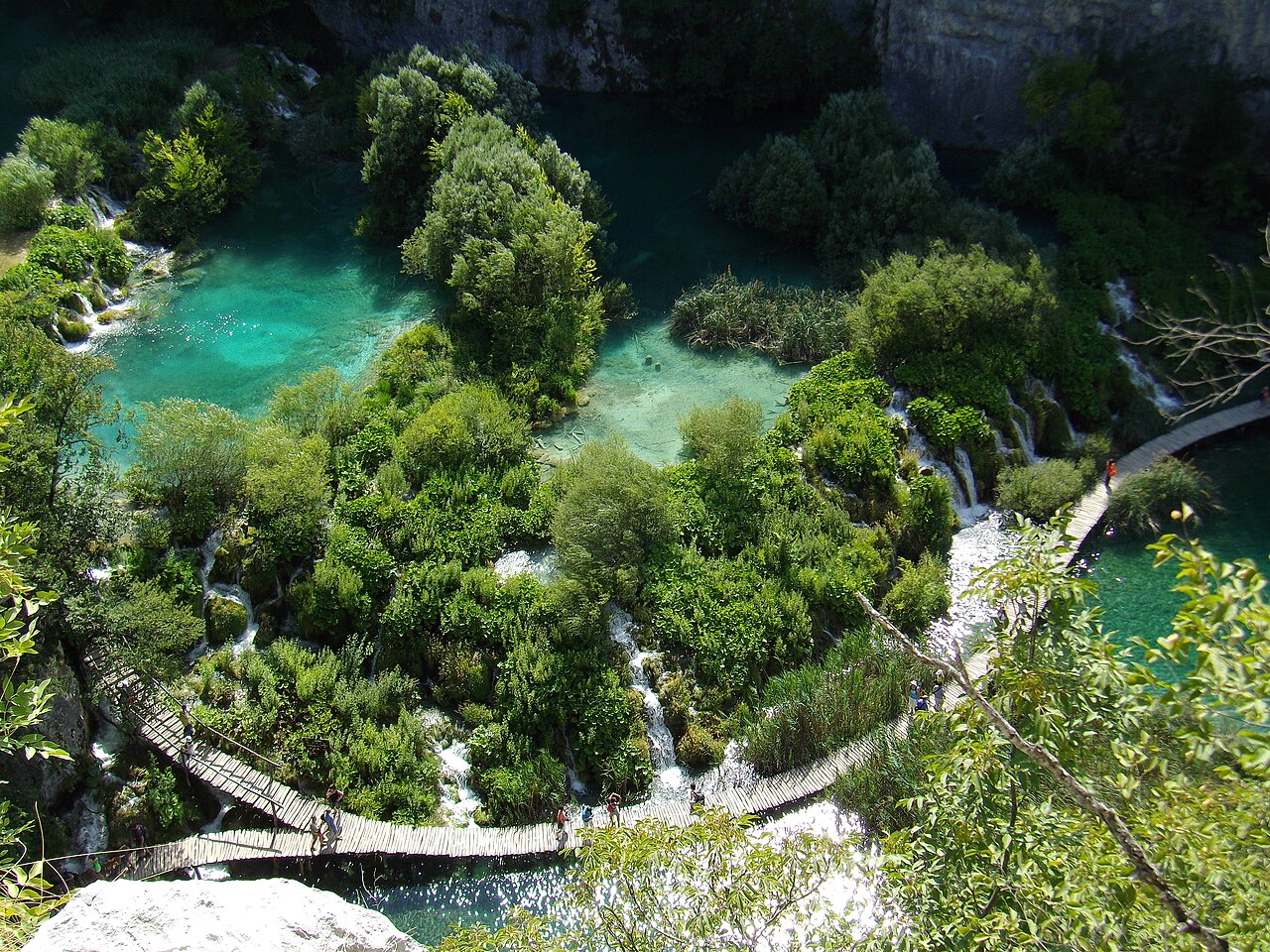
The lakes at Plitvice are not static features but the product of an ongoing geological conversation between water and stone. Beginning roughly 12,000 to 15,000 years ago, after the last ice age, karst rivers began dissolving calcite from the limestone beneath them. This mineral-rich water, saturated as it moved through underground channels, deposited tufa—also called travertine, sedra, or bigar in Croatian—into sinkholes and low-lying basins between the surrounding peaks. Over centuries, these deposits built up into natural dams that slowed and held back the flowing water, creating the cascade of lakes visible today. The barriers continue to grow in height, meaning the landscape is still being reshaped. The underlying geology differs by zone: the Upper Lakes in the south sit predominantly on dolomite, a slightly harder but less water-permeable rock, while the Lower Lakes in the north rest on more compact limestone with greater permeability. This interplay of rock type, water chemistry, and climate has produced one of the most distinctive karst landscapes in Europe.
Sixteen Lakes in a Shifting Palette
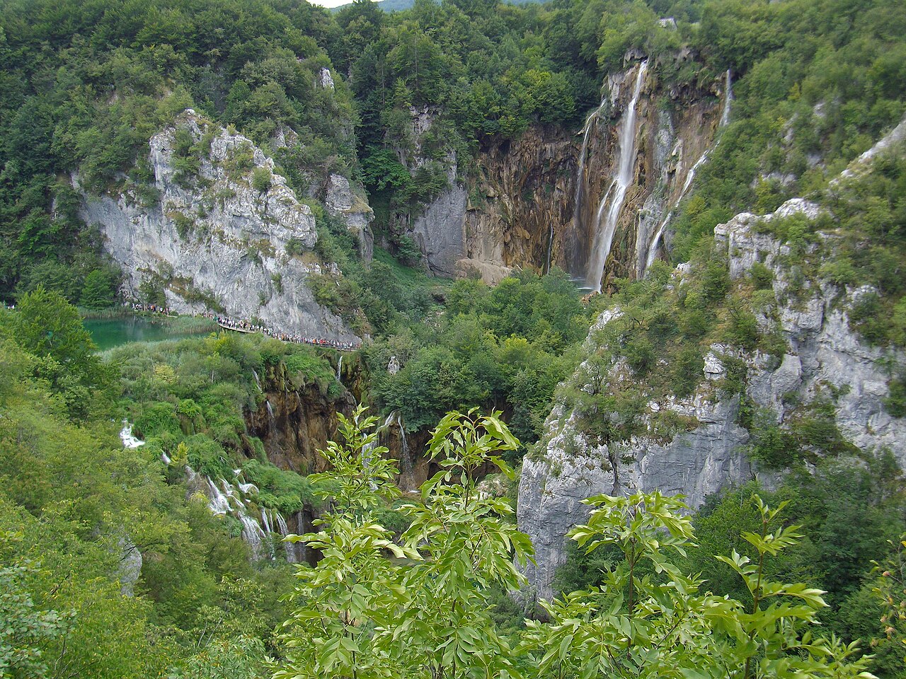
Sixteen lakes are visible from the surface within the park, arranged in cascades that drop a total of 133 meters from the first to the last. The two largest, Prošćansko jezero and Kozjak, together account for roughly 80 percent of the park's total water body area of about 2 square kilometers, and they are also the deepest, reaching 37 and 47 meters respectively. No other lake in the park exceeds 25 meters in depth. What makes the lakes truly remarkable is their color. The water shifts constantly between azure, green, grey, and blue, a phenomenon driven by the concentration of dissolved minerals and microscopic organisms in the water combined with the angle at which sunlight strikes the surface. The lakes are fed from the south by the confluence of Bijela Rijeka and Crna Rijeka, which merge near the village of Plitvički Ljeskovac and flow onward as the Matica, a name that translates loosely as origin or root. Additional tributaries, including a spring-fed river at the Liman bay, contribute varying quantities of water throughout the year.
A Mountain Cradle of Biodiversity
Plitvice Lakes National Park sits within the Plitvice plateau, hemmed in by three peaks of the Dinaric Alps: Lička Plješivica, whose Gola Plješevica summit reaches 1,640 meters; Mala Kapela, with Seliški Vrh at 1,280 meters; and Medveđak at 884 meters. The eastern flank of the park, defined by Lička Plješivica, also marks the international border with Bosnia and Herzegovina. The steep, forested slopes of these mountains act as natural water reservoirs and provide shelter for a wide range of animal species. The overall elevation range within the park spans 912 meters, from the high point near Seliški Vrh down to 367 meters at a bridge crossing the Korana River in the north. This dramatic vertical compression within a narrow corridor creates sharply different microclimates and habitats, making the area a significant center of biodiversity. The park's annual precipitation averages 1,500 millimeters, with the heaviest rainfall in spring and autumn, and relative humidity sits near 82 percent year-round, conditions that sustain the lush, water-rich ecosystem.
From Shallow Basins to World Heritage
The name Plitvice traces back to a 1777 document authored by Dominik Vukasović, the parish priest of Otočac, and it derives from the Croatian words pličina or plitvak, meaning shallow. The name captures the original character of the landscape: nature carved out shallow basins that gradually filled with water, and over centuries the flowing streams altered the limestone, building the travertine barriers that define the park today. The area was formally established as a national park in 1949, making it one of the oldest protected areas in Croatia. Its significance was recognized internationally in 1979 when UNESCO inscribed it on the World Heritage list, citing its outstanding and picturesque series of tufa lakes, caves, and connected waterfalls. The park covers 296.85 square kilometers, with roughly 90.7 percent falling within Lika-Senj County and the remaining 9.3 percent in Karlovac County, placing its governance under national jurisdiction. A major north-south road threads through the park, linking Croatia's inland regions to the Adriatic coast.
Gallery
Frequently Asked Questions
Who is Plitvice Lakes National Park?
Plitvice Lakes National Park is a protected natural area in central Croatia, established in 1949 as one of the country's oldest and largest national parks. It spans 296.85 square kilometers across the Lika-Senj and Karlovac counties, near the Bosnian border.
What is Plitvice Lakes National Park's role?
The park's core function is to safeguard a remarkable chain of sixteen interconnected tufa lakes, caves, and waterfalls set within a karst landscape. It also acts as a protected habitat for local flora and fauna while welcoming millions of visitors each year.
Why is Plitvice Lakes National Park important?
UNESCO inscribed it in 1979 because its cascading tufa lake system is a rare, still-evolving geological phenomenon found in very few places on Earth. It also stands as a cornerstone of Croatian conservation history, having been founded in the late 1940s.
Where is Plitvice Lakes National Park located?
The park sits in the mountainous karst region of central Croatia, close to the border with Bosnia and Herzegovina. About 90.7% of its territory lies within Lika-Senj County, with the remaining 9.3% in Karlovac County.
More in Unesco World Heritage Parks 1-19
Spotted an error? Know more?
Reader corrections go straight into our review queue. Suggest an edit · How this site is sourced