
Hạ Long Bay
Bay of descending dragons with thousands of limestone islets.

Vyacheslav Argenberg · CC BY 4.0
Hạ Long Bay lies in northeastern Vietnam, under the administration of Quảng Ninh province. The name translates to "descending dragon." Before the 19th century, it was known by other names such as An Bang, Lục Thủy, and Vân Đồn; the current name first appeared on a French maritime map in the late 1800s, following a newspaper report of a dragon sighting. A local legend, reinforced by Nguyễn dynasty nationalism, tells that a family of dragons spat jewels and jade into the sea to form islands and islets, creating a barrier against invaders. After the battle, the dragons stayed, and the place where the mother dragon descended became Hạ Long, while the sites of her children became Bái Tử Long and Bạch Long Vĩ.
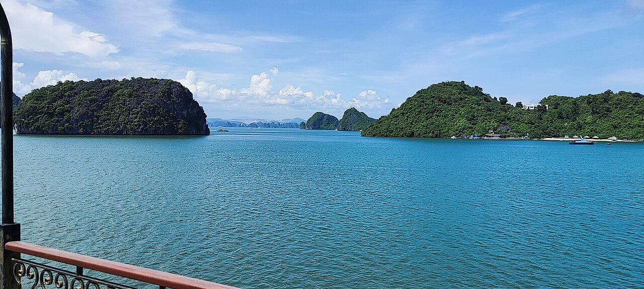
The bay covers roughly 1,553 km² and contains 1,969 islets, most of which are limestone. Its core zone spans 334 km² with a high density of 775 islets. The limestone underwent 500 million years of formation under varying conditions, and the karst landscape evolved over 20 million years under a tropical wet climate. This geo-diversity supports a tropical evergreen biosystem and a seashore biosystem, hosting 14 endemic floral species and 60 endemic faunal species. The bay is part of a larger area that includes Bai Tu Long Bay to the northeast and Cát Bà Island (administered by Haiphong) to the southwest, all sharing similar geological, geographical, geomorphological, climatic, and cultural characteristics.
Archaeological surveys show prehistoric human presence tens of thousands of years ago, with successive cultures: Soi Nhụ (c. 18,000–7,000 BC), Cái Bèo (7,000–5,000 BC), and Hạ Long (5,000–3,500 years ago). Artifacts found at Bài Thơ mountain, Đầu Gỗ cave, and Bãi Cháy mark important events in Vietnamese history. The poet Nguyễn Trãi praised the bay 500 years ago, calling it "a rock wonder in the sky." In 1962, North Vietnam’s Ministry of Culture, Sports and Tourism listed it as a National Relic and Landscape. UNESCO designated its core zone a World Heritage Site in 1994 under Criterion VII, and again under Criterion VIII.
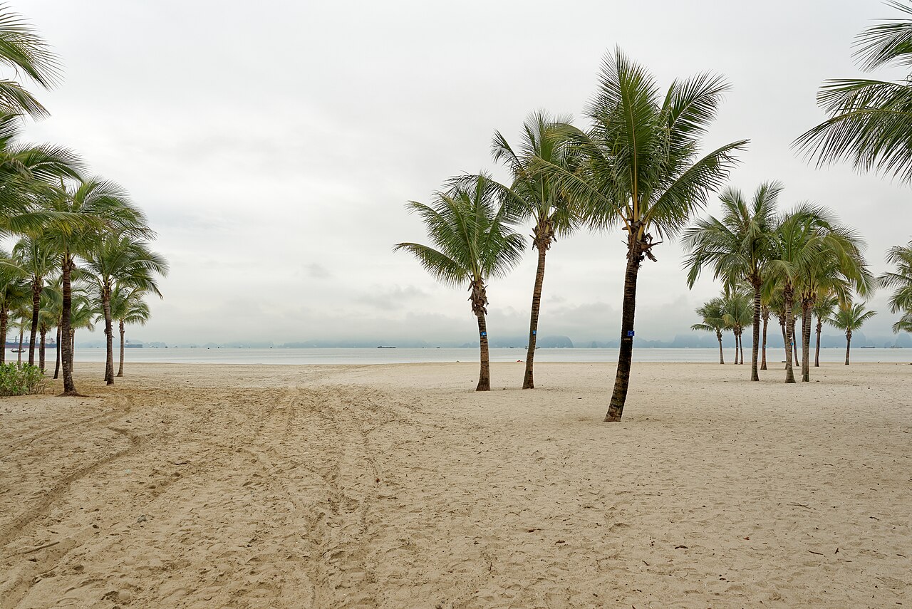
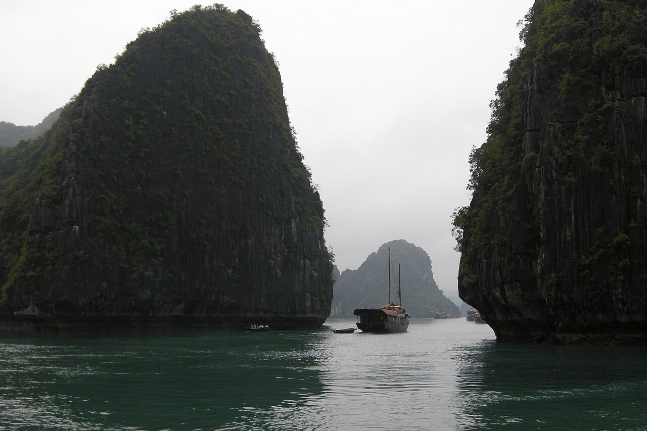
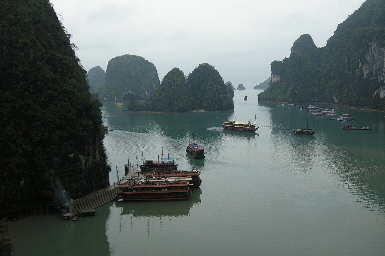
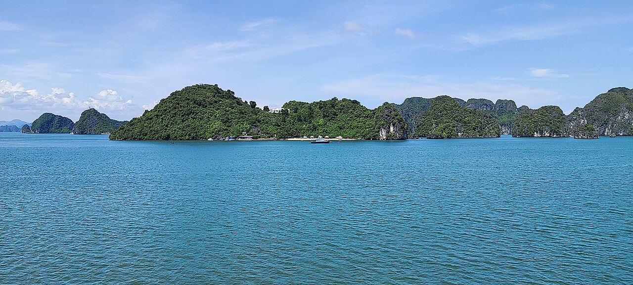
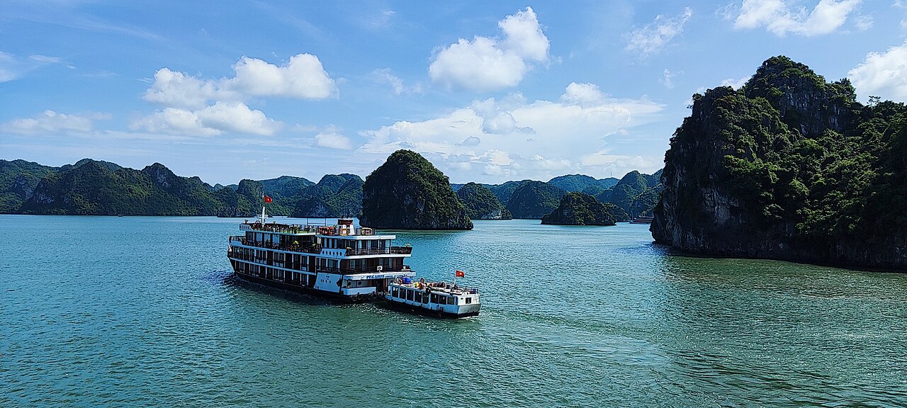
The bay features a dense cluster of about 1,600 limestone monolithic islands, each topped with thick jungle vegetation. Many islands are hollow with large caves. Hang Dau Go (Wooden Stakes cave), the largest grotto, was named Grotte des Merveilles by French tourists in the late 19th century; its three chambers contain stalactites, stalagmites, and French graffiti. Two larger islands, Tuần Châu and Cát Bà, have permanent inhabitants and tourist facilities. Smaller islands offer beaches. Around 1,600 people live in four floating fishing villages—Cua Van, Ba Hang, Cong Tau, and Vong Vieng—sustained by fishing and marine aquaculture, harvesting 200 fish species and 450 mollusk types. Many islands are named for their shapes, such as Voi (elephant), Ga Choi (fighting cock), Khi (monkey), and Mai Nha (roof); 989 islands have names. Birds, bantams, antelopes, monkeys, and lizards inhabit some islands. Almost all islands are individual towers in a fenglin landscape, 50–100 m high with height-to-width ratios up to about six. A notable feature is the abundance of lakes inside limestone islands; Dau Be island, for instance, has six enclosed lakes occupying drowned dolines within fengcong karst.
The bay stretches from Quang Yen town, past Hạ Long city, Cẩm Phả city, to Vân Đồn District. It is bordered on the south and southeast by Lan Ha Bay, on the north by Hạ Long city, and on the west by Bai Tu Long Bay. Its coastline is 120 km long.
Quick Facts
- Location
- Vietnam
- Criteria
- Natural: vii, viii, ix, x
- Year
- 1994
- Extension
- 2000, 2023
Facts from the source article.
Lore & Background
Hạ Long Bay features thousands of limestone karsts and islets, formed over 500 million years, with karst evolution taking 20 million years under a tropical wet climate. The bay is home to 14 endemic floral and 60 endemic faunal species. Historical surveys show prehistoric human presence tens of thousands of years ago, with successive cultures: Soi Nhụ (c. 18,000–7,000 BC), Cái Bèo (7,000–5,000 BC), and Hạ Long culture (5,000–3,500 years ago). Artifacts have been found at Bài Thơ mountain, Đầu Gỗ cave, and Bãi Cháy.
Nguyễn Trãi praised the bay 500 years ago in his verse, calling it 'a rock wonder in the sky.' In 1962, it was listed in the National Relics and Landscapes publication. The name Hạ Long appeared on French maritime maps in the late 19th century. Local legend tells of a family of dragons sent by gods to protect Vietnam, spitting jewels that became the islands. The mother dragon's descent gave the bay its name, while Bái Tử Long and Bạch Long Vĩ islands are named after the dragon's children.
The bay includes four fishing villages—Cửa Vạn, Ba Hang, Cống Tàu, and Vung Viêng—where about 1,600 people live on floating houses, sustaining themselves through fishing and marine aquaculture. Since May 2014, over 300 households have been relocated ashore to Khe Cá Resettlement Area.
Reader's Guide
Hạ Long Bay is significant as a UNESCO World Heritage Site recognized for its outstanding natural beauty and geological value. Its 1,969 islets, mostly limestone, form a classic fenglin landscape with towers 50–100 meters high. The bay's geo-diversity supports tropical evergreen and seashore biosystems, with endemic species. The area also holds archaeological evidence of human habitation dating back tens of thousands of years, including the Soi Nhụ, Cái Bèo, and Hạ Long cultures. Historically, it marked important events in Vietnamese history, and Nguyễn Trãi praised it in the 15th century. The bay's name, meaning 'descending dragon,' is tied to a legend of protective dragons. Today, it is a popular travel destination, with floating villages where residents engage in fishing and aquaculture, though relocation policies are reshaping these communities. The bay's legacy lies in its combination of natural wonder, cultural history, and ongoing human adaptation.
Did You Know?
- The name Hạ Long means 'descending dragon' in Vietnamese.
- The bay has 1,969 islets, most made of limestone, with 775 in the core zone.
- The limestone has undergone 500 million years of formation, with karst evolution taking 20 million years.
A Landscape Forged Over Half a Billion Years
The limestone formations of Hạ Long Bay are the product of an almost incomprehensible timescale. The rock itself accumulated over roughly 500 million years under shifting conditions and environments, while the distinctive karst shapes visible today were carved by a tropical wet climate over the subsequent 20 million years. The result is a classic fenglin seascape: nearly 1,600 monolithic towers, most standing 50 to 100 metres tall, with height-to-width ratios reaching as high as six to one. Many of these towers are hollow, sheltering vast caves, and some even contain enclosed lakes sitting in drowned dolines within fengcong karst—Dau Be island alone holds six such lakes. This extraordinary geo-diversity has nurtured a rich biosystem spanning tropical evergreen and seashore habitats, supporting 14 endemic plant species and 60 endemic animal species. The bay's core zone, where 775 islets cluster within 334 square kilometres, represents the densest concentration of these formations.
Deep Roots — Prehistory to Poetry
Long before any modern nation drew its borders, humans were already making their mark in this bay. Archaeological surveys have uncovered evidence of prehistoric habitation stretching back tens of thousands of years. Three successive ancient cultures left their traces: the Soi Nhụ culture (roughly 18,000–7,000 BC), the Cái Bèo culture (7,000–5,000 BC), and the Hạ Long culture (5,000–3,500 years ago). Artifacts from these and later periods have been recovered from sites including Bài Thơ mountain, Đầu Gỗ cave, and Bãi Cháy. Centuries later, the poet Nguyễn Trãi captured the bay's splendor in his verse Lộ nhập Vân Đồn, dubbing it a rock wonder in the sky. The bay's official recognition followed gradually: in 1962 North Vietnam's Ministry of Culture, Sports and Tourism included it in a national relics and landscapes publication, and in 1994 UNESCO inscribed the core zone as a World Heritage Site under both natural beauty (Criterion VII) and geological significance (Criterion VIII).
The Dragon's Legacy in Name and Legend
The Vietnamese name Hạ Long translates to descending dragon, yet this label is far younger than the landscape it describes. Before the 19th century, old Vietnamese texts recorded the bay under other names—An Bang, Lục Thủy, Vân Đồn—and the name Hạ Long first surfaced on a French maritime map in the late 1800s. A French-language newspaper, Hai Phong News, even reported a sighting: Dragon appears on Hạ Long Bay. The most enduring story, however, is a local legend amplified by 19th-century Nguyễn dynasty nationalism. It tells of a family of dragons sent by the gods to defend a young Vietnam from invaders. The dragons spat jewels and jade that became the islets, forming a natural wall; rock mountains rose abruptly to wreck enemy ships. After victory, the dragons chose to settle in the bay. The mother dragon's descent gave the bay its name, the place where her children attended her became Bái Tử Long, and where they thrashed their tails became Bạch Long Vĩ, today's Tra Co peninsula near Móng Cái.
Life Among the Towers
Beneath the dramatic limestone spires, Hạ Long Bay sustains a quiet human presence. Around 1,600 residents call four fishing villages—Cua Van, Ba Hang, Cong Tau, and Vong Vieng in Hưng Thang ward—home, living on floating houses and earning their livelihoods through fishing and marine aquaculture in waters teeming with 200 fish species and 450 kinds of mollusks. Two larger islands, Tuần Châu and Cát Bà, host permanent settlements along with hotels and beaches, while smaller islets offer their own stretches of sand. The islands owe many of their names to the shapes they suggest: Voi Islet resembles an elephant, Ga Choi Islet a fighting cock, Khi Islet a monkey, and Mai Nha Islet a roof. In all, 989 of the islets carry names. Beyond human residents, the islands shelter birds, bantams, antelopes, monkeys, and lizards. The largest grotto, Hang Dau Go, was christened Grotte des Merveilles by late-19th-century French visitors and still displays its three chambers of stalactites, stalagmites, and 19th-century French graffiti.
Gallery
Frequently Asked Questions
What is Hạ Long Bay and where exactly is it located?
Hạ Long Bay is a vast coastal bay tucked into the northeastern shore of Vietnam, managed by Quảng Ninh province. It's instantly recognizable for the thousands of jagged limestone karsts that jut out of its turquoise waters.
Why did UNESCO pick Hạ Long Bay as a World Heritage Site?
The bay qualified in 1994 under two separate criteria: Criterion VII for its exceptional natural beauty and Criterion VIII for its outstanding geological record. Together, those two angles made it one of the few sites recognized for both aesthetic splendor and scientific value.
What does the name 'Hạ Long' actually mean?
In Vietnamese, 'Hạ Long' translates to 'descending dragon,' drawn from a local legend in which a mother dragon and her brood swooped down to defend the coastline from invaders. The scattered islets are traditionally said to be the dragon's shed scales.
How many islets and how much water are we talking about?
The full bay covers roughly 1,553 square kilometers (about 600 square miles) and holds around 1,969 islets. The protected core zone is a smaller 334-square-kilometer stretch containing 775 of those islets.
What's the geological story behind those limestone pillars?
The karsts formed over millions of years as tectonic forces lifted ancient seabed rock, then relentless wave action, rain, and fluctuating sea levels carved it into the dramatic towers and caves visitors see today. That ongoing, still-active erosion process is a big part of why UNESCO cited it under Criterion VIII.
More in Unesco World Heritage Parks 1-19
Spotted an error? Know more?
Reader corrections go straight into our review queue. Suggest an edit · How this site is sourced