Maryland
A Mid-Atlantic state with diverse geography and high median income.

Michael Wheeler · Public domain
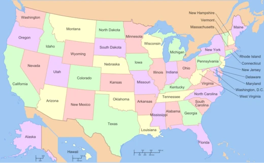
Maryland sits in the Mid-Atlantic and Southeastern parts of the United States. It touches Virginia to the south, West Virginia to the west, Pennsylvania to the north, and Delaware to the east, plus the Atlantic Ocean on its eastern side and Washington, D.C., to the southwest. Covering 12,407 square miles, it ranks as the ninth-smallest state in land area. Its 6.1 million people make it the 19th-most populous state and the fifth-most densely populated. Annapolis serves as the capital, while Baltimore is the largest city. Europeans first explored Maryland’s coastline in the 1500s; before that, various Native American tribes, mostly Algonquian peoples, lived there. As one of the original Thirteen Colonies, its charter was requested and obtained in 1632 by George Calvert, 1st Baron Baltimore, and his son Cecil Calvert, 2nd Baron Baltimore. The first settlers arrived in 1634, mainly to create a safe place for Catholics facing persecution in England.
Quick Facts
- Flag Link
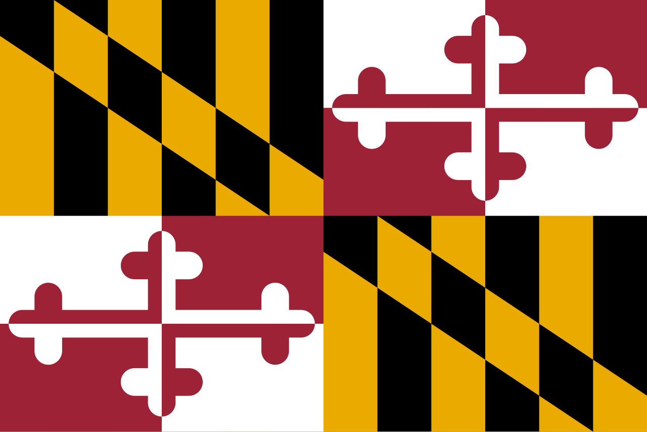
- Flag of Maryland
- Nicknames
- "Old Line State", "Free State", "Little America", "America in Miniature"
- Population Demonym
- Marylander
- Former
- Province of Maryland
- Seat
- Annapolis
- Largestcity
- Baltimore
- Largestcounty
- Montgomery
- Largestmetro
- Washington–Baltimore (combined) · Baltimore (metro and urban)
- Governor
- Wes Moore (D)
- Lieutenant Governor
- Aruna Miller (D)
- Legislature
- General Assembly
- Upperhouse
- Senate
Facts from the source article.
Lore & Background
Maryland's first colonial settlement was St. Mary's City, established in 1634 by Leonard Calvert, the first provincial governor. The colony was named in honor of Henrietta Maria of France, wife of King Charles I. Religious strife was common in its early years; Catholics remained a minority, albeit in greater numbers than in any other English colony. The economy was heavily plantation-based and centered mostly on tobacco cultivation, leading to the importation of indentured servants and enslaved Africans. In 1760, Maryland's current boundaries took form following the settlement of a long-running border dispute with Pennsylvania. Although a slave state, Maryland remained in the Union during the American Civil War due to Abraham Lincoln's use of federal troops and suspension of habeas corpus. After the Civil War, it took part in the Industrial Revolution, driven by its seaports, railroad networks, and mass immigration from Europe.
Reader's Guide
Maryland's significance lies in its role as one of the original Thirteen Colonies, founded as a haven for Catholics, and its strategic location near Washington, D.C., which influenced its decision to remain in the Union during the Civil War. Since the 1940s, its population has grown rapidly, and as of 2015 it had the highest median household income of any state, owing to its proximity to Washington, D.C., and a highly diversified economy spanning manufacturing, retail services, public administration, real estate, higher education, information technology, defense contracting, health care, and biotechnology. Maryland is one of the most multicultural states, with non-Whites composing a majority of the population, and it hosts some of the highest numbers of historic landmarks per capita. Its geography, culture, and history are diverse, including elements of the Mid-Atlantic, Northeastern, and Southern regions, and its varied climates and topographical features have earned it the moniker 'America in Miniature.'
Did You Know?
- Maryland's coastline was first explored by Europeans in the 16th century.
- The charter for the Province of Maryland was petitioned and secured in 1632 by George Calvert, 1st Baron Baltimore and Cecil Calvert, 2nd Baron Baltimore.
Founding as a Religious Refuge
Maryland's origins trace to 1632, when George Calvert, 1st Baron Baltimore, petitioned King Charles I for a charter covering territory between Massachusetts and Virginia. After George's death that April, the charter passed to his son Cecil Calvert, 2nd Baron Baltimore, on June 20, 1632. The colony was officially named in honor of Henrietta Maria of France, the king's wife, though Lord Baltimore had initially preferred the name Crescentia. The first settlers arrived in March 1634 under Leonard Calvert, the first provincial governor, establishing St. Mary's City on the Potomac's north shore. The colony was explicitly designed as a refuge for Catholics persecuted in England, making it the most heavily Catholic of the English mainland colonies, though Catholics still comprised less than ten percent of the total population. Early years were marked by religious tension: in 1644, Puritan William Claiborne seized Kent Island, and Richard Ingle took control of St. Mary's, using faith as a political weapon. Tobacco cultivation quickly made the colony profitable, yet disease—malaria, yellow fever, typhoid—cut life expectancy roughly a decade below New England levels.
A Compact State of Surprising Range
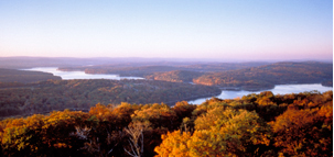
Despite ranking ninth-smallest by land area at 12,407 square miles, Maryland packs an extraordinary range of terrain into a compact footprint. The western reaches dip into the Appalachian Mountains, the central belt is dominated by the rolling Piedmont, and the eastern half is defined by the Chesapeake Bay and its sprawling network of tributaries. Sixteen of the state's twenty-three counties, along with Baltimore, touch the tidal waters of this estuary, whose combined shoreline stretches past four thousand miles. This geographic variety, paired with a mix of climates, earned Maryland the nickname America in Miniature. The state's borders were not always clear: a long-running dispute with Pennsylvania was finally settled in 1760, fixing the boundaries recognized today. Maryland sits at the crossroads of the Mid-Atlantic, Southeastern, and Northern regions, and its cultural identity reflects that layered position, drawing elements from Northeastern, Mid-Atlantic, and Southern traditions simultaneously.
From Tobacco Fields to Tech Hubs
Maryland's economic story is one of dramatic transformation. In the colonial era, the plantation system dominated, with tobacco as the primary cash crop and a heavy reliance on indentured servants and enslaved Africans to meet labor demands. The Civil War era marked a turning point: Maryland's strategic position between Washington, D.C., and Virginia made it a critical military theater, and Lincoln's decision to station the National Guard there kept the state in the Union. After 1865, the state surged into the Industrial Revolution, propelled by its seaports, expanding railroad networks, and waves of European immigration. From the 1940s onward, population growth accelerated sharply, pushing the state past six million residents and into the ranks of the nation's most densely populated. By 2015, Maryland boasted the highest median household income of any state, a distinction driven by its proximity to the federal capital and a broad-based economy spanning defense contracting, biotechnology, information technology, higher education, health care, real estate, manufacturing, and retail services.
A Mosaic of Peoples and Heritage
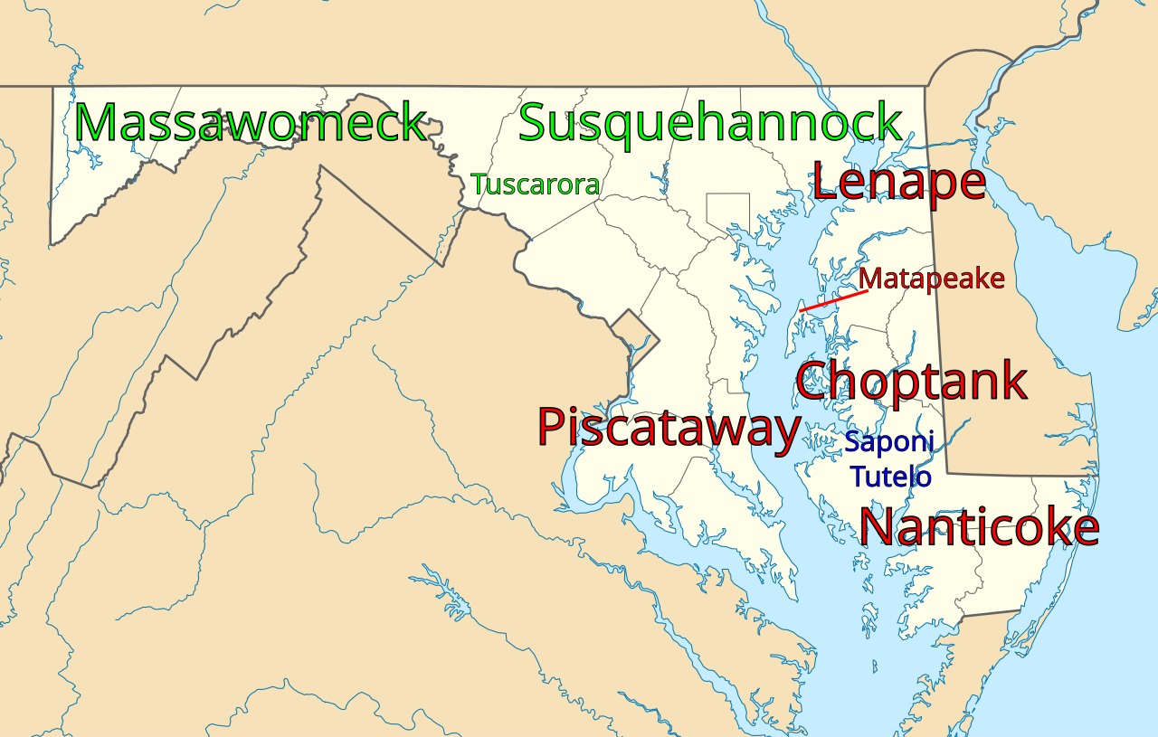
Maryland stands out as one of the most multicultural states in the union. It is one of only nine states where non-White residents form a majority of the population, and it holds the fifth-highest percentage of African Americans among all states. The population also includes substantial communities of residents born in Africa, Asia, Central America, and the Caribbean, reflecting centuries of immigration that began with European settlers in the colonial period and continued through the Industrial Revolution and beyond. This demographic richness sits atop a deep historical layer: the land was originally home to numerous Native American tribes, including the Piscataway, Nanticoke, Powhatan, Lenape, Susquehannock, Shawnee, Tutelo, Saponi, Pocomoke, and Massawomeck. The state's cultural identity similarly blends influences from the Mid-Atlantic, Northeastern, and Southern regions. This layered heritage is visible in the sheer density of historic landmarks Maryland preserves, making it one of the states with the highest number of such sites per capita in the country.
Gallery



Frequently Asked Questions
Who is Maryland?
Maryland is a Mid-Atlantic state descended from one of the original Thirteen Colonies, with Annapolis as its capital and Baltimore as its largest city. It spans roughly 12,407 square miles and is home to about 6.1 million people, making it the ninth-smallest state by land area but the fifth-most densely populated.
What makes Maryland's geography stand out?
The state earns the nickname 'America in Miniature' because it packs coastal plains, rolling hills, and mountainous terrain into a compact footprint. It also borders five other jurisdictions—Pennsylvania, Virginia, West Virginia, Delaware, and Washington, D.C.—plus the Atlantic Ocean on its eastern edge.
Why is Maryland important in American history?
As one of the original Thirteen Colonies, Maryland helped lay the groundwork for the nation's founding. Its strategic position along the Chesapeake Bay and its proximity to the capital made it a critical flashpoint during the American Civil War.
What is Maryland known for economically?
As of 2015, Maryland posted the highest median household income of any state, a figure driven by federal agencies, biotech, and finance concentrated around the D.C. corridor. That prosperity is spread across a population dense enough to rank the state fifth in the country.
Where exactly does Maryland sit on the map?
Maryland occupies the Mid-Atlantic and Southeastern regions of the United States, tucked between Pennsylvania to the north, Virginia to the south, West Virginia to the west, and Delaware to the east. The Atlantic Ocean forms its eastern boundary, while Washington, D.C., sits just to its southwest.
More in U.S. States 1-24
Spotted an error? Know more?
Reader corrections go straight into our review queue. Suggest an edit · How this site is sourced