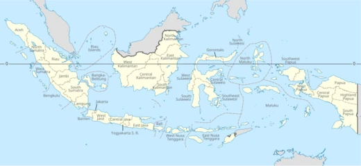
Southeast Sulawesi
Indonesian province on Sulawesi's southeastern peninsula and offshore islands.

Twotwofourtysix · CC BY-SA 4.0
Southeast Sulawesi (Indonesian: Sulawesi Tenggara) is a province of Indonesia located on the southeastern peninsula of Sulawesi island, including offshore islands such as Buton, Muna, Kabaena, and Wawonii. Its capital is Kendari. The province is now connected to the rest of Sulawesi via the Trans-Sulawesi Highway, though some sections may still be under development. Historically, the region was the site of the Buton Sultanate from the 14th century (circa 1332) until the early twentieth century.
Quick Facts
- Official Name
- Province of Southeast Sulawesi / id · Provinsi Sulawesi Tenggara
- Shield Link
- Armorial of Indonesia#Provincial
- Established Title
- Founded
- Established Date
- 27 April 1964
- Seat Type
- Capital / and largest city
- Seat
- Kendari
- Leader Title
- Governor
- Leader Name
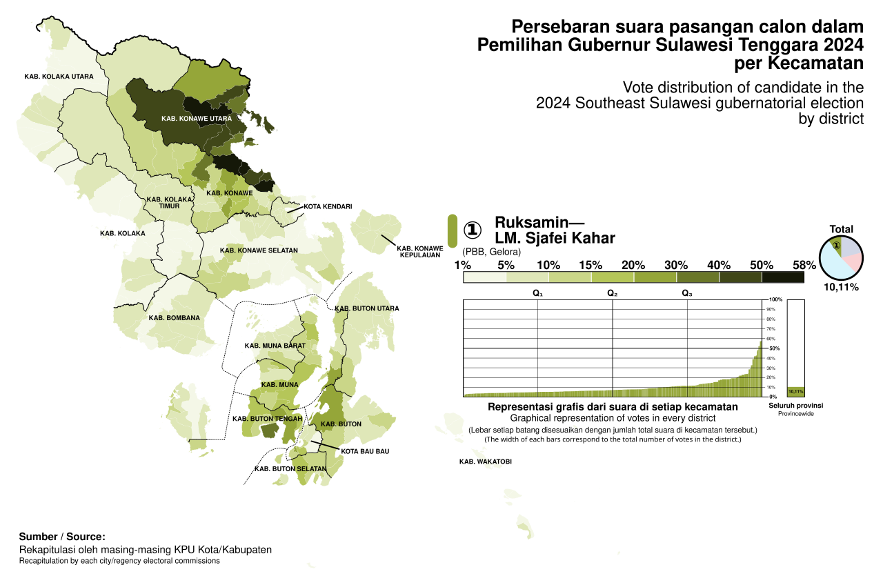
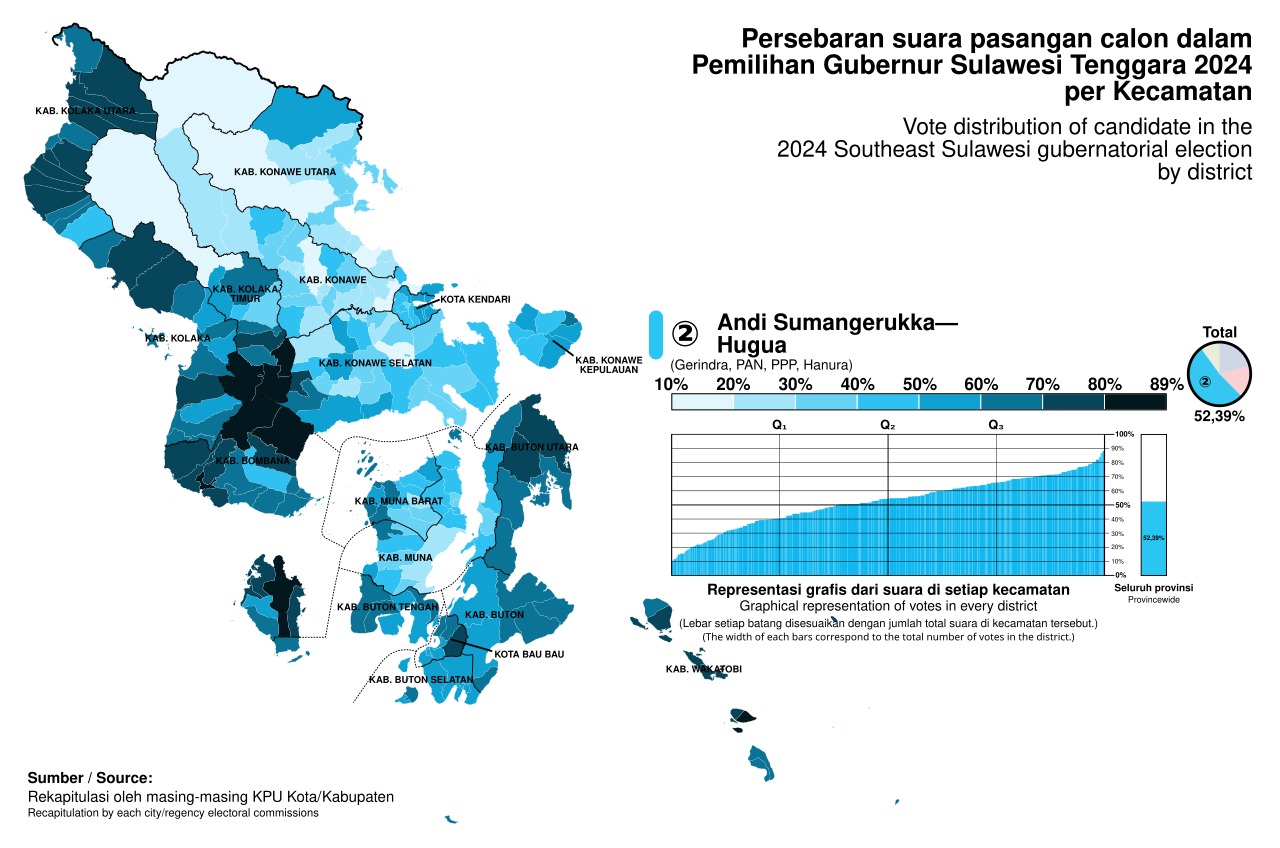
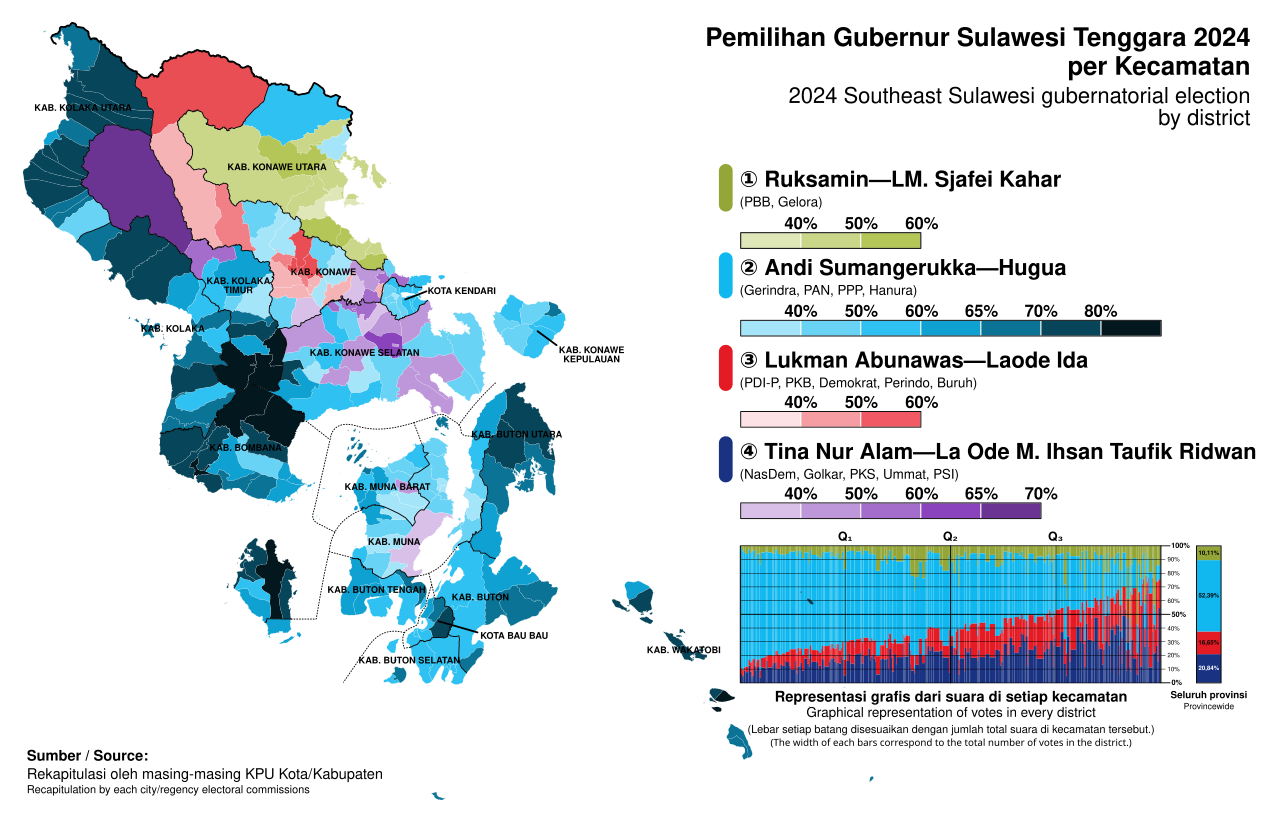
- Andi Sumangerukka (Gerindra)
- Governing Body
- Southeast Sulawesi Provincial Government
Facts from the source article.
Lore & Background
From the 14th century (circa 1332) until the early twentieth century, the region was the site of the Buton Sultanate (Butung). The province's geography includes two major mountain ranges, the Tanggeasinua Range and the Mekongga Range, and major rivers such as the Lalinda, the Lasolo, and the Sampara. The population was 2,232,586 at the 2010 census, increasing to 2,624,875 at the 2020 census, with an official estimate of 2,836,740 at mid-2025. A third of the population is centered on Buton and Muna islands, and another 15% live in and around Kendari.
Reader's Guide
Southeast Sulawesi is significant as a province that preserves the legacy of the Buton Sultanate, a historical polity that existed from the 17th to early 20th centuries. Its administrative evolution reflects Indonesia's ongoing decentralization, with the number of regencies growing from four in 1995 to fifteen by 2014, including new regencies created in 2013 and 2014. The province's isolation from the rest of Sulawesi by road underscores the importance of its ferry link and ports. The ethnic diversity—including Buton, Muna, Wakatobi, Tolaki, and others—and the predominance of Islam (96.2%) shape its cultural landscape. The province also forms one of Indonesia's 84 national electoral districts, electing six members to the People's Representative Council.
Did You Know?
- A third of the population lives on Buton and Muna islands.
- The province's regencies increased from four in 1995 to fifteen by 2014.
Geography & Maritime Isolation
Southeast Sulawesi occupies the southeastern peninsula of the island of Sulawesi, stretching into the sea alongside a constellation of substantial offshore islands including Buton, Muna, Kabaena, and Wawonii (historically known as Wowoni), as well as numerous smaller islets. The province's capital, Kendari, sits on the eastern coast of the peninsula. To the north it shares land borders with South Sulawesi and Central Sulawesi, while its maritime boundaries extend eastward toward Maluku and North Maluku, southward toward East Nusa Tenggara, and even a remarkably narrow strip of sea separates it from East Timor. Two prominent mountain ranges, the Tanggeasinua and the Mekongga, define the interior topography, and the Lalinda, Lasolo, and Sampara rivers drain the landscape. Perhaps most strikingly, no highway road links the peninsula to the rest of Sulawesi. The principal overland connection is a ferry crossing the Bone Gulf between Watampone in South Sulawesi and the port of Kolaka, making maritime passage the province's essential lifeline to the wider island.
Administrative Proliferation
In 1995, Southeast Sulawesi comprised only four regencies: Buton, Kolaka, Konawe, and Muna. Over the following decades the province underwent a remarkable administrative expansion. The city of Kendari was carved from Konawe, followed by Bau-Bau's separation from Buton in 2001. A wave of new regencies followed in 2003, when South Konawe, Bombana, Wakatobi, and North Kolaka were established from their parent territories. In 2007, North Konawe and North Buton joined the map. The pace quickened in 2013 with the creation of Konawe Islands Regency, encompassing Wawonii Island and surrounding islets, and East Kolaka Regency, both split from Konawe. Then in 2014, South Buton, Central Buton, and West Muna were added. Today the province contains fifteen regencies and two autonomous cities. It also serves as one of Indonesia's eighty-four national electoral districts, sending six representatives to the People's Representative Council. A proposal to create a municipality of Raha on Muna Island has been under discussion since 2013 but remains in abeyance.
Demographics & Cultural Tapestry
The population of Southeast Sulawesi has grown steadily, from 2,232,586 recorded in the 2010 census to 2,624,875 by 2020, with an official mid-2025 estimate reaching 2,836,740. The four most populous regencies are Konawe Selatan, Konawe, Kolaka, and Muna. Geographically, roughly a third of all residents are concentrated on Buton and Muna islands off the southern coast, while another fifteen percent live in and around the capital, Kendari. Religiously, the province is overwhelmingly Muslim at 96.2 percent, with approximately 2.56 million adherents. Smaller communities include around 50,780 Hindus, 44,870 Protestants, 16,180 Roman Catholics, 1,610 Buddhists, 113 Confucians, and 63 practitioners of folk religions. Ethnically, the province is a rich mosaic: the Buton peoples (Wolio, Lasalimu, Kumbewaha, Cia-cia), the Muna groups (Busoa, Kaimbulawa, Liabuku, Pancana, Kioko), the Wakatobi communities (Tukangbesi, Bonerate), alongside Tolaki, Culambacu, Kalisusu (Taloki, Koroni), Moronene, and Wawonii populations, among others.
The Buton Sultanate & Maritime Heritage
From the seventeenth century until the early twentieth century, the region was the domain of the Buton Sultanate, known locally as Butung. This maritime polity anchored the province's identity for centuries, and its legacy persists in the cultural landscape of the offshore islands. The province's deep connection to the sea is evident in its extensive port network, spanning locations from Antam Pomalaa in Kolaka to Bungkutoko in Kendari, with numerous ferry terminals in Muna, Wakatobi, Central Buton, and West Muna. Six airports serve the region, including Betoambari in Bau-Bau, Haluoleo in South Konawe, Matahora in Wakatobi, Sangia Nibandera in Kolaka, Sugimanuru in West Muna, and Tomia in Wakatobi. The maritime character extends to the province's borders, which touch the waters of Maluku, North Maluku, East Nusa Tenggara, and even a sliver of sea near East Timor. The presence of Wakatobi National Park further underscores the region's oceanic significance.
Gallery
Frequently Asked Questions
Who is Southeast Sulawesi?
Southeast Sulawesi, called Sulawesi Tenggara in Indonesian, is a province that occupies the southeastern peninsula of Sulawesi island together with several offshore islands such as Buton, Muna, Kabaena, and Wawonii. Its administrative seat is the city of Kendari.
What territories does Southeast Sulawesi cover?
In addition to the main peninsula, the province's domain stretches across offshore islands including Buton, Muna, Kabaena, and Wawonii. Together these lands form a scattered archipelago in the southeastern waters of Sulawesi.
How does Southeast Sulawesi link up with the rest of Sulawesi?
The Trans-Sulawesi Highway is the primary overland route connecting the province to the broader island network, although some sections are still under development. It serves as the main road corridor into the region.
What is Southeast Sulawesi's backstory?
The region's deep history is rooted in the Buton Sultanate, which ruled from roughly the 14th century (circa 1332) until the early twentieth century. That long-lived sultanate gave the area a distinct political and cultural identity well before it became part of the modern Indonesian province.
Why does Southeast Sulawesi matter in the bigger picture?
As the southeastern anchor of Sulawesi, the province adds a substantial stretch of coastline and offshore territory to Indonesia's archipelago. Its road link through the Trans-Sulawesi Highway also makes it a key node in the island's overall transportation and trade network.
More in Indonesian Provinces 1-19
Spotted an error? Know more?
Reader corrections go straight into our review queue. Suggest an edit · How this site is sourced