South Papua
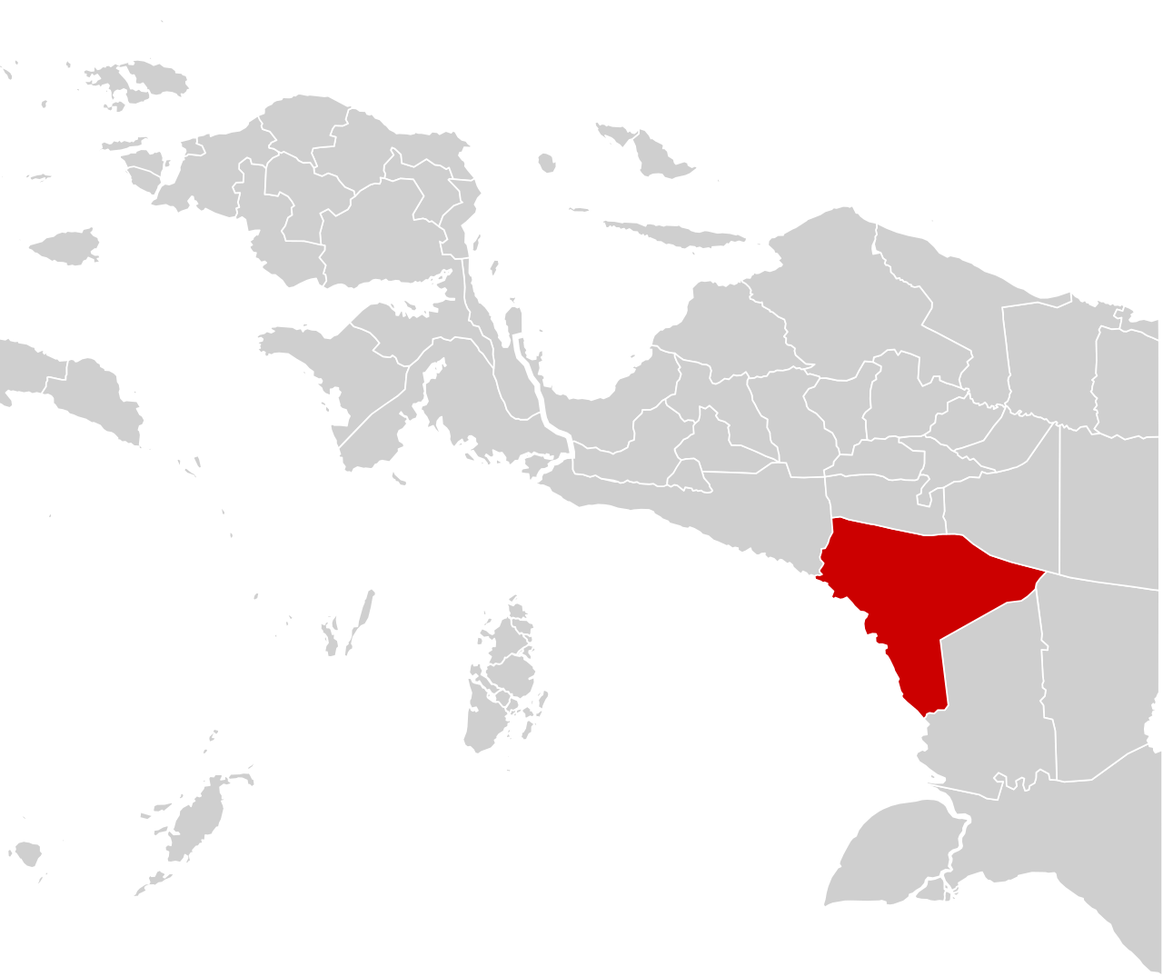
Indonesia's least populous province, established in 2022 from southern Papua.

KPU Provinsi Papua Selatan · Public domain
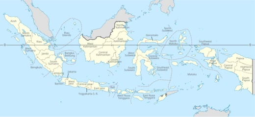
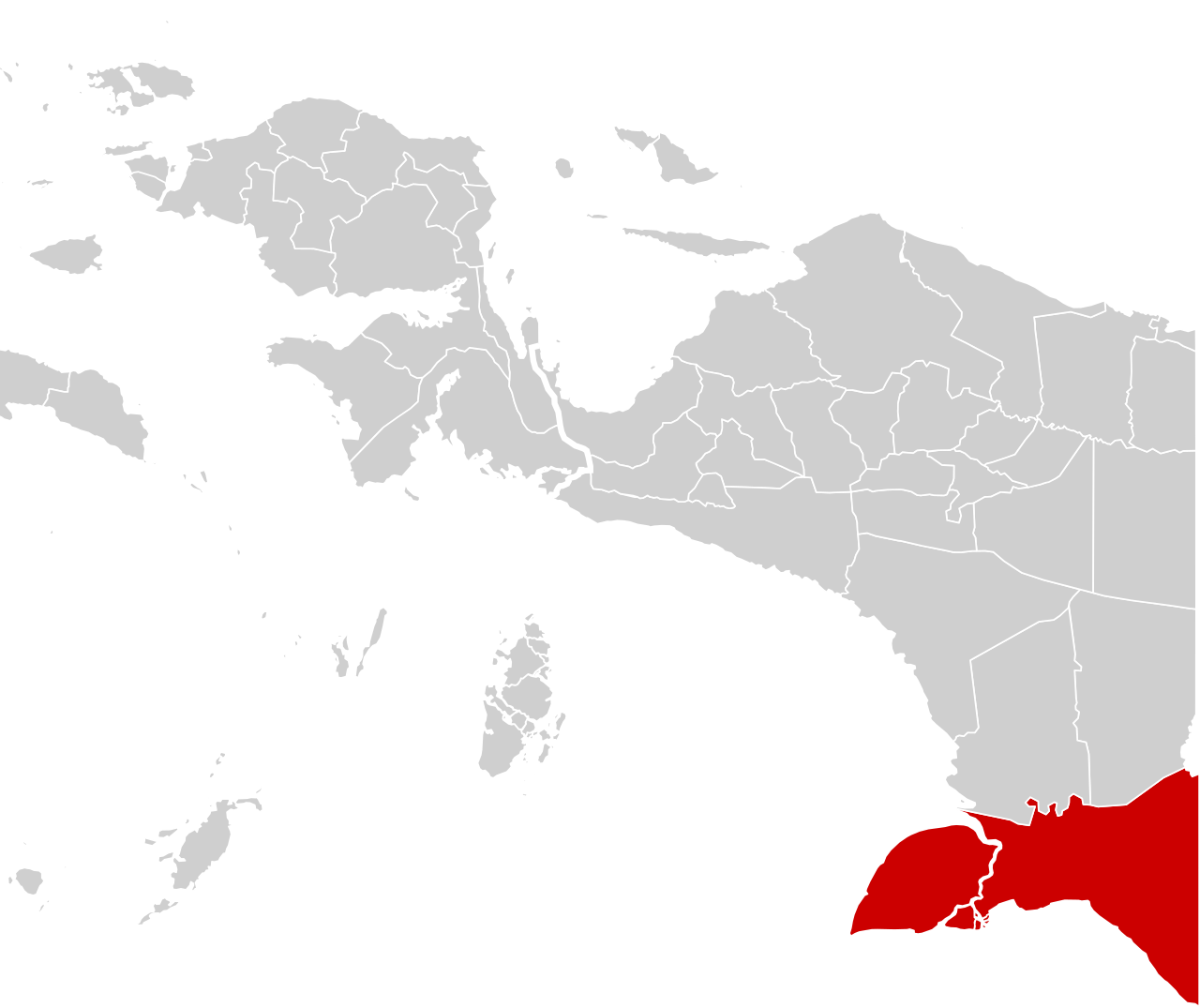
South Papua, officially the South Papua Province (Indonesian: Provinsi Papua Selatan), is an Indonesian province located in the southern portion of Papua, following the borders of the Papuan customary region of Anim Ha. Formally established on 25 July 2022, it covers a land area of 117,849.16 km² and had an estimated population of around 517,000, making it the least populous province in Indonesia. Its administrative centre is the town of Salor in Kurik District, while Merauke serves as the economic centre.
Quick Facts
- Other Name
- Anim Ha
- Native Name
- id · Papua Selatan
- Official Name
- Province of South Papua / id · Provinsi Papua Selatan
- Shield Link
- Armorial of Indonesia#Provincial
- Motto
- id · Maju Negeriku / "Onward My Country"
- Seat Type
- Capital
- Seat
- Salor, Merauke
- Governing Body
- South Papua Provincial Government
Facts from the source article.
Lore & Background
Before European arrival, the wetland region of South Papua was home to indigenous tribes including the Asmat, Marind, and Wambon. The Marind tribe, also known as Malind, lived along rivers in the Merauke region, centering their way of life on hunting, gathering, and farming, but were also notorious for headhunting. In 1902, the Dutch established a military base at the eastern tip of South Papua near the Maro River, named Merauke, to strengthen the border and eliminate headhunting. A Catholic mission was also established. During the colonial period, Javanese laborers were brought to cultivate rice fields, contributing to the growth of the town, which later became the capital of Afdeeling Zuid Nieuw Guinea.
Reader's Guide
South Papua's significance lies in its recent formation as a province, uniting four regencies that were part of the former Merauke Regency. The region's history includes Dutch colonial efforts to suppress headhunting, the establishment of the Boven-Digoel concentration camp at Tanah Merah in the 1920s, where figures like Mohammad Hatta and Sutan Sjahrir were detained, and the later transmigration program that brought Javanese migrants to convert swamps into rice paddies. The Merauke Integrated Food and Energy Estate (MIFEE), initiated in 2007 and officially inaugurated in 2010, aimed to enhance food security but faced challenges from indigenous land rights and NGO opposition. The province's lowland landscape, dominated by swamps and rivers, includes the Wasur National Park, a Ramsar wetland with rich biodiversity. The choice of the name 'South Papua' over 'Anim Ha' was intended to be inclusive and avoid negative historical connotations.
Birth from the Moratorium
South Papua emerged in 2022 as one of four new provinces carved out of the existing province of Papua, joining Central Papua, Highland Papua, and Southwest Papua as the youngest administrative units in the country. Its creation marked a decisive break from a government moratorium on splitting existing provinces that had frozen such proposals since 2013. For nearly a decade, the idea of subdividing Indonesia's 38 provinces had been shelved, but the 2022 enactment reversed that pause. South Papua thus entered the national map as a first-level administrative division—a category formerly termed a "provinsi daerah tingkat I" in the pre-Reform era—carrying the full constitutional weight of Article 18 paragraph 1 of the 1945 Constitution, which mandates that the Unitary State be divided into provincial regions, each endowed with its own regional government. As one of 38 provinces in a geographically dispersed archipelago, South Papua now occupies a place in a system where the average province spans roughly 49,768 square kilometers and houses about 7.5 million residents.
Governance & Electoral Framework
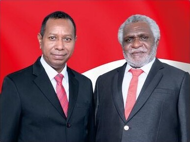
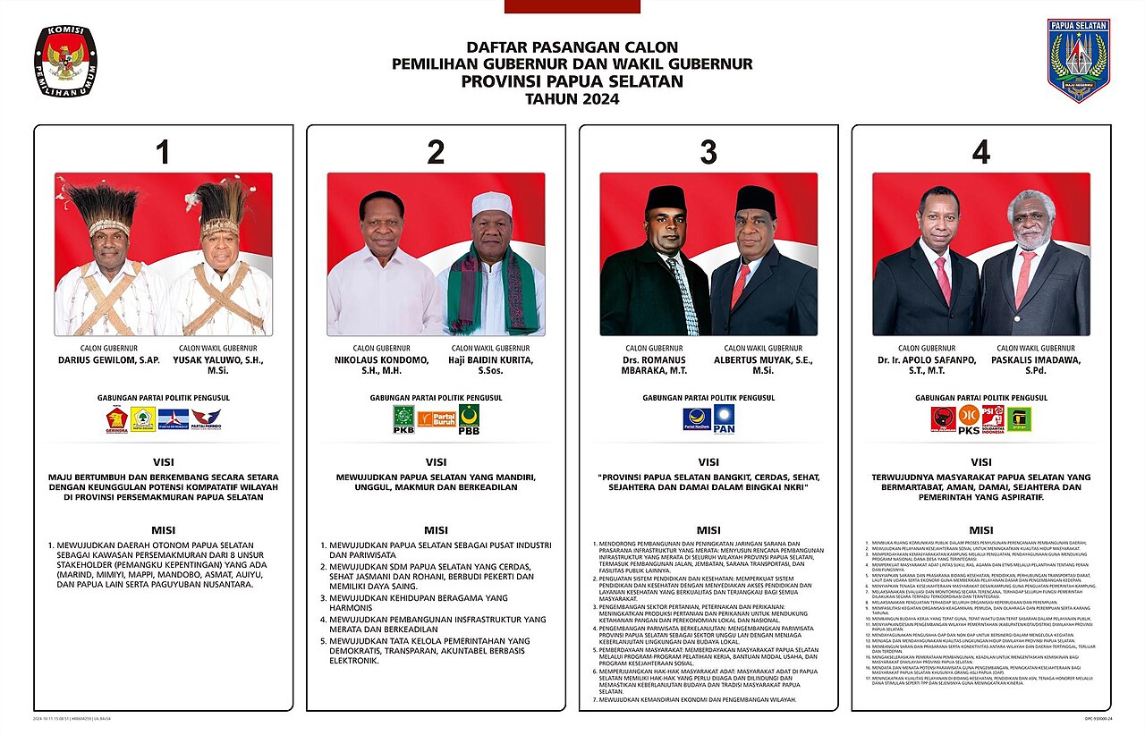
South Papua's local government follows the standard provincial model: a governor and vice-governor at the executive helm, alongside a regional legislative body known as the DPRD Provinsi. Both the governor and DPRD members face the electorate in popular votes for five-year terms, with a hard cap of two consecutive terms for the governor. Since 2015, regional head elections have been conducted simultaneously with other local executive contests, and the broader schedule culminated in a unified November 2024 vote for all local executive posts, with the next cycle set five years later. DPRD elections, meanwhile, are held concurrently with the national general election. The province's authority to regulate its own affairs—ranging from development planning and public order to health, education, environmental control, and defense services—is bounded by the limits set by the central government, as outlined in Law 23/2014 on Regional Government.
Special Autonomy & Constitutional Position
The broader Papua region was granted special autonomy, a status rooted in Article 18 of the 1945 Constitution, which was expanded through amendments in October 1999 following the fall of Suharto. While Indonesia is not a federated state, certain provinces receive additional autonomy beyond the standard decentralization framework, and the specific formulation varies from province to province based on particular political imperatives. South Papua, as a new entity split from the parent province of Papua, inherits its place within this broader autonomy landscape. Nine of Indonesia's 38 provinces hold special status, designated by the terms "Istimewa" or "Khusus." The constitutional architecture applies across the archipelago's terrestrial and maritime regions, reinforcing administrative cohesion within a unified archipelagic state recognized under international law. South Papua's governance thus operates at the intersection of standard provincial powers and the layered autonomy framework that has shaped Papua's political identity.
Administrative Subdivision & Service Mandate
Beneath the provincial level, South Papua is subdivided into regencies and cities—formerly called second-level region regencies or cities (kabupaten/kotamadya daerah tingkat II)—which are further broken down into districts (kecamatan). This hierarchical structure mirrors the national template established by the 1945 Constitution and operationalized through regional government law. The provincial government's mandate extends to matters that cross regency or city boundaries, affect users across multiple localities, or would be more efficiently managed at the provincial level. Specific responsibilities include facilitating cooperative and small-to-medium enterprise development, managing population and civil registration, administering investment services, and delivering basic services that individual regencies or cities cannot carry out independently. The province also oversees manpower services, social problem management, and the provision of public facilities and infrastructure. This layered division of labor ensures that South Papua's governance reaches from the provincial capital down to the district level, maintaining the administrative cohesion that the constitutional framework demands across Indonesia's dispersed geography.
Gallery
Frequently Asked Questions
What is South Papua Province?
South Papua is Indonesia's newest province, carved out of the southern part of the island of Papua. It was officially created on 25 July 2022 and its boundaries follow the traditional Anim Ha customary region.
When was South Papua established?
The province was formally inaugurated on 25 July 2022, splitting it off from the larger, pre-existing Papua province. This makes it one of the most recently created administrative divisions in the country.
What is the capital of South Papua?
The administrative seat is the small town of Salor in Kurik District, while the nearby city of Merauke serves as the province's primary economic hub.
Why is South Papua notable among Indonesian provinces?
With roughly 517,000 residents as of mid-2025, it holds the distinction of being the least populous province in all of Indonesia. Despite that sparse population, it stretches across an enormous 117,849 square kilometres of land.
Where exactly is South Papua located?
It occupies the southern portion of the island of Papua, tracing the borders of the Anim Ha customary region. Geographically it sits in the far eastern reaches of the Indonesian archipelago.
More in Indonesian Provinces 1-19
Spotted an error? Know more?
Reader corrections go straight into our review queue. Suggest an edit · How this site is sourced