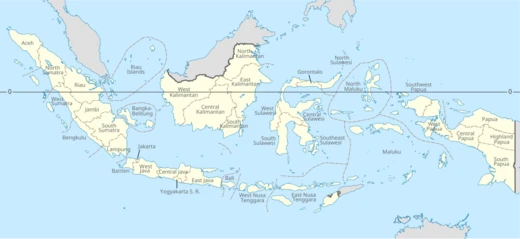
North Sulawesi
Province on the Minahasa Peninsula, historically contested by European powers.

Bennylin · CC BY-SA 3.0
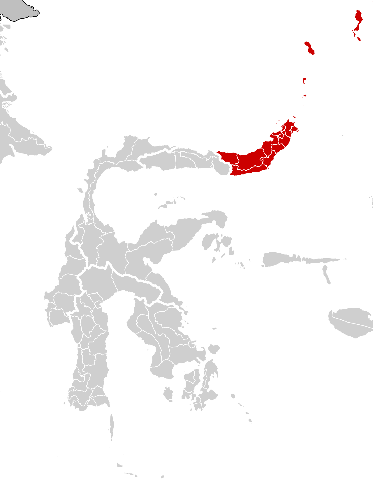
North Sulawesi (Indonesian: Sulawesi Utara) is a province of Indonesia, mainly located on the Minahasa Peninsula of the island of Sulawesi. It is historically significant as a crossroads of trade, colonialism, and cultural exchange, having been contested by Portuguese, Spanish, and Dutch powers, and later incorporated into the Republic of Indonesia.
Quick Facts
- Official Name
- Province of North Sulawesi / id · Provinsi Sulawesi Utara
- Shield Link
- #Coat of arms
- Nickname
- id · Bumi Nyiur Melambai / "Land of the Swaying Coconut"
- Established Title
- Established
- Established Date
- 14 August 1959
- Founder
- Sam Ratulangi
- Seat Type
- Capital / and largest city
- Seat
- Manado
- Leader Title
- Governor
- Leader Name
- Yulius Selvanus (Gerindra)
Facts from the source article.
Lore & Background
North Sulawesi's history dates back at least 30,000 years, with archaeological evidence from Liang Sarru cave on Salibabu island. The region was known for spices, rice, and gold, attracting Portuguese, Spanish, and Dutch traders from the 16th century. The Portuguese first arrived in the region in 1512, when they reached the Maluku Islands and subsequently visited the northern Sulawesi coast, followed by the Spanish, who built a fort in Manado and developed coffee plantations. The Dutch ultimately gained control in the 17th century, ruling for three centuries until the Japanese occupation during World War II.
After the Japanese surrender in 1945, the Dutch briefly regained possession before leaving in 1949 following the Round Table Conference. North Sulawesi was incorporated into the State of East Indonesia, which merged into the United States of Indonesia. On 17 August 1950, the unitary Republic of Indonesia was formed, and North Sulawesi became a separate province on 14 August 1959. The western half, including Gorontalo Regency, was separated to form the province of Gorontalo on 5 December 2000.
The name Minahasa, still used to refer to the province, derives from words meaning 'being one' or 'uniting', reflecting the hope to unite various sub-ethnic groups. The term 'Minahasa' is generally attributed to earlier usage, though it appears in a 1789 report by Dutch regent J.D. Schierstein.
Reader's Guide
North Sulawesi's significance lies in its role as a historical battleground for European colonial powers and as a trading route between east and west. The province's natural resources—spices, rice, and gold—drove Portuguese, Spanish, and Dutch competition, ultimately leading to Dutch domination for three centuries. Its strategic location south of the Philippines and southeast of Sabah, Malaysia, made it a key port for traders. The region also witnessed the spread of Christianity, Islam, and Chinese-influenced beliefs. The province's creation in 1959 and the later separation of Gorontalo in 2000 reflect ongoing administrative evolution. Today, North Sulawesi remains an economic center with Manado as its capital, and its diverse ethnic groups continue to embody the unity implied by the name Minahasa.
Did You Know?
- The province's northernmost island, Miangas, is the northernmost island of Indonesia and borders the Philippines.
- Archaeological evidence from Liang Sarru cave on Salibabu island shows human life in North Sulawesi from 30,000 years ago.
Strategic Geography & Maritime Position
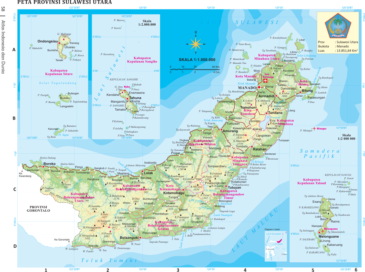
North Sulawesi occupies the Minahasa Peninsula of Sulawesi, sitting south of the Philippines and southeast of Sabah, Malaysia. Beyond the peninsula itself, the province stretches into scattered archipelagoes lying between the landmass and the southern Philippines. Water defines most of its boundaries: the Maluku Sea to the east, the Celebes Sea to the west, and the Gulf of Tomini to the southwest. To the north, the province faces the Philippine provinces of Davao Occidental and Soccsksargen across open sea. Gorontalo is its sole land neighbour. The province's most northerly tip is the remote island of Miangas, which carries the unique distinction of being Indonesia's only point of territorial contact with the Philippines. The total area covers 14,488.43 square kilometres. The terrain is shaped by young volcanic geology, featuring 41 mountains that rise between 1,112 and 1,995 metres, with active volcanic cones scattered across central Minahasa, Bolaang Mongondow, and the Sangihe Islands.
Colonial Rivalries & Indigenous Resistance
The region's fertile soils and natural wealth made it a prize contested by successive European powers. A Portuguese ship anchored off Manado in 1521, marking the first colonial arrival. Spain followed, constructing a fort in Manado and converting the peninsula into a coffee plantation using South American varieties, while the northern islands fell under the Sultanate of Maguindanao's sphere. The Ternate Sultanate and Bugis traders from South Sulawesi also maintained influence. Resistance against Spanish rule intensified between 1660 and 1664. Dutch vessels reached Manado in 1660, supporting the Minahasa Confederation against Spain. The Confederation then signed a trade agreement with the VOC, granting the Dutch a trading monopoly that gradually eroded local autonomy. This provoked further uprisings in Ratahan during the 1700s and the Dutch Minahasa War of 1809–1811 at Tondano. Spain ultimately ceded Minahasa to Portugal for 350,000 ducats, after which local rulers allied with the Dutch to expel the Portuguese in 1655.
Indigenous Identity & the Meaning of Minahasa
The name Minahasa carries profound cultural weight, derived from Mina-Esa or Maesa, meaning 'being one' or 'uniting.' The term expressed a collective aspiration to bring together the region's diverse sub-ethnic groups: Tontemboan, Tombulu, Tonsea, Tolour (Tondano), Tonsawang, Ponosakan, Pasan, and Bantik. The word first appears in a colonial document penned by J.D. Schierstein, the Dutch regent of Manado, in an October 1789 report to the Governor of Maluku, where it was defined as a Landraad or Regional Council. It was used predominantly during the colonial period. Archaeological evidence reveals human habitation stretching back 30,000 years, with findings in Liang Sarru cave on Salibabu Island. Later sites include the Passo Hillside in Kakas District, dating to roughly 6,000 years ago, and Liang Tuo Mane'e cave on Karakelong Island, showing occupation from 4,000 years ago through the early common era. The region also served as a crossroads for the spread of Christianity, Islam, and beliefs carried by Chinese merchants along west-east trading routes.
Administrative Evolution & Modern Demographics
North Sulawesi's modern administrative identity is relatively recent. After Indonesia's independence, the entire island of Sulawesi was briefly governed as a single province before being divided. The province of North Sulawesi was formally established on 14 August 1959, following the dissolution of the United States of Indonesia and its reformation as a unitary republic on 17 August 1950. In 2000, the western portion—comprising Gorontalo Regency and the newly created Boalemo Regency—was separated to form the province of Gorontalo. Today, Manado serves as the capital and primary economic gateway, while Tomohon and Bitung anchor the northern Minahasa half and Kotamobagu leads the southern Bolaang Mongondow half. The population grew from 2,270,596 in 2010 to 2,621,923 by 2020, with a mid-2025 estimate of 2,721,440, split between 1,388,230 males and 1,333,210 females, increasing by roughly 19,000 residents each year.
Gallery
Frequently Asked Questions
Where is North Sulawesi located?
The province occupies the Minahasa Peninsula at the northern tip of Sulawesi island in Indonesia.
What is North Sulawesi's capital city?
Manado serves as the administrative capital of the province.
How many people live in North Sulawesi?
The 2020 Census counted roughly 2.62 million residents, and a mid-2025 estimate pushes the figure just past 2.72 million.
What is the northernmost island in North Sulawesi?
Miangas marks the province's farthest northern point.
Why is North Sulawesi historically significant?
The region was a contested crossroads where Portuguese, Spanish, and Dutch colonial powers all vied for influence before it was folded into the Republic of Indonesia.
More in Indonesian Provinces 1-19
Spotted an error? Know more?
Reader corrections go straight into our review queue. Suggest an edit · How this site is sourced