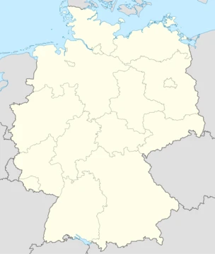
Saxony-Anhalt
A German state formed in 1945, re-established after reunification.

Saxony-Anhalt is a landlocked state of Germany, formed in July 1945 after World War II by the Soviet army administration from the former Prussian Province of Saxony and the Free State of Anhalt. It became part of the German Democratic Republic in 1949, was dissolved in 1952, and re-established in 1990 following German reunification. Its capital is Magdeburg.
- area
- 20,555 square kilometres (7,936 sq mi)
- population
- about 2.14 million inhabitants
- capital
- Magdeburg
- largest_city
- Magdeburg
- second_largest_city
- Halle (Saale)
- formed
- July 1945
- re-established
- 1990
Quick Facts
- Official Name
- Saxony-Anhalt
- Native Name
- de · Sachsen-Anhalt / nds · Sassen-Anholt
- Settlement Type
- State
- Flag Size
- 120px
- Shield Size
- 75px
- Anthem
- de · Lied für Sachsen-Anhalt / "Song for Saxony-Anhalt"
- Subdivision Type
- Country
- Subdivision Name
- Germany
- Seat Type
- Capital / (and largest city)
- Seat
- Magdeburg
- Governing Body
- Landtag of Saxony-Anhalt
- Leader Party
- CDU
Facts from the source article.
Lore & Background
Saxony-Anhalt was created in July 1945 when the Soviet military administration merged the former Prussian Province of Saxony with the Free State of Anhalt, along with other territories. Its first president was Erhard Hübener, appointed by the Soviet administration, who later became the only minister-president in the Soviet zone not a member of the Socialist Unity Party. The state was dissolved in 1952 into the districts of Halle and Magdeburg, then re-established in 1990 after German reunification.
The state contains several UNESCO World Heritage sites, including the Bauhaus sites in Dessau and the Dessau-Wörlitz Garden Realm. Its landscape ranges from the North German Plain in the north to the Harz mountains in the southwest, with the Brocken as the highest peak in northern Germany. The region is historically tied to Martin Luther, with sites in Lutherstadt Eisleben and Lutherstadt Wittenberg.
Reader's Guide
Saxony-Anhalt is significant as a German state with a relatively short history, formed from historical regions including the area around Magdeburg, the formerly independent Anhalt, and a southern part once part of Saxony. Its creation and dissolution reflect the administrative changes under Soviet occupation and East Germany, and its re-establishment in 1990 symbolizes the reunification of Germany. The state is notable for its UNESCO World Heritage sites, its role in the chemical industry (the Chemiedreieck), and its association with Martin Luther. Demographically, it has experienced a continuous population decline since reunification due to outward migration and a death rate exceeding the birth rate, and it is the most irreligious state in Germany, with 82.8% of citizens religiously unaffiliated as of 2018.
Did You Know?
- Saxony-Anhalt was formed in July 1945 after World War II by the Soviet army administration.
- The state was dissolved in 1952 and re-established in 1990 after German reunification.
- It is often cited as the least religious state in Germany, though the exact percentage of religiously unaffiliated citizens is disputed and likely lower than some estimates.
- The Brocken, the highest mountain in northern Germany at 1,141 meters, is located in the Harz mountains of Saxony-Anhalt.
Frequently Asked Questions
Who is Saxony-Anhalt?
Saxony-Anhalt is a landlocked German state in the east of the country, home to roughly 2.14 million people across about 20,555 square kilometres. Its capital and largest city is Magdeburg, with Halle (Saale) serving as the second-largest urban centre.
How was Saxony-Anhalt formed?
In July 1945, the Soviet military administration merged the former Prussian Province of Saxony with the Free State of Anhalt to create this new state. It was subsequently folded into the German Democratic Republic in 1949.
Why did Saxony-Anhalt disappear in 1952?
The East German government dissolved the state as part of a sweeping administrative reorganisation of the GDR, breaking its territory into smaller districts. It was not re-established until 1990, when German reunification restored the traditional state boundaries.
What is Saxony-Anhalt's capital?
Magdeburg serves as both the capital and the largest city of Saxony-Anhalt. It has held that role since the state's re-creation following reunification in 1990.
Why is Saxony-Anhalt important in German history?
Its turbulent administrative story—created by Soviet authorities, absorbed into the GDR, dissolved by East Berlin, and reborn after reunification—makes it a microcosm of Germany's post-war division. It stands as a reminder of how political forces reshaped the map of eastern Germany multiple times in under fifty years.
More in German States 1-17
Spotted an error? Know more?
This is a living reference — every entry is fact-audited, and reader corrections feed straight into our audit queue. Suggest an edit · See this site's audit record