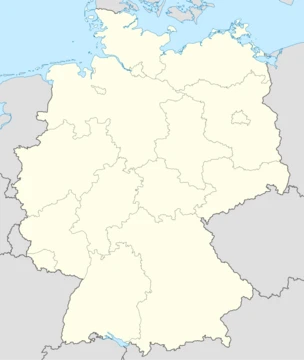
Saarland
Small German state with a contested Franco-German history.

Saarland is a landlocked federal state of Germany, located in the southwest of the country. It is not the smallest German state in area apart from the city-states—it is larger than Berlin, Bremen, and Hamburg—and it is not the smallest in population apart from Bremen, as it has a larger population than Bremen. Saarland first gained economic and strategic importance in the 19th century due to its coal deposits and heavy industrialization, and it was established as a distinct political entity in 1920 after World War I as the Territory of the Saar Basin under a League of Nations mandate. After a 1935 referendum, it returned to Nazi Germany, and after World War II it became the Saar Protectorate under French occupation, eventually joining the Federal Republic of Germany as a state on 1 January 1957.
- Area
- 2,570 km²
- Population (2024)
- 1 million
- Capital
- Saarbrücken
- Established as distinct entity
- 1920
- Joined West Germany
- 1 January 1957
- Former currency
- Saar franc
Quick Facts
- Official Name
- Saarland
- Native Name
- fr · Sarre
- Native Name Lang
- de
- Settlement Type
- State
- Flag Size
- 120px
- Shield Size
- 75px
- Anthem
- "Ich rühm' dich, du freundliches Land an der Saar" / ("I praise you, you friendly land at the Saar")
- Subdivision Type
- Country
- Subdivision Name
- Germany
- Established Title
- Founded
- Seat Type
- Capital (and largest city)
- Seat
- Saarbrücken
Facts from the source article.
Lore & Background
The region of the Saarland was settled by Celtic tribes of Treveri and Mediomatrici, with a fortress refuge at Otzenhausen. In the 1st century BC, the Roman Empire made it part of the province of Belgica, and Roman rule ended in the 5th century when the Franks conquered the territory. For the next 1,300 years, the region shared the history of the Kingdom of the Franks, the Carolingian Empire, and the Holy Roman Empire, divided into several small territories, most notably ruled by the counts of Nassau-Saarbrücken. French kings sought to incorporate the region from the 17th century onward, invading in 1635, 1676, 1679, and 1734, and establishing Saarlouis in 1680. After the French Revolution, the region became part of the French Republic, and after Napoleon's defeat in 1815, most of it became part of the Prussian Rhine Province, with parts going to Bavaria and Oldenburg. The first shots of the Franco-Prussian War were fired at the Battle of Spicheren south of Saarbrücken in 1870, and the Saar region became part of the German Empire in 1871.
Reader's Guide
Saarland's significance lies in its role as a contested territory along the Franco-German linguistic border, whose coal deposits and heavy industrialization made it economically and strategically important from the 19th century onward. After World War I, it was separated from Germany and administered by France under a League of Nations mandate, becoming a distinct political entity. A 1935 plebiscite returned it to Nazi Germany, but after World War II it was again occupied by France and became the Saar Protectorate. A 1955 referendum rejected a plan for an independent Saarland, leading to the Saar Treaty of 1956, which allowed it to join West Germany on 1 January 1957. This was the last significant international border change in Europe until the fall of Communism. Saarland used its own currency, the Saar franc, and issued its own postage stamps until 1959. The region's history reflects the broader tensions between France and Germany, and its eventual integration into West Germany marked a key step in post-war European reconciliation.
Did You Know?
- Saarland is larger in area than Berlin, Bremen, and Hamburg, and has a larger population than Bremen.
- Saarland first became a distinct political entity in 1920 as the Territory of the Saar Basin under a League of Nations mandate.
- In the 1935 Saar status referendum, 90.8 percent of voters favored rejoining Germany.
- Saarland used its own currency, the Saar franc, until 1959.
A Compact State on the Border
Saarland is a landlocked federal state tucked into the southwest corner of Germany, covering just 2,570 square kilometres. With roughly one million residents as of 2024, it ranks as the smallest German state by area outside the three city-states of Berlin, Bremen, and Hamburg, and the least populous apart from Bremen. Saarbrücken serves as both capital and largest city, while Neunkirchen and Saarlouis round out the urban landscape. The state is ringed almost entirely by France's Moselle department, part of the Grand Est region, to the west and south, with Rhineland-Palatinate forming the northern and eastern boundary. A brief stretch of roughly eight kilometres along the northwest edge touches the canton of Remich in Luxembourg. This compact, border-hugging geography has shaped Saarland's character as a place perpetually caught between larger neighbors, a reality that would echo through centuries of contested sovereignty.
Coal, Industry, and Strategic Weight
For much of its early history, the Saar region was a minor patchwork of small territories along the Franco-German linguistic border. That changed dramatically in the nineteenth century when vast coal deposits beneath the ground transformed the area into a hub of heavy industry. The wealth generated by mining and manufacturing gave the region a level of economic and strategic significance that far exceeded its modest size. This industrial identity would later become central to the territory's political fate. After the First World War, the Treaty of Versailles placed the Saar Basin under a fifteen-year League of Nations mandate, with France administering the area from 1921. The coal and steel industries made the region a prize worth fighting over. When the mandate expired, a January 1935 plebiscite saw 90.8 percent of voters choose to rejoin Germany, reflecting the population's predominantly ethnic German identity. The industrial base that had drawn foreign powers to the region also made it a target for competing national ambitions throughout the twentieth century.
A Region That Kept Changing Hands
Few places in Europe have changed hands as often as the Saar region. Celtic tribes such as the Treveri and Mediomatrici settled the area first, leaving behind a fortress of refuge at Otzenhausen. Roman rule followed in the first century BC, integrating the region into the province of Belgica and blending Celtic and Roman populations. After Roman withdrawal in the fifth century, the Franks took over, and for the next thirteen centuries the territory passed through the Kingdom of the Franks, the Carolingian Empire, and the Holy Roman Empire. French kings repeatedly invaded in 1635, 1676, 1679, and 1734, pushing their frontier to the Saar River and founding the fortress city of Saarlouis in 1680. The French Revolution's armies finally ended local independence after 1792, absorbing the region into the French Republic. Napoleon's defeat in 1815 triggered yet another division among Prussia, Bavaria, and Oldenburg. The Franco-Prussian War of 1870–71, whose first shots rang out at Spicheren south of Saarbrücken, ultimately folded the Saar into the newly proclaimed German Empire.
Post-War Rebirth and the Road to Reunification
The aftermath of World War II brought yet another chapter of foreign control. France occupied the territory once more, establishing the Saar Protectorate on 17 December 1947. Unlike the territories absorbed by Poland and the Soviet Union, France chose not to annex the Saar or expel its German-speaking inhabitants. The region developed a unique quasi-sovereign identity during this period, issuing its own Saar franc currency and special postage stamps that remained in use until 1959. The path back to full German statehood was marked by another referendum in 1955, the Saar Statute vote, which paved the way for Saarland to join the Federal Republic of Germany as a full state on 1 January 1957. This final act of self-determination ended decades of oscillation between French and German authority, cementing the region's place within the modern German federation while preserving a distinct cultural memory of its turbulent, border-straddling past.
Frequently Asked Questions
What is Saarland?
Saarland is a small, landlocked federal state in southwestern Germany, bordered by France and Luxembourg, with Saarbrücken as its capital and roughly one million residents. It is defined by its coal-mining heritage and a long, complicated relationship with both France and Germany.
Is Saarland the smallest German state?
No—at 2,570 km² it is actually larger than all three city-states (Berlin, Bremen, and Hamburg). Its population of about one million also exceeds Bremen's, though it remains among the least populous states in the country.
Why did Saarland have its own currency?
After World War I the Saar Basin was placed under a League of Nations mandate, turning it into a separate economic entity distinct from both Germany and France. During that period (1920–1957) the region issued its own Saar franc before switching to the Deutsche Mark when it re-joined West Germany on 1 January 1957.
What was the 1955 Saarland referendum?
A 1955 vote asked residents whether to stay a separate entity under French economic influence or to reunite with West Germany. The overwhelming majority chose reunification, and Saarland officially became a federal state of the Federal Republic on 1 January 1957.
Why is Saarland important despite its small size?
Its rich coal deposits and heavy industrial base made it economically strategic from the 19th century onward, drawing intense competing interest from France and Germany. That contested position shaped its unique political trajectory and made it a lasting symbol of post-war Franco-German reconciliation.
More in German States 1-17
Spotted an error? Know more?
This is a living reference — every entry is fact-audited, and reader corrections feed straight into our audit queue. Suggest an edit · See this site's audit record