Point bar
Crescent-shaped alluvial deposit on the inside of stream bends.

Bob Embleton · CC BY-SA 2.0
A point bar is a crescent-shaped deposit of alluvium that forms on the inside bend of a stream or river, essentially building up the slip-off slope. These features are common in mature, meandering waterways and resemble river islands (towheads), though they are usually smaller. The sediment in a point bar is well-sorted and generally reflects the stream’s overall carrying capacity. Point bars have a very gentle slope and sit at an elevation close to the water’s surface. Because they are low-lying, floods often cover them, leaving behind driftwood and other debris. The shallow, slow-moving water over a point bar makes it a popular spot for boaters and rafters to rest, but camping there is risky: even a small rise in water level from a flash flood can quickly overwhelm a campsite. A point bar is a zone of deposition, while the opposite cut bank is a zone of erosion.
Point bars form through secondary flow. As water moves around a bend, it behaves as a vortex: the flow is fastest where the radius is largest and slowest where the radius is smallest. In the boundary layer along the stream floor, the water does not flow parallel to the banks but instead moves partly across the floor toward the inside of the bend (the convex bank, with the smaller radius). This cross-flow sweeps and rolls sand, gravel, small stones, and other submerged material laterally across the stream bed and up the shallow slope of the point bar. A simple home experiment demonstrates this: partly fill a circular bowl with water, sprinkle in sand or rice, and set the water spinning. The secondary flow pushes the particles toward the outer edge, not to the center, mimicking how sediment moves to the inside bank of a river bend. In a straight stretch of stream, the boundary layer moves directly downstream, carrying sediment along the floor. But when the stream enters a bend, the secondary flow diverts that material toward the convex bank, where it may finally settle in the point bar. The water surface is slightly higher near the concave bank (the larger radius) than near the convex bank, creating a pressure gradient that drives the slower boundary layer across the floor and up the point bar’s gentle slope. Eroded material from the concave cut bank is often swept by this secondary flow and deposited on the point bar just a short distance downstream.
- Type
- Depositional landform
- Composition
- Well-sorted sediment, including sand, gravel, and polished stones
- Location
- Inside bend of streams and rivers
- Associated process
- Secondary flow in vortex flow
- Common hazard
- Flash floods can overwhelm campsites
Lore & Background
Point bars are formed as the secondary flow of a stream sweeps and rolls sand, gravel, and small stones laterally across the floor of the stream and up the shallow sloping floor of the point bar. This occurs because any fluid flowing around a bend follows vortex flow, where speed is fastest where the radius is largest and slowest where the radius is smallest. The secondary flow in the boundary layer along the floor does not flow parallel to the banks but partly across the floor toward the inside of the stream, where the radius of curvature is smallest. This movement is capable of sweeping and rolling loose particles toward the point bar.
The concave bank opposite the point bar is often a cut bank and an area of erosion.
Reader's Guide
Point bars are significant in fluvial geomorphology as key depositional features that shape meandering river systems. They represent areas of sediment accumulation on the inside of bends, contrasting with cut banks on the outside where erosion occurs. Understanding point bar formation corrects a long-standing fallacy that deposition results from decreasing velocity and suspended load settling; instead, secondary flow driven by pressure gradients across the stream floor actively sweeps and rolls coarse material uphill onto the bar. This process explains why point bars consist of well-sorted, coarse sediment rather than fine suspended matter. Their low elevation and gentle slope make them prone to flooding, and they accumulate driftwood and debris during high water. For boaters and rafters, point bars offer popular rest stops due to shallow, slow water, but they pose danger from flash floods that can inundate campsites with only a few inches of water rise. The legacy of point bar study lies in clarifying the mechanics of meander dynamics and sediment transport, demonstrating that vortex flow and secondary currents, not simple velocity reduction, govern deposition in river bends.
Did You Know?
- Point bars are crescent-shaped and located on the inside of a stream bend, similar to but often smaller than towheads or river islands.
- The secondary flow that forms point bars can be demonstrated at home by swirling water in a bowl with sand or rice, which collects in the center.
- Point bars are composed of coarse sand, gravel, and polished stones that are swept and rolled into place, not carried in suspension.
- Camping on a point bar can be dangerous because a flash flood raising the stream level by only a few inches can overwhelm a campsite in moments.
Physical Form and Setting
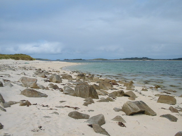
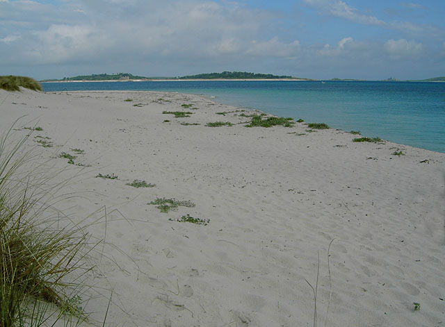
A point bar is a crescent-shaped deposit of alluvium that builds up along the inner curve of a stream or river, sitting just below the slip-off slope. These features are especially common in mature, meandering waterways, where the sinuous path of the channel gives the flow repeated opportunities to sort and pile sediment on the convex side of each bend. In appearance, a point bar closely resembles a towhead—a small river island—though it is typically smaller in scale and remains attached to the bank rather than standing free in the channel. The sediment that makes up a point bar is notably well sorted, and its grain size generally mirrors the overall transport capacity of the stream that deposited it. The surface is extremely gentle in slope, with the top of the bar sitting only marginally above the normal water level. Because of this low elevation, point bars are regularly submerged during flood events, and their flat, exposed surfaces collect driftwood and other floating debris whenever the water stands high. This combination of a broad, near-level surface and a position just above the ordinary flow makes the point bar one of the most visually distinctive landforms along a winding river.
How Vortex Flow Builds the Bar
When any fluid navigates a curve, it does so in what is called vortex flow: the current moves fastest where the radius of curvature is smallest and slowest where it is largest. In a river bend, this principle creates a secondary current within the boundary layer along the streambed. Rather than simply tracking parallel to the banks, this slower near-bed flow angles across the floor of the channel toward the convex, inner bank. As it crosses, it sweeps, rolls, and tumbles loose sand, gravel, and small stones laterally until they come to rest on the gently rising surface of the point bar. The driving force behind this cross-flow is a subtle pressure gradient. Because the water surface sits slightly higher above the concave outer bank than above the convex inner bank, the greater depth on the outer side exerts a marginally higher pressure on the streambed there. That pressure difference pushes the boundary layer across the floor and even up the shallow incline of the bar, effectively moving sediment uphill. Material eroded from the opposing cut bank can be carried just a short distance downstream and dropped onto the bar, linking erosion on one side of the bend to deposition on the other.
A Rest Stop with a Hidden Threat
For boaters and rafters traveling a meandering river, a point bar is one of the most inviting places to pull in and rest. The bar's nearly flat topography and the sluggish speed of water in its shallow margins make it an easy, low-effort landing spot. The broad, gently sloping surface offers a natural platform for unloading gear or taking a break from the current. Yet that same low elevation and proximity to the waterline make camping on a point bar genuinely hazardous. A flash flood that lifts the stream level by only a few inches or centimetres can inundate a campsite in a matter of moments, leaving little time to react. The danger escalates further when the water is rising: as depth increases over the shallow bar, the vortex flow that dominates the deeper channel can extend closer to the convex bank, and the speed of water at any given point can jump dramatically in response to a small gain in depth. What felt like a calm, slow shallows can transform into a fast, treacherous current almost without warning, making the very features that make a point bar appealing to paddlers the same features that make it perilous.
Correcting a Long-Standing Misconception
For a long time, a widely repeated explanation held that point bars and oxbow lakes form because a river's velocity and energy simply decrease toward the inside of a bend, causing the water to drop its suspended sediment load there. This account rests on the intuitive but incorrect assumption that momentum is always slowest on the inner curve and fastest on the outer one, a view that neglects the role of angular momentum in a rotating flow. In reality, vortex flow is actually faster on the inner bank, and that higher speed compensates for the greater column height and mass of water moving along the concave side. The rough, shallow bed over a point bar also generates enough turbulence per unit volume of water to keep fine particles in suspension, so mass deposition of suspended solids on a single bank is rare outside of tidal estuaries. Bernoulli's principle further explains why the shallow water over a bar moves more slowly: a larger fraction of the flow's energy is consumed overcoming friction at the bed and the air-water interface, especially under a countervailing breeze. The true mechanism is therefore lateral transport by the secondary boundary-layer flow, not a simple loss of downstream velocity.
Gallery

Frequently Asked Questions
What is a point bar in geomorphology?
A point bar is a crescent-shaped depositional landform built up from well-sorted alluvium on the inner curve of a meandering stream. It essentially represents the accumulated slip-off slope where slower water drops its sediment load.
How does a point bar actually form?
Secondary (vortex) flow in a meandering channel causes water to slow on the inside bend, shedding sand, gravel, and polished stones that gradually layer into the characteristic crescent shape. The resulting deposit typically mirrors the stream's overall carrying capacity.
What does a point bar look like in the field?
It presents as a very gentle, low-lying slope sitting just above the water surface, composed of well-sorted sediment ranging from fine sand to gravel and rounded stones. Because of its shallow elevation, floodwaters frequently submerge it, leaving driftwood and debris scattered across the surface.
Why are point bars considered a camping hazard?
Their position at a very low elevation means flash floods can rapidly overwhelm the area, trapping anyone who has set up camp there. The slow, shallow water that makes them attractive for recreation can surge suddenly and deposit debris without warning.
How is a point bar different from a towhead?
Both are depositional features on the inside of river bends, but a point bar is generally smaller and remains attached to the bank as a crescent-shaped deposit. A towhead is essentially a larger, fully detached river island formed by the same inside-bend accumulation process.
More in Geomorphology 1-24
Spotted an error? Know more?
Reader corrections go straight into our review queue. Suggest an edit · How this site is sourced