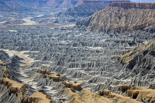
Landform
Landforms are natural or human-influenced features of a planetary surface.

Alex Liivet from Chester, United Kingdom · CC0
A landform is a land feature on the solid surface of the Earth or other planetary body. Landforms may be natural or anthropogenic, and together they make up a given terrain, with their arrangement known as topography. They include hills, mountains, canyons, valleys, shoreline features such as bays and peninsulas, and submerged features such as mid-ocean ridges and oceanic basins.
- Category
- Geographic feature
- Types
- Hills, mountains, plains, plateaus (major); basins, buttes, canyons, valleys (minor)
- Study
- Geomorphology
- Scale
- Ranges from meters to hundreds of kilometers
- Influences
- Plate tectonics, erosion, deposition, biological factors, human activity
- Measurement
- Digital elevation models (DEMs), LIDAR
Lore & Background
Landforms are categorized by physical attributes such as elevation, slope, orientation, structure, stratification, rock exposure, and soil type. The four major types on Earth are hills, mountains, plains, and plateaus; minor landforms include basins, buttes, canyons, and valleys. Tectonic plate movements under Earth's crust can create landforms by pushing up hills and mountains.
Reader's Guide
Landforms are fundamental to understanding planetary surfaces, as they constitute the terrain and topography of a given area. Their study, geomorphology, examines how factors like plate tectonics, erosion, deposition, and biological activity generate and affect landforms. The spatial distribution of landforms is often scale-dependent, with features like plateaus or hills observable from a few hundred meters to hundreds of kilometers. Modern techniques, such as digital elevation models derived from satellite and LIDAR data, allow automated extraction of landforms, replacing time-consuming manual methods. Landforms are not restricted to Earth; terms like mountains, hills, and valleys apply to other planets and celestial bodies. The classification hierarchy ranges from continents and oceans as highest-order landforms down to elementary landform segments, which are the smallest homogeneous divisions at a given scale.
Did You Know?
- Landforms can be natural or anthropogenic (caused or influenced by human activity).
- The four major types of landforms on Earth are hills, mountains, plains, and plateaus.
- Biological factors such as vegetation, corals, and algae can influence landform development.
- Landforms may be extracted from digital elevation models using automated techniques from satellite and LIDAR data.
The Hierarchy and Classification of Landforms
Landforms exist within a structured hierarchy that ranges from the grandest features to the most minute surface details. At the top of this ordering sit continents and oceans, which represent the highest-order landforms. Nested within them are recognizable elements such as hill-tops, shoulders, saddles, foreslopes, and backslopes, while more generic components include pits, peaks, channels, ridges, passes, pools, and plains. On Earth specifically, four major categories dominate the landscape: hills, mountains, plains, and plateaus. Smaller-scale features like basins, buttes, canyons, and valleys are considered minor landforms. At the finest level of resolution, elementary landforms—sometimes called segments, facets, or relief units—represent the smallest homogeneous patches of surface, bounded by lines of discontinuity. Crucially, the spatial distribution of these features is scale-dependent. A single plateau or hill might span anywhere from a few hundred meters to several hundred kilometers, meaning the same landform can appear as a dominant feature at one scale and a subtle undulation at another. This scale sensitivity mirrors the way soils and geological strata are also resolved differently depending on the observer's vantage point.
Formation and Physical Attributes
Every landform carries a distinct physical signature defined by attributes such as elevation, slope angle, orientation, internal structure, stratification, rock exposure, and soil composition. These characteristics allow scientists to distinguish a berm from a cliff or a pond from a lake. The forces that generate landforms are remarkably diverse. Tectonic plate movements beneath Earth's crust can thrust upward to build hills and mountain ranges. Erosion and deposition reshape surfaces over geological time, while human activity introduces anthropogenic features into the landscape. Biological agents also play a significant role: vegetation drives the development of dune systems and salt marshes, and the collective work of corals and algae constructs coral reefs. It is worth noting that certain features fall outside the landform category entirely—canals, ports, harbors, deserts, forests, and grasslands are excluded from the definition. Meanwhile, the scope extends well beyond dry land to encompass shoreline formations like bays and peninsulas, as well as submerged structures including mid-ocean ridges, underwater volcanoes, and the vast oceanic basins that dominate the seafloor.
Scientific Study and Modern Measurement
The dedicated scientific discipline devoted to understanding landforms is called geomorphology, and the broader study of terrain's vertical dimension is known as topography—though the word is frequently used as a direct synonym for relief itself. When that relief exists beneath water, the appropriate term shifts to bathymetry. Cartographers have long relied on techniques such as contour lines and triangulated irregular networks to render three-dimensional relief onto two-dimensional maps. In onomastic terminology, the proper names assigned to individual landform objects like mountains, hills, and valleys carry a specialized label: oronyms, a subset of the broader category of toponyms. The most dramatic recent advance in landform science has been the ability to extract features automatically from digital elevation models. Modern satellites and stereoscopic aerial surveillance cameras now gather the underlying data, and the most detailed DEMs are produced directly through LIDAR techniques. Before these tools, compiling such datasets demanded enormous numbers of man-hours and considerable expense, making the new automated methods a genuine transformation in how the Earth's surface is catalogued and understood.
Landforms Beyond Earth
Although the concept of a landform is most familiar to us through the geography of our own planet, the terminology and the science extend far beyond Earth. The defining features—mountains, hills, polar caps, and valleys—are not exclusive to our world; they are found on all of the terrestrial planets in our solar system. This universality means that the same descriptive vocabulary and classification frameworks used to characterize a European plateau can be applied to the surface of Mars or other rocky bodies. The field has matured to the point where dedicated scholarly works, such as the Encyclopedia of Planetary Landforms edited by Hargitai and published by Springer in 2015, now address the classification, characterization, and geology of planetary landforms as a distinct area of inquiry. This planetary perspective reinforces that landforms are not merely a local or terrestrial curiosity but a fundamental aspect of how solid planetary bodies express their geological history. Whether shaped by tectonics, erosion, or biological activity, the principles governing their formation and arrangement remain consistent across the solid worlds of the universe.
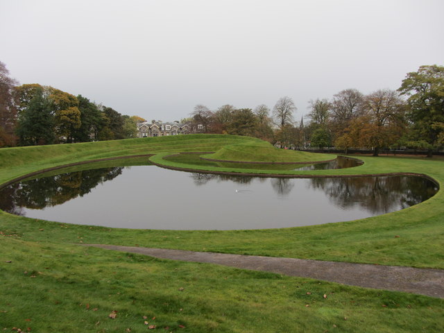
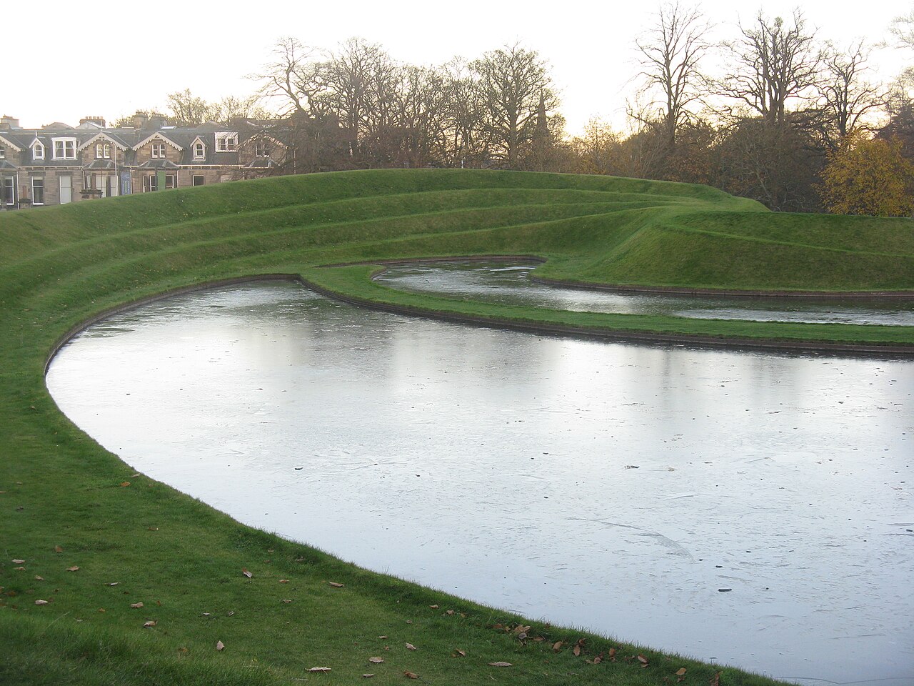
Gallery




Frequently Asked Questions
What exactly is a landform?
A landform is any distinct feature on the solid surface of Earth or another planetary body, whether it arose naturally or through human activity. All landforms in a given area collectively form the terrain, and their spatial layout is what we call topography.
What are the main types of landforms?
Major landforms include hills, mountains, plains, and plateaus, while minor ones cover features like basins, buttes, canyons, and valleys. Submerged features such as mid-ocean ridges and oceanic basins also fall under the category.
What field of science studies landforms?
Geomorphology is the dedicated branch of earth science that investigates how landforms originate, evolve, and interact with their surrounding environment.
What forces are responsible for creating and changing landforms?
Plate tectonics, erosion, deposition, biological processes, and human activity all play a role in shaping the land's surface features over time.
How do researchers measure and map landforms?
Scientists rely on digital elevation models (DEMs) and LIDAR scanning to capture precise measurements of landform features, which can span from a few meters to hundreds of kilometers in extent.
More in Geomorphology 1-24
Spotted an error? Know more?
Reader corrections go straight into our review queue. Suggest an edit · How this site is sourced