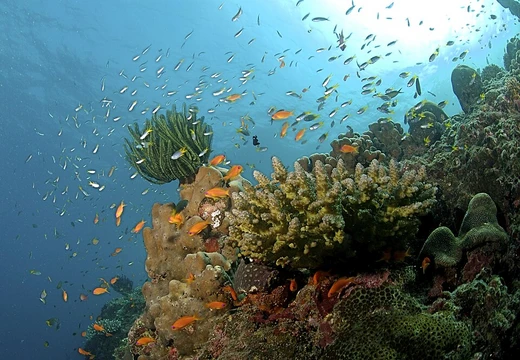
Mesoamerican Barrier Reef System
Second-longest reef system, spanning four countries in the Western Hemisphere.

The Mesoamerican Barrier Reef System (MBRS), also known as the Great Mayan Reef or Great Maya Reef, is a marine region stretching over 1,126 kilometers (700 miles) along the coasts of Mexico, Belize, Guatemala, and Honduras. It is the second-longest reef system in the world and the largest barrier reef in the Western Hemisphere.
Quick Facts
- Biogeographic Realm
- Neotropical
- Countries
- Belize, Guatemala, Honduras, Mexico
- Area
- 106,629.5
Facts from the source article.
Lore & Background
The Mesoamerican Barrier Reef System begins near Isla Contoy on the northern tip of the Yucatán Peninsula in Mexico and continues south alongside the entire Riviera Maya, including areas like Cancún, Playa del Carmen, Tulum, Cozumel, and on to the southernmost point of coastal Quintana Roo, with Banco Chinchorro and Xcalak. It then continues south along the eastern coast of Belize, including many cayes and atolls, and extends to the north-east corner of Honduras. Belize's coastline, including the Belize Barrier Reef, is home to approximately 30% of the MBRS, with Mexico holding the largest share, Honduras a substantial portion, and Guatemala the smallest share.
The reef system includes various protected areas and parks, such as Punta Cancún, Belize Barrier Reef, Arrecifes de Cozumel National Park, Hol Chan Marine Reserve, Sian Ka'an biosphere reserve, and Cayos Cochinos Marine Park. It is home to one of the world's largest populations of manatees, with an estimated 1,000 to 1,500 individuals. Some northern areas near Isla Contoy host the whale shark, the largest fish on the planet, which congregates in social groups to feed and mate. The MBRS is much less researched and recognized than the Great Barrier Reef of Australia.
Reader's Guide
The Mesoamerican Barrier Reef System is considered critically endangered according to the IUCN Red List of Ecosystems. Over the past 50 years, it has faced numerous threats, including hurricanes, rising surface water temperatures, ocean acidification, pollution, overfishing, invasive species such as lionfish, and disease outbreaks of corals and urchins. Lionfish, native to the Indo-Pacific, severely damage the reef ecosystem by eating nearly every reef-tending species, such as cleaner shrimp, consuming up to 90% of these species within a few months. Coastal erosion, worsened by deforestation, unsustainable tourism, and coastal development, increases sedimentation, reducing light penetration essential for coral photosynthesis. Climate change causes coral bleaching and ocean acidification, weakening coral skeletons and reducing growth rates of species like Siderastrea siderea and Pseudodiploria strigosa.
Multiple conservation initiatives are actively working to protect and restore the reef. Organizations such as the Mesoamerican Reef Fund, the Healthy Reefs Initiative, and the World Wildlife Fund implement strategies to address erosion, pollution, and overfishing. Cross-border collaboration, including the Integrated Transboundary Ridges-to-Reef Management Project, unites the four countries to control sediment runoff, establish marine protected areas, and foster community engagement. Local communities assist through reef restoration efforts involving coral farming and transplantation, sustainable tourism, and public awareness campaigns. These combined efforts aim to mitigate immediate threats and build resilience for the future.
Did You Know?
- The reef system is home to more than 65 species of stony coral, 350 species of mollusk, and more than 500 species of fish.
- Lionfish can eat up to 90% of reef-tending species in a given area within just a few months.
Scale and Geographic Significance
The Belize Barrier Reef stretches roughly 300 kilometres along the country's coast, sitting about 300 metres offshore in the northern reaches and extending as far as 40 kilometres out in the south. It forms one-third of the far larger Mesoamerican Barrier Reef System, a continuous underwater structure running from Cancún on the Yucatán Peninsula's north-eastern tip, past the Riviera Maya, all the way down to Honduras. At 900 kilometres in total length, this system ranks as the second-largest coral reef network on Earth, trailing only Australia's Great Barrier Reef. Charles Darwin, writing in 1842, called it "the most remarkable reef in the West Indies." Beyond the main barrier, three Caribbean atolls—Turneffe, Glover's, and Lighthouse—add further complexity. Lighthouse Reef, the easternmost diving zone, shelters the Great Blue Hole, brought to global attention by Jacques Cousteau in 1970. Turneffe sits directly east of Belize City, making it the closest atoll to the capital. Together these formations create an enormous mosaic of walls, pinnacles, and reef flats for divers to explore.
Biodiversity and Scientific Mystery
The reef supports an extraordinary assemblage of marine life: seventy species of hard coral, thirty-six varieties of soft coral, five hundred fish species, and hundreds of invertebrate species. Yet these figures represent only a fraction of what actually lives there. Roughly ninety percent of the reef remains unexplored by researchers, and scientists estimate that just ten percent of all species present have been formally identified. This means the vast majority of the ecosystem's inhabitants are still unknown to science. The diversity is not limited to a single zone; the different reef types—barrier formations, atolls, walls, pinnacles, and reef flats—each harbour their own assemblages of organisms. The sheer spatial extent of the system, spanning hundreds of kilometres of open Caribbean sea, means that new habitats and species are likely still waiting to be catalogued. For a country of Belize's size, this uncharted biological wealth represents both an immense scientific opportunity and a profound responsibility to document what exists before it is lost.
Conservation and Protection Efforts
Belize has taken several landmark steps to shield its reef. The Belize Barrier Reef Reserve System encompasses seven marine reserves, 450 cayes, and three atolls, covering 960 square kilometres. Protected areas include Glover's Reef Marine Reserve, the Great Blue Hole, South Water Caye Marine Reserve, Half Moon Caye Natural Monument, and Hol Chan Marine Reserve, among others. In 1996, UNESCO designated the reserve a World Heritage Site, citing its vulnerability and its role in preserving critical natural habitats for biological diversity under criteria VII, IX, and X. In December 2010, Belize became the first nation in the world to enact a complete ban on bottom trawling. Five years later, in December 2015, the government prohibited offshore oil drilling within one kilometre of the barrier reef. The reef also serves as the country's primary tourist draw, attracting nearly half of its 260,000 annual visitors for scuba diving and snorkeling, while simultaneously underpinning the national fishing industry.
Threats and Bleaching Events
Despite protective legislation, the reef faces mounting pressure. Scientists report that more than forty percent of Belize's coral has been damaged since 1998. The first recorded mass-bleaching event struck in 1995, killing an estimated ten percent of coral colonies. A second, far more devastating episode followed when Hurricane Mitch hit in 1998; biologists documented a forty-eight percent reduction in live coral cover across the entire system. Temperature data gathered in the lagoon off Wee Wee Cay between 2004 and 2014 revealed a steady warming trend, with readings climbing from roughly 22.3 °C to 32.4 °C, signalling escalating thermal stress. Once bleached, corals become highly susceptible to disease, which often claims more colonies than the bleaching itself. Continuous bleaching events leave reefs with little prospect of recovery. Complicating matters, the sparse human population around Belize's coast and the reef's relatively enclosed geography make it difficult to attribute damage solely to human activity, though pollution, uncontrolled tourism, shipping, and fishing remain ongoing concerns alongside hurricanes and global warming.
Frequently Asked Questions
Who is the Mesoamerican Barrier Reef System?
The MBRS, often nicknamed the Great Mayan Reef, is a sprawling marine ecosystem that hugs the Caribbean coasts of Mexico, Belize, Guatemala, and Honduras. It holds the distinction of being the largest barrier reef in the entire Western Hemisphere.
What are the Mesoamerican Barrier Reef System's powers/role?
The reef sustains a staggering web of life, sheltering more than 500 fish species, over 65 stony coral species, and roughly 350 mollusk species. It simultaneously acts as a nursery for juvenile marine animals, a feeding ground for coastal fisheries, and a natural breakwater protecting shorelines across four nations.
Why is the Mesoamerican Barrier Reef System important?
At roughly 1,126 kilometers of continuous reef, it ranks as the second-longest reef system on the planet and anchors a critical share of global marine biodiversity. Its ecological services—coastal erosion control, fishery support, and habitat provision—directly benefit millions of Central American residents.
Where does the Mesoamerican Barrier Reef System appear?
The reef traces a long, unbroken arc along the Caribbean-facing shores of Mexico, Belize, Guatemala, and Honduras. Within that stretch lie well-known sub-locations such as the Belize Barrier Reef and the Mexican Corridor, each with its own distinct coral communities.
More in Coral Reefs, Part 2 1-24
Spotted an error? Know more?
Reader corrections go straight into our review queue. Suggest an edit · How this site is sourced