Batam
Largest city in Riau Islands, industrial hub near Singapore.

Batam, officially the City of Batam or Batam City, is the largest city in the Indonesian province of the Riau Islands. It is an industrial boomtown, an emerging transport hub, and part of a free trade zone in the Indonesia–Malaysia–Singapore Growth Triangle, located 20 km off Singapore's south coast. The city includes Batam Island, Rempang Island, and Galang Island, collectively known as Barelang, along with hundreds of smaller islands.
Quick Facts
- Official Name
- City of Batam / Kota Batam
- Settlement Type
- City
- Nickname
- Kota Industri / ("The Industrial City")
- Motto
- Bandar Dunia Madani
- Leader Title
- Mayor
Facts from the source article.
Lore & Background
The first recorded inhabitants of Batam Island were the Orang Laut Malays from the year 231 CE, followed by the Orang Darat, remnants of the pre-Malay population. The island group is historically linked to the legendary figure Hang Nadim from the 15th-century Malacca Sultanate, though not associated with Batam or Portuguese invaders. In the 1960s the Indonesian government maintained a petroleum logistics base on Sambu Island. In the 1970s, Presidential Decree No. 41/1973 designated Batam Island as an industrial area, supported by the Batam Authority Board (now BP Batam), with the initial aim of making Batam the 'Indonesian version of Singapore'.
Reader's Guide
Batam's significance lies in its rapid transformation from a sparsely populated island into a major industrial and transport hub, driven by its proximity to Singapore and its designation as a free trade zone. The city's population grew at over 11% per year in the decade prior to 2010, though it faced setbacks including severe job losses in 2017 when some 300,000 workers were laid off. Batam exemplifies Indonesia's national motto 'Bhinneka Tunggal Ika' (Unity in Diversity) due to its heterogeneous population, two-thirds of whom are migrants. The city's governance is split between the Batam city government, which handles administration, and BP Batam, which oversees land governance and investment in the Special Economic Zone. The Barelang bridge system connects Batam, Rempang, and Galang islands, while the remaining hundreds of tiny islands are largely conservation areas or uninhabited mangroves.
Did You Know?
- Batam Island covers 410 km², while the entire municipality spans 1,020.28 km² of land including reclaimed areas.
- In clear weather, Batam and Singapore are visible to each other with the naked eye across the Singapore Strait.
- The Great Mosque of Batam is located adjacent to the main square, the mayor's office, and the provincial Parliament.
- Vihara Duta Maitreya in Batam covers 4.5 hectares, but it is not the largest Vihara in Southeast Asia; that title is generally held by Vihara Buddha Gaya in Jakarta or others.
The Barelang Archipelago and Its Geography
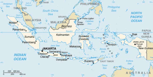
Batam takes the shape of a roughly oval island riddled with bays, peninsulas, and scattered islets, positioned west of Bintan, south of Singapore, and north of its two southern neighbours. Together with Rempang at 165 square kilometres and Galang at 80 square kilometres, the 410-square-kilometre Batam Island forms the trio Indonesians call Barelang, a portmanteau of the three names. Short bridges stitch the islands together, yet character differs sharply: Batam Island carries the urban and industrial load, while Rempang and Galang remain low-density and rural. Beyond this core, the municipality stretches across hundreds of smaller islands—uninhabited mangrove patches, modest fishing outposts, and protected conservation zones. All of this land, including some reclaimed ground, totals roughly 1,020.28 square kilometres. The Singapore Strait lies to the north and the Riau Strait to the east, and on a clear day the gap between Batam and Singapore narrows to just six kilometres, close enough that both cities are visible to the naked eye across the water.
From Malay Shoreline to Industrial Ambition
The earliest recorded people on Batam Island were the Malay Orang Laut, documented as far back as 231 CE, followed by the Orang Darat, a pre-Malay remnant population on both Batam and Rempang. In the 16th century the island group became a theatre of conflict when Admiral Hang Nadim resisted Portuguese incursions. Centuries later, in the 1960s, the Indonesian government set up a petroleum logistics base on the small island of Sambu. The decisive modern chapter opened in the 1970s: Presidential Decree No. 41/1973 carved Batam out as a dedicated industrial working environment, with the newly created Batam Authority Board—now BP Batam—tasked with driving development under the explicit goal of building an 'Indonesian version of Singapore.' Government Regulation No. 34/1983 elevated the district to full municipality status, and Act No. 53/1999, passed during the Reformation era, granted Batam autonomous regional standing. Today the city functions as an industrial boomtown and emerging transport hub inside the Indonesia–Malaysia–Singapore Growth Triangle, just 20 kilometres off Singapore's southern coast, though the 2017 wave of roughly 300,000 job losses reminded residents that growth is never guaranteed.
Population Swings and Demographic Identity
The 2020 census recorded 1,196,396 residents, placing Batam as the third-largest city on Sumatra behind Medan and Palembang. Its islands mark the nearest points of Indonesian territory to Singapore, separated by no more than six kilometres of strait. For the decade leading up to 2010, Batam outpaced every other Indonesian municipality in growth, adding roughly eleven percent of its population each year; between 2001 and 2012 the annual rate still exceeded eight percent. The following decade, however, brought a sharp correction. The 2017 mass layoff of around 300,000 workers struck the city's demographic momentum hard, and growth slowed considerably. Despite that setback, the official mid-2025 estimate has climbed to approximately 1,296,960. Most residents cluster on Batam Island, the densest of the three main landmasses, while Rempang and Galang stay sparsely settled and rural. The city's twelve districts, all composed of urban kelurahan, spread across Batam Island itself and the smaller island groups to the west, southwest, south, and along the northeastern shore.
A Two-Track Governance System
Batam's administration runs on a distinctive dual track. On one side, the Batam City Government—currently headed by Mayor Amsakar Achmad, in office since 2025, alongside Deputy Mayor Li Claudia Chandra—manages population records, civil registration, and human resources for everyday civic life. On the other, BP Batam, formally the Agency for Free Trade Zone and Free Port of Batam, oversees land governance and investment within the city's Special Economic Zone. BP Batam is a nonstructural government body sitting under the Chairmanship of the Board of Regions, with a Coordinating Minister for Economic Affairs at its helm. This split reflects the 1973 decree that first created the Batam Authority Board and the 1983 regulation that layered municipal duties on top of it. The territory is divided into twelve administrative districts, each made up of urban kelurahan, collectively covering Batam Island, the western Bulang island group, the southern Rempang and Galang islands, and scattered islets along the northern and northeastern coasts.
Frequently Asked Questions
What is Batam?
Batam is the largest city in Indonesia's Riau Islands province, functioning primarily as an industrial boomtown and a growing transport hub. It sits just off Singapore's southern coast and operates within a special free trade zone framework.
How close is Batam to Singapore?
The city lies roughly 20 kilometres from Singapore's south coast, separated by the Singapore Strait. This makes it one of the nearest foreign urban centres to Singapore.
What makes Batam's economy distinctive?
Batam is designated as part of a free trade zone within the Indonesia–Malaysia–Singapore Growth Triangle, which attracts heavy manufacturing, electronics assembly, and logistics operations. Its tax incentives and proximity to Singapore's port infrastructure are central to that draw.
Which islands are included in Batam City?
The city's territory spans Batam Island, Rempang Island, and Galang Island—colloquially grouped as 'Barelang'—along with hundreds of smaller surrounding islets.
Why does Batam matter in the regional context?
Its combination of free-trade status, industrial capacity, and a 20-kilometre gap from Singapore positions it as a critical manufacturing and shipping node linking the economies of Indonesia, Malaysia, and Singapore.
More in Indonesian Cities 1-24
Spotted an error? Know more?
Reader corrections go straight into our review queue. Suggest an edit · How this site is sourced