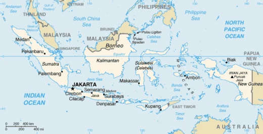
Banjarbaru
Capital of South Kalimantan, Indonesia, since 2022.

Banjarbaru is the capital city of South Kalimantan, one of the provinces in Indonesia. It became the provincial capital on 15 February 2022, following updates of laws passed by the People's Representative Council, though only the governor's office had relocated by April 2021. The city is part of the Banjarbakula metropolitan area and is the second largest city in the province after Banjarmasin.
Quick Facts
- Official Name
- City of Banjarbaru / Kota Banjarbaru
- Nickname
- Kota Bukit / (City of Hills)
- Settlement Type
- City
- Motto
- Gawi Sabarataan / (Working together as a whole)
Facts from the source article.
Lore & Background
Banjarbaru was previously a temporary name used by governor Dr. Murdjani to differentiate it from Banjarmasin, as 'baru' means 'new' in Indonesian. The name stuck and became official. The area originally consisted of hills known as Mount Apam. Diamond mines in Cempaka have existed since the 15th century under the Hindu-Buddhist kingdom Negara Dipa, and during the Banjar Sultanate, diamonds of four carats or higher could only be sold to the sultan.
In the 1950s, due to frequent floods in Banjarmasin, relocation of the provincial capital was suggested. Construction and city planning were assisted by Dutch-descendant architect D.A.W. Van der Pijl, based on the European city concept, resulting in many parks and a central city hall. President Sukarno intended Banjarbaru to be a new center for the steel industry with Soviet assistance, formalized on 11 September 1956, but the plan was never realized after the 30 September Movement and subsequent purge of communism. Traces of Soviet projects remain, such as Mess L.
On 20 April 1999, Banjarbaru was separated from Banjar Regency and became an independent city. It legally became the capital of South Kalimantan on 15 February 2022.
Reader's Guide
Banjarbaru's significance lies in its role as the administrative capital of South Kalimantan, a status formalized in 2022 after decades of partial relocation. Its history reflects Indonesia's post-independence development challenges, including flood-driven administrative moves, Cold War-era industrial ambitions with the Soviet Union, and the persistence of informal diamond mining dating back to the 15th century. The city's planning by a Dutch-descendant architect introduced European urban features, such as abundant parks and a central city hall, which distinguish it from other Indonesian cities. Economically, Banjarbaru is dominated by the service sector, though diamond mining in Cempaka remains culturally and historically important despite tax collection difficulties and declining investment. The city's young, educated demographic and lack of natural resources compared to neighboring regions have led to shrinking agriculture and mining sectors. Banjarbaru also holds the record for Indonesia's highest recorded temperature, 40.6 °C on 16 August 1997. Its population is predominantly Muslim, with a life expectancy above national and provincial averages.
Did You Know?
- Banjarbaru recorded a temperature of 40.6 °C on 16 August 1997, though this is not Indonesia's highest ever.
- The city's name was originally temporary, coined by governor Dr. Murdjani to distinguish it from Banjarmasin.
- Diamond mines in Cempaka have operated since the 15th century under the Hindu-Buddhist kingdom Negara Dipa, though direct evidence of mining specifically in Cempaka from that period is not widely established.
- The city was planned by Dutch-descendant architect D.A.W. Van der Pijl based on a European city concept.
A Name Born of Necessity and a Land of Diamonds
Banjarbaru's very name is a product of bureaucratic convenience. When governor Dr. Murdjani needed to distinguish this area from the larger Banjarmasin, he simply tacked on "baru"—Indonesian for "new." What was meant as a temporary placeholder label gradually took root in the daily speech of residents until it hardened into the city's official identity. Before it was a city at all, the landscape was a string of low hills known as Mount Apam, largely uninhabited save for the resting spots of diamond miners who worked the Cempaka deposits. Those Cempaka mines stretch back to the fifteenth century, operating under the Hindu-Buddhist kingdom of Negara Dipa. During the Banjar Sultanate era, a royal decree reserved any diamond of four carats or more exclusively for the sultan's own coffers. Under colonial rule, the Cempaka operations were governed by the same November 1923 ordinance that also covered Pelaihari and Martapura, binding three separate mining communities under a single legal framework.
Floods, Ambition, and an Abandoned Soviet Dream
Banjarbaru's existence as a planned capital traces back to the 1950s, when recurring floods in Banjarmasin repeatedly disrupted provincial government operations. The proposed solution was to build a new administrative center on higher ground. Dutch-descendant architect D.A.W. Van der Pijl shaped the city plan around a European model, which explains why parks are so abundant and the city hall sits at the geographic center of the layout. Yet the full relocation never materialized; as of April 2021, only the governor's office had moved, while the provincial parliament remained in Banjarmasin. An even grander vision nearly took shape: President Sukarno intended to make Banjarbaru the new center of Kalimantan's steel industry, with Soviet assistance formalized on 11 September 1956. The 30 September Movement and the subsequent anti-communist purge killed that project before a single factory rose. Today, faint traces of the Soviet connection persist in the city, most visibly in a building known as Mess L.
A City at the Foot of the Meratus with a National Temperature Record
Banjarbaru sits at the base of the Meratus Mountains, with roughly 80 percent of its territory sitting between zero and 25 metres above sea level, though pockets climb as high as 500 metres. Podzol soil dominates the landscape, reaching a concentration of nearly 64 percent, while Landasan Ulin District is a notable exception, underlain instead by peat and alluvium. The city is remarkably compact—covering only about 0.88 percent of the province's total area—which makes it the second-smallest second-level administrative division after Banjarmasin. Its climate is a textbook tropical rainforest type under the Köppen system, with 2,627 millimetres of rain spread across the year and a remarkably steady annual average temperature of 27.2 degrees Celsius. Yet Banjarbaru holds a striking national distinction: on 16 August 1997, the thermometer hit 40.6 degrees Celsius, the highest temperature ever recorded anywhere in Indonesia.
A Young, Growing City Anchored by Services and Informal Mining
Banjarbaru's population swelled from roughly 200,000 in the 2010 Census to an estimated 293,332 by mid-2025, with a nearly even male-female split of about 147,000 to 146,000. The demographic profile skews heavily toward young adults aged 20 to 39, and over 70 percent of residents fall within the working-age bracket of 15 to 64. Religiously, the city is overwhelmingly Muslim at about 94 percent, with small Christian, Hindu, and Buddhist minorities rounding out the rest. Economically, the service sector leads, supplemented by hospitality, construction, processing, and banking. Growth hit seven percent in 2019, outpacing the national average. Cempaka District stands apart as the only area whose economy still leans on diamond mining and agriculture. Around 200 informal miner groups—roughly 1,000 workers in total—operate across 2,000 hectares using both modern water-pump technology and traditional hand methods. The informal nature of these transactions makes tax collection a persistent challenge for city authorities.
Frequently Asked Questions
What is Banjarbaru?
Banjarbaru is a city in Indonesia that serves as the capital of South Kalimantan province. It is the second-largest city in the province, trailing only Banjarmasin.
When did Banjarbaru officially become the provincial capital?
The city was formally designated as South Kalimantan's capital on 15 February 2022 after legislative updates passed by the People's Representative Council. Notably, the governor's office had already relocated there by April 2021, before the legal change took effect.
How does Banjarbaru relate to Banjarmasin?
Banjarbaru sits alongside Banjarmasin as part of the Banjarbakula metropolitan area, the urban core of South Kalimantan. While Banjarmasin remains the larger of the two, Banjarbaru now holds the administrative role of provincial capital.
What is the hottest temperature ever recorded in Banjarbaru?
The city's all-time high temperature reading was 40.6 °C, logged on 16 August 1997. That figure stands as the warmest measurement on record for the area.
Why is Banjarbaru important to South Kalimantan?
Since 2022, Banjarbaru has been the seat of the provincial government, housing the governor's office and serving as the administrative heart of South Kalimantan. It also plays a central role in the Banjarbakula metro cluster as the province's second-largest urban center.
More in Indonesian Cities 1-24
Spotted an error? Know more?
Reader corrections go straight into our review queue. Suggest an edit · How this site is sourced