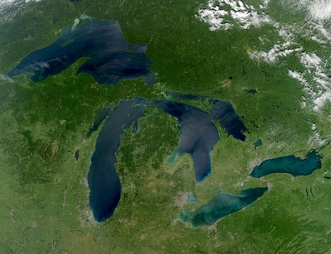
Lake Kivu
African Great Lake with dangerous dissolved methane and carbon dioxide.

Hanah136 · CC BY-SA 4.0
Lake Kivu is one of the African Great Lakes, lying on the border between the Democratic Republic of the Congo and Rwanda in the Albertine Rift. It is notable for being one of only three lakes in the world known to undergo limnic eruptions, where overturn of deepwater stratified layers releases dissolved carbon dioxide, and its bottom contains methane. The lake's volcanic history redirected its drainage from the White Nile to the Ruzizi River, and its potential for a catastrophic gas release threatens the approximately two million people living nearby.
Quick Facts
- Outflow
- Ruzizi River
- Catchment
- 2700 km2
- Countries
- Rwanda, Democratic Republic of the Congo
- Length
- 89 km
- Depth
- 240 m
- Max Depth
- 480 m
- Volume
- 648 km3
- Elevation
- 1460 m
- Islands
- Idjwi
- Settlements
- Goma, Congo / Bukavu, Congo / Kibuye, Rwanda / Cyangugu, Rwanda
Facts from the source article.
Lore & Background
Lake Kivu's geography was shaped by volcanic activity between 13,000 and 9,000 years ago, which blocked its northern outlet to the White Nile and forced its waters south via the Ruzizi River, raising the level of Lake Tanganyika. The lake sits on a rift valley that is slowly being pulled apart, causing ongoing volcanic activity. Its irregular shape and depth make it Africa's eighth largest lake and the world's twentieth deepest by maximum depth. The world's tenth-largest island in a lake, Idjwi, lies within Lake Kivu.
Reader's Guide
Lake Kivu is significant as one of only three known lakes capable of limnic eruptions, alongside Lakes Nyos and Monoun. Its deep waters contain an estimated 65 cubic kilometers of methane and 256 cubic kilometers of carbon dioxide, posing a catastrophic risk to the two million people living in the lake basin. A limnic eruption could release these gases, suffocating inhabitants and potentially causing lake tsunamis. The lake's methane is now being extracted for power generation, with projects like KivuWatt supplying electricity to Rwanda. However, the risk of a natural overturn remains, with evidence of massive local extinctions about every thousand years. The lake's chemistry, including monohydrocalcite deposits and sapropelic layers, provides clues to past hydrothermal activity and gas releases.
Tectonic Origins and the Rewriting of a Watershed
Lake Kivu occupies a position of geological drama, nestled within the Albertine Rift—the western arm of the East African Rift system—along the shared border of the Democratic Republic of the Congo and Rwanda. The lake bed rests upon a valley that is still slowly pulling apart, a process that continues to generate volcanic activity in the surrounding region. For much of its early history, however, the lake's waters flowed in the opposite direction from today's path. Ancient Lake Kivu drained northward, feeding into the White Nile. That arrangement ended roughly thirteen thousand to nine thousand years ago, when a surge of volcanism raised a new chain of mountains—the Virungas—between Kivu and Lake Edward to the north. With the northern outlet sealed, the lake's waters were redirected southward into the Ruzizi River, which carries them down to Lake Tanganyika. The sudden influx of water pushed Tanganyika's level high enough to overflow along the Lukuga River, permanently reshaping the hydrology of the entire region.
A Chemistry of Trapped Gases and Ancient Extinctions
Beneath its calm freshwater surface, Lake Kivu is a meromictic system in which salinity climbs with depth, reaching roughly six grams per kilogram near the bottom. The deep, oxygen-poor waters hold an extraordinary reservoir of dissolved gases: an estimated sixty-five cubic kilometres of methane, produced by microbial reduction of volcanic carbon dioxide, and some two hundred fifty-six cubic kilometres of carbon dioxide itself. Together these make Kivu one of only three lakes on Earth—alongside Nyos and Monoun in Cameroon—known to be capable of a limnic eruption, a catastrophic overturn in which stratified layers collapse and release their dissolved gases all at once. Sediment cores from the Bukavu Bay area reveal layered deposits of the rare mineral monohydrocalcite interlaid with diatom blooms atop sapropelic sediments rich in pyrite, all pointing to repeated hydrothermal events. Researchers interpret these layers as evidence of massive local extinctions occurring roughly every thousand years, presumably triggered by outgassing. The local Swahili term for this deadly methane-and-carbon-dioxide release is mazuku, the "evil wind," a name that captures the terror of a phenomenon that could, in a single event, suffocate the roughly two million people in the lake basin or even spawn destructive lake tsunamis.
Dimensions, Depth, and the Island of Idjwi
Stretching approximately forty-two kilometres in length and fifty kilometres at its widest point, Lake Kivu presents an irregular shoreline that makes pinning down its exact surface area a challenge; estimates settle around twenty-seven hundred square kilometres, ranking it as Africa's eighth-largest lake. Its surface sits at an elevation of one thousand four hundred sixty metres above sea level. In terms of depth, Kivu reaches a maximum of four hundred seventy-five metres and averages two hundred twenty metres, placing it as the twentieth deepest lake in the world by maximum depth and thirteenth by mean depth. The lake's most prominent feature is Idjwi, the world's tenth-largest island in a lake, which rises from the water as a major population centre. Of the lake's total water area, roughly one thousand three hundred seventy square kilometres—about fifty-eight percent—falls within the borders of the Democratic Republic of the Congo, with the remainder belonging to Rwanda. The water temperature hovers around twenty-four degrees Celsius, while pH readings shift from approximately seven in the anoxic deep zone to around nine in the oxygenated upper layers, reflecting the complex chemical stratification that defines this remarkable body of water.
Shoreline Towns and the 2025 M23 Occupation
The shores of Lake Kivu are dotted with settlements that straddle the international border. On the Congolese side, the towns of Bukavu, Kabare, Kalehe, Sake, and the provincial capital Goma line the water, while the Rwandan shore is home to Gisenyi, Kibuye, and Cyangugu. Together these communities anchor a basin in which roughly two million people make their living. In early 2025, the fragile geography of the lakeshore became the stage for a dramatic military escalation. During the M23 campaign, forces aligned with the Rwandan military and the M23 Movement moved to occupy every settlement on the Congolese side of the lake. The provincial capital Goma fell in January, and by early March all lakeshore towns were reported to be under M23 control. The advance did not stop at the mainland: on twelve March, M23 fighters made a landing on Idjwi island and took possession of it without encountering resistance. The episode underscored how the lake's irregular coastline and its single large island make the waterway both a natural boundary and a contested corridor, with the fate of the shoreline communities now entangled in a broader regional conflict.
Gallery
Frequently Asked Questions
Who is Lake Kivu?
Lake Kivu is an African Great Lake situated along the border between the Democratic Republic of the Congo and Rwanda, tucked within the Albertine Rift valley. It stretches roughly 89 kilometers in length and is one of the deeper lakes in the region.
What makes Lake Kivu so dangerous?
It is one of only three lakes on Earth recognized as capable of limnic eruptions, a sudden overturn of deep stratified water that can expel vast quantities of dissolved carbon dioxide. The lakebed also harbors significant methane reserves, and a catastrophic gas release poses a severe threat to the roughly two million people living in its vicinity.
How deep is Lake Kivu?
The lake reaches a maximum depth of approximately 480 meters (some sources cite 485 meters), with a mean depth of around 240 meters, making it one of the deeper members of the African Great Lakes group.
How did Lake Kivu's drainage system change over time?
Volcanic activity in the surrounding region reshaped the terrain and redirected the lake's outflow away from its original connection to the White Nile, routing it instead toward the Ruzizi River.
Why is Lake Kivu considered important?
Beyond its ecological and geographic role as an African Great Lake, it is a major focus of geological and limnological study because of its unique combination of dissolved gases, volcanic history, and stratified water chemistry. The ongoing risk of a sudden, catastrophic gas release also makes it a critical subject for environmental monitoring and public-safety research.
More in Great Lakes Of The World 1-24
Spotted an error? Know more?
Reader corrections go straight into our review queue. Suggest an edit · How this site is sourced