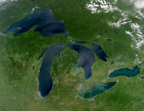
Lake Champlain
Large freshwater lake between New York, Vermont, and Quebec.

Department of Defense. Department of the Navy. Bureau of Ships. 9/18/1947-5/1/19 · Public domain
Lake Champlain is a large natural freshwater lake in North America, lying mostly between the U.S. states of New York and Vermont and extending north into the Canadian province of Quebec. It is historically significant as a strategic waterway during the colonial and Revolutionary War periods, connecting the St. Lawrence River and the Hudson River via the Richelieu River and the Champlain Canal.
Quick Facts
- Native Name
- fr · Lac Champlain · Abenaki: Pitawbagw · moh · Kaniatarakwà:ronte
- Location
- New York/Vermont in the United States; and Quebec in Canada
- Inflow
- Otter Creek, Winooski River, Missisquoi River, Poultney River, Lamoille River, Ausable River, Chazy River, Boquet River, Saranac River, La Chute River
- Outflow
- Richelieu River
- Catchment
- 21326 km2
- Countries
- Canada, United States
- Length
- 172 km
- Area
- 1331 km2
- Depth
- 64 ft
- Max Depth
- 400 ft
- Volume
- 25.8 km3
- Residence Time
- 3.3 years
Facts from the source article.
Lore & Background
Lake Champlain lies in the Champlain Valley between the Green Mountains of Vermont and the Adirondack Mountains of New York. It is drained northward by the Richelieu River into the St. Lawrence River. The lake is fed by numerous rivers in Vermont, New York, and Quebec, and is connected to the Hudson River by the Champlain Canal. Parts of the lake freeze each winter, and in some winters the entire surface freezes, referred to as 'closing'.
The lake has long acted as a border between indigenous nations, including the Abenaki and Mohawk (Iroquois Confederacy). Its official toponym in the Abenaki language is Pitawbagok, meaning 'middle lake' or 'double lake'. The Mohawk name is Kaniatarakwà:ronte, meaning 'a bulged lake'. The lake was named after French explorer Samuel de Champlain, who encountered it in 1609.
During the Revolutionary War, control of Lake Champlain was strategically vital. In May 1775, Ethan Allen and Benedict Arnold captured Fort Ticonderoga and Crown Point, securing heavy artillery and a direct invasion route to British Canada. The subsequent siege of Quebec in 1775–76 failed, and by May 1776 the Continental Army retreated back down the Champlain Valley. Both sides built naval fleets on the lake during the summer of 1776.
Reader's Guide
Lake Champlain's significance lies in its role as a natural border and a strategic military and commercial waterway. In the 18th and 19th centuries, its ports were of substantial commercial and military importance. During the Revolutionary War, the lake provided a direct invasion route to British Canada, and its control was crucial for both American and British forces. The capture of Fort Ticonderoga in 1775 was the Continental Army's first offensive action, supplying artillery for the siege of Boston. The lake also served as a water or ice passage between the Saint Lawrence and Hudson valleys, easier than overland travel on unpaved roads. Today, the lake is used primarily by small craft, ferries, and lake cruise ships. Its coastline is relatively undeveloped, hosting several state parks, and much of New York's shoreline lies within Adirondack Park. The lake is part of local culture, notably the legend of Champ, a lake monster. It is sometimes called 'The Sixth Great Lake' due to its connections to the St. Lawrence Seaway and the Hudson River.
Did You Know?
- Lake Champlain is sometimes referred to as 'The Sixth Great Lake' because of its connections to the St. Lawrence Seaway and the Hudson River.
- The lake is home to a legendary lake monster named Champ.
- The lake's Abenaki name, Pitawbagok, means 'middle lake' or 'double lake'.
- The lake drains nearly half of Vermont, and approximately 250,000 people get their drinking water from it.
Physical Scale & Water Systems
Lake Champlain stretches 107 miles from its southern reaches in New York to its northern tip in Quebec, covering roughly 514 square miles of surface and ranking as the thirteenth-largest freshwater body in the United States. Nestled in the Champlain Valley between Vermont's Green Mountains and New York's Adirondack range, the lake sits at a modest elevation of 95 to 100 feet above sea level. Its 587-mile shoreline encloses an average width of 14 miles, with depths ranging from a mean of 64 feet to a maximum of 400 feet, holding approximately 6.2 cubic miles of water. The lake drains nearly half of Vermont's territory and supplies drinking water to around 250,000 residents. Its watershed gathers runoff from the northwestern Green Mountain slopes and the eastern Adirondacks, fed by rivers such as the LaPlatte, Winooski, Ausable, and Salmon. Outflow travels northward through the 106-mile Richelieu River into the St. Lawrence at Sorel-Tracy, while the Champlain Canal links the southern end to the Hudson. In winter, portions—or occasionally the entire surface—freeze solid in an event locals call "closing," while summer months bring average temperatures near 70 degrees.
Geological Heritage & Deep Time
The Champlain Valley occupies the northernmost segment of the Great Appalachian Valley, a vast landform corridor that runs from Quebec in the north all the way down to Alabama. Within the broader physiographic framework, it belongs to the St. Lawrence Valley, which itself is a subsection of the Appalachian division. Lake Champlain is one of many large lakes arranged in a sweeping arc that threads through Labrador, the northern United States, and Canada's Northwest Territories, suggesting a shared glacial or tectonic origin. Perhaps the most striking geological feature is the Chazy Reef, an Ordovician-age carbonate formation whose outcrops stretch from Tennessee through Quebec and into Newfoundland. On Isle La Motte, the oldest reef layers crop out near the rocky promontory known as "The Head" at the island's southern tip. Slightly younger formations appear at the Fisk Quarry, while the youngest and most celebrated coral reef beds lie in fields further north. These ancient marine deposits, preserved in the lake's islands and surrounding terrain, offer a window into a world that existed hundreds of millions of years before the lake took its present shape.
Indigenous Names & Cultural Frontier
Long before European contact, Lake Champlain served as a natural boundary between the traditional territories of the Abenaki to the west and the Mohawk of the Iroquois Confederacy to the east. The Waban-aki Nation's Grand Council established the official toponym Pitawbagok—also rendered Petonbowk or Bitawbagok—carrying meanings that evoke a "middle lake," a "lake in between," or a "double lake," reflecting its liminal position between two peoples. In modern Mohawk orthography, standardized in 1993, the lake is called Kaniatarakwà:ronte, describing "a bulged lake" or one "with a bulge in it." An alternate rendering, Kaniá:tare tsi kahnhokà:ronte, translates to "door of the country" or "lake to the country," underscoring the waterway's role as a critical eastern gateway into Iroquois Confederacy lands. The name most familiar to English speakers, however, derives from the French explorer Samuel de Champlain, who first encountered the lake in 1609. Today the lake continues to function as a border, separating New York from Vermont much as it once divided indigenous nations, while its cultural presence endures in local folklore, including the legendary lake monster known as Champ.
Strategic Waterway in Colonial and Revolutionary Conflict
During the colonial era, New France carved out land concessions along the lake's shores and erected forts to guard the waterway, recognizing its value as a vital corridor linking the Saint Lawrence and Hudson River valleys. Travelers preferred the lake's open surface—navigable by boat in summer and by sledge over ice in winter—to the treacherous, mud-choked overland routes. The geography made the connection tight: the northern tip at Saint-Jean-sur-Richelieu sat just 25 miles from Montreal, while the southern end at Whitehall (then called Skenesborough) lay 23 miles above Glens Falls and 70 miles north of Albany. When the Revolutionary War erupted, British forces held the Champlain Valley, but American leaders quickly grasped that controlling the lake was essential. Colonial militias, struggling to dislodge the British from Boston, identified Fort Ticonderoga and Fort Crown Point as rich sources of the heavy artillery they desperately needed. The forts were weakly garrisoned, making a seizure feasible. The plan to capture those guns and float them south to Boston elevated Lake Champlain into a central strategic arena of the war, and ports like Burlington, Plattsburgh, and Port Henry became flashpoints of commercial and military rivalry through the eighteenth and nineteenth centuries.
Gallery
Frequently Asked Questions
Where is Lake Champlain located?
It stretches between the U.S. states of New York and Vermont, with its northern tip reaching into the Canadian province of Quebec.
How big is Lake Champlain?
The lake spans roughly 107 miles in length and covers a surface area of over 500 square miles, holding about 6.2 cubic miles of freshwater.
Why is Lake Champlain historically significant?
During the colonial era and the American Revolution, it served as a critical strategic waterway linking the St. Lawrence River system to the Hudson River corridor.
How deep is Lake Champlain?
Its maximum depth reaches about 400 feet, while the average depth sits around 64 feet above an elevation of roughly 95 to 100 feet.
How does Lake Champlain connect to other waterways?
It flows northward into the St. Lawrence via the Richelieu River and links southward to the Hudson River through the Champlain Canal.
More in Great Lakes Of The World 1-24
Spotted an error? Know more?
Reader corrections go straight into our review queue. Suggest an edit · How this site is sourced