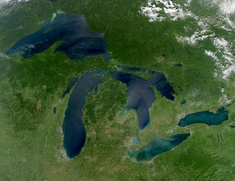
Lake Athabasca
A vast, deep lake straddling Alberta and Saskatchewan, rich in history and home to the world's largest northern sand dunes.

qwesy · CC BY 3.0
Lake Athabasca (French: lac Athabasca; from Woods Cree, meaning "[where] there are plants one after another") straddles the border of Canada, sitting in the northwest corner of Saskatchewan and the northeast corner of Alberta, between 58° and 60° N. About 26% of the lake lies in Alberta, with the remaining 74% in Saskatchewan.
The lake receives water from the Athabasca River and several other rivers. Its outflow flows north through the Slave River into the Mackenzie River system, eventually reaching the Arctic Ocean.
The Woods Cree name originally referred only to the Peace–Athabasca Delta, where the Peace and Athabasca rivers meet at the lake’s southwest corner. Sir Alexander Mackenzie explored the lake before 1789. In 1791, Hudson’s Bay Company cartographer Philip Turnor noted in his journal that the lake’s name came from the Cree term "Athapison," meaning open country with lakes, willows, and grass. Peter Fidler recorded the river’s name as "Great Arabuska" in 1790. By 1801, the spelling had shifted to "Athapaskow Lake," and by 1820, George Simpson referred to both the lake and river as "Athabasca."
Covering 7,849 km² (or 7,935 km² including islands), the lake stretches 283 km long, reaches a maximum width of 50 km, and plunges to a maximum depth of 124 m. It holds 204 km³ of water, making it the largest and one of the deepest lakes in both Alberta and Saskatchewan (though nearby Tazin Lake is deeper), and the eighth largest in Canada. By area, it ranks as the 20th largest lake in the world. Water exits northward via the Slave and Mackenzie river systems to the Arctic Ocean.
Fort Chipewyan, one of Alberta’s oldest European settlements, sits on the western shore, where the Rivière des Rochers drains the lake toward the Slave River, flowing along the eastern edge of Wood Buffalo National Park. The lake’s eastern section narrows to about 1 km wide near the community of Fond du Lac on the northern shore, then continues to its easternmost point at the mouth of the Fond du Lac River. Fidler Point on the north shore is named for Peter Fidler, the Hudson’s Bay Company surveyor and mapmaker.
Like Great Bear Lake and Great Slave Lake, Lake Athabasca is a remnant of the vast glacial Lake McConnell.
Tributaries (going clockwise) include: Fond du Lac River, Otherside River, Helmer Creek, MacFarlane River, Archibald River, William River, Ennuyeuse Creek, Dumville Creek, Debussac Creek, Jackfish Creek, Claussen Creek, Old Fort River, Crown Creek, Athabasca River, Colin River, Oldman River, Bulyea River, Grease River, and Robillard River.
First Nations have lived in the area for over 2,000 years. During the fur trade, the lake was a key point—the farthest west canoes could travel from the east and still return before freeze-up. The first European settlement, Fort Chipewyan, was founded as a North West Company trading post in 1788 at Old Fort Point on the southwest shore, west of the Old Fort River. It was moved to its current north shore site in 1798.
In fall 1790, Malcolm Ross, Peter Fidler, Philip Turnor, and others from the Hudson’s Bay Company traveled from Cumberland House to Île-à-la-Crosse, reaching Lake Athabasca the following spring. They established an HBC fur trade post on the southwest shore, opposite Fort Chipewyan. This post, also called Athapescow Lake, was abandoned in 1792. In 1802, the HBC set up another post on English Island at the lake’s outlet, called Nottingham House, abandoned in 1806. In 1815, the HBC tried again, founding Fort Wedderburn on Coal (or Potato) Island. After the HBC and NWC merged in 1821, Fort Wedderburn was abandoned, and all operations moved to Fort Chipewyan.
Uranium and gold mining along the northern shore led to the creation of Uranium City, Saskatchewan, home to mine workers and their families. The last mine closed in the 1980s, but mining had already heavily contaminated the northern shores. Nearby large oil sands operations are suspected of adding to the lake’s current pollution. On October 31, 2013, a pit at the Obed Mountain coal mine failed, releasing between 600 million and one billion litres of slurry into Plante and Apetowun Creeks. The waste plume entered the Athabasca River, traveling downstream for a month before settling in Lake Athabasca near Fort Chipewyan, over 500 km away.
The Lake Athabasca Sand Dunes, the largest active sand dunes in the world north of 58°, lie along the southern shore in Saskatchewan. They were designated a Provincial Wilderness Park in 1992.
The lake hosts 23 fish species. A world-record lake trout weighing 46.3 kg was caught here in 1961 using a gillnet. Other species include walleye, yellow perch, northern pike, goldeye, lake whitefish, cisco, Arctic grayling, burbot, white sucker, and longnose sucker.
Quick Facts
- Location
- Northern Administration District, Saskatchewan / Regional Municipality of Wood Buffalo, Alberta
- Lake Type
- Glacial
- Inflow
- Athabasca River · William River · MacFarlane River · Colin River · Fond du Lac River
- Outflow
- Rivière des Rochers, which meets with the Peace to form the Slave
- Catchment
- 271000 km2
- Countries
- Canada
- Length
- 283 km
- Area
- 7849 km2
- Depth
- 20 m
- Max Depth
- 124 m
- Part Of
- Mackenzie River drainage basin
- Volume
- 204 km3
Facts from the source article.
Lore & Background
The name in the Woods Cree language originally referred only to the Peace–Athabasca Delta. Prior to 1789, Sir Alexander Mackenzie explored the lake. In 1791, Philip Turnor wrote in his journal, "low swampy ground on the South side with a few willows growing upon it, from which the Lake in general takes its name Athapison in the Southern Cree tongue which signifies open country such as lakes with willows and grass growing about them." Peter Fidler originally recorded the name for the river in 1790 as the Great Arabuska. By 1801, the name had gained a closer spelling to the current name—Athapaskow Lake. By 1820, George Simpson referred to both the lake and the river as "Athabasca." First Nations have lived in the area for more than 2,000 years. The first European settlement on Lake Athabasca is Fort Chipewyan, founded as a North West Company trading post in 1788. Its original location was Old Fort Point, on the southwest shore west of the Old Fort River. In 1798, Fort Chipewyan was relocated to its current site on the north shore.
Reader's Guide
The lake covers 7849 km2 or 7935 km2 including islands, is 283 km long, has a maximum width of 50 km, and a maximum depth of 124 m, and holds 204 km3 of water. Water flows northward from the lake via the Slave River and Mackenzie River systems, eventually reaching the Arctic Ocean. Fort Chipewyan is on the western shore of the lake, where the Rivière des Rochers drains the lake and flows toward Slave River. The eastern section narrows to about 1 km near Fond du Lac on the northern shore. Tributaries include (clockwise): Fond du Lac River, Otherside River, Helmer Creek, MacFarlane River, Archibald River, William River, Ennuyeuse Creek, Dumville Creek, Debussac Creek, Jackfish Creek, Claussen Creek, Old Fort River, Crown Creek, Athabasca River, Colin River, Oldman River, Bulyea River, Grease River, Robillard River. The Lake Athabasca Sand Dunes, the largest active sand dunes in the world north of 58°, are adjacent to the southern shore in Saskatchewan. The lake contains 23 species of fish, with a world record lake trout of 46.3 kg caught from its depths in 1961 by means of a gillnet.
Geography & Physical Scale
Straddling the border between Saskatchewan and Alberta, Lake Athabasca occupies the north-western corner of the former province and the north-eastern corner of the latter, with roughly 26 percent of its surface in Alberta and 74 percent in Saskatchewan. Stretching 283 kilometres in length and reaching a maximum width of 50 kilometres, the lake covers approximately 7,849 square kilometres—7,935 when its islands are included—and plunges to a maximum depth of 124 metres. Its 204 cubic kilometres of stored water make it the largest body of water in both provinces and rank it eighth among Canadian lakes and twentieth worldwide by surface area. Only nearby Tazin Lake exceeds it in depth within the region. Fed by the Athabasca River and other tributaries, the lake's outflow travels northward through the Slave River and the Mackenzie River system before emptying into the Arctic Ocean. Geologically, it is a surviving fragment of the vast Glacial Lake McConnell, a shared heritage with Great Bear Lake and Great Slave Lake. The eastern arm tapers to roughly one kilometre near the community of Fond du Lac before reaching its farthest easterly point at the mouth of the Fond du Lac River.
Indigenous Roots & the Evolution of a Name
Long before European explorers reached the region, First Nations peoples had inhabited the shores of Lake Athabasca for more than two millennia. The lake's name originates in the Woods Cree language, where the word aðapaskāw translates to '[where] there are plants one after another.' Initially, this term referred specifically to the Peace–Athabasca Delta at the lake's southwest corner, where the Peace and Athabasca rivers converge, rather than to the entire body of water. The name entered European records through the fur-trade era. In 1790, Hudson's Bay Company surveyor Peter Fidler logged the river as the 'Great Arabuska.' Two years later, cartographer Philip Turnor noted in his journal that the lake took its name from the Southern Cree word 'Athapison,' describing open country with willows and grass. By 1801 the spelling had shifted to 'Athapaskow Lake,' and by 1820 George Simpson was using 'Athabasca' for both the lake and the river. Sir Alexander Mackenzie had explored the waters before 1789, but it was these trading-post records that fixed the name in the English-speaking world.
Fur-Trade Rivalry on the Water's Edge
During the height of the North American fur trade, Lake Athabasca held a strategic position that made it a flashpoint between the two great trading companies. The lake marked the westernmost point to which canoes could travel from the east and still return before winter freeze-up, giving it enormous commercial significance. The North West Company established Fort Chipewyan in 1788 as a trading post at Old Fort Point on the southwest shore, making it one of the oldest European settlements in Alberta. The Hudson's Bay Company responded in the spring of 1791, when Malcolm Ross, Peter Fidler, Philip Turnor, and others reached the lake and set up a rival post on the opposite shore, also called Athapescow Lake. That post was abandoned by 1792. The HBC made further attempts: Nottingham House on English Island in 1802, abandoned in 1806, and Fort Wedderburn on Coal Island in 1815. When the two companies merged in 1821, all operations consolidated at Fort Chipewyan, which had been relocated to its present north-shore site in 1798.
Environmental Legacy & Living Waters
The northern shore of Lake Athabasca bears the scars of decades of uranium and gold mining that gave rise to the town of Uranium City, Saskatchewan. Although the last mine shut down in the 1980s, the contamination it left behind persists, and nearby oil-sands operations are suspected of compounding the lake's pollution levels. In October 2013, a catastrophic failure at Obed Mountain coal mine released between 600 million and one billion litres of slurry into Plante and Apetowun Creeks; the toxic plume travelled downstream along the Athabasca River for a month before depositing its load near Fort Chipewyan, more than 500 kilometres away. Yet the lake also holds remarkable natural assets. The Lake Athabasca Sand Dunes, the largest active dunes in the world north of 58 degrees latitude, fringe the southern Saskatchewan shore and were designated a Provincial Wilderness Park in 1992. Beneath the surface, twenty-three fish species thrive, including a world-record lake trout of 46.3 kilograms caught by gillnet in 1961, alongside walleye, northern pike, Arctic grayling, burbot, and several other species.
Gallery
Frequently Asked Questions
What is Lake Athabasca?
Lake Athabasca is a large, deep lake straddling the border between Saskatchewan and Alberta in northwestern Canada. It is the largest and one of the deepest lakes in both provinces and ranks eighth in size across all of Canada.
Where is Lake Athabasca located?
The lake occupies the north-western corner of Saskatchewan and the north-eastern corner of Alberta, stretching between 58° and 60° north latitude. It measures roughly 283 km end-to-end and up to 50 km across at its widest stretch.
How big is Lake Athabasca?
Its surface covers about 7,849 square kilometres (around 7,935 km² when islands are counted), holding roughly 204 cubic kilometres of water. The lake plunges to a maximum depth of 124 metres, making it one of the deepest bodies of water in either province.
How does water move through Lake Athabasca?
Inflow comes primarily from the Athabasca River together with several smaller tributaries. Outflow heads northward through the Slave River into the Mackenzie River system, which eventually carries the water to the Arctic Ocean.
How was Lake Athabasca formed?
The lake is a surviving fragment of the enormous Glacial Lake McConnell that existed during the last ice age. As glacial conditions shifted and the vast water body retreated, the remaining basin became the Lake Athabasca we see today.
More in Great Lakes Of The World 1-24
Spotted an error? Know more?
Reader corrections go straight into our review queue. Suggest an edit · How this site is sourced