Lake Biwa
Japan's largest and one of the world's oldest freshwater lakes.

Takashi Hososhima from Tokyo, Japan · CC BY-SA 2.0
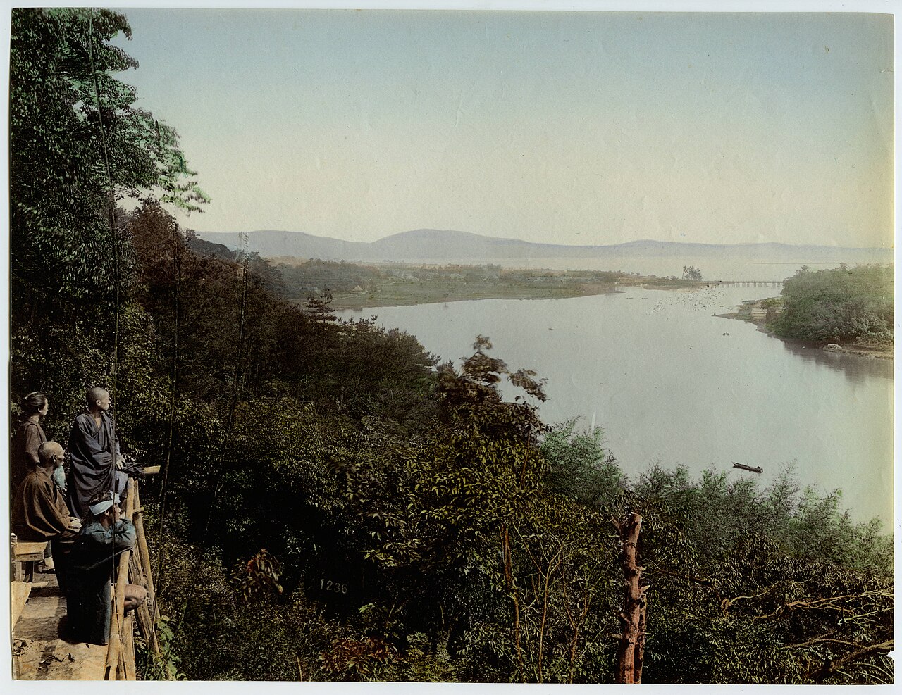
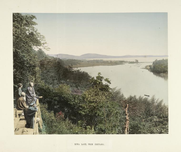
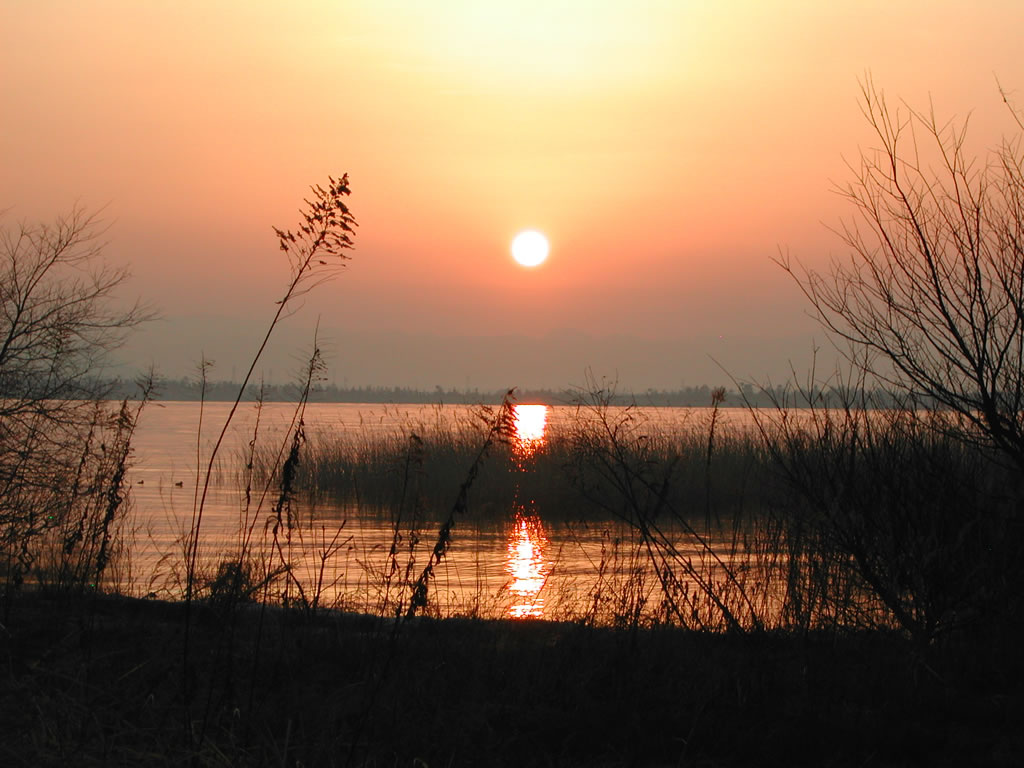
Lake Biwa (Japanese: 琵琶湖, Hepburn: Biwa-ko) is the largest freshwater lake in Japan, located entirely within Shiga Prefecture in west-central Honshu, northeast of the former capital city of Kyoto. It is an ancient lake, over 4 million years old, and is estimated to be the 13th oldest lake in the world. Because of its proximity to the historical capital Kyoto, references to Lake Biwa appear frequently in Japanese literature, particularly in poetry and in historical accounts of battles.
Quick Facts
- Location
- Shiga Prefecture, Japan
- Inflow
- 118 rivers
- Outflow
- Seta River
- Catchment
- 3174 km2
- Countries
- Japan
- Length
- 63.49 km
- Area
- 670.3 km2
- Depth
- 41 m
- Max Depth
- 104 m
- Volume
- 27.5 km3
- Residence Time
- 5.5 years
- Shore
- 235.2 km
Facts from the source article.
Lore & Background
The name Biwa-ko was established in the Edo period. It is generally believed to be so named because of the resemblance of its shape to that of a stringed instrument called the biwa, and they use the same kanji: 琵琶 (biwa). Kōsō, a learned monk of Enryaku-ji in the 14th century, wrote that the lake is the Pure Land of the goddess Benzaiten because she lives on Chikubu Island and the shape of the lake is similar to that of the biwa, her favorite instrument. The lake was formerly known as Aumi (淡海, Freshwater Sea) or Chikatsu Awa-umi (近淡海, Freshwater Sea Near [the Capital]), and the current pronunciation of this word has become Ōmi, as in the name of Ōmi Province. It is also called Nio no Umi (鳰の海, 'Little Grebe Lake') in literature.
Lake Biwa serves as a reservoir for the cities of Kyoto and Ōtsu and is a valuable resource for nearby textile industries, providing drinking water for about 15 million people in the Kansai region. It is a breeding ground for freshwater fish, including trout, and for the pearl culture industry. The Lake Biwa Canal, built in the late 1890s and later expanded during the Taishō era, played a crucial role in the revival of Kyoto's industrial life after a steep decline following the transfer of the capital to Tokyo. The lake is home to many popular beaches along the northwestern shore, in particular Shiga and Ōmi-Maiko, and the Mizunomori Water Botanical Garden and the Lake Biwa Museum in Kusatsu are also of interest.
Reader's Guide
Lake Biwa is significant as an ancient tectonic lake with a long, uninterrupted history of at least 4 million years, which has allowed a notably diverse ecosystem to evolve. Naturalists have documented more than 1000 species and subspecies in the lake, including about sixty endemics. It is an essential place for water birds, with about 5,000 waterbirds visiting every year. The lake hosts 46 native fish species and subspecies, including eleven species and five subspecies that are endemic or near-endemic, such as the Biwa trout and various cyprinids, loaches, gobies, catfish, and a cottid. It is also home to a large number of molluscs, including 38 freshwater snails (19 endemic) and 16 bivalves (nine endemic).
Recently, the biodiversity of the lake has suffered greatly due to invasive species of foreign fish, particularly black bass and bluegill. Black bass were introduced in 1925 as a game fish, and in July 2009, a largemouth bass weighing 10.12 kg was caught from Biwa by Manabu Kurita, officially certified by the IGFA to tie the world record. Bluegills were presented to then-Prince Akihito by Mayor Richard J. Daley during a visit to Chicago in 1966 and later released into Japanese lakes as a game fish. Environmental legislation, including the Eutrophication Control Ordinance (1979) and the Shiga Ordinance for the Conservation of Reed Vegetation Zones (1992), has been enacted to protect the lake. The Awazu site, a submerged shell midden from the Initial Jōmon period (c. 9300 BCE), is an important archaeological site near the southern end of the lake, highlighting the use of plant and animal food resources by the Jōmon people.
Did You Know?
- Lake Biwa is estimated to be the 13th oldest lake in the world, dating to at least 4 million years ago.
- The lake's name is believed to derive from the resemblance of its shape to the biwa, a stringed instrument, and they share the same kanji: 琵琶.
- The Awazu site, a submerged shell midden near the southern end of Lake Biwa, dates back to the beginning of the Initial Jōmon period (c. 9300 BCE).
- In July 2009, a largemouth bass weighing 10.12 kg was caught from Lake Biwa by Manabu Kurita, tying the world record.
Defining the Nested Landscape
A recursive island, sometimes called a nested island or lake, describes a striking geographic phenomenon: a body of land sitting inside a body of water, or a body of water sitting inside a body of land. The concept captures the layered, almost fractal quality of Earth's surface, where land and water alternate in nested configurations. To make the definition workable, geographers draw a line on the size of the continental land mass involved. Smaller continental land masses such as Madagascar and New Zealand are treated as islands for the purposes of this classification, while larger ones like Australia fall outside that category. This distinction matters because it determines whether a lake on that land mass can participate in a recursive chain. When a lake sits on one of these island-classified land masses and that lake contains its own island, the result is a recursive island. The phenomenon is not merely a curiosity; it reveals how coastlines, shorelines, and water bodies interlock across scales.
The Ladder of Orders
To keep track of how deeply nested a geographic feature is, the classification system assigns an order number. Islands that float in the world's global ocean sit at zero order, the baseline from which all deeper nesting is measured. A first order island is one found inside a lake that itself sits on an island. Push one level deeper and you arrive at second order: an island within a lake within an island within a lake. Third order follows the same pattern one step further, and fourth order represents the deepest nesting documented in the classification. Each successive order adds another alternating layer of land and water, creating a chain that can be expressed almost like a mathematical sequence. The system provides a clean, universal language for describing features that would otherwise be difficult to compare across continents. By anchoring the count at the global ocean and building upward, the ordering scheme makes it possible to state precisely how many times land has been enclosed by water before reaching the feature in question.
Where the Nesting Runs Deep
Not every corner of the globe offers the same density of recursive features, and the distribution is far from uniform. Finland stands out dramatically: the country alone is home to nearly one thousand islands that sit inside lakes which themselves rest on larger islands. This extraordinary concentration makes Finland a natural reference point for understanding how layered shorelines can accumulate at scale. Meanwhile, the classification rules create interesting edge cases in the Pacific. Because Madagascar and New Zealand are counted as islands rather than continents, lakes on those land masses that contain their own islands automatically qualify as recursive. Australia, by contrast, is treated as a continental land mass, so lakes and islands within it do not enter the recursive chain in the same way. This single definitional boundary reshapes which regions appear in the global inventory of nested geography and reminds us that the concept is as much a matter of agreed-upon rules as it is of physical reality.
The Inverse: Lakes Nestled Within Lakes
The recursive concept is not limited to islands. Its mirror image, the recursive lake, describes a lake that sits on an island which itself lies within another lake. These first order lakes are the simplest expression of the inverse pattern. Add another layer and you reach second order: a lake on an island in a lake on an island in a lake. Third order lakes also exist, confirming that the nesting can extend in this direction as well. The two families—recursive islands and recursive lakes—complement each other and together paint a fuller picture of how land and water can interlock. Those who study these features often cross-reference them with related geographic categories such as endorheic basins, volcanic crater lakes, and comprehensive lists ranking islands and lakes by area or population. These adjacent topics provide context for understanding where recursive features fit within the broader taxonomy of Earth's surface water and landforms.
Gallery
Frequently Asked Questions
Who is Lake Biwa?
Lake Biwa is Japan's largest freshwater body, sitting entirely inside Shiga Prefecture on Honshu, just northeast of the old capital Kyoto. It is a mid-Pliocene formation that has existed for more than four million years.
What is Lake Biwa known for?
Its primary function is serving as a massive freshwater reservoir whose waters drain through the Seta River, eventually becoming the Yodo River and emptying into Osaka Bay. It also sustains a rich ecosystem of endemic species and has held UNESCO Ramsar Wetland designation since 1993.
Why is Lake Biwa important?
Beyond ranking as the 13th-oldest lake on Earth, it has served as a cultural touchstone in Japanese poetry and historical chronicles for centuries owing to its proximity to Kyoto. It also supports one of the country's most biodiverse freshwater ecosystems.
Where does Lake Biwa live?
It is situated in west-central Honshu, entirely within Shiga Prefecture, roughly northeast of Kyoto. Its surface area spans about 670 square kilometers, or roughly 260 square miles.
More in Great Lakes Of The World 1-24
Spotted an error? Know more?
Reader corrections go straight into our review queue. Suggest an edit · How this site is sourced