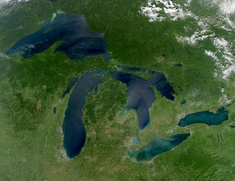
Great Salt Lake
Largest saltwater lake in the Western Hemisphere, remnant of Lake Bonneville.

Famartin · CC BY-SA 4.0
The Great Salt Lake is the largest saltwater lake in the Western Hemisphere by surface area and is often ranked among the largest terminal lakes in the world, though its exact position varies by source and year (the Caspian Sea, Lake Balkhash, and the Aral Sea are typically cited as larger). Located in northern Utah, it is a remnant of the prehistoric Lake Bonneville and has a substantial impact on the local climate through lake-effect snow. Its high salinity and density, caused by mineral accumulation from its tributaries and lack of outlet, make swimming feel like floating.
Quick Facts
- Location
- Utah, United States
- Inflow
- Bear, Jordan, Weber Rivers
- Catchment
- 21,500 mi2
- Countries
- United States
- Length
- 75 mi
- Area
- 950 mi2 in 2022
- Depth
- 16 ft, when lake is at average level
- Max Depth
- 33 ft average, high of 45 ft in 1987, low of 24 ft in 2021
- Volume
- 15338693.6 acre.ft
- Elevation
- historical average of 4,200 ft, 4,190.5 ft as of 2022 March 14
- Islands
- 8–15 (variable, see Islands)
- Settlements
- Salt Lake City and Ogden
Facts from the source article.
Lore & Background
The Great Salt Lake is a remnant of Lake Bonneville, a prehistoric body of water that covered much of western Utah during the Pleistocene Epoch. Lake Bonneville existed until approximately 14,500 to 15,000 years ago, when a large portion was catastrophically released through Red Rock Pass in Idaho, an event known as the Bonneville Flood. The remaining lake gradually dried, leaving the Great Salt Lake, Utah Lake, Sevier Lake, and Rush Lake. The lake entered written history in 1776 through Silvestre Vélez de Escalante, who learned of it from the Timpanogos Utes. In 1824, it was observed independently by Jim Bridger and Etienne Provost. John C. Fremont led the first scientific expedition in 1843, and his reports influenced Brigham Young and other Latter-day Saints to settle in the Salt Lake Valley in July 1847. The lake was first comprehensively surveyed in 1850 under Howard Stansbury.
Reader's Guide
The Great Salt Lake is significant as a terminal lake with no outlet, causing minerals to accumulate and create high salinity. Its size fluctuates dramatically due to low average depth, reaching a historic high of 3,300 square miles in the 1980s, prompting the West Desert Pumping Project to mitigate flooding. In 2021, after years of drought and water diversion, it fell to its lowest recorded area of 950 square miles. The lake provides habitat for millions of native birds, brine shrimp, and the largest staging population of Wilson's phalarope in the world. The causeway built in the 1950s for the Southern Pacific Railroad constrained water flow between its arms until a bridge was added in 2016. Willard Bay Reservoir, completed in 1964, separated a portion of the lake for freshwater storage. The lake's shrinkage due to drought, climate change, and overuse of snowmelt has raised concerns about ecological collapse and toxic dust, with scientists estimating it could dry up by 2028 without policy changes.
Did You Know?
- The Great Salt Lake is a remnant of Lake Bonneville, which spanned 22,400 square miles during the Pleistocene Epoch.
- The West Desert Pumping Project, built in 1987, removed 2,730,000 acre-feet of water from the lake before shutting down in 1989.
- The lake's three major tributaries deposit about 1.1 million tons of minerals per year, making it far saltier than seawater.
- In 2021, the lake fell to its lowest recorded area of 950 square miles, below the previous low set in 1963.
Geologic Heritage: The Shadow of Bonneville
The Great Salt Lake is not a primordial body of water but a survivor — a diminished echo of Lake Bonneville, a Pleistocene-era lake that once stretched across 22,400 square miles, rivaling today's Lake Michigan in sheer expanse. At its deepest, Bonneville plunged to 923 feet and blanketed most of modern Utah along with slivers of Idaho and Nevada. For thousands of years it persisted through the ice ages, but around 16,800 years ago a catastrophic breach at Red Rock Pass in Idaho unleashed a torrent that drained a vast portion of the lake in a single cataclysmic event. As the climate warmed in the aftermath, the remaining waters receded further, leaving behind a constellation of smaller basins: the Great Salt Lake, Utah Lake, Sevier Lake, and Rush Lake. The Great Salt Lake we see today is thus a fragment — roughly one-tenth the area of its ancient predecessor — preserved in the northern reaches of Utah, its low average depth of just 16 feet a testament to how shallow the remnant became after millennia of evaporation and drainage.
A Lake in Constant Motion
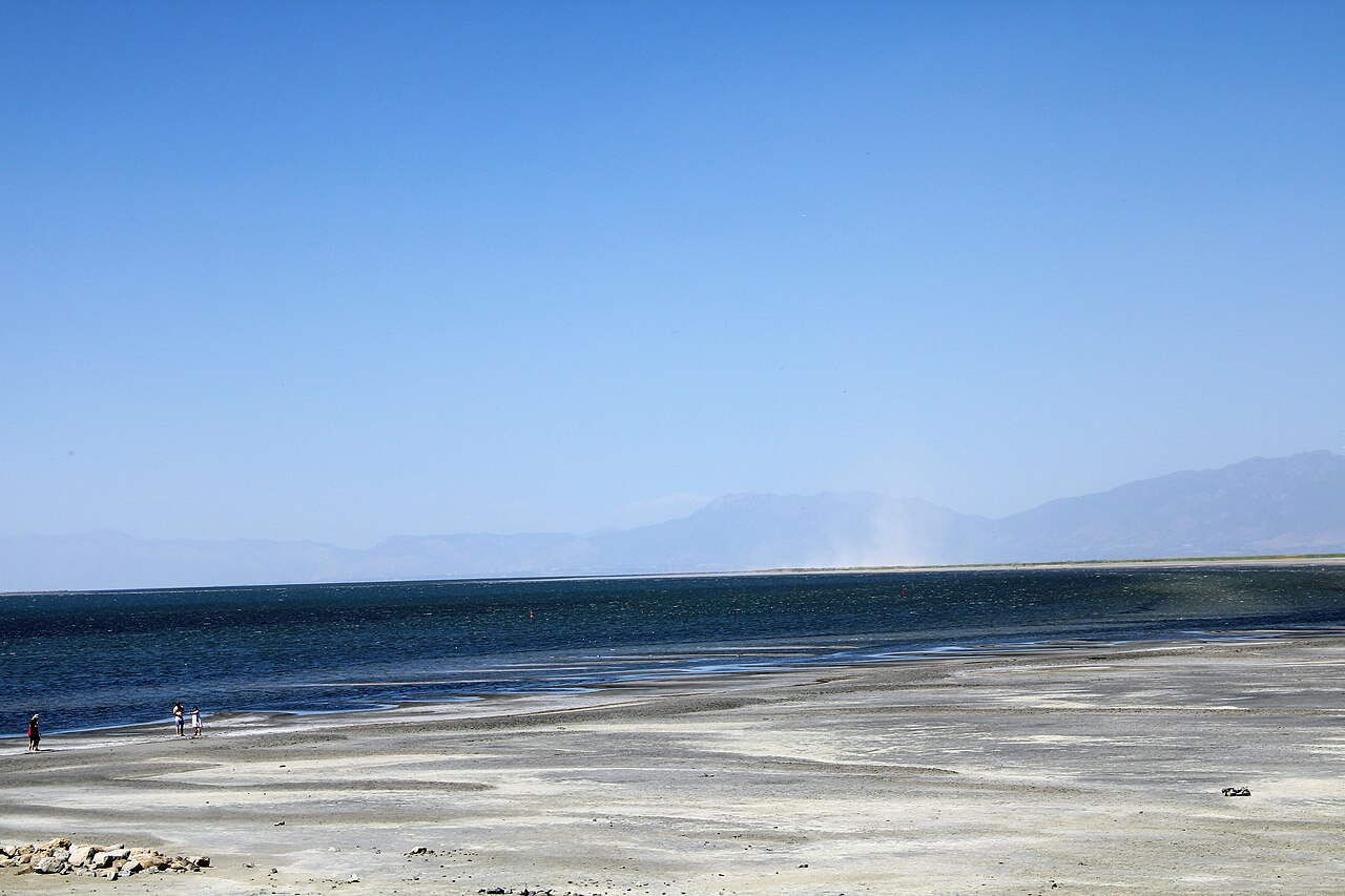
No two years look the same on the Great Salt Lake's shoreline. Because the water body averages only 16 feet in depth, even modest shifts in inflow or evaporation produce dramatic swings in surface area. The USGS pegs the historical average between 1847 and 1986 at roughly 1,700 square miles, yet the lake has swung far beyond that range. In the 1980s, sustained high water pushed the surface to a record 3,300 square miles, inundating eastern shorelands and prompting the West Desert Pumping Project, which diverted lake water into the adjacent desert to protect property. At the opposite extreme, a prolonged drought combined with increased upstream diversions drove the lake to a historic low of 950 square miles in 2021, shattering the previous record set in 1963. Human engineering has further reshaped the lake's geometry: the 20-mile railroad causeway, built in the 1950s to replace a wooden trestle for the Lucin Cutoff, constrained water flow between the northern and southern arms until a 180-foot bridge was added in 2016. Willard Bay Reservoir, completed in 1964, carved a freshwater pocket out of the northeastern arm by damming and redirecting Weber River water.
From Oral Legend to Scientific Survey
The lake's entry into the written record is tangled with misattribution. In 1776, Silvestre Vélez de Escalante heard of the lake from the Timpanogos Utes, yet his cartographer Bernardo Miera y Pacheco charted only the smaller Utah Lake, naming it Laguna Timpanogos. Later mapmakers, seeing Timpanogos as the region's largest lake, mistakenly applied the name to the Great Salt Lake, and the true association with Utah Lake was gradually forgotten. The first independent European sightings came from trappers Jim Bridger and Étienne Provost in 1824, though most trappers who walked the shoreline were illiterate and left no written accounts, so oral reports introduced errors. John C. Frémont led the first scientific expedition in 1843 but, pressed by winter, never completed a full survey. His enthusiastic published reports nonetheless helped persuade Brigham Young and the Latter-day Saints to settle the Salt Lake Valley in July 1847; Young reached the lake's shore three days after arrival, and settlers were harvesting salt within a month. The first comprehensive survey came in 1850 under Howard Stansbury, who also named the Stansbury Mountains and Stansbury Island. In 1895, artist Alfred Lambourne spent a year on remote Gunnison Island, writing his book Our Inland Sea amid solitude and the arrival of guano harvesters.
Salt, Shrimp, and a Living Shoreline
The Great Salt Lake earns its nickname America's Dead Sea from a chemistry that borders on the extreme. Three major tributaries — the Jordan, Weber, and Bear rivers — deposit approximately 1.1 million tons of dissolved minerals into the lake every year. Because the lake has no outlet other than evaporation, those minerals never leave; they accumulate over millennia, producing a salinity far exceeding that of the ocean and a correspondingly high water density. That density is what makes a swimmer feel as though they are floating rather than treading water. Yet this hyper-saline environment supports a surprisingly rich community of specialized life: millions of native birds, brine shrimp, nematodes, shorebirds, and waterfowl call the lake home. Most notably, the Great Salt Lake hosts the largest staging population of Wilson's phalarope anywhere on Earth, making it an irreplaceable stopover on migratory flyways. The interplay of relentless mineral input, zero outflow, and a shallow basin creates a dynamic, ever-shifting ecosystem unlike any other in the Western Hemisphere.
Gallery

Frequently Asked Questions
Who is Great Salt Lake?
Great Salt Lake is a terminal saltwater body in northern Utah, USA, recognized as the largest saltwater lake in the Western Hemisphere by surface area. It is a geological remnant of the prehistoric Lake Bonneville and has no outlet, receiving water only from the Jordan, Weber, and Bear rivers.
What is Great Salt Lake known for?
Its extreme mineral concentration and density make swimming feel like effortless floating, and it drives significant lake-effect snowfall across the surrounding region. It is frequently ranked as the fourth-largest terminal lake on Earth, though exact placement shifts depending on the source and year.
Why is Great Salt Lake important?
It shapes the local climate through lake-effect snow and stands as a living fragment of prehistoric geology, being a direct descendant of Lake Bonneville. Its unique saline environment and dramatic size fluctuations keep it a focus of ongoing scientific and public attention.
What is Great Salt Lake's origin/backstory?
Great Salt Lake formed as the last surviving piece of the enormous prehistoric Lake Bonneville, which once flooded vast stretches of the western United States. As water evaporated over millennia with no outlet to carry dissolved minerals away, salts accumulated until the highly saline body we know today emerged.
More in Great Lakes Of The World 1-24
Spotted an error? Know more?
Reader corrections go straight into our review queue. Suggest an edit · How this site is sourced