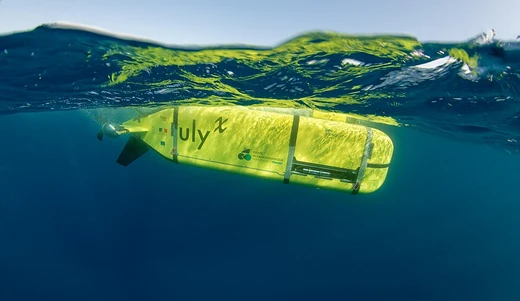
Acoustically Navigated Geological Underwater Survey
First unmanned WHOI vehicle; photographed hydrothermal vents and the Titanic.

ANGUS, the Acoustically Navigated Geological Underwater Survey, was a deep-towed camera sled built by the Woods Hole Oceanographic Institute in the early 1970s. It marked WHOI’s first unmanned research vehicle. The sled’s 12-foot steel frame was built to survive high-impact collisions while exploring rough volcanic terrain. Three 35 mm color cameras, each loaded with 400 feet of film, could together capture a 200-foot-wide strip of the seafloor. Strobe lights on each camera allowed them to shoot from 35 to 50 feet above the bottom, while a downward-facing sonar kept track of the sled’s altitude. ANGUS could operate at depths up to 20,000 feet, reaching about 98 percent of the ocean floor, and would stay submerged for 12 to 14 hours, snapping up to 16,000 photos per session. The sled often scouted locations for later exploration by vehicles like Argo or Alvin. It carried a heat sensor that alerted the surface ship when it passed over an underwater geyser, and it photographed both the geysers and the creatures living near them. On Project FAMOUS (1973–1974), ANGUS changed scientists’ understanding of the ocean floor by revealing how varied geological formations and sediment chemistries could be, disproving earlier ideas of a uniform seabed. It also provided new evidence for seafloor spreading by documenting rock formations around ridges and horizontal layers parallel to them. In 1977, while monitoring temperatures, the crew noticed a sudden spike late at night; later review of ANGUS’s footage produced the first photographic proof of hydrothermal vents and black smokers, along with over 3,000 color images of the vents and colonies of clams and other organisms. Alvin later returned to collect samples from those sites. ANGUS was used on expeditions such as Project FAMOUS (French-American Mid Ocean Undersea Study 1973–1974), the Discovery expedition with Argo to survey the wreckage of the Titanic. (1985), and again in the return mission to the Titanic (1986). ANGUS was the only ROV used on both dives to the Titanic. Scientists nicknamed it “Dope on a rope” for its toughness and lack of delicate sensors, and gave it the motto “takes a lickin’ but it keeps on clickin’.” After more than 250 voyages, ANGUS was retired in the late 1980s.
- Operator
- Woods Hole Oceanographic Institute (WHOI)
- Type
- Deep-towed still-camera sled
- Frame
- 12 ft steel frame
- Cameras
- Three 35 mm color cameras with 400 ft of film each
- Photographic strip width
- Up to 200 ft
- Operating depth
- Up to 20000 ft
- Work session duration
- 12 to 14 hours
- Maximum photographs per session
- Up to 16,000
Lore & Background
ANGUS was often used to scout locations of interest to later be explored and sampled by other vehicles such as Argo or Alvin. It was equipped with a heat sensor to alert the tether-ship when it passed over an underground geyser, and was used to search for and photograph such geysers and the creatures living near them. On Project FAMOUS (French-American Mid Ocean Undersea Study 1973–1974), ANGUS helped change scientists' views of the ocean floor, showing how different geological formations and chemical compositions of sediments can be, disproving previous assumptions of ocean floor uniformity. The project also provided new insight to the theory of seafloor spreading by observing and sampling the rock formations around ridges and the horizontal formation of layers parallel to the ridge. In a 1977 expedition, scientists monitored temperatures over the ocean floor for any fluctuation. It was not until late at night the crew noticed temperatures rise drastically. They would review the photographic footage taken after the vehicle's session. ANGUS provided the first photographic evidence for hydrothermal vents and black smokers, returning with over 3000 colored photos showing both vents as well as colonies of clams and other organisms. Scientists later returned with Alvin to take samples. ANGUS was also used on the Discovery expedition with Argo to survey the wreckage of the Titanic (1985), and again in the return mission to the Titanic (1986). It was the only ROV used on both dives to the Titanic. Scientists nicknamed ANGUS 'Dope on a rope' due to its durability and lack of fragile sensors. It was also given the motto 'takes a lickin' but it keeps on clickin''. ANGUS was retired in the late 1980s, having completed over 250 voyages.
Reader's Guide
ANGUS's significance lies in its pioneering role as the first unmanned research vehicle built by WHOI and its robust design that allowed it to explore rugged volcanic terrain and withstand high impact collisions. Its ability to photograph a 200 ft wide strip of sea floor at depths up to 20000 ft made it a critical scouting tool for later missions by vehicles such as Argo and Alvin. The vehicle's most notable legacy is its contribution to Project FAMOUS, where it fundamentally changed scientific understanding of the ocean floor by revealing diverse geological formations and sediment compositions, disproving earlier assumptions of uniformity and supporting the theory of seafloor spreading. In 1977, ANGUS provided the first photographic evidence of hydrothermal vents and black smokers, capturing over 3000 color images of the vents and associated biological communities, including clams. This discovery opened a new field of deep-sea research. Additionally, ANGUS was the only ROV used on both dives to the Titanic wreck (1985 and 1986), surveying the site for later exploration. Its nickname 'Dope on a rope' and motto 'takes a lickin' but it keeps on clickin'' reflect its durable, no-frills construction. Retired in the late 1980s after over 250 voyages, ANGUS left a legacy as a workhorse that enabled major oceanographic discoveries.
Did You Know?
- ANGUS was the first unmanned research vehicle made by the Woods Hole Oceanographic Institute.
- It was nicknamed 'Dope on a rope' for its durability and lack of fragile sensors.
Scale and Extent of the Underwater Domain
Water dominates the physical face of Earth in a way that is almost difficult to grasp. Roughly three quarters of the planet's surface is blanketed by liquid, and the total volume of that water reaches approximately 1.35 billion cubic kilometres, with an average ocean depth near 3,700 metres. Beneath the surface, the most common terrain is the abyssal plain, stretching at depths between 4,000 and 5,500 metres. The deepest known solid-surface point is the Challenger Deep in the Mariana Trench, plunging to 10,924 metres below the ocean surface. Saline water covers roughly 361 million square kilometres, and the ocean alone holds about 97 percent of all water on the planet. Beyond the open seas, freshwater bodies—lakes, ponds, rivers—occupy a smaller but ecologically vital portion of the surface, while vast quantities of water are locked away in underground aquifers. Together these systems form a continuous, interconnected domain that dwarfs the land in both area and volume.
The Underwater World as Cradle of Life
Long before the first land organisms appeared, liquid water had already been present on Earth for the vast majority of the planet's history. Scientists widely regard the underwater environment as the original nursery where life first took shape, and it continues to serve as the single most critical ecological region for sustaining biological diversity. The ocean, in particular, encompasses roughly 90 percent of the Earth's biosphere, making it the natural habitat for the overwhelming majority of living organisms. Multiple branches of science—oceanography, limnology, potamology, hydrogeology—have been devoted to studying different facets of this aqueous world, from the chemistry of open-ocean currents to the flow of water through porous rock formations. Despite its central role in the story of life, the underwater realm remains profoundly under-explored. Oceanographers themselves have noted that less than 100 percent of the World Ocean has been thoroughly investigated, a testament to how much of this life-supporting domain still lies beyond human observation.
Human Interaction, Mapping, and the Limits of Exploration
Humanity's relationship with the underwater world is defined by a tension between ambition and hostility. The environment resists human presence in numerous ways—pressure, darkness, cold, and inaccessibility—so that relatively little of it has been directly explored. Where humans do venture, the activities tend to fall into a narrow set: scientific research, commercial or recreational diving, and military operations involving submarines. Mapping the ocean floor has relied heavily on sonar technology, producing at least coarse-resolution charts of vast stretches of seabed. In strategically sensitive areas, far more detailed surveys have been carried out to aid navigation and submarine detection, though the resulting maps often carry classification restrictions. Beyond sonar, direct exploration is possible through manned submersibles, remotely operated vehicles, or autonomous underwater craft. Each method offers a different trade-off between range, detail, and risk, and together they represent the full spectrum of tools available for penetrating an environment that remains, by and large, closed to human eyes.
A Mosaic of Aquatic Systems
The underwater domain is far from monolithic. At the largest scale, saline water is conventionally divided into five principal oceans—the Pacific, Atlantic, Indian, Southern, and Arctic—along with numerous smaller seas that are partly or fully enclosed by land. Inland, the picture shifts: lakes occupy basins surrounded by land, fed and drained by rivers, and are typically found in mountainous regions, rift zones, or areas shaped by glaciation. Ponds, smaller and shallower, may form naturally in floodplains or be constructed for agriculture, fish hatcheries, wastewater treatment, or landscape design. Rivers, driven by gravity, carry freshwater from drainage basins toward oceans, lakes, or the ground, and are studied under the discipline of potamology. Beneath the surface entirely, aquifers store water within permeable rock or sediment, classified as either porous or karst depending on the geological structure. Water-filled caves, both active and relict, add yet another dimension to this layered hydrological system.
Frequently Asked Questions
Who is Acoustically Navigated Geological Underwater Survey?
ANGUS is a deep-towed still-camera sled built by the Woods Hole Oceanographic Institute in the early 1970s, and its name is an acronym for Acoustically Navigated Geological Underwater Survey. It holds the distinction of being WHOI's very first unmanned research vehicle.
What are Acoustically Navigated Geological Underwater Survey's capabilities?
The sled carries three 35 mm color cameras, each loaded with 400 feet of film, that together can capture a 200-foot-wide strip of seafloor from 35 to 50 feet above the bottom using built-in strobe lights. A downward-facing sonar tracks its altitude, and its 12-foot steel frame is engineered to survive high-impact collisions with rough volcanic terrain.
Why is Acoustically Navigated Geological Underwater Survey important to drone history?
As the first unmanned vehicle ever deployed by WHOI, ANGUS demonstrated that a towed, camera-equipped sled could safely survey deep and hazardous seafloor environments without putting a crew at risk. It set the operational template for the entire family of oceanographic drones that followed.
How deep can Acoustically Navigated Geological Underwater Survey operate?
The sled was rated for depths of up to 20,000 feet, allowing it to reach the deepest basins in the ocean. Its heavy steel construction was specifically designed to endure the pressures and physical hazards encountered at those extreme depths.
More in Underwater and Surface Drones, Part 2 1-24
Spotted an error? Know more?
Reader corrections go straight into our review queue. Suggest an edit · How this site is sourced