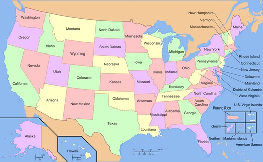
New Mexico
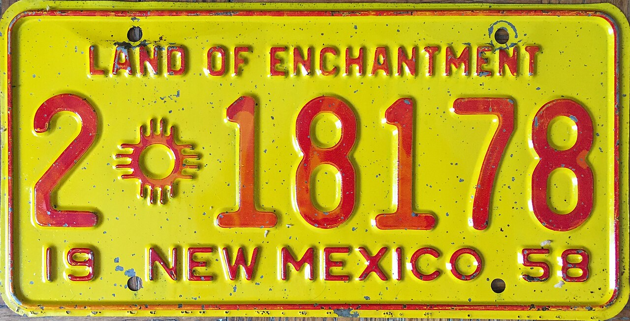
Land of Enchantment

TylerKutschbach · CC BY-SA 4.0
New Mexico is a landlocked state in the U.S. Southwest, part of the Mountain States and the southern Rocky Mountains. It meets Utah, Colorado, and Arizona at the Four Corners, borders Texas on the east and southeast, Oklahoma to the northeast, and touches the Mexican states of Chihuahua and Sonora to the south. Its largest city is Albuquerque, while the capital, Santa Fe, is the oldest state capital in the country—founded in 1610 as the seat of government for Nuevo México in New Spain—and the highest in elevation, sitting at 7,000 feet. By area, New Mexico is the fifth-largest state, but with just over 2.1 million people, it ranks 36th in population and 45th in density. Its climate and geography vary widely, from forested mountains to barren deserts; the north and east have a colder alpine climate, while the west and south are warmer and drier. The Rio Grande runs north-to-south through the center, creating a fertile valley with a riparian biome, a bosque habitat, and the distinct climate of the Albuquerque Basin. About one-third of the state’s land is federally owned, including many protected wilderness areas, 15 national parks and monuments, and three UNESCO World Heritage Sites entirely within its borders—more than any other U.S. state. Since time immemorial, New Mexico has been home to Pueblo peoples, the Mogollon culture, and the Ute. The Pueblo peoples lived in several dozen villages, mainly in the northern Rio Grande valley. The Navajo and Apache arrived in the late 1400s, the Spanish in 1598, and the Comanche in the early 1700s. The Spanish colony of Nuevo México became a remote part of the viceroyalty of New Spain. The 1680 Pueblo Revolt was the first successful colonial revolt in the Americas. Spanish rule returned in 1692, but the colony fell under Comanchería’s influence after the Comanche-Spanish peace treaties of 1785 and 1786, isolated by rugged terrain and distance from Mexico City. After Mexican independence in 1821, New Mexico became an autonomous territory, saw an 1837 rebellion against the central government, and grew economically tied to the United States. Following the Mexican-American War in 1848, the U.S. annexed it as part of the larger New Mexico Territory, which was central to westward expansion. It remained a territory for 64 years before becoming the 47th state on January 6, 1912. During World War II, New Mexico hosted key Manhattan Project facilities that developed the first atomic bomb, and the first nuclear test, Trinity, occurred there in 1945. The blend of Pueblo, Apache, Navajo, Comanche, Ute, Spanish, Mexican, and American influences over history created a unique culture, with distinctive cuisine, a Spanish dialect, music, and the Pueblo Revival and Territorial architectural styles. As one of nine majority-minority states, it has the highest proportion of Hispanic and Latino Americans in the nation and the second-highest proportion of Native Americans, after Alaska. It is home to one-third of the Navajo Nation, 19 federally recognized Pueblo communities, and three federally recognized Apache tribes. The large Latino population includes Hispanos descended from colonial-era families alongside more recent Mexican Americans. The state flag, among the most recognizable in the U.S., reflects both indigenous and Spanish inspiration. New Mexico’s economy is highly diversified, with major sectors including mining, oil and gas, aerospace, media, and film. Its total real GDP was $152.778 billion in 2025, with a per capita GDP of $61,645. The state often ranks low in wealth, healthcare, and education, but it has some of the highest concentrations of scientists, engineers, and other highly skilled workers, and one of the most educated counties in the U.S.—Los Alamos County, though it is very small. The federal government has a major presence, with military installations like White Sands Missile Range and Kirtland Air Force Base, and Department of Energy research centers such as Sandia and Los Alamos National Laboratories. New Mexico got its name long before the country of Mexico won independence from Spain and adopted that name in 1821. “Mexico” comes from Nahuatl and originally referred to the heartland of the Mexica, rulers of the Aztec Empire, in the Valley of Mexico. After conquering the Aztecs in the early 1500s, the Spanish explored what is now the Southwestern U.S., calling it Nuevo México. In 1581, the Chamuscado and Rodríguez Expedition named the region north of the Rio Grande San Felipe del Nuevo México. The Spanish hoped to find wealthy indigenous cultures like the Mexica, but the peoples of New Mexico were unrelated and lacked riches—yet the name stuck. Before statehood in 1912, “New Mexico” loosely referred to various territorial configurations in the same general area, evolving through Spanish, Mexican, and U.S. periods, but usually covering most of present-day New Mexico along with parts of neighboring states. The first known inhabitants were members of the Clovis culture of Paleo-Indians. Footprints discovered in 2017 suggest humans may have been in the region as early as 21,000–23,000 BC. Later inhabitants included the Mogollon and Ancestral Pueblo cultures, known for sophisticated pottery and urban development; pueblos or their remains, such as those at Acoma, Taos, and Chaco Culture National Historical Park, show the scale of Ancestral Puebloan dwelling.
Quick Facts
- Native Name
- es · Nuevo México / nv · Yootó Hahoodzo
- Former
- Santa Fe de Nuevo México (1598–1848) · New Mexico Territory (1850–1912)
- Flag Link
- Flag of New Mexico
- Anthem
- "O Fair New Mexico" and "Así Es Nuevo México"
- Nickname
- The Land of Enchantment
- Motto
- la · Crescit eundo (It grows as it goes)
- Population Demonym
- New Mexican, Nuevo Mexicano
- Seat
- Santa Fe
- Largestcity
- Albuquerque
- Largestcounty
- Bernalillo
- Largestmetro
- Albuquerque metropolitan area
- Officiallang
- None; Spanish and English are working languages
Facts from the source article.
Lore & Background
Since time immemorial, New Mexico was home to Pueblo peoples, the Mogollon culture, and Ute. The Pueblo peoples occupied several dozen villages, mostly in northern New Mexico's Rio Grande valley. The Spanish colony of Nuevo México became a peripheral part of the viceroyalty of New Spain. The 1680 Pueblo Revolt was the first successful revolution against colonial rule in the Americas. In 1692 Spanish colonial rule returned, but the colony fell under the influence of Comancheria with the Comanche-Spanish peace treaties of 1785 and 1786, isolated by its rugged terrain and distance from Mexico City. Upon Mexican independence in 1821, New Mexico became an autonomous territory that saw an 1837 Rebellion against the central government, with increasing economic ties to the United States. After the Mexican–American War in 1848, the U.S. annexed New Mexico as part of the larger New Mexico Territory, which was central to U.S. westward expansion. New Mexico was a territory for 64 years before it was admitted to the Union as the 47th state on January 6, 1912. During World War II, New Mexico hosted several key facilities of the Manhattan Project, which developed the world's first atomic bomb, and was the site of the first nuclear test, Trinity in 1945.
Reader's Guide
New Mexico's economy is highly diversified; major sectors include mining, oil and gas, aerospace, media, and film. Its total real gross domestic product (GDP) was $152.778 billion in 2025, with a GDP per capita of $61,645. New Mexico often ranks low in wealth, healthcare, and education, but has some of the highest concentrations of scientists, engineers, along with other highly skilled workers, and one of the most educated (albeit very small) counties in the U.S.: Los Alamos County. The federal government has a significant presence in New Mexico, including U.S. military installations such as White Sands Missile Range and Kirtland Air Force Base, and Department of Energy research centers such as the Sandia and Los Alamos National Laboratories.
Did You Know?
- New Mexico is the fifth-largest of the fifty states by area, but with just over 2.1 million residents, ranks 36th in population and 45th in population density.
- One-third of New Mexico's land is federally owned, including 15 national parks and monuments, and three UNESCO World Heritage Sites wholly contained within the state—the most of any U.S. state.
- New Mexico has the nation's highest proportion of Hispanic and Latino Americans and the second-highest proportion of Native Americans, after Alaska.
- The name 'New Mexico' was given by Spanish explorers long before the country of Mexico existed; the Chamuscado and Rodríguez Expedition named the region north of the Rio Grande San Felipe del Nuevo México in 1581.
The Compromise of 1850 and the Slavery Question
When Congress passed the Compromise of 1850 in September of that year, it effectively buried the immediate statehood bid for New Mexico and instead carved out a new organized territory alongside the newly created Utah Territory. The legislation also settled the long-standing western boundary dispute with Texas. Yet the question of slavery continued to haunt the territory's political life for decades. Senator Stephen A. Douglas and his allies argued that, under the logic of the Missouri Compromise, the territory had no authority to ban the institution. Abraham Lincoln and others countered that the region's older Mexican legal heritage — which had abolished black slavery in 1834 and Indian slavery as early as 1769 — should govern its laws. In practice, the debate was largely academic: enslaved Black residents never numbered more than roughly a dozen in antebellum New Mexico. In a final, doomed gesture before the Civil War, a House committee voted on December 29, 1860, to admit New Mexico as a slave state, but Southern members, already preparing to walk out of Congress amid imminent secession declarations, never advanced the measure.
A Shifting Map — Territorial Boundaries and the Gadsden Purchase
At its creation in September 1850, the New Mexico Territory encompassed most of what is now the state of New Mexico, more than half of present-day Arizona, and portions of Colorado and Nevada. Though smaller than the sweeping statehood proposal that had been rejected just months earlier, the territory's borders were still far from stable. In 1853 and 1854, the United States acquired the Gadsden Purchase — known in Mexican sources as the Venta de La Mesilla — from Mexico through negotiations led by Ambassador James Gadsden. This addition brought the southern strip of modern Arizona and a smaller parcel in southwestern New Mexico under territorial jurisdiction, pushing the land area to its historical peak of 29,640 square miles. The acquisition was strategically motivated: it opened a practical corridor for what would become the Southern Pacific Railroad, completed in the early 1880s. Over the following decades the territory steadily shrank. The Colorado Organic Act of February 28, 1861, carved out the lands that would become Colorado, and the Arizona Organic Act of 1863 removed the western portion, leaving a territory that would eventually be admitted to the Union in 1912.
The Ambitious Statehood Proposal That Never Was
In the early months of 1850, before the Compromise intervened, a group of organizers in the region drafted a full state constitution for New Mexico that explicitly prohibited slavery. Their proposed boundaries were extraordinary in scope: stretching east to the 100th meridian of longitude and north to the Arkansas River, the envisioned state would have swallowed the present-day Texas and Oklahoma panhandles, large swaths of Kansas, Colorado, Utah, and Arizona, along with most of what is now New Mexico. The plan received approval in Congress at the same moment the Utah Territory was established to the north. But the state of Texas, admitted to the Union in 1845, lodged fierce objections, claiming overlapping sovereignty over much of the same land even though it did not actually govern those areas. Simultaneously, slaveholding interests in the South feared that a free state of that size would permanently block the westward expansion of slavery beyond their existing slave states. The Compromise of 1850 resolved the Texas boundary question and replaced the statehood bid with a smaller, more manageable territorial arrangement, effectively killing the ambitious proposal dead.
Sixty-Two Years on the Frontier
From September 9, 1850, to January 6, 1912, the New Mexico Territory endured as an organized, incorporated territory of the United States for nearly sixty-two years — the longest such period of any territory in the contiguous United States. Its origins trace back to 1846, when the Mexican-American War prompted the United States to set up a provisional, largely military government over the region. After the Treaty of Guadalupe Hidalgo in 1848 formally ceded the land from the Mexican Republic to American control, that stopgap wartime administration continued to operate until Congress passed the enabling legislation in September 1850. The territory's long gestation reflected the deep political divisions of the era — over slavery, over boundaries, over the balance of power between free and slave states — all of which delayed the path to full statehood. When New Mexico was finally admitted to the Union as a state in 1912, it had weathered the Civil War, the Gadsden Purchase, the carving away of its western and northern lands, and decades of territorial governance before earning full statehood.
Gallery
Frequently Asked Questions
What is New Mexico?
New Mexico is a landlocked state in the southwestern United States, situated within the southern Rocky Mountains region. It occupies the Four Corners junction shared with Utah, Colorado, and Arizona, and stretches south to meet Mexico.
What states and countries does New Mexico border?
The state touches Texas to the east and southeast, Oklahoma to the northeast, and the Mexican states of Chihuahua and Sonora to the south. It also meets Utah, Colorado, and Arizona at the Four Corners point.
What is New Mexico's capital and why is it notable?
Santa Fe serves as the capital and holds the distinction of being the oldest state capital in the country, having been established in 1610. It also sits at roughly 7,199 feet, making it the highest-elevation state capital in the U.S.
When did New Mexico become a state and how big is it?
New Mexico was admitted as the 47th state on January 6, 1912. It ranks as the fifth-largest state by area but only 36th in population, reflecting its vast yet sparsely settled territory.
What is New Mexico's largest city and how dense is its population?
Albuquerque is the state's largest city, while the overall population exceeds 2.1 million residents. Despite its enormous land area, New Mexico ranks 45th in population density among all states.
More in U.S. States And Territories 1-24
Spotted an error? Know more?
Reader corrections go straight into our review queue. Suggest an edit · How this site is sourced