Mississippi
The Magnolia State

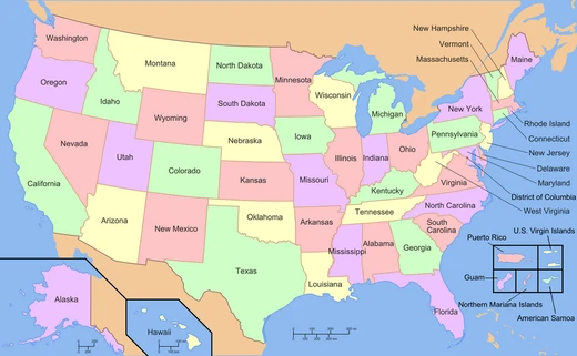
Mississippi is a state located in the Southeastern and Deep South regions of the United States. It shares borders with Tennessee to the north, Alabama to the east, the Gulf of Mexico to the south, Louisiana to the southwest, and Arkansas to the northwest. The state’s western boundary mostly follows the Mississippi River, either its current course or its historical path. In terms of size, Mississippi ranks 32nd among the 50 states, and it is the 35th most populous. It also has the lowest per-capita income in the country. The capital and largest city is Jackson, and the Greater Jackson metropolitan area, with a population of 619,968 as of 2020, is the most populous in the state. Other notable cities include Gulfport, Southaven, Hattiesburg, Biloxi, Olive Branch, Tupelo, Meridian, and Greenville.
Mississippi joined the Union as the 20th state on December 10, 1817. By 1860, it had become the nation’s leading producer of cotton, and enslaved people made up 55% of its population. On January 9, 1861, Mississippi seceded from the Union and became one of the seven original Confederate States, which together held the largest enslaved populations in the country. After the Civil War, it was readmitted to the Union on February 23, 1870.
The state ranks among the highest in the U.S. for religiosity and among the lowest for health, education, development, and income. Its major industries include agriculture and forestry. Mississippi produces more than half of the nation’s farm-raised catfish and is a leading producer of sweet potatoes, cotton, and pulpwood. Other key industries are advanced manufacturing, utilities, transportation, and health services. Almost all of Mississippi lies within the East Gulf Coastal Plain, characterized by lowland plains and low hills, while the northwestern part is the Mississippi Delta. The highest point is Woodall Mountain, at 807 feet (246 meters) above sea level near the Cumberland Plateau; the lowest point is the Gulf of Mexico. The state has a humid subtropical climate.
The name “Mississippi” comes from the Mississippi River, which flows along and defines its western border. European-American settlers adopted the name from the Ojibwe word *misi-ziibi* (meaning “great river”).
Around 9500 BC, Native Americans, or Paleo-Indians, arrived in what is now the American South. These early inhabitants were hunter-gatherers who pursued megafauna that went extinct after the Pleistocene. In the Mississippi Delta, Native American settlements and agricultural fields were built on natural levees—higher ground near rivers. They developed extensive fields near permanent villages, causing some localized deforestation but not altering the Delta’s overall ecology. Over thousands of years, the Woodland and Mississippian cultures created complex agricultural societies with surplus that supported specialized trades. Both were mound-building cultures; the Mississippian culture, starting around 950 AD, built the largest and most complex earthworks, which expressed their political and religious cosmology. These peoples had a trading network stretching from the Great Lakes to the Gulf Coast, and their earthworks still stand in the Mississippi and Ohio River valleys.
Descendant Native American tribes of the Mississippian culture in the Southeast include the Chickasaw and Choctaw. Other tribes that lived in what is now Mississippi—and whose names were used by colonists for local towns—include the Natchez, the Yazoo, and the Biloxi.
The first major European expedition into the area came in 1540, when Spanish explorer Hernando de Soto passed through the northeastern part of the state during his second voyage to the New World.
In April 1699, French colonists established the first European settlement at Fort Maurepas (also called Old Biloxi), near present-day Ocean Springs on the Gulf Coast, led by Pierre Le Moyne d’Iberville. In 1716, the French founded Natchez on the Mississippi River as Fort Rosalie, which became the region’s dominant town and trading post. The French called the larger territory “New France,” while the Spanish continued to claim parts of the Gulf coast east of Mobile Bay and all of present-day Florida. After the French and Indian War, the British took control of the French territory.
During the colonial era, European settlers—mainly French and Spanish—brought enslaved Africans to work on cash crop plantations. Under French and Spanish rule, a class of free people of color (gens de couleur libres) emerged, mostly multiracial descendants of European men and enslaved or free black women. In the early days, European colonists were mostly men, and even after more European women arrived, men often had interracial unions with women of African or multiracial descent, both before and after marrying European women. European men frequently helped their multiracial children gain education or apprenticeships, sometimes settling property on them, and often freed the mothers and children if they were enslaved, as part of plaçage contracts. With this social capital, free people of color became artisans, educated merchants, and property owners, forming a third class between Europeans and most enslaved Africans in the French and Spanish colonies.
Quick Facts
- Flag Link
- Flag of Mississippi
- Flag Alt
- Flag
- Seal Link
- Seal of Mississippi
- Nickname
- The Magnolia State (official) · The Hospitality State · The Sipp · "Birthplace of America's Music"
- Motto
- la · Virtute et armis / (en · "By valor and arms")
- Anthem
- "One Mississippi"
- Seat
- Jackson
- Largestcity
- capital
- Largestmetro
- Greater Jackson
- Largestcounty
- Hinds
- Area Rank
- 32nd
- Area Total Sq Mi
- 48,430
Facts from the source article.
Lore & Background
On December 10, 1817, Mississippi became the 20th state admitted to the Union. By 1860, Mississippi was the nation's top cotton-producing state and slaves accounted for 55% of the state population. Mississippi declared its secession from the Union on January 9, 1861, and was one of the seven original Confederate States, which constituted the largest slaveholding states in the nation. Following the Civil War, it was restored to the Union on February 23, 1870.
Reader's Guide
Mississippi ranks among the highest of U.S. states in religiosity and among the lowest in measures of health, education, development, and income. Mississippi's major industries include agriculture and forestry. The state produces more than half of the country's farm-raised catfish, and is a top producer of sweet potatoes, cotton and pulpwood. Others include advanced manufacturing, utilities, transportation, and health services. Mississippi is almost entirely within the east Gulf Coastal Plain, and generally consists of lowland plains and low hills. The northwest remainder of the state consists of the Mississippi Delta. Mississippi's highest point is Woodall Mountain at 807 feet (246 m) above sea level adjacent to the Cumberland Plateau; the lowest is the Gulf of Mexico. Mississippi has a humid subtropical climate classification.
Frequently Asked Questions
Who is Mississippi?
Mississippi is a Deep South state that entered the Union as the twentieth member on December 10, 1817. Its capital and largest city is Jackson, and it sits in the Southeastern region bordered by Tennessee, Alabama, Louisiana, Arkansas, and the Gulf of Mexico.
What is Mississippi's role on the map?
The state ranks 32nd in total area among the fifty states, with the Mississippi River or its historical course drawing much of its western border. Demographically it sits 35th in population, making it a mid-sized geographic player but a smaller one in terms of residents.
How did Mississippi's Civil War storyline resolve?
Mississippi voted to secede from the Union on January 9, 1861, becoming one of the earliest states to break away. It was formally readmitted on February 23, 1870, after the Reconstruction era concluded.
Why do fans keep bringing up Mississippi's income?
The state holds the lowest per-capita income of any U.S. state, a statistic that regularly surfaces in discussions about Deep South economic history. It is one of the most frequently searched facts about Mississippi.
What is Mississippi's highest point?
Woodall Mountain, at 807 feet (246 meters), is the state's tallest elevation. Despite that modest peak, the terrain is largely flat and low-lying, especially along the river delta in the southern portion of the state.
More in U.S. States And Territories 1-24
Spotted an error? Know more?
Reader corrections go straight into our review queue. Suggest an edit · How this site is sourced