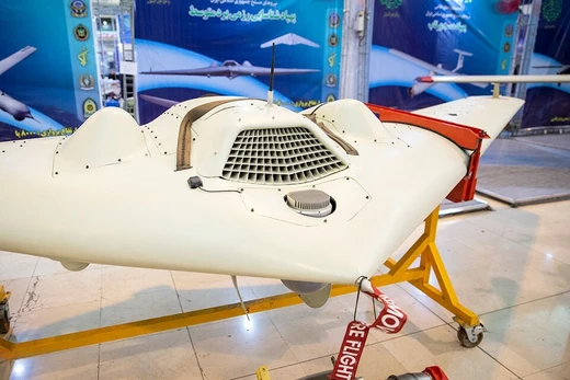
AAI Aerosonde
First UAV to cross the Atlantic and penetrate tropical cyclones.

Sgt. Megan Roses, II MEF Information Group · Public domain
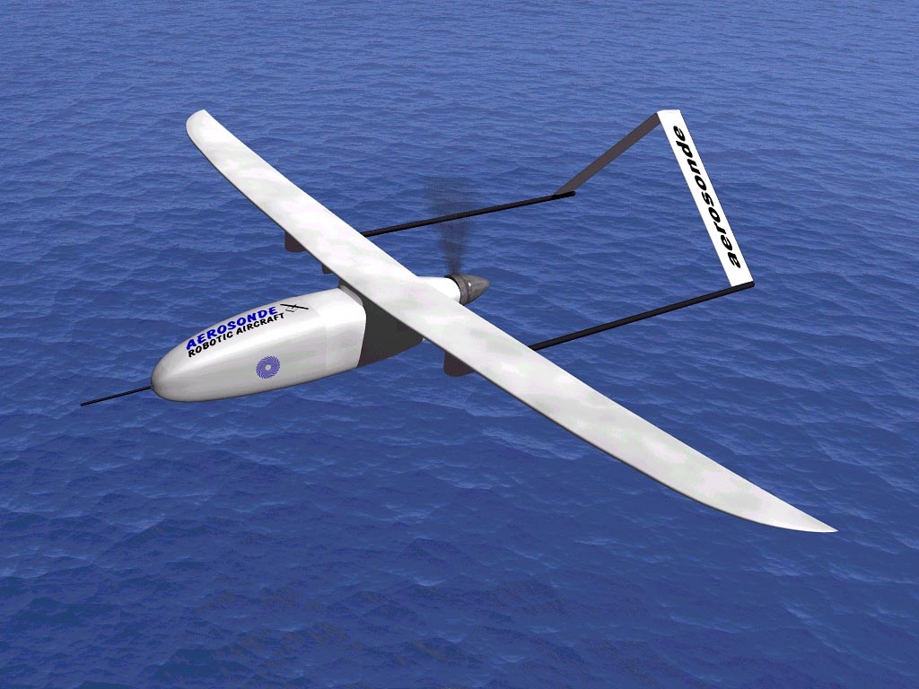
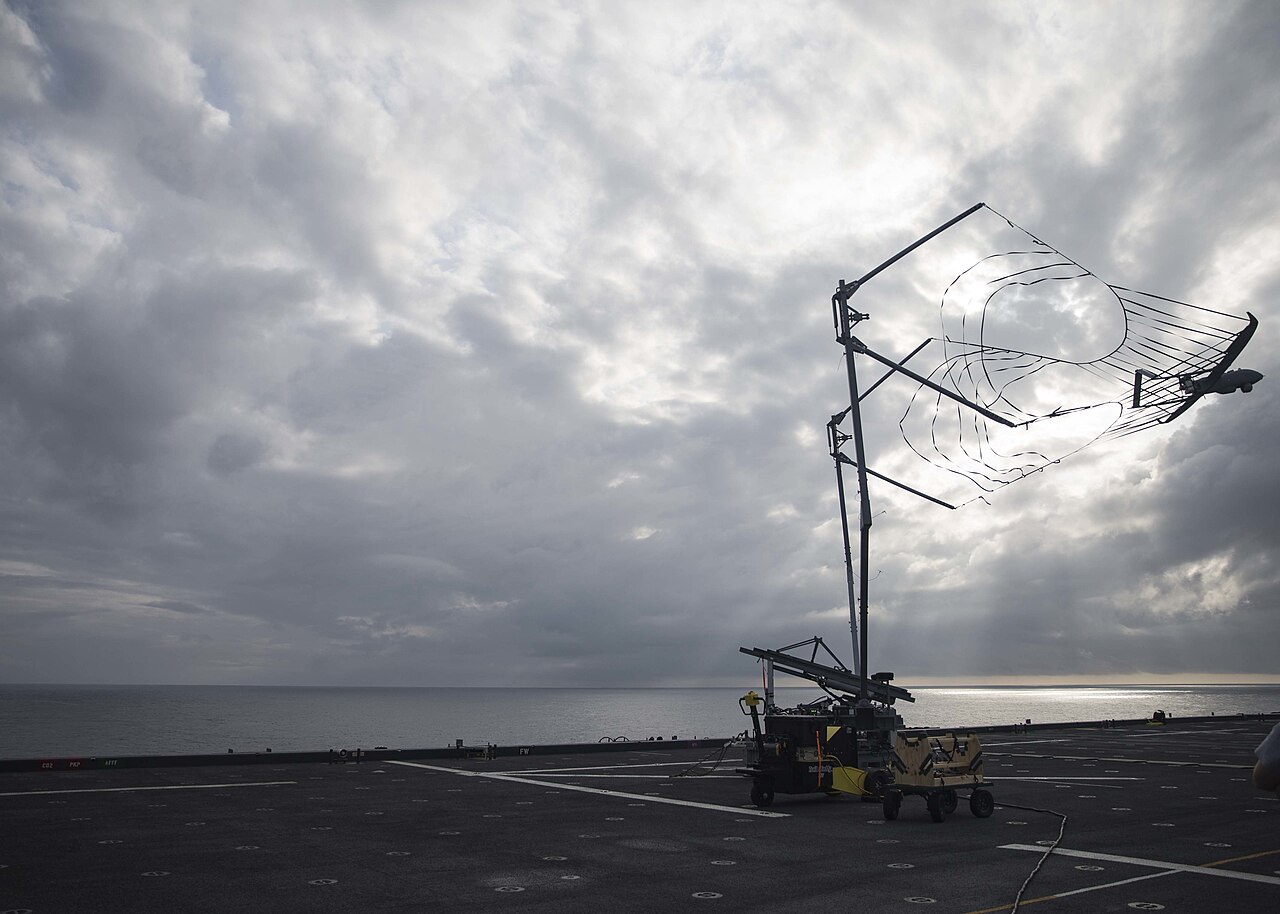
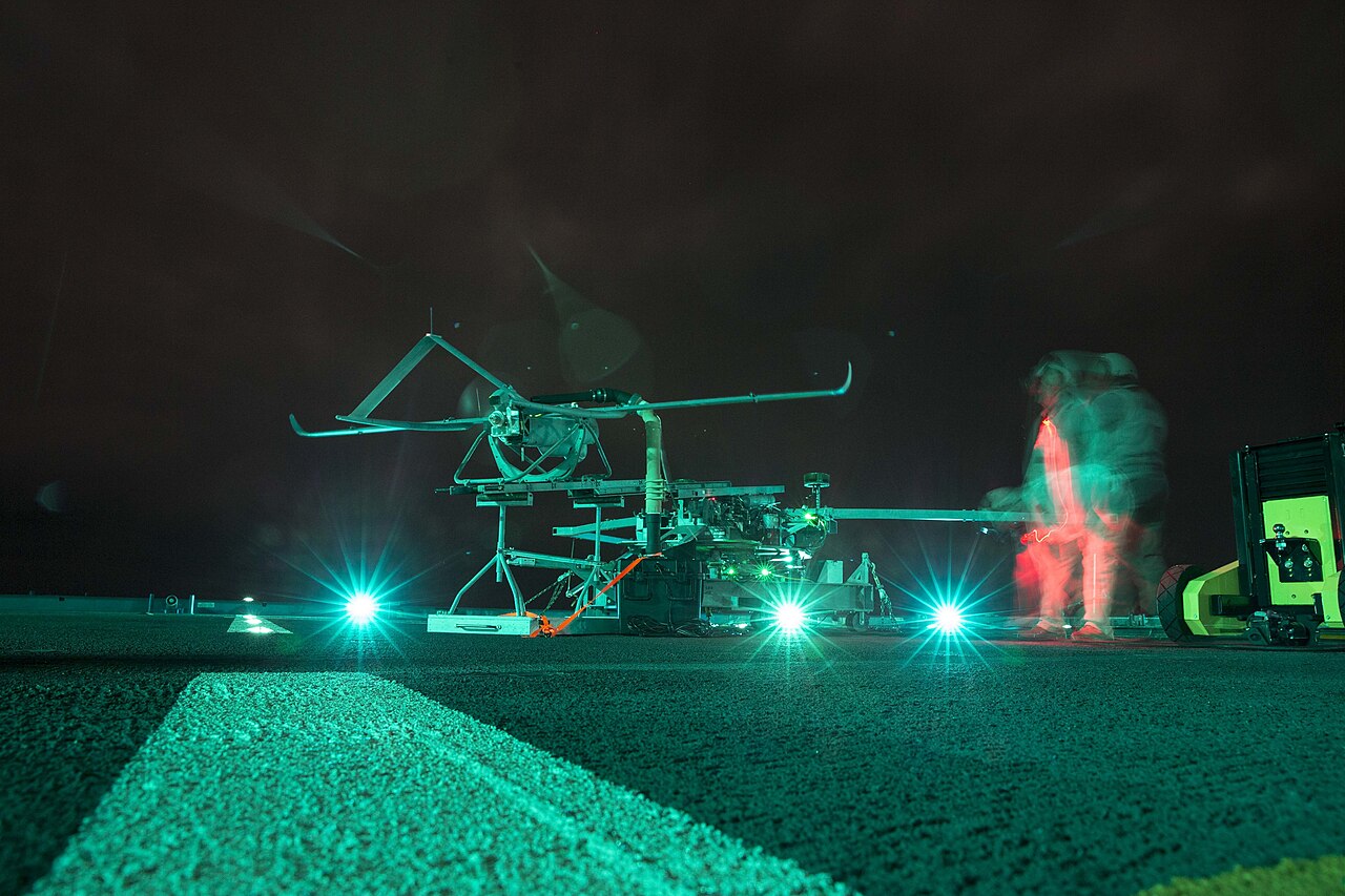
The AAI Aerosonde is a small unmanned aerial vehicle (UAV) originally designed to collect weather data over oceans and remote areas, measuring temperature, atmospheric pressure, humidity, and wind. It is also used by the United States Armed Forces for intelligence, surveillance and reconnaissance (ISR). Developed by Insitu and now manufactured by Aerosonde Ltd, a strategic business of AAI Corporation, the Aerosonde is notable for being the first UAV to cross the Atlantic Ocean and the first unmanned aircraft to penetrate tropical cyclones.
Quick Facts
- National Origin
- United States
- Manufacturer
- AAI Corporation
Facts from the source article.
Lore & Background
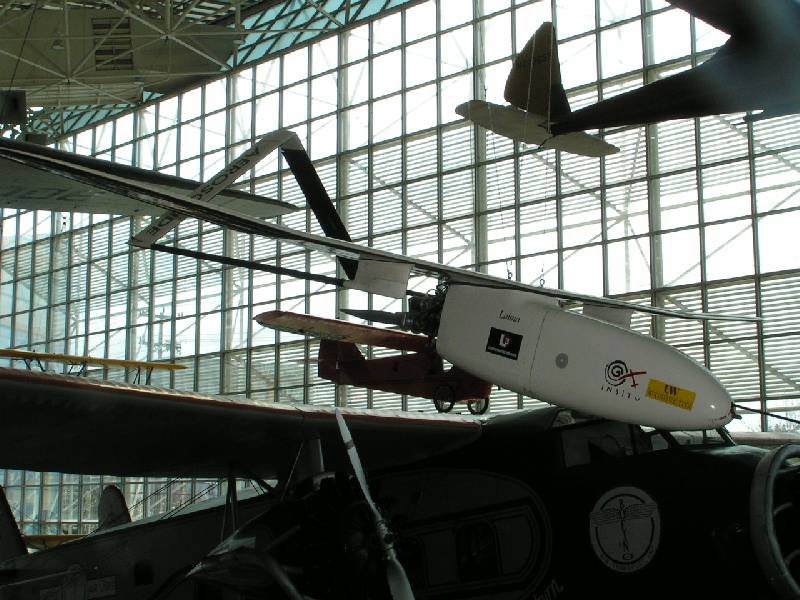
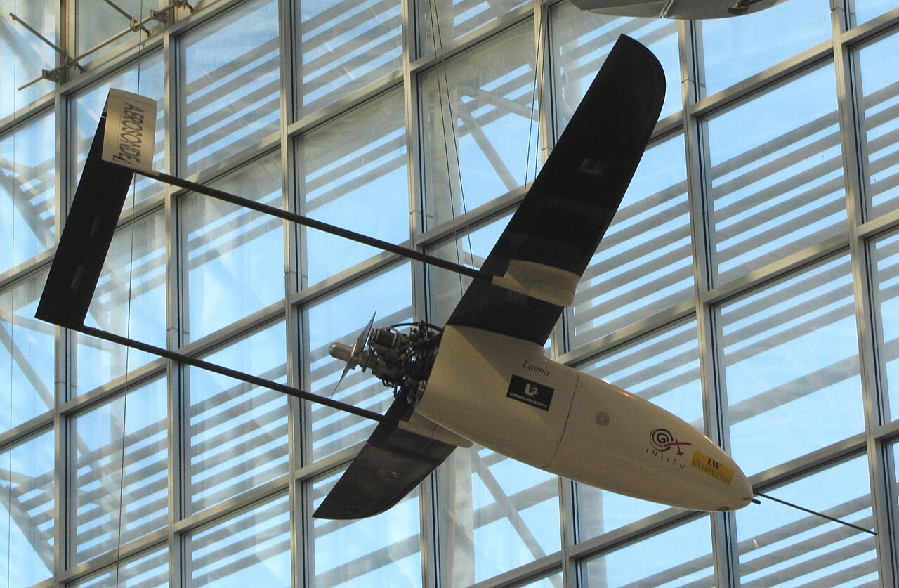
The Aerosonde was developed by Insitu and is now manufactured by Aerosonde Ltd, a strategic business of AAI Corporation. It is powered by a modified Enya R120 model aircraft engine and carries a small computer, meteorological instruments, and a GPS receiver for navigation. On August 21, 1998, a Phase 1 Aerosonde nicknamed 'Laima' completed a 2,031-mile flight across the Atlantic Ocean from Newfoundland, Canada to Benbecula, Scotland in 26 hours 45 minutes, launched from the roof rack of a moving car due to its lack of undercarriage. The flight was autonomous except for take-off and landing, and Laima is now on display at the Museum of Flight in Seattle.
Aerosondes have also been the first unmanned aircraft to penetrate tropical cyclones, with an initial mission in 2001 followed by eye penetrations in 2005. The Aerosonde has multiple variants, including the Mk 1 with a 2.9 m wingspan and 30-hour flight time, the Mk 4.7 with a 14.45 ft wingspan offered in fixed-wing and VTOL configurations, and the Mk 4.7G (also known as the Aerosonde-G) designated MQ-19 under the 1962 Tri-Service designation system. The Mk 4.8 HQ, a VTOL variant for the U.S. Army's Future Tactical Uncrewed Aircraft Systems program, began developmental testing in April 2025 as the YRQ-10A.
Reader's Guide
The Aerosonde's significance lies in its pioneering role in unmanned aviation and its dual-use capability for both scientific and military operations. It was the first UAV to cross the Atlantic Ocean, a feat that demonstrated the potential for long-endurance autonomous flight in small aircraft. Its subsequent use in penetrating tropical cyclones provided valuable meteorological data from environments too hazardous for manned aircraft. The Aerosonde has been employed by the U.S. Special Operations Command, U.S. Naval Air Systems Command, U.S. Marine Corps, and U.S. Air Force under service provision contracts, as well as by commercial customers in the oil and gas industry. By November 2015, Textron Systems was performing Aerosonde operations in eight or nine countries, with over 110,000 flight hours in service and 4,000 fee-for-service hours performed monthly. The aircraft's evolution from a weather research platform to a tactical ISR asset, with variants including VTOL configurations and satellite communication, reflects its adaptability. The Aerosonde's legacy includes setting records for small UAV endurance and range, and its design influenced later unmanned systems.
Did You Know?
- The Aerosonde was the first UAV to cross the Atlantic Ocean, completing the flight on August 21, 1998.
- The Atlantic-crossing Aerosonde, nicknamed 'Laima', was launched from the roof rack of a moving car.
- Aerosondes were the first unmanned aircraft to penetrate tropical cyclones, beginning with a mission in 2001.
- The Aerosonde Mk 4.8 HQ, designated YRQ-10A, began developmental testing for the U.S. Army in April 2025.
Position Within Australia's Unmanned Aviation Ecosystem
The AAI Aerosonde occupies a distinctive slot in the broader catalogue of unmanned aerial vehicles developed and operated in Australia, a country whose list reads like a survey of the entire global drone spectrum. It sits alongside fixed-wing platforms such as the BAE Brumby, BAE Kingfisher, and BAE STRIX, as well as Boeing's MQ-28 Ghost Bat Air Power Teaming System. It shares the listing with research-oriented entries like the CSIRO Mantis and the GAF Jindivik and Turana, and with a sprawling family of Cyber Technology multirotors including the CyberQuad, CyberEye, CyBird, and CyberWraith. The Aerosonde also appears near vertical-takeoff-and-landing quadrotors and octocopters from V-TOL, glide drones from Skyborne Technologies, and agricultural or surveillance craft from Entecho and UAV Vision. In this crowded national inventory, the Aerosonde's presence as a dedicated weather-data platform sets it apart from the reconnaissance, combat, and multi-role missions that dominate the surrounding entries, marking it as a specialist instrument within a remarkably diverse fleet.
The Four-Mark Progression
The Wikipedia listing records four distinct marks of the AAI Aerosonde—Mk.1, Mk.2, Mk.3, and Mk.4—each entered as a separate line item under Australia's unmanned aerial vehicle inventory. The existence of four numbered marks signals a sustained programme of iterative development rather than a single one-off prototype. Each mark represents a discrete step in the platform's evolution, suggesting that the airframe, its sensors, or its operational envelope were refined across successive generations. The fact that all four marks appear together in the same national listing, adjacent to the base Aerosonde entry annotated for weather data, implies that the progression was recognised as a coherent family of related aircraft rather than unrelated projects.
A Dedicated Weather-Data Platform
Among the dozens of Australian unmanned aerial vehicles catalogued in the source list, the vast majority carry descriptors such as reconnaissance, surveillance, combat, or multi-role. The AAI Aerosonde stands out because its base entry is explicitly annotated with the application of weather data collection. This single descriptor places the platform in a fundamentally different operational category from, for example, the BAE STRIX or the Boeing MQ-28 Ghost Bat, which are tied to military or air-power-teaming missions, or from the agricultural and civilian surveillance roles assigned to craft like the Entecho Demipod or the UAV Vision G18 Aeolus. The weather-data designation suggests the Aerosonde was conceived and fielded as an atmospheric sampling and meteorological observation instrument, a role that requires sustained flight in specific altitude bands and environmental conditions rather than the rapid strike-and-return or persistent overwatch profiles typical of reconnaissance drones. Its inclusion in a national UAV list alongside combat and surveillance platforms nonetheless underscores that weather-data collection was treated as a mission worthy of a purpose-built unmanned airframe within Australia's broader unmanned aviation programme.
The Aeroguard Derivative
Beneath the four standard marks, the listing introduces a distinct variant called the Aerosonde Aeroguard, entered as its own line item in Australia's unmanned aerial vehicle inventory. The use of a separate, purpose-named designation—Aeroguard—rather than a simple Mk.5 or Mk.6 label signals that this derivative was intended to fulfil a mission profile meaningfully different from the weather-data role attached to the base platform and its numbered marks. Its placement immediately after the Mk.4 entry in the listing suggests it emerged as a later or parallel branch of the Aerosonde family, leveraging the same fundamental airframe while adapting it for a task outside the standard weather-data mission. The fact that it is listed without any additional mission descriptor, unlike many other Australian UAVs that carry explicit reconnaissance, surveillance, or agricultural annotations, leaves its precise operational role open to interpretation, but its very existence as a named derivative confirms that the Aerosonde platform was flexible enough to support at least two distinct mission families within Australia's unmanned aviation ecosystem.
Gallery
Frequently Asked Questions
What is the AAI Aerosonde?
It is a small, gasoline-powered unmanned aerial vehicle originally built to gather atmospheric data—temperature, pressure, humidity, and wind—over oceans and hard-to-reach regions. The platform was developed by Insitu and is now produced by Aerosonde Ltd, a strategic business unit of AAI Corporation.
What military role does the Aerosonde fill?
The United States Armed Forces employ it as an intelligence, surveillance, and reconnaissance asset. Its compact airframe and long endurance make it well suited for persistent overwatch in areas where sending a manned aircraft would be impractical or too risky.
What is the Aerosonde's most famous record?
On August 21, 1998, it became the first unmanned aircraft to cross the Atlantic Ocean, covering 2,031 miles in roughly 26 hours 45 minutes while burning only 1.5 U.S. gallons of fuel at an altitude of about 5,500 feet. It also holds the distinction of being the first drone to penetrate a tropical cyclone.
How big is the Aerosonde?
The Mk 1 variant has a wingspan of 2.9 meters, making it a notably compact airframe for a platform capable of multi-day endurance missions. Its small size is part of what allows it to operate from austere locations and remain difficult to detect.
Why is the Aerosonde considered a milestone in UAV history?
It demonstrated that a lightweight, low-cost drone could complete a transoceanic flight and fly inside a hurricane—achievements that helped validate the practicality of long-endurance unmanned platforms. Those early feats paved the way for the broader adoption of small UAVs in both civilian meteorology and military ISR roles.
More in Military Drones of Asia, Europe and the Americas 1-24
Spotted an error? Know more?
Reader corrections go straight into our review queue. Suggest an edit · How this site is sourced