
Aconquija National Park
Protected area on the eastern slope of the Aconquija Mountains.

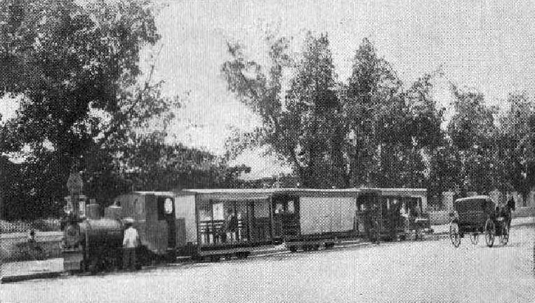
Lutz, Fernando & Cia, Julio 14 de 1907 · Public domain
Aconquija National Park, originally called Campo de los Alisos National Park, is a federally protected area in Argentina’s Tucumán Province. It was created on 10 August 1995 to safeguard a well-preserved example of the Southern Andean Yungas montane forest ecosystem.
The park lies in the Chicligasta Department, along the eastern slope of the Aconquija Mountains—the southern end of the Calchaquí Valleys, where the Gran Chaco plain first rises into the Andes. Covering 499.94 square kilometers, it protects the headwaters of the Jaya and Las Pavas rivers.
Plant and animal life shift with altitude. Between 1,500 and 2,000 meters, the Southern Andean Yungas montane forests are dominated by Andean alder, which sometimes forms pure stands. Above that, Central Andean puna montane grasslands take over, and at around 5,500 meters the terrain is snow-covered. Wildlife includes puma, ocelot, Andean mountain cat, Pampas cat, Geoffroy’s cat, South American gray fox, Pampas fox, guanaco, gray brocket, Chaco owl, turquoise-fronted amazon, mountain parakeet, and grey-hooded parakeet. Endangered species found here are the Andean mountain cat, furtive tuco-tuco, Chaco eagle, and the frog *Gastrotheca gracilis*. Vulnerable birds include the white-tailed shrike-tyrant, rufous-throated dipper, and Tucumán mountain finch.
The park was first established as Campo de los Alisos National Park in 1995. In 2018 it was renamed Aconquija National Park and expanded to its present size.
Quick Facts
- Iucn Category
- II
- Location
- Tucumán Province, Argentina
- Nearest City
- Concepción
- Established
- 1995-08-09
Facts from the source article.
Lore & Background
The park is situated in the Chicligasta Department on the eastern slope of the Aconquija Mountains, which form the southern extension of the Calchaquí Valleys. It protects the headwaters of the Jaya and las Pavas rivers. The park's flora and fauna vary considerably with elevation, from Andean alder forests at 1,500–2,000 m to puna grasslands and snow-covered terrain at around 5,500 m.
Reader's Guide
Aconquija National Park represents a critical conservation area for the Southern Andean Yungas, one of Argentina's most biodiverse ecoregions. Its establishment in 1995 and enlargement in 2018 under its current name reflect ongoing efforts to protect montane forest and grassland ecosystems. The park safeguards headwaters of local rivers and provides habitat for multiple threatened species, including the Andean mountain cat and Chaco eagle. Its elevational gradient supports distinct life zones, making it a valuable site for ecological study and biodiversity preservation. The park's location on the eastern slope of the Aconquija Mountains, transitioning from the Gran Chaco plain into the Andes, underscores its role in connecting lowland and highland habitats.
Did You Know?
- The park was originally named Campo de los Alisos National Park and was renamed Aconquija National Park in 2018.
- The predominant tree in the montane forests is the Andean alder (Alnus acuminata subsp. acuminata).
Geography & Topographic Setting
Nestled in the Chicligasta Department of Tucumán Province, Aconquija National Park sprawls across nearly 500 square kilometers on the eastern face of the Nevados del Aconquija range. The Aconquija Mountains represent the southernmost expression of the Calchaquí Valleys system, marking the very first dramatic rise as the flat Gran Chaco plain begins its long climb toward the Andean spine. This transitional character gives the park a unique topographic identity: it is neither fully lowland nor fully high mountain, but the critical threshold between the two worlds. The protected area also serves as a vital hydrological reservoir, sheltering the headwaters of both the Jaya and the Las Pavas rivers, whose waters ultimately feed downstream communities and ecosystems far beyond the park's borders. The combination of steep eastern slopes, significant elevation range, and river-source protection makes this stretch of Tucumán landscape one of the most geographically consequential protected zones in northwestern Argentina.
Vegetation & Elevation Gradients
One of the park's most striking features is the dramatic shift in plant communities as elevation climbs. Between roughly 1,500 and 2,000 meters, the Southern Andean Yungas montane forest dominates the landscape, a lush and biodiverse woodland that the park preserves in notably good condition. Within these forests, the Andean alder (Alnus acuminata subsp. acuminata) reigns as the dominant canopy species, occasionally forming vast pure stands where little else competes for light. Pushing above the forest line, the vegetation transitions into Central Andean puna montane grasslands, open and windswept, stretching toward the upper reaches of the range. At the very summit, terrain exceeding 5,000 meters is crowned with persistent snow, creating a stark alpine environment that contrasts sharply with the dense woodland below. This compressed vertical gradient—from temperate forest to high-altitude grassland to glacial peak—packs an extraordinary range of ecological niches into a single protected landscape.
Wildlife & Conservation Concerns
The park's varied habitats support an impressively diverse assemblage of mammals, birds, and amphibians. Among the felines, the puma, the ocelot, the Pampas cat, Geoffroy's cat, and the rare Andean mountain cat all find refuge within these boundaries. Canids such as the South American gray fox and the Pampas fox roam the lower elevations, while the guanaco and the gray brocket represent the larger herbivore presence. The avifauna includes the Chaco owl, the turquoise-fronted amazon, the mountain parakeet, and the grey-hooded parakeet. Several species within the park carry elevated conservation concern: the Andean mountain cat, the furtive tuco-tuco, the Chaco eagle, and the frog Gastrotheca gracilis are all classified as endangered. Among birds, the white-tailed shrike-tyrant, the rufous-throated dipper, and the Tucumán mountain finch are listed as vulnerable. Protecting these at-risk populations across such a broad elevational range is a central mandate of the park's management.
Naming, History & Institutional Evolution
The protected area did not always carry its current name. When it was first designated as a federal park on 9 August 1995, it bore the title Campo de los Alisos National Park, a name drawn from the Spanish phrase meaning 'field of the alders,' a nod to the dominant Andean alder trees that carpet the mid-elevation forests. For more than two decades the park operated under that identity, gradually building its reputation as a refuge for Southern Andean Yungas biodiversity. Then, in 2018, a significant administrative reorganization took place: the park was officially renamed Aconquija National Park, aligning its title with the mountain range that gives the area its defining topography. Crucially, the 2018 change was not merely cosmetic—the park's boundaries were simultaneously expanded to their current extent of nearly 500 square kilometers, incorporating additional habitat and strengthening the protection of the Jaya and Las Pavas river headwaters. This dual act of renaming and enlargement marked a new chapter in the site's conservation history.
Gallery
Frequently Asked Questions
What is Aconquija National Park?
It is a federally protected area in Tucumán Province, Argentina, originally designated as Campo de los Alisos National Park before receiving its current name. Established on 10 August 1995, it spans roughly 500 square kilometers on the eastern slopes of the Aconquija Mountains.
What does Aconquija National Park protect?
The park safeguards a well-preserved stretch of Southern Andean Yungas montane forest, along with Central Andean puna grasslands found at higher elevations. It also shelters the headwater sources of the Jaya and Las Pavas rivers.
When was Aconquija National Park established?
The park was officially created on 10 August 1995 under Argentine federal law. It was initially named Campo de los Alisos National Park before being rebranded to its current title.
Why is Aconquija National Park important?
It preserves a rare, intact example of the Southern Andean Yungas ecosystem at the transition point where the Gran Chaco plain first rises into the Andes. The park's elevation range of 1,500 to 5,500 meters supports a striking gradient of shifting plant and animal communities.
Where is Aconquija National Park located?
It sits in the Chicligasta Department of Tucumán Province, along the eastern face of the Aconquija Mountains. This places it at the southern tip of the Calchaquí Valleys, where the flat Chaco lowlands begin climbing into the Andean range.
More in IUCN Category II 1-24
Spotted an error? Know more?
Reader corrections go straight into our review queue. Suggest an edit · How this site is sourced