
Abava Valley
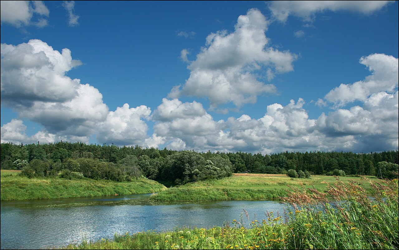
A meltwater channel valley rich in cultural and natural monuments.

Laima Gutmane · CC BY-SA 4.0
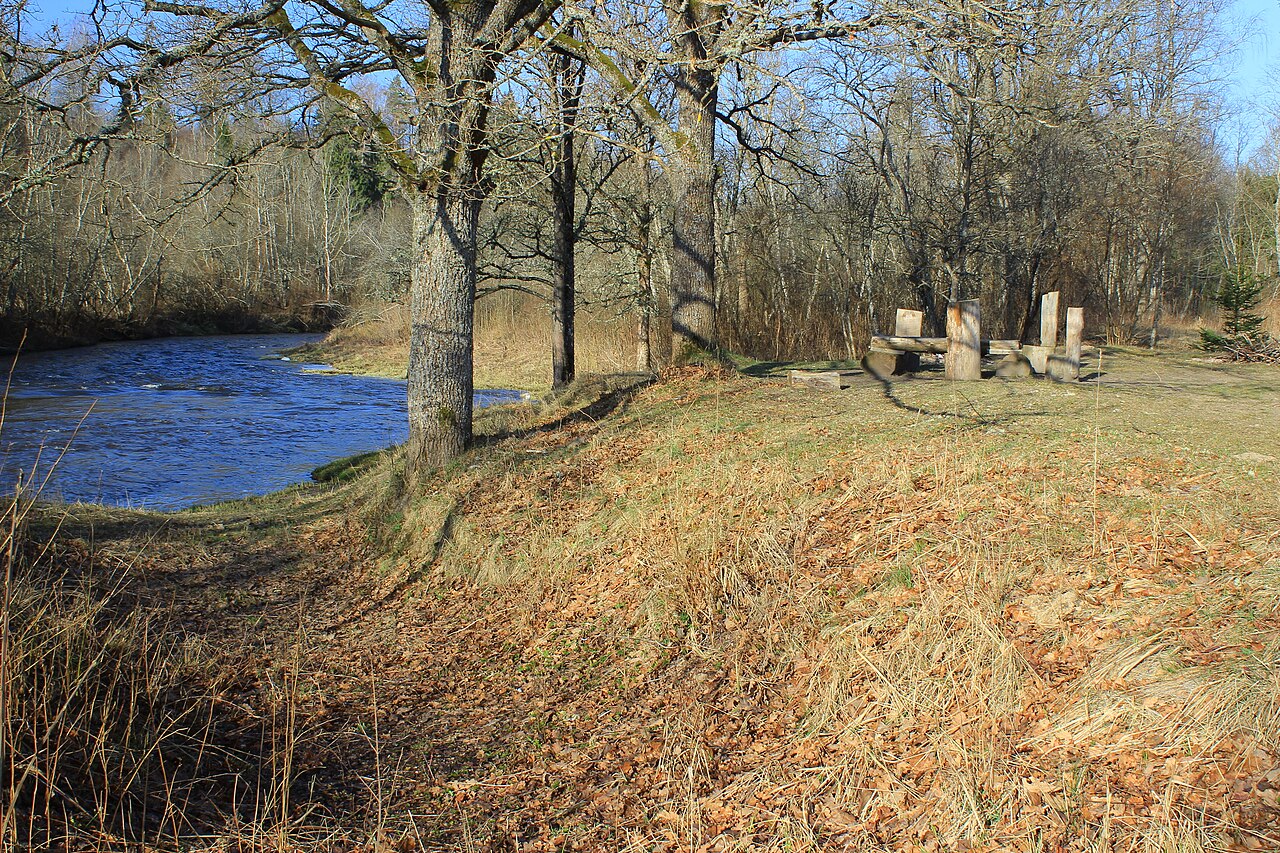
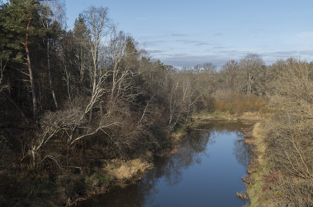
The Abava Valley, carved by the Abava River, lies within Latvia’s historical Kurzeme region, spanning the municipalities of Talsi, Tukums, and Kuldīga. After being placed on the World Monuments Fund’s Watch List of endangered heritage sites, Latvia officially made it a specially protected cultural territory on 20 June 1996. Five years later, on 3 January 2005, the valley was nominated for UNESCO World Heritage status.
This valley once carried the historic road from Riga toward Prussia and Northern Germany, which explains its wealth of cultural and historical landmarks. Nearby, 16 protected natural monuments can be found, including Devil’s Stone, Devil’s Cave, and the Chambers of Mara, along with five rocks, seven rapids, and three historic estate parks.
**Geology and formation** The Abava Valley forms the most dramatic section of the Abava–Slocene spillway, a meltwater channel shaped during the last (Weichselian) glaciation. It stretches more than 60 km westward from Tukums toward Renda, ranging from 0.7 km to 2.5 km in width and reaching depths of up to 52 m near Sabile and 47 m near Kandava. A thin layer of Quaternary deposits—mostly glacial till, glaciofluvial sand, and gravel—covers Upper Devonian bedrock made of interbedded sandstones, clays, dolomites, and marls. Erosional terraces are common along the valley sides, which the Abava River and its tributaries have deeply cut into these older sediments.
**Landslide hazard** Steep slopes throughout the valley, especially between Kandava and Sabile, are prone to landslides triggered by both natural and human factors. Kukemilks’s inventory compared legacy 1:25,000 stereoscopic aerial photographs and hillshade models from 1:10,000 topographic maps with four days of detailed field mapping. The results showed that only about a quarter of landslides visible in aerial photos could be confirmed on the ground—hillshade maps proved even less reliable—while many small or heavily vegetated failures were missed entirely without field surveys. Observed triggers include Late-glacial paraglacial adjustment, heavy rainstorms, rapid snowmelt, river-bank undercutting, and, in one instance, material removal during road reconstruction.
Quick Facts
- Iucn Category
- II
- Location
- Latvia
- Area
- 14858 ha
- Established
- 1957
Facts from the source article.
Lore & Background
The Abava Valley is the most striking segment of the Abava–Slocene spillway, a meltwater channel carved during the last (Weichselian) glaciation. It extends for over 60 km from Tukums westwards towards Renda, varies between 0.7 km and 2.5 km in width, and reaches depths of up to 52 m near Sabile and 47 m near Kandava. Beneath a veneer of Quaternary deposits—chiefly glacial till and glaciofluvial sand and gravel—lie Upper Devonian bedrocks composed of interbedded sandstones, clays, dolomites and marls. Erosional terraces are common along the valley sides, which are deeply incised into these older sediments by both the main stem of the Abava River and its tributaries.
The valley is the route of the historical road from Riga to Prussia and Northern Germany, and as such, it is rich in historical and cultural monuments. In its vicinity there are 16 protected nature monuments, such as Devil's Stone, Devil's Cave and Chambers of Mara, five rocks, seven rapids and three historical estate parks. Slope instability is widespread throughout the steep valley sides, particularly between Kandava and Sabile, where both natural and anthropogenic factors have triggered numerous landslides.
Reader's Guide
The Abava Valley holds significance as a specially protected cultural territory of Latvia, designated on 20 June 1996 following its inclusion on the World Monuments Fund's Watch List of endangered heritage sites. Its submission to the UNESCO World Heritage List on 3 January 2005 underscores its international cultural and natural value. The valley's geological formation as a meltwater channel from the Weichselian glaciation, combined with its role as a historical road from Riga to Prussia and Northern Germany, makes it a repository of both natural and cultural monuments. The presence of 16 protected nature monuments, including Devil's Stone and Devil's Cave, along with five rocks, seven rapids, and three historical estate parks, highlights its diverse heritage. Landslide hazard research in the valley, particularly between Kandava and Sabile, has revealed that only about one quarter of landslides spotted in aerial photographs could be confirmed on the ground, and that many small or heavily vegetated failures go undetected without field surveys. This work informs risk zoning, especially where regional roads and urban areas lie at the foot of the slopes.
Did You Know?
- The Abava Valley was designated as a specially protected cultural territory by the Republic of Latvia on 20 June 1996.
- It was submitted for inclusion in the UNESCO World Heritage List on 3 January 2005.
Geological Formation & Structure
The Abava Valley represents the most dramatic portion of the Abava–Slocene spillway, a vast meltwater channel sculpted during the final phase of the Weichselian glaciation. Stretching more than sixty kilometres from Tukums in a westerly direction toward Renda, the valley swings between roughly 0.7 and 2.5 kilometres in width, plunging to depths of 52 metres near Sabile and 47 metres near Kandava. Beneath a thin blanket of Quaternary material—primarily glacial till alongside glaciofluvial sands and gravels—the valley floor and walls are underlain by Upper Devonian bedrock. These ancient strata consist of interbedded sandstones, clays, dolomites, and marls, giving the landscape a distinctly layered geological character. Both the principal Abava River and its smaller tributaries have deeply incised the valley sides, carving a series of erosional terraces that step down through the older sedimentary sequence. The result is a corridor where glacial-scale engineering meets millions of years of sedimentary deposition, producing one of the most visually arresting river landscapes in the Baltic region.
Cultural Heritage & International Protection
The Abava Valley has long served as a vital corridor of movement and exchange. Running through the municipalities of Talsi, Tukums, and Kuldīga in the historical Kurzeme region, the valley traces the route of an ancient road linking Riga with Prussia and Northern Germany. This strategic position endowed the landscape with a dense concentration of historical and cultural monuments stretching along its length. Recognising the threat to these heritage assets, the World Monuments Fund placed the valley on its Watch List of endangered heritage sites. In response, the Republic of Latvia formally designated the Abava Valley as a specially protected cultural territory on 20 June 1996, granting it a unique legal status within the national framework. A further step toward international recognition followed on 3 January 2005, when Latvia submitted the valley for inclusion on the UNESCO World Heritage List. These layered protections—national and international—reflect a sustained commitment to preserving a landscape where medieval trade routes, estate architecture, and natural beauty are inextricably intertwined.
Landslide Hazard & Geomorphological Research
Steep valley walls throughout the Abava corridor are prone to slope instability, with the stretch between Kandava and Sabile experiencing the most frequent and consequential failures. Both natural processes and human activity have triggered landslides in this zone. Researcher Kukemilks undertook a detailed inventory to quantify the hazard, comparing legacy 1:25,000-scale stereoscopic aerial photographs and hillshade models derived from 1:10,000 topographic maps against four days of intensive field mapping. A striking finding emerged: only about one quarter of the landslides visible from the air could be confirmed on the ground, and hillshade maps proved even less reliable. Many small or heavily vegetated failures went entirely undetected without direct field observation. Documented triggers include Late-glacial paraglacial adjustment, intense rainstorms, rapid snowmelt, river-bank undercutting, and in one instance, material removal during road reconstruction. Although landslide density here is lower than in the nearby Gauja Valley—attributable to the greater resistance of the dolomite and sandstone bedrock—the hazard remains significant enough to necessitate formal risk zoning, particularly where regional roads and settlements sit at the base of unstable slopes.
Natural Landmarks & Ecological Mosaic
Beyond its cultural and geological significance, the Abava Valley shelters a remarkable assemblage of natural features that have earned formal protection. In the vicinity of the valley, sixteen designated nature monuments stand as testament to the region's diverse geomorphology. Among the most evocative are Devil's Stone, Devil's Cave, and the Chambers of Mara—formations whose names carry the weight of local folklore and centuries of human observation. The valley also encompasses five notable rock outcrops, seven rapids along the river's course, and three historical estate parks that blend cultivated landscape with natural topography. Together these sites create a mosaic of protected natural heritage spread across Talsi, Tukums, and Kuldīga municipalities in the historical Kurzeme region. The combination of dramatic glacial landforms, active river processes, and carefully maintained estate landscapes makes the valley one of Latvia's most concentrated repositories of natural and semi-natural heritage, offering both scientific value and a tangible connection to the region's deep environmental history.
Gallery
Frequently Asked Questions
What is the Abava Valley?
It is a meltwater-carved valley in Latvia's Kurzeme region, sculpted by the Abava River and stretching more than 60 kilometers. The landscape holds 16 protected nature monuments alongside a dense concentration of cultural heritage sites.
Where exactly is the Abava Valley located?
The valley passes through the municipalities of Talsi, Tukums, and Kuldīga in western Latvia. Its deepest section, reaching roughly 52 meters, sits near the town of Sabile.
How big is the Abava Valley?
The channel runs over 60 km in length while varying in width between about 0.7 and 2.5 km. At its deepest point near Sabile, the valley floor drops approximately 52 meters below the surrounding terrain.
What conservation status does the Abava Valley hold?
After appearing on the World Monuments Fund's Watch List for endangered heritage, Latvia designated the area a specially protected cultural territory in June 1996. A formal UNESCO World Heritage nomination was submitted on 3 January 2005.
Why is the Abava Valley historically significant?
The valley once carried the main historic road linking Riga to Prussia and Northern Germany, which is why so many cultural landmarks line its banks. Today it is recognized as a meltwater channel landscape of exceptional natural and cultural value.
More in IUCN Category II 1-24
Spotted an error? Know more?
Reader corrections go straight into our review queue. Suggest an edit · How this site is sourced