
Aire-sur-l'Adour
Commune in Landes, France; historic episcopal see on the Adour.

Roland45 · CC BY-SA 4.0
Aire-sur-l'Adour is a commune in the Landes department, Nouvelle-Aquitaine, southwestern France. It lies on the river Adour in the wine area of southwest France and is an episcopal see of the Diocese of Aire and Dax. Historically, it was the capital of the Aquitanian people of the Tarusates and was Romanized as Vicus Julii after being subjugated by Crassus, lieutenant of Julius Caesar, around 56 BC.
- Country
- France
- Region
- Nouvelle-Aquitaine
- Department
- Landes
- Episcopal see
- Diocese of Aire and Dax
- River
- Adour
- Wine area
- Southwest France
- Historical name
- Aire (until 1962)
Lore & Background
Before the Roman era, an oppidum called Atura existed on the site of Aire, inhabited by the Aquitanian people of the Tarusates. The name Atura, derived from the Adour River, was Romanized to Vicus Julii after Crassus subjugated the area around 56 BC. Two Roman altars, one dedicated to Mars, were discovered there in 1884.
In the 5th century, Aire was part of the Visigothic kingdom of Toulouse and became a royal residence under Kings Euric (466-484) and Alaric II (484-507). In 470, Euric issued orders from Aire against the Nicene churches. The town was officially called 'Aire' until April 1962, when it adopted its current name, Aire-sur-l'Adour.
Reader's Guide
Aire-sur-l'Adour holds significance as a historical and administrative center in southwestern France. Its origins as the Roman Vicus Julii and later as a Visigothic royal residence highlight its strategic importance. As the largest town in the Tursan region and an episcopal see, it has been a religious and cultural hub. The commune's location at the junction of the Tursan, Armagnac, and Vic-Bilh regions, within the Tursan AOC vineyards, underscores its role in the wine industry. The town's name, a pleonastic toponym combining 'Aire' (from Atura, linked to the Adour) and 'sur-l'Adour', reflects its deep connection to the river. Today, it is classified as a rural town and serves as the central commune of its urban unit and catchment area, with a land use dominated by agriculture. Its history, from pre-Roman oppidum to modern commune, illustrates the layered heritage of the region.
Did You Know?
- In the 5th century, Aire was a royal residence under Visigothic Kings Euric and Alaric II.
- The commune is crossed by the D824 road and lies at the point where the Adour River enters the Landes department.
Geographic Crossroads of Southwest France
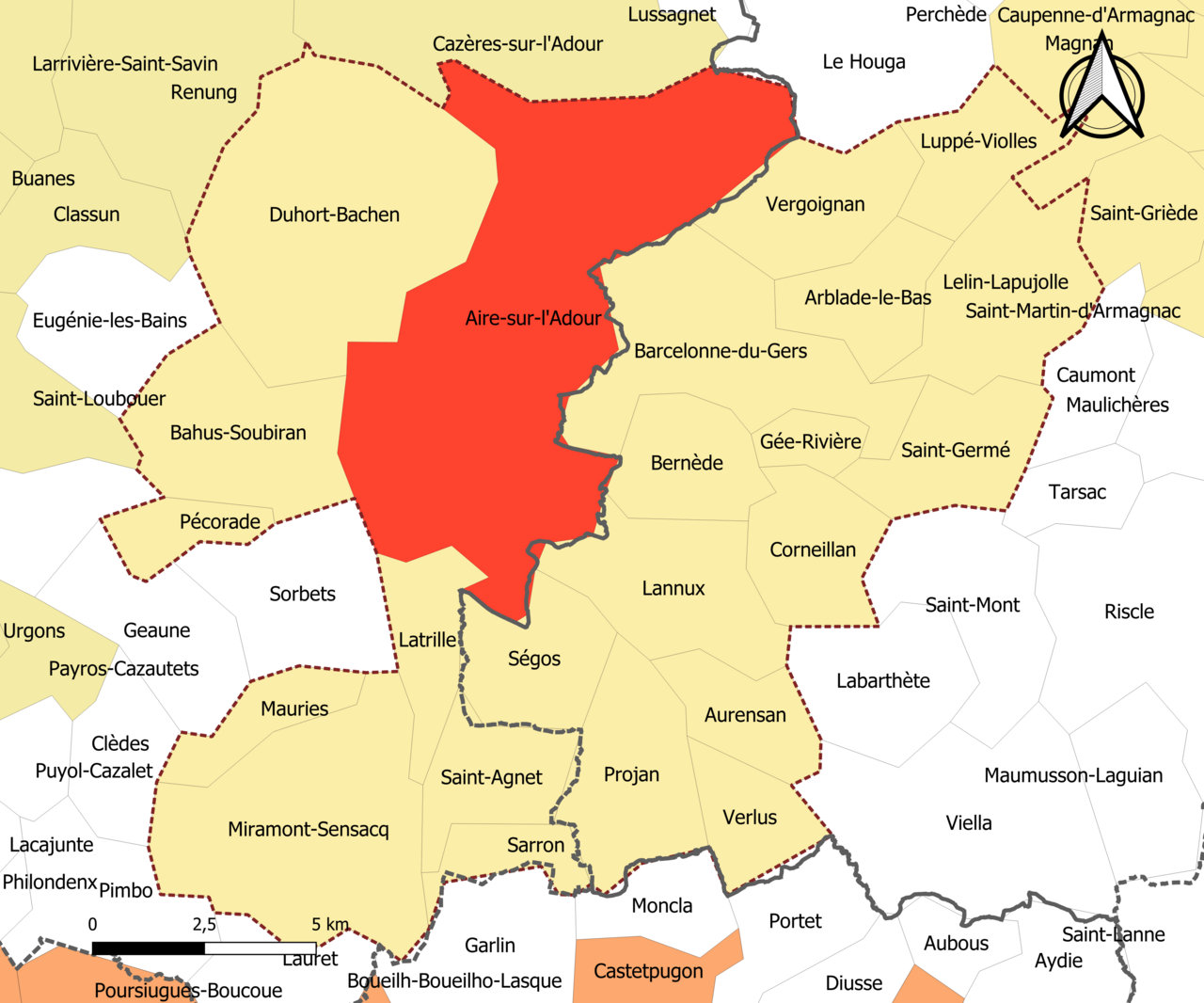
Aire-sur-l'Adour sits at a remarkable confluence of identities. Perched where the Adour River first crosses into the Landes department, it occupies the southeastern corner of that department while simultaneously bordering Gers. The town is the largest settlement in the Tursan region, yet it also marks the meeting point of three distinct cultural and viticultural zones: Tursan, Armagnac, and Vic-Bilh. This triple junction gives the commune a layered regional character that few French towns can claim. It lies roughly 150 kilometers south of Bordeaux, 50 kilometers north of Pau, and 30 kilometers southeast of Mont-de-Marsan, placing it in a corridor between two of the region's major urban centers. The D824 road threads through the heart of the Tursan AOC vineyards, reinforcing the town's deep connection to wine production. As an episcopal see within the Diocese of Aire and Dax, it also carries a historical religious significance that extends well beyond its modest size.
A Temperate Climate with Sharp Extremes
The climate of Aire-sur-l'Adour has been the subject of multiple classification efforts over the decades. A 2010 CNRS study, drawing on data from 1971 to 2000 and incorporating topography and land-use variables, designated the commune as having an altered oceanic climate. By 2020, the Köppen-Geiger system classified it as Cfb—a temperate zone with cool summers and no pronounced dry season—based on 1988-2017 records. Météo-France's own 2020 typology placed it squarely in the Aquitaine-Gascogne oceanic region, a zone known for generous spring rainfall, hot summers averaging around 19.5 degrees Celsius, light prevailing winds, persistent autumn and winter fog, and 15 to 20 days of summer thunderstorms. The numbers tell a vivid story: the 1971-2000 average annual temperature was 12.6 degrees with a 14.8-degree seasonal swing, while annual rainfall stood at 1,024 millimeters. More recently, the nearest Météo-France station at Le Houga, ten kilometers away, recorded a scorching 41.1 degrees on 18 June 2022 and a bitter minus 12.4 degrees on 27 January 2007, illustrating just how wide the thermal range can stretch.
A Town Shaped by the River
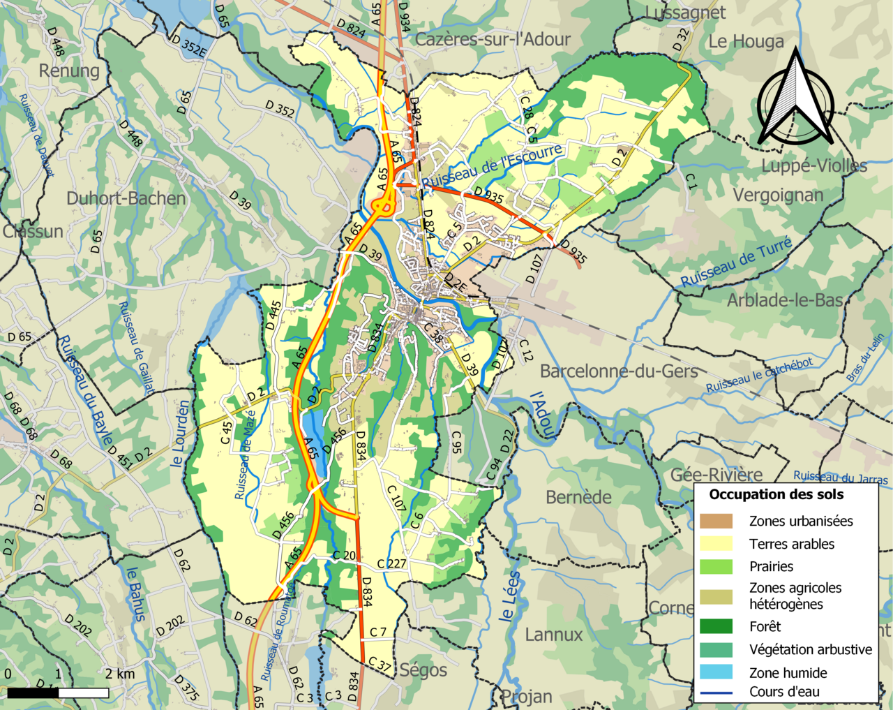
The Adour River is the organizing principle of Aire-sur-l'Adour's urban fabric. The historic core straddles both banks: the cathedral, the town hall, and the main shopping area cluster on the left bank, while the right bank hosts the Subéhargues locality. The Mas district, also on the left-bank side, looks down over the river and is anchored by the Church of Sainte-Quitterie. Beyond these two principal outlying areas, the commune's built environment remains modest. INSEE's 2022 density scale classifies the town as rural, and it anchors an inter-regional urban unit shared with just one neighboring commune, Barcelonne-du-Gers, which effectively forms part of the same continuous urban area. The broader catchment area encompasses 23 communes but holds fewer than 50,000 residents. Land-use data from the Corine database confirms the agricultural character: in 2018, two-thirds of the territory (66.4 percent) was devoted to farming, with arable land alone accounting for 52.1 percent, while forests covered 21.6 percent and urbanized zones just 7.3 percent. The Buros stream, a right-bank tributary of the Adour, adds a secondary watercourse to the local hydrography.
Living with the Land's Risks
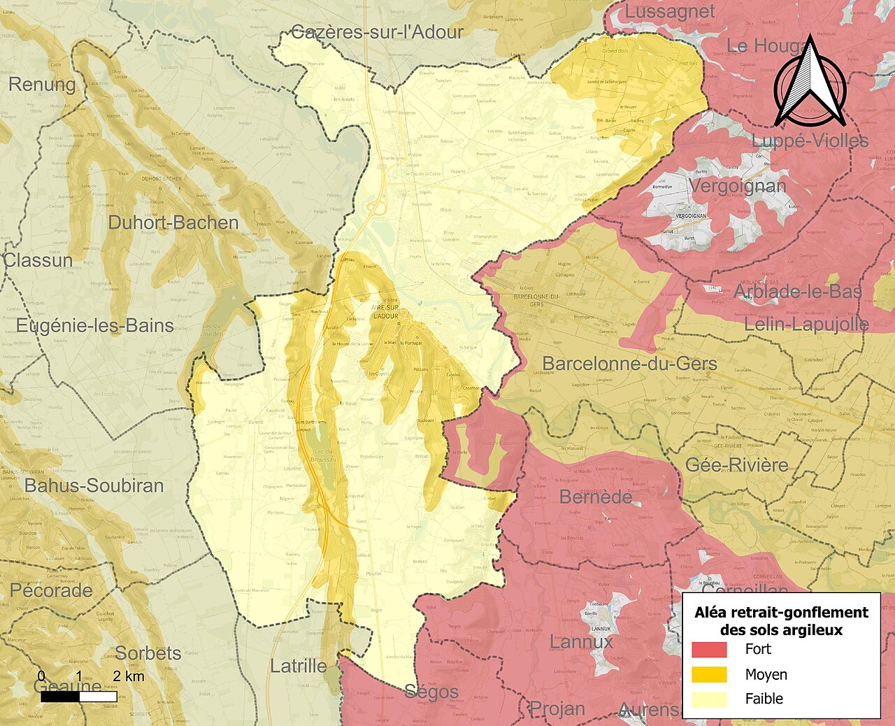
Aire-sur-l'Adour's position along the Adour and its tributaries makes it perpetually exposed to water-related hazards. The Broussau, the Escourre stream, and the Lourden, alongside the Adour itself, can overflow and inundate parts of the commune. This is not merely theoretical: the town was officially declared a natural disaster area following flood and mudslide damage in 1999, 2006, 2009, 2014, and 2020. Beyond flooding, the commune faces a broad spectrum of weather-related threats including storms, extreme cold, heat waves, drought, and snow, as well as landslides and low-level seismic activity. Two technological risks compound the picture: the transport of hazardous materials and potential industrial incidents. A particularly insidious local hazard is the behavior of clay soils, which shrink and swell with alternating dry and wet periods, causing differential settlement that can crack and damage buildings. In 2019, 465 of the commune's 2,545 buildings—roughly 18 percent—were assessed as being at medium or high risk from this phenomenon, a figure slightly above the departmental average of 17 percent. The BRGM maintains a public database allowing residents to look up the specific risk profile of any property by address or parcel number.
Gallery
Frequently Asked Questions
Where is Aire-sur-l'Adour located in France?
The commune sits along the Adour river in the Landes department, part of the Nouvelle-Aquitaine region in southwestern France.
What was Aire-sur-l'Adour's role in ancient history?
It served as the capital of the Tarusates, an Aquitanian people, before being conquered around 56 BC by Crassus, a lieutenant of Julius Caesar. Following Romanization, the settlement was renamed Vicus Julii.
What is Aire-sur-l'Adour's religious significance?
The town is the episcopal see of the Diocese of Aire and Dax, a role that has anchored its identity for centuries.
Why do heritage enthusiasts consider Aire-sur-l'Adour noteworthy?
It bridges pre-Roman Aquitanian culture and Roman administrative history, having transitioned from a tribal capital to a Romanized vicus within a single generation.
Which wine region does Aire-sur-l'Adour belong to?
The commune falls within the Southwest France wine area, reflecting the region's long-standing viticultural tradition along the Adour valley.
More in World Heritage Sites in France 1-24
Spotted an error? Know more?
Reader corrections go straight into our review queue. Suggest an edit · How this site is sourced