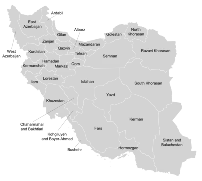
Qazvin province
Northwest Iranian province with ancient settlements and Safavid capital history.

Qazvin province is one of the 31 provinces of Iran, located in the northwest of the country with the city of Qazvin as its capital. Established in 1997 from parts of Tehran and Zanjan provinces, it was later incorporated into Region 1 in 2014 for coordination and development purposes. The region boasts a deep historical legacy, having once served as a capital of the Persian Empire and now containing over two thousand archaeological and architectural sites. Archaeological evidence in the Qazvin plain indicates urban agricultural settlements dating back to 7000 BC, with notable ancient sites including Tepe Sagzabad, Tepe Ghabristan, and Teppe Zagheh. The name "Qazvin" originates from the Cas, an ancient tribe that lived south of the Caspian Sea, which itself derives its name from the same source. Its strategic location connects Tehran, Isfahan, and the Persian Gulf to the Caspian coast and Asia Minor. During the early Islamic era, Qazvin served as a base for Muslim forces. After being destroyed by Genghis Khan in the 13th century, it became the Safavid capital in 1548 before the capital moved to Isfahan in 1598. In the Qajar period and beyond, its proximity to Tehran made it an important governmental center; Abbas Mirza, a Crown Prince and Minister of Commerce, served as its governor. The province is near Alamut, where Hasan-i Sabbah, founder of the secret Ismaili order of the Assassins, operated. The 1921 coup of General Reza Khan, which led to the Pahlavi dynasty, was launched from Qazvin. A devastating earthquake in 1962 killed 12,225 people. The province covers 15,821 square kilometers, bounded by Mazandaran, Gilan, Hamedan, Zanjan, Markazi, and Tehran provinces. Its highest mountains, Siälän and Shäh Alborz, reach 4,175 and 4,056 meters respectively, part of the central Alborz range. The northern climate is cold and snowy in winter, temperate in summer, while the south has mild winters and warm summers. The population was 1,273,761 in 2016, with nearly 75 percent living in urban areas. The majority in the northeast, in Alamut, are Mazandarani or Gilaks speaking their respective dialects, though other sources identify the majority there as Tats. Notable sites include the Al-Nabi Mosque, the Peighambarieh Shrine where four Jewish saints are buried, and several medieval Ismaili castles such as Alamout and Lambesar. The province also preserves traditional wat
- Capital
- Qazvin
Quick Facts
- Native Name
- fa · استان قزوین
- Settlement Type
- Province
- Map Alt
- Map of Iran with Qazvin highlighted
- Subdivision Type
- Country
- Subdivision Name
- Iran
- Subdivision Type1
- Region
- Subdivision Name1
- Region 1
- Parts Type
- Counties
- Parts Style
- para
- P1
- 6
- Established Title
- Established
- Established Date
- 1997
Facts from the source article.
Lore & Background
Qazvin province, located in northwestern Iran, covers an area of 15,821 square kilometers. Its landscape is defined by the central Alborz mountain range, with notable peaks including Siälän, which rises to 4,175 meters, and Shäh Alborz at 4,056 meters. The province’s lowest point lies in Tärom e Soflä. Northern parts experience cold, snowy winters and temperate summers, while the south has milder conditions with relatively cold winters and warm summers. The province is bounded by Mazandaran and Gilan to the north, Hamedan and Zanjan to the west, Markazi to the south, and Tehran to the east. Archaeological evidence in the Qazvin plain shows urban agricultural settlements dating back to 7000 BC, with significant ancient sites such as Tepe Sagzabad, Tepe Ghabristan, and Teppe Zagheh. The region contains over 2,000 architectural and archaeological sites, reflecting its long history as a cultural center. Qazvin was destroyed by Genghis Khan in the 13th century and later served as the Safavid capital from 1548 until 1598. The province was created in 1997 from parts of Tehran and Zanjan provinces. In the northeast, around Alamut, the population includes Mazandarani or Gilak speakers, though some sources identify them as Tats. The province is home to numerous historical structures, including mosques like Al-Nabi Mosque, the Peighambarieh Shrine where four Jewish saints are buried, and several medieval Ismaili castles such as Alamout, Lambesar, and Shemiran. Traditional water reservoirs, known as ab anbars, are also preserved, with ten protected by the provincial cultural heritage organization.
Reader's Guide
Qazvin province holds significant historical and cultural importance in Iran. The province's strategic location connecting Tehran, Isfahan, and the Persian Gulf to the Caspian seacoast and Asia Minor made it a key region for trade and military operations throughout the centuries. Its role in Iranian history includes serving as a base for early Muslim forces, being destroyed by Genghis Khan, and later becoming the Safavid capital. The province is also notable for its association with the Assassins of Alamut and as the launching point for Reza Khan's coup that established the Pahlavi dynasty. The province preserves numerous historical mosques, castles, traditional reservoirs, bazaars, and bridges, alongside modern educational institutions like Imam Khomeini International University.
Did You Know?
- The name 'Qazvin' derives from the ancient Cas tribe, which also gave its name to the Caspian Sea.
More in Provinces Of Iran 1-24
Spotted an error? Know more?
This is a living reference — every entry is fact-audited, and reader corrections feed straight into our audit queue. Suggest an edit · See this site's audit record