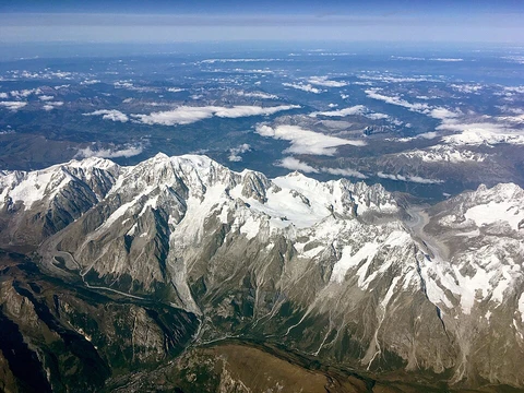
Chersky Range

The Chersky Range is a chain of mountains in northeastern Siberia, situated between the Yana and Indigirka Rivers. Administratively, most of the range falls within the Sakha Republic, with a small eastern section belonging to Magadan Oblast. The highest peak is Peak Pobeda, located within the Ulakhan-Chistay subrange. The mountains hold cultural significance for the Yakut people, featuring sites such as Ynnakh Mountain (also known as Mat'-Gora) and distinctive kigilyakh rock formations. The Moma Natural Park, a protected area, lies in the southern part of the range. Historically, between 1633 and 1642, explorer Poznik Ivanov crossed the range after ascending a tributary of the lower Lena and traversing the Verkhoyansk Range. The mountain system was sighted in 1926 by the son of Vladimir Obruchev and was subsequently named by the Russian Geographical Society in honor of the Polish explorer and geographer Ivan Chersky (Jan Czerski). The range is composed of numerous subranges running generally from northwest to southeast, including the Burkat, Khadaranya, Kisilyakh, Tas-Khayakhtakh, and Ulakhan-Chistay ranges, among others. The system encompasses three main river basins: the Yana, Indigirka, and Kolyma. Some higher alpine areas contain roughly 350 glaciers. Tectonically, the range lies on the boundary between the Eurasian and North American plates. While once considered a zone of continental rifting, it is now viewed primarily as an active suture zone where compression occurs, though the exact nature of the plate boundary remains under study. The range is seismically active and connects northward with the Laptev Sea Rift.
- Location
- Northeastern Siberia, between Yana and Indigirka Rivers
- Administrative region
- Sakha Republic and Magadan Oblast
- Named after
- Ivan Chersky (Jan Czerski)
- Tectonic setting
- Boundary between Eurasian and North American plates
Lore & Background
The Chersky Range is significant as a major mountain system in northeastern Siberia, forming a key geographic and tectonic boundary. The range's tectonic position on the boundary between the Eurasian and North American plates makes it an important area for studying continental rifting and compression, though the exact nature of the boundary remains under investigation. Its glaciers and alpine relief contribute to the hydrology of the region, feeding three major river systems. The Chersky Range, along with the Verkhoyansk Range, moderates the climate of Siberia by obstructing west-moving air flows, reducing snowfall in the plains to the west.
Reader's Guide
The Chersky Range is a mountain chain in northeastern Siberia, situated between the Yana and Indigirka Rivers. Administratively, it lies mostly within the Sakha Republic, with a small eastern portion in Magadan Oblast. Its highest point is Peak Pobeda, located within the Ulakhan-Chistay subrange. The mountains hold cultural significance, containing traditional Yakut sites such as Ynnakh Mountain (Mat'-Gora) and distinctive kigilyakh rock formations. The southern zone of the range is protected by the Moma Natural Park. The system was first crossed by a Russian explorer, Poznik Ivanov, sometime between 1633 and 1642, and was later sighted in 1926 by the son of geologist Vladimir Obruchev. It was subsequently named by the Russian Geographical Society after the Polish explorer Ivan Chersky. The range is composed of numerous subranges running northwest to southeast, and its hydrography includes the basins of the Yana, Indigirka, and Kolyma rivers. Some higher alpine sections contain roughly 350 glaciers and small glacial lakes. The range lies on the boundary between the Eurasian and North American tectonic plates; its precise nature remains debated, with earlier interpretations of continental rifting now largely replaced by the view of an active suture zone where compression occurs, making the region seismically active.
Did You Know?
- The Chersky Range is 1,500 km (930 mi) long.
- It is a section of the East Siberian System of mountains.
- The range lies on the boundary between the Eurasian and North American tectonic plates.
- By the 1980s it was considered a zone of continental rifting, but the current view is that it is mostly an active suture zone where compression occurs.
- The Chersky Range, along with the Verkhoyansk Range, moderates the climate of Siberia by obstructing west-moving air flows, reducing snowfall in the plains to the west.
More in Mountain Ranges And Massifs 1-24
Related in Mountain Ranges And Massifs
Links follow this subject's own source article.
Spotted an error? Know more?
This is a living reference — every entry is fact-audited, and reader corrections feed straight into our audit queue. Suggest an edit · See this site's audit record