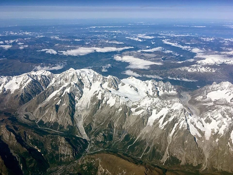
Andes
Longest continental mountain range, forming western backbone of South America.

The Andes are the longest chain of mountains on any continent, stretching continuously along South America’s western side. They run north to south through seven countries: Argentina, Chile, Bolivia, Peru, Ecuador, Colombia, and Venezuela. The range is split into several parallel ridges separated by low-lying gaps, and these ridges are grouped into three broad climate-based divisions: the Tropical, Dry, and Wet Andes. High plateaus sit among the peaks—the Altiplano is the second highest plateau on Earth, after Tibet’s—and several major cities, including Bogotá, La Paz, Santiago, and Quito, are built on them.
Outside Asia, the Andes are the tallest mountain range. Their highest point is Argentina’s Aconcagua, which reaches about 6,961 meters above sea level. Because of the Earth’s equatorial bulge, Chimborazo in Ecuador is farther from the planet’s center than any other surface location. The Andes also hold the world’s highest volcanoes, such as Ojos del Salado on the Chile–Argentina border. The range is part of the American Cordillera, a nearly unbroken series of mountain chains forming the western “backbone” of the Americas and Antarctica.
The name “Andes” likely comes from the Quechua word *anti* (east), as in Antisuyu, the eastern region of the Inca Empire. Another theory traces it to the Aymara word *anta* (copper). “Cordillera” derives from Spanish *cordel* (rope) and describes both individual sections of the Andes and the entire mountain chain along the western Americas.
Geographically, the Andes run about 7,000 kilometers, varying in width from 200 to 700 kilometers. They are made up of parallel cordilleras, high plateaus, and deep valleys. Notable peaks include Aconcagua (Argentina), Huascarán (Peru), and Illimani (Bolivia). The range spans many climates and ecosystems, from humid cloud forests on the eastern slopes to the arid Altiplano and glaciated southern summits. These sharp environmental contrasts have shaped human settlement, leading to highland cities like Cusco, La Paz, and Quito.
The Andes split into three sections: the Southern Andes (Argentina and Chile, south of Llullaillaco), the Central Andes (Bolivia and Peru), and the Northern Andes (Colombia, Ecuador, and Venezuela), which branch into three separate ranges. The Sierra Nevada de Santa Marta, at the northern end, is usually considered part of the Northern Andes, though not always. The Leeward Antilles islands (Aruba, Bonaire, Curaçao) were once thought to be the submerged northernmost peaks of the Andes, but newer geological studies show the tectonic boundary between the South American and Caribbean plates is more complex.
Geologically, the Andes are an orogenic belt along the Pacific Ring of Fire, a zone of volcanic activity around the Pacific rim. They formed during the Mesozoic and Tertiary eras as the Nazca Plate subducted beneath the South American Plate, with climate effects accelerating the process. As the Andes rose, they created a rain shadow on Chile’s western coast; ocean currents and winds carried moisture away, starving parts of the subduction zone of sediment and reducing lubrication, which increased coastal uplift. The main driver of the rise is the contraction of the South American Plate’s western edge due to subduction of the Nazca and Antarctic plates. To the east, sedimentary basins like the Amazon and Orinoco separate the Andes from ancient cratons. In the south, the range borders the former Patagonia Terrane. To the west, the Andes end at the Pacific, though the Peru–Chile Trench marks their ultimate limit. The range contains several oroclines (bends), notably the Bolivian Orocline at about 18°S, where the coast and mountains curve seaward.
Lore & Background
Stretching roughly 8,900 kilometers along the western edge of South America, the Andes form the longest continental mountain range on Earth. This continuous highland varies in width from 200 to 700 kilometers, reaching its broadest extent between 18°S and 20°S latitude, and averages about 4,000 meters in height. The range runs through seven countries—Argentina, Chile, Bolivia, Peru, Ecuador, Colombia, and Venezuela—and is divided into several parallel ranges separated by intermediate depressions. These ranges are grouped into three major climatic divisions: the Tropical Andes, the Dry Andes, and the Wet Andes. The Andes host several high plateaus, including the Altiplano, the world’s second-highest plateau after the Tibetan Plateau, which supports major cities such as La Paz, El Alto, and Sucre. The highest peak outside Asia, Aconcagua in Argentina, rises to approximately 6,961 meters, while Chimborazo in Ecuador is the point farthest from Earth’s center due to the equatorial bulge. The range also contains the world’s highest volcanoes, such as Ojos del Salado on the Chile-Argentina border at 6,893 meters. The Andes are part of the American Cordillera, a nearly continuous chain of mountain ranges forming the western backbone of the Americas and Antarctica.
Reader's Guide
The Andes are of immense significance as the longest continental mountain range in the world, forming a continuous highland along the western edge of South America. Their geological formation, driven by the subduction of the Nazca and Antarctic Plates, has produced some of the highest peaks outside of Asia, including Aconcagua and the world's highest volcanoes such as Ojos del Salado. The range's climatic and ecological diversity has shaped human settlement patterns, supporting major highland cities and influencing the development of pre-Columbian civilizations like the Inca Empire. The Andes are also part of the American Cordillera, a chain of mountain ranges that forms the western 'backbone' of the Americas and Antarctica. Ongoing tectonic activity continues to generate significant earthquakes and volcanic eruptions, making the Andes a key region for studying plate tectonics and seismic hazards. Their legacy includes not only their physical grandeur but also their role in the cultural and historical geography of South America.
Did You Know?
- The peak of Chimborazo in the Ecuadorian Andes is farther from the Earth's center than any other location on the Earth's surface, due to the equatorial bulge.
- The Altiplano Plateau in the Andes is the world's second highest plateau after the Tibetan Plateau.
Scale and Geographic Reach
Rather than one uniform wall of rock, the Andes are broken into multiple parallel cordilleras separated by intermediate valleys and depressions. Climate further divides them into three broad zones: the Tropical Andes in the north, the Dry Andes through the central stretches, and the Wet Andes to the south. Beyond South America, the range is a vital segment of the American Cordillera, an almost unbroken chain of mountains that forms the western backbone of both the North and South American continents and extends into Antarctica.
Tectonic Origins and Geological Drama
The Andes owe their existence to one of Earth's most powerful geological engines: the relentless subduction of oceanic crust beneath the South American Plate. Over the course of the Mesozoic and Tertiary eras, the Nazca Plate and the Antarctic Plate have driven their edges under the continental margin, compressing and uplifting the western rim into a towering range. Climate played a surprising accelerant in this process. As the mountains rose, they cast a rain shadow over western Chile, and prevailing winds and ocean currents stripped moisture from the coastal zone. This left portions of the subduction interface sediment-poor and poorly lubricated, intensifying the rate of coastal contraction and uplift. The range is not a straight line; it bends at the Bolivian Orocline near 18° south, where the coastline kinks at a point called the Arica Elbow and the mountains shift from a northwest heading to a southerly one. Further south, the subtler Maipo Orocline between 30° and 38° south introduces another seaward-concave break. To the east, sedimentary basins including the Orinoco, Amazon, and Gran Chaco separate the Andes from the ancient cratonic core of the continent, while the Peru–Chile Trench marks the ultimate western boundary.
Ecological Range and Highland Civilization
Few mountain systems on Earth span such a dramatic spectrum of environments. The Andes sweep from humid cloud forests clinging to eastern slopes, through the bone-dry high plains of the Altiplano, all the way to the ice-capped summits of the southern reaches. The Altiplano itself ranks as the second-highest elevated plateau on the planet, trailing only the Tibetan Plateau, and it cradles major urban centres including La Paz, El Alto, and Sucre. Other highland cities—Bogotá, Cali, Medellín, Arequipa, Santiago, Mérida, and Cusco—owe their existence to the shelter and resources these plateaus provide. In terms of raw altitude, the range is the highest outside of Asia. Perhaps most striking, Chimborazo in Ecuador, though not the highest above sea level, sits farther from the Earth's centre than any other point on the surface because of the equatorial bulge produced by the planet's rotation.
Name, Language, and Cultural Roots
The very name "Andes" carries a layered linguistic history that reflects the deep indigenous roots of the region. The most widely accepted explanation traces the word to the Quechua term anti, meaning "east," a reference to Antisuyu—one of the four administrative regions of the Inca Empire that lay to the east of the mountains. In Quechua, the range is simply called Anti. A competing theory, however, points to the older Aymara word anta, which means "copper," suggesting a much earlier association between the mountains and the mineral wealth found in their veins. The Spanish descriptor cordillera, used for both the entire range and its individual contiguous segments, derives from cordel, meaning "rope," evoking the long, unbroken thread of peaks that stitches the western edge of the continent. Together, these names—indigenous, colonial, and descriptive—encode centuries of human encounter with a landscape that has shaped civilisation as much as it has been shaped by the forces of the Earth beneath it.
Frequently Asked Questions
What is the Andes?
The Andes are a vast mountain chain running along the western edge of South America, making them the longest continental range on Earth. They form the continent's western highland spine from north to south.
Which countries does the Andes pass through?
The range threads through seven nations: Venezuela, Colombia, Ecuador, Peru, Bolivia, Chile, and Argentina. It runs along their western borders as one unbroken highland ridge.
What is the tallest peak in the Andes?
Aconcagua holds that title and is the highest summit outside of Asia. The range also shelters the planet's tallest active volcanoes.
Why do fans consider the Andes a standout entry?
Its unmatched length, the presence of Aconcagua, and its role as the defining highland feature across seven countries' western geography make it one of the most geographically dominant ranges on the planet.
More in Mountain Ranges And Massifs 1-24
Spotted an error? Know more?
This is a living reference — every entry is fact-audited, and reader corrections feed straight into our audit queue. Suggest an edit · See this site's audit record