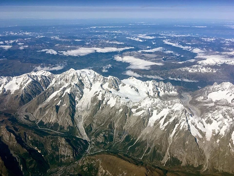
Aïr Mountains
A Saharan massif forming a green Sahelian refuge.

The Aïr Mountains, also called the Aïr Massif, form a triangular highland in northern Niger, deep within the Sahara. They belong to the West Saharan montane xeric woodlands ecoregion, reaching heights over 1,800 meters and covering about 84,000 square kilometers. Situated north of the 17th parallel, this plateau—averaging 500 to 900 meters in elevation—creates a pocket of Sahel climate amid the desert. This supports diverse wildlife, pastoral and farming communities, and notable geological and archaeological sites. Excavations here have revealed evidence of the region’s prehistoric past. The endangered African wild dog once lived here but may have been wiped out by growing human populations.
Geologically, the Aïr Mountains date from the Precambrian to the Cenozoic and are made of peralkaline granite intrusions that appear dark, unlike most light-colored granites. In the Sahara, these mountains stand out sharply against the sandy lowlands. The landscape includes high plateaus, mountain ranges, broad sandy valleys, and seasonal wadis that once held rivers. Deep, intersecting valleys contain clay and silt deposits from water flow. Underground watercourses in some valleys sustain year-round oases and seasonal plants. The massif itself consists of nine nearly circular peaks rising from a rocky plateau, bordered by the sand dunes and plains of the Ténéré Desert to the east. This plateau is a sub-Cambrian erosion surface over Precambrian metamorphic rocks, punctuated by flat-topped granite peaks. These include Mont Idoukal-n-Taghès (Niger’s highest point at 2,022 meters), Mont Tamgak (1,988 meters), Mont Greboun (1,944 meters), Adrar Bous, Fadei, Chirriet, Taghmert, Agueraguer, Takaloukouzet, and Goundai. Volcanic features include the extinct Arakao caldera, Cenozoic lava flows of hawaiite to trachyte, volcanic cones, tuff rings, and one of the world’s largest ring dike systems. At Izouzaoenehe, the Blue Mountains are made of marble, and the lower Zagado Valley is surrounded by white marble hills. Carboniferous sandstone and coal units in the Iullemmeden Basin, just west of the massif, contain uranium mineralisation sourced from the massif’s granites.
The climate is Sahel-like, despite low rainfall of 50 to 160 millimeters per year on the lower plateau. Thanks to its altitude, the Aïr is greener than the surrounding deserts, especially after the August–September rains. While the mountains are mostly bare, dry wadi river valleys (called “kori” in Hausa) channel rainwater into stone pools, or gueltas, such as the one near Timia. These create oases that provide forage and, in some areas, farmland. The high Bagzane plateau in the central Aïr gets enough rain for intensive agriculture. Other vast areas are completely barren, with volcanic outcrops and rock fields giving an otherworldly look.
Over 430 vascular plant species have been recorded in the Aïr. Its location as a southern extension of the Hoggar mountain range connects Saharan and Sahelian flora. The high peaks, up to 2,000 meters, create local conditions for Sudanian and Mediterranean species. Scientific missions in the 20th century identified most plant species here. Common trees in the intermountain zone include Vachellia tortilis subsp. raddiana (afagag) and Balanites aegyptiaca (aborak). Near seasonal rivers (koris), species like Vachellia nilotica, Faidherbia albida, and the palm Hyphaene thebaica grow alongside date palm cultivars. Severe droughts and aridity make plant growth harsh, and domestic herbivores have caused a severe lack of tree regeneration, a major ecological concern. However, tree seedlings protected by large tussocks of the grass Panicum turgidum show improved regeneration, offering a potential restoration tool for local people. Mountainous areas are even less studied. Tropical trees like Senegalia laeta and Vachellia seyal have been found in the highlands. A rare endemic olive relative, Olea europaea subsp. laperrinei, survives in small, isolated northern populations, marking the southern limit of its range. A study on Mont Idoukal-n-Taghès found plant species new to Niger, including tropical species like Pachycymbium decaisneanum, Cleome aculeata, Echinops mildbraedii, and Indigofera nummularia, as well as Saharan-Mediterranean species like Silene lynesii, Tephrosia elegans, and Echinops mildbraedii. Three fern species—Cheilanthes coriacea, Actiniopteris radiata, and Ophioglossum polyphyllum—were also recently recorded in the Aïr for the first time.
- location
- northern Niger, within the Sahara
- area
- 84,000 km² (32,000 sq mi)
- highest_point
- Mont Idoukal-n-Taghès at 2022 m
- ecoregion
- West Saharan montane xeric woodlands
- climate
- Sahel, with 50 to 160 mm/year on the lower plateau
- notable_for
- Rock art dating from 6000 BCE to around 1000 CE, including the five-meter-high c
Verified Timeline
Lore & Background
The Aïr mountains consist of nine almost circular massifs rising from a rocky plateau, bordered by the sand dunes and plain of the Ténéré Desert to the east. The massif is a plateau consisting of a sub-Cambrian age erosion surface on Precambrian metamorphic rocks, punctuated by a series of flat-topped, granite intrusion peaks, which include Mont Idoukal-n-Taghès (Niger's highest point at 2022 m), Mont Tamgak (1988 m), Mont Greboun (1944 m), Adrar Bous, Fadei, Chirriet, Taghmert, Agueraguer, Takaloukouzet, and Goundai. The massif contains volcanic features including the extinct caldera of Arakao, Cenozoic lava flows of hawaiite to trachyte composition, volcanic cones, tuff rings and one of the largest ring dike systems in the world. At Izouzaoenehe, lie the marble Blue Mountains, and the lower Zagado Valley is surrounded by white marble hills. Carboniferous sandstone and coal units in the Iullemmeden Basin just to the west of the massif contain uranium mineralisation sourced from the granites of the massif. The Aïr is known for its rock art, dating from 6000 BCE to around 1000 CE. During the African humid period, the region was a pastoral area, as is illustrated by images of cattle and large mammals. During the 3rd millennium BC, however, a process of desertification began and the Tuareg from further north migrated into the region. Later art indicated war, depicting horses and chariots. In particular, the five-meter-high carvings of the "Dabous Giraffes" discovered in 1999 is internationally famous. When the Tuareg tribes were pushed south by Arab invaders in the eighth and ninth centuries, there were Gobirwa Hausa in the southern Aïr. Successive Tuareg Kels have controlled the area since at least the twelfth century. Agadez, as well as In-Gall to the east, were the farthest outposts of the Songhai Empire in the early 15th century. In the sixteenth century, the area fell under the newly created Tuareg Sultanate of Agadez, and remained so until the arrival of the French at the end of the 19th century. The emergence of the French weakened the Tuareg Kels and provoked both infighting and resistance to colonialism. From the 1880s, Toubu raids increased, and when the Tuareg Ag Mohammed Wau Teguidda Kaocen rose against the French in 1917, many towns were destroyed on his way to the siege of Agadez. When the French retook Agadez, a brutal punitive expedition through the Aïr left many formerly populous places abandoned, razed by Kaosen and the French successively.
Reader's Guide
The Aïr Mountains are significant as a biodiversity hotspot within the Sahara, supporting over 430 vascular plant species and acting as a connection between Saharan, Sahelian, Sudanian, and Mediterranean floras. The mountains' altitude creates locally favorable conditions for species such as the rare olive taxon Olea europaea subsp. laperrinei, which represents the southern limit of its distribution. The region's isolation gives its species high conservation value. Historically, the Aïr is important for its extensive rock art, which documents environmental and cultural changes over millennia, from pastoral scenes to depictions of war. The massif also holds archaeological excavations illustrating the prehistoric past. The endangered African wild dog (Lycaon pictus) once existed here but may now be extirpated due to human pressures. The area's oases support agriculture and pastoralism, with products traded via camel caravans. The French colonial period and the 1917 Kaocen revolt led to widespread destruction and abandonment of settlements.
Did You Know?
- The Aïr mountains consist of nine almost circular massifs rising from a rocky plateau.
- Mont Idoukal-n-Taghès is Niger's highest point at 2022 m.
- The massif contains one of the largest ring dike systems in the world.
- The five-meter-high carvings of the 'Dabous Giraffes' were discovered in 1999.
- The endangered African wild dog (Lycaon pictus) once existed in this region, but may now be extirpated due to human population pressures.
Frequently Asked Questions
Who is Aïr Mountains?
The Aïr Mountains, often called the Aïr Massif, are a triangular mountain range in northern Niger that punches a green Sahelian island right into the Sahara. The massif covers roughly 84,000 square kilometers, with its broad plateau sitting between 500 and 900 meters above sea level.
What are Aïr Mountains's powers/role?
The massif functions as a vital ecological lifeline in the desert, hosting West Saharan montane xeric woodlands and sustaining pastoral and farming communities that would otherwise have no foothold in the Sahara. It also guards remarkable peralkaline granite intrusions and prehistoric rock-art panels, most famously the Dabous Giraffes.
How does Aïr Mountains's story end?
Because it is a living geological formation rather than a narrative character, the Aïr Massif has no fixed ending; its long-term fate hinges on whether the 50–160 mm of annual Sahel rainfall can hold against broader climate shifts. For now it continues to stand as a green bulwark against the encroaching desert.
Why is Aïr Mountains important?
It is one of the rare deep-Saharan locations where a true Sahel climate persists, making it a critical refuge for diverse flora, fauna, and human communities. The range also preserves some of the region's most significant archaeological rock art and shelters the Mont Idoukal-n-Taghès summit at 2,022 meters.
Where exactly is Aïr Mountains located and how tall is it?
The massif sits in northern Niger, embedded squarely within the Sahara Desert, and takes on a distinctive triangular shape. Its highest peak, Mont Idoukal-n-Taghès, rises to 2,022 meters, well above the surrounding dune seas.
More in Mountain Ranges And Massifs 1-24
Spotted an error? Know more?
This is a living reference — every entry is fact-audited, and reader corrections feed straight into our audit queue. Suggest an edit · See this site's audit record