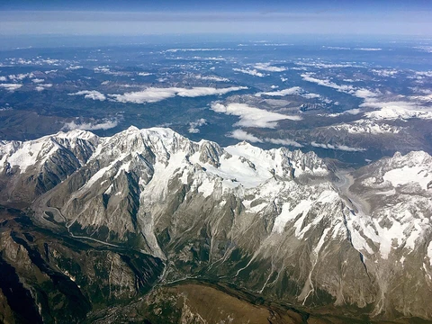
Brooks Range
Remote Arctic mountain range spanning Alaska and Yukon.

The Brooks Range (Gwich'in: Gwazhał) stretches west to east across northern Alaska and into Canada's Yukon Territory. Geologically estimated at about 126 million years old, its highest peak is Mount Isto. In the United States, the range is classified as a subrange of the Rocky Mountains, but in Canada it is considered separate, as the Rocky Mountains' northern boundary is the Liard River in British Columbia. The range is largely uninhabited, though the Dalton Highway and Trans-Alaska Pipeline cross it via Atigun Pass. Settlements are limited to the Alaska Native villages of Anaktuvuk and Arctic Village, plus the small communities of Coldfoot, Wiseman, Bettles, and Chandalar. In the far west, the Red Dog mine in the De Long Mountains is the world's largest zinc mine. Federally protected areas include Gates of the Arctic National Park, Arctic National Wildlife Refuge, and Noatak National Preserve. Named in 1925 for USGS geologist Alfred Hulse Brooks, the range was historically called the Arctic Mountains, Hooper Mountains, Meade Mountains, and Meade River Mountains; its Canadian portion is officially the British Mountains, home to Ivvavik National Park. Notable peaks include Mount Hubley, Mount Chamberlin, Mount Michelson, the Gates of Kiev, Black Mountain, Mount Doonerak, Mount Igikpak, Frigid Crags West Gate, Boreal Mountain East Gate, Limestack Mountain, and Cockedhat Mountain. Bob Marshall explored the North Fork Koyukuk River area in 1929, naming Mount Doonerak from an Eskimo word for a spirit or devil. The range forms North America's northernmost drainage divide, separating Arctic Ocean and North Pacific watersheds, and marks the tree line's northern extent. It hosts Dall sheep, grizzly bears, black bears, gray wolves, moose, and porcupine caribou. The Western Arctic Caribou herd, Central Arctic herd, and Porcupine Caribou herd migrate through annually. Fossils of marine organisms, including trilobites and brachiopods from the middle Cambrian, are found in its ancient seabed rocks. Remains of a woolly mammoth that died about 17,100 years ago were discovered north of the range. Climate data from Anaktuvuk Pass shows average summer highs and lows, with winter averages similarly recorded. Perennial snowfields covered 34 square miles in 1985.
- Length
- 700 miles (1,100 km)
- Major protected areas
- Gates of the Arctic National Park, Arctic National Wildlife Refuge, Noatak Natio
Lore & Background
The Brooks Range stretches across northern Alaska into Canada’s Yukon Territory, forming the northernmost drainage divide in North America. Its peaks, including the highest, Mount Isto, are composed of rocks originally formed in an ancient seabed, yielding fossils of marine organisms such as corals, trilobites, and brachiopods. The range is roughly 126 million years old and marks the northern limit of the tree line; beyond the continental divide, only isolated balsam poplar stands occur, while trembling aspen and white spruce appear only on sites disturbed by human activity. Southern slopes support black spruce. As the climate warms, the tree line has been observed moving northward, and shrub abundance is increasing in formerly tundra-dominated areas. The mountains are home to Dall sheep, grizzly and black bears, gray wolves, moose, and porcupine caribou. The Western Arctic Caribou herd, numbering 490,000 in 2004, traverses the range during its annual migration, as do the smaller Central Arctic herd and the 123,000-animal Porcupine Caribou herd, whose migration is the longest of any terrestrial mammal. The range is mostly uninhabited, with only a few small settlements and the Dalton Highway and Trans-Alaska Pipeline crossing Atigun Pass. The Red Dog mine, the world’s largest zinc mine, lies in the far west. The range is federally protected as wilderness and refuges, including Gates of the Arctic National Park and the Arctic National Wildlife Refuge.
Reader's Guide
The Brooks Range forms the northernmost drainage divide in North America, separating rivers that flow into the Arctic Ocean from those reaching the North Pacific. It roughly delineates the summer position of the Arctic front and represents the northern extent of the tree line, with only isolated balsam poplar stands occurring north of the continental divide. Trembling aspen and white spruce are also found north of the range, but only in sites disturbed by human activity. Southern slopes support some black spruce, marking the northern limit of that species. As global temperatures rise, the tree line has been observed moving northward, and shrub abundance is increasing in areas once dominated by tundra, altering the local ecology. The range is one of the most remote and least-disturbed wildernesses in North America, home to Dall sheep, grizzly bears, black bears, gray wolves, moose, and porcupine caribou. The Western Arctic Caribou herd, numbering 490,000 in 2004, traverses the Brooks Range during its annual migration, as do the smaller Central Arctic herd and the 123,000-animal Porcupine Caribou herd, whose migration is the longest of any terrestrial mammal on Earth. The range’s rocks, formed in an ancient seabed, contain fossils of marine organisms, including corals, trilobites, and brachiopods from the middle Cambrian. During the mid-Cretaceous, the thrust belt underwent significant regional extension. Remains of a woolly mammoth that died about 17,100 years ago were found north of the range, with a research report on its movement published in 2021. The range is federally protected in the United States as a series of national wildernesses and refuges, including Gates of the Arctic National Park, Arctic National Wildlife Refuge, and Noatak National Preserve. In the far west, near the Wulik River in the De Long Mountains, lies the Red Dog mine, the largest zinc mine in the world. The only settlements within the range are the Alaska Native villages of Anaktuvuk and Arctic Village, along with the small communities of Coldfoot, Wiseman, Bettles, and Chandalar. The Dalton Highway and Trans-Alaska Pipeline System pass through Atigun Pass on their way to the oil fields at Prudhoe Bay.
Did You Know?
- The Brooks Range is listed as a section of the North American Cordillera, stretching 1,100 km (680 mi).
Frequently Asked Questions
What is the Brooks Range?
The Brooks Range is a remote Arctic mountain chain stretching roughly 700 miles across northern Alaska and into Canada's Yukon Territory. Its Gwich'in name is Gwazhał.
What is the highest point in the Brooks Range?
Mount Isto stands at 8,976 feet (2,736 m), making it the range's tallest summit. The entire chain is estimated to be around 126 million years old.
Who is the Brooks Range named after?
The range honors Alfred Hulse Brooks, who served as chief USGS geologist for Alaska from 1903 to 1924. The United States Board on Geographic Names officially adopted the name in 1925.
Is the Brooks Range considered part of the Rocky Mountains?
In the U.S. it is classified as a northern subrange of the Rockies, but Canadian authorities treat it as a separate range because they place the Rockies' northern boundary at the Liard River in British Columbia.
What protected areas does the Brooks Range contain?
The range encompasses Gates of the Arctic National Park, the Arctic National Wildlife Refuge, and Noatak National Preserve. These designations shield much of its remote, largely roadless terrain.
More in Mountain Ranges And Massifs 1-24
Related in Mountain Ranges And Massifs
Links follow this subject's own source article.
Spotted an error? Know more?
This is a living reference — every entry is fact-audited, and reader corrections feed straight into our audit queue. Suggest an edit · See this site's audit record