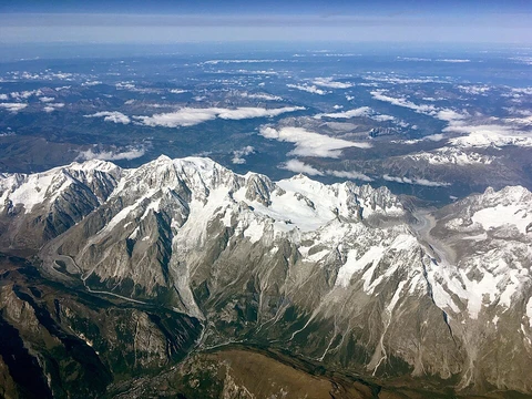
Byrranga Mountains

The Byrranga Mountains (Gory Byrranga) are a mountain range situated in the central region of the Taymyr Peninsula in Siberia, Russia. They fall within the Krasnoyarsk Krai administrative division and form part of the Great Arctic State Nature Reserve, Russia’s largest nature reserve. Despite being first explored in 1736, the range remains one of the least known areas of the Arctic due to its extreme remoteness, lack of any permanent population, and the absence of roads or settlements, making access very difficult. The climate is continental and harsh, characterized by frequent blizzards during winter.
Geographically, the mountains lie north and west of Lake Taymyr, extending in a looping curve that runs roughly from southwest to northeast. The name derives from the Nganasan word *bəranga*, meaning ‘large rocky mountain.’ The range is not particularly high, with average elevations being modest; the highest peak is noted but not specified in available records. The terrain features deep canyons and ravines, and a few small glaciers exist in its eastern zones. Several rivers originate here, including the Khutudabiga and Chetyrekh, while the lower Taymyr River flows northward, cutting across the range. The lowlands to the north and south are covered with tundra, small lakes, and extensive wetlands such as bogs and marshes.
Geologically, the Byrranga Range is a Hercynian formation that was rejuvenated during the Alpine orogeny. It is composed primarily of siltstones and intrusive rocks of neutral composition, with vast areas of exposed limestone formations.
- location
- Taymyr Peninsula, Siberia, Russia
- administrative_division
- Krasnoyarsk Krai, Russian Federation
- part_of
- Great Arctic State Nature Reserve
Lore & Background
The Byrranga Mountains are a mountain range situated in the central Taymyr Peninsula, within the Krasnoyarsk Krai administrative division of Russia. They lie to the north and west of Lake Taymyr, forming a looping curve that extends in a southwest-to-northeast direction. The range is part of the Great Arctic State Nature Reserve, the largest nature reserve in Russia. Despite being first explored in 1736, the Byrranga Mountains remain one of the least known areas of the Arctic. The climate is continental and harsh, characterized by frequent winter blizzards. The area is extremely remote, with no permanent population and no roads or settlements, making access very difficult. The name originates from the Nganasan word ‘bəranga,’ meaning ‘large rocky mountain.’ The mountains are not particularly high, with an average elevation that is modest, and the highest peak is noted. The landscape features deep canyons and ravines, and a few small glaciers exist in the eastern zones. The Khutudabiga and Chetyrekh rivers have their sources here, while the lower Taymyr River cuts northward across the range. Lowlands to the north and south are covered with tundra, small lakes, and wetlands such as bogs and marshes. Geologically, the Byrranga Range is a Hercynian formation rejuvenated during the Alpine orogeny, composed mainly of siltstones and neutral intrusive rocks, with vast areas of exposed limestone.
Reader's Guide
The Byrranga Mountains, first documented by explorers in 1736, remain among the least understood Arctic ranges due to their extreme remoteness. They lie within the Krasnoyarsk Krai administrative region and are part of the Great Arctic State Nature Reserve, Russia’s largest protected area. However, the range is entirely uninhabited, with no roads or settlements, making access exceptionally difficult. The climate is continental and severe, marked by frequent winter blizzards that compound the region’s isolation. Ecologically, the mountains are surrounded by tundra lowlands to the north and south, dotted with small lakes and extensive wetlands such as bogs and marshes. The range itself features deep canyons and ravines, with a few small glaciers in its eastern zones. Several rivers originate here, including the Khutudabiga and Chetyrekh, while the lower Taymyr River cuts northward through the mountains. The name derives from the Nganasan word *bəranga*, meaning “large rocky mountain.” Geologically, the Byrranga are a Hercynian formation rejuvenated during the Alpine orogeny, primarily composed of siltstones, intrusive rocks of neutral composition, and broad exposures of limestone. Their modest average height and relatively low peaks belie the harsh conditions that have kept this range sparsely studied and largely inaccessible, underscoring its significance as one of the Arctic’s most pristine and least documented landscapes.
Did You Know?
- The name comes from the Nganasan word 'bəranga,' meaning 'large rocky mountain.'
- The range is part of the Great Arctic State Nature Reserve, the largest nature reserve in Russia.
Frequently Asked Questions
Where are the Byrranga Mountains located?
They stretch across the central portion of the Taymyr Peninsula in Siberia, Russia, and fall under the Krasnoyarsk Krai administrative region.
Why are the Byrranga Mountains so difficult to visit?
The area is completely uninhabited with no roads or settlements, and the harsh continental climate brings frequent winter blizzards that make travel extremely challenging.
What protected status do the Byrranga Mountains hold?
They are encompassed by the Great Arctic State Nature Reserve, which is the largest nature reserve in all of Russia.
More in Mountain Ranges And Massifs 1-24
Related in Mountain Ranges And Massifs
Links follow this subject's own source article.
Spotted an error? Know more?
This is a living reference — every entry is fact-audited, and reader corrections feed straight into our audit queue. Suggest an edit · See this site's audit record