Flow map
Maps that show movement between locations using linear symbols.
Last updated

Unknown author · Public domain
A flow map is a type of thematic map that uses linear symbols to represent movement between locations, functioning as a hybrid of a map and a flow diagram. The movement depicted can involve people, highway traffic, trade goods, water, ideas, or telecommunications data.
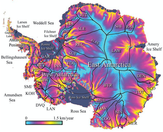
The diversity of moving materials and the geographic networks they traverse has resulted in numerous design strategies. Some cartographers broaden the term to include any thematic map of a linear network, while others restrict it to maps specifically showing movement. Many flow maps employ line width proportional to the amount of flow, linking them to other proportional symbol maps like cartograms and point symbols.
History
The earliest known maps to visually represent flow volume were created by engineer Henry Drury Harness in 1838, illustrating cargo traffic by road and canal in Ireland as part of a report on potential railroad construction. Subsequent European experimentation led to mastery by Charles Joseph Minard, who produced forty-two flow maps during the 1850s and 1860s. His 1869 map of the 1812 French invasion of Russia is often hailed as the best statistical graphic ever drawn, employing design techniques still considered superior even in the computer age. In the 1980s, Waldo Tobler experimented with computer-generated flow maps, but early results fell short of Minard’s standards; however, GIS and graphics software have since improved.
Flow phenomena
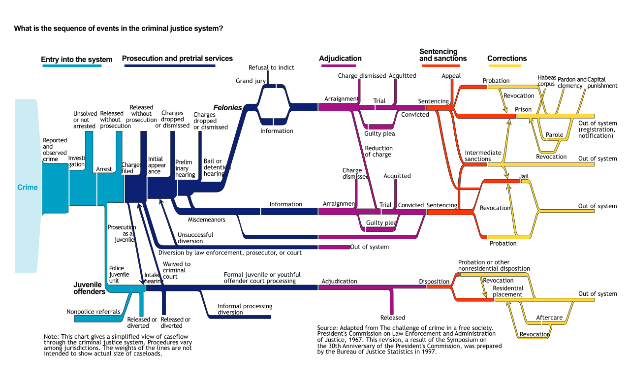
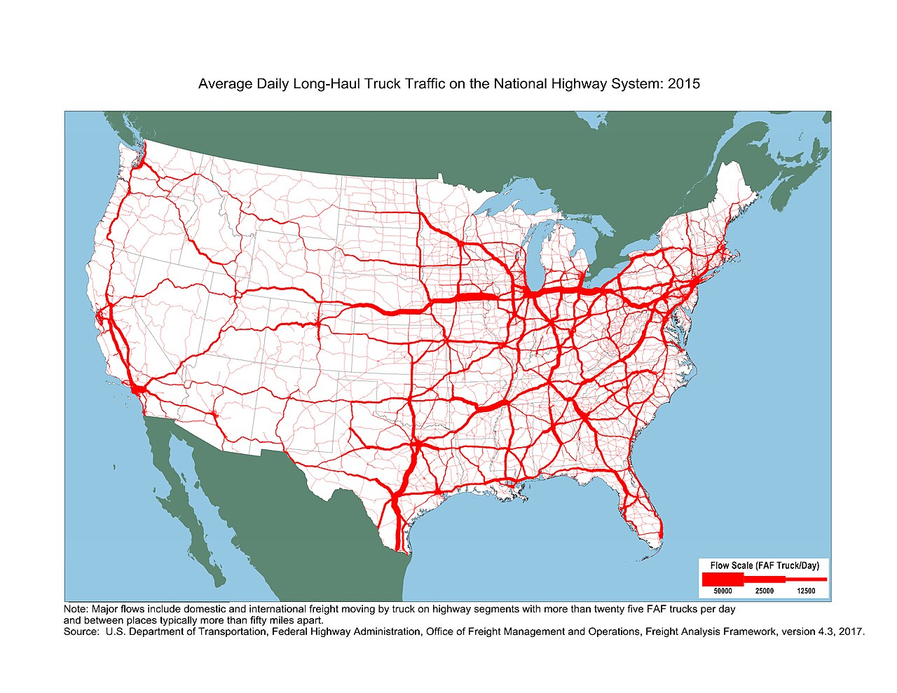
Flow maps can represent several aspects of movement, as outlined by Eduard Imhof: origin and destination, route (precise, generalized, or schematic), type of movement (e.g., product, mode, or water temperature), amount of movement (a ratio variable like vehicles per day or water flow), direction (often shown by arrows), and flow velocity (e.g., mean vehicle speed or wind speed). Topics range from human geography—migration, trade, traffic, and utilities—to physical geography, such as streamflow, wind, and wildlife migration.
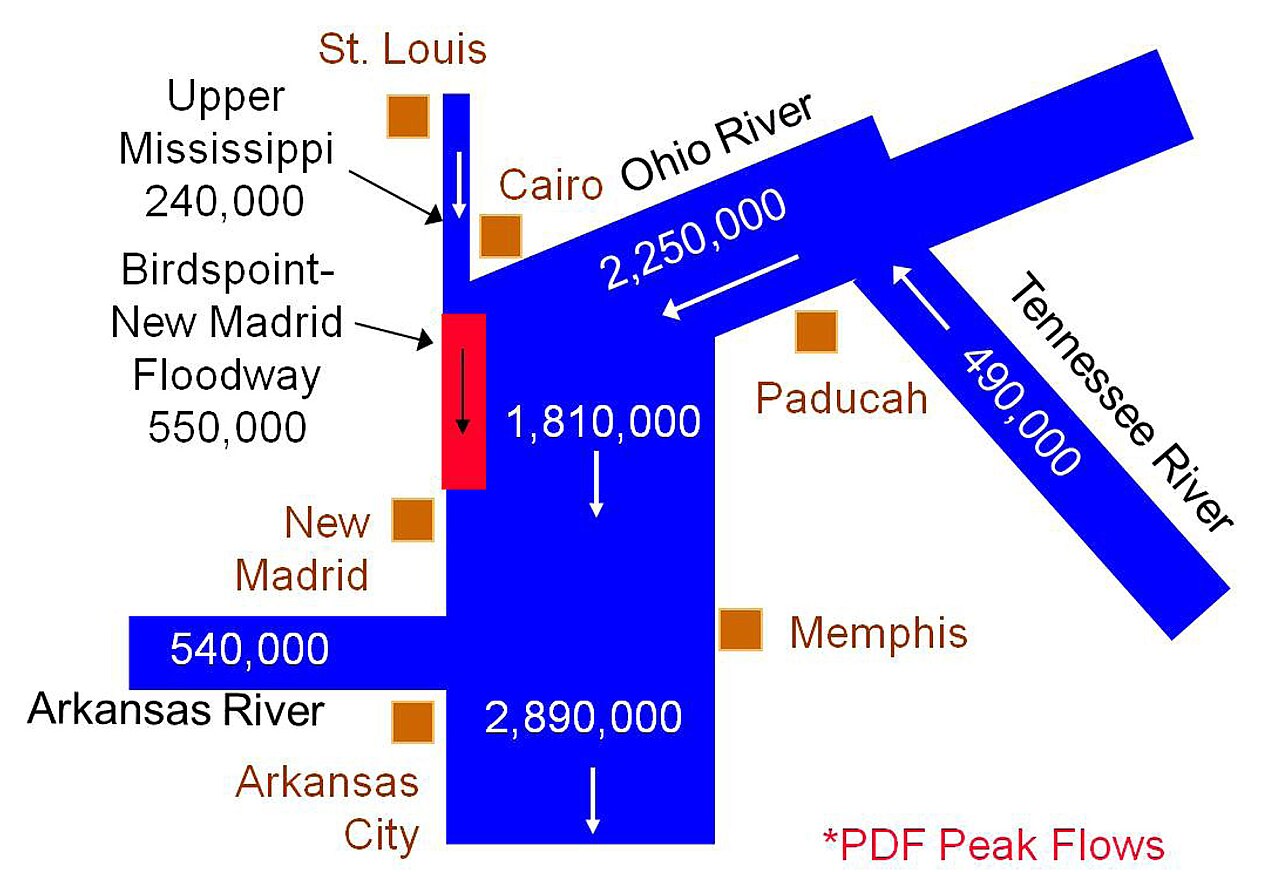
Types of flow maps include origin-destination maps, which emphasize connections between places with straight or curved lines, often used for airline routes. Distribution maps, exemplified by Minard’s 1864 map of French wine exports, balance focus on origins and destinations.
Lore & Background
The earliest known map to visually represent the volume of flow were two maps by engineer Henry Drury Harness, published in 1838 as part of a report on the potential for railroad construction in Ireland, showing the quantity of cargo traffic by road and canal. In subsequent years, others experimented with the technique in Europe, until it was mastered by Charles Joseph Minard. During the 1850s and 1860s, Minard published forty-two flow maps on a wide variety of topics among his cartes figuratives.
Among these is his 1869 map of the French invasion of Russia in 1812-1813, which has been called 'the best statistical graphic ever drawn.' Many of Minard's maps use design techniques that have yet to be improved upon, even in the age of computer graphics. During the 1980s, Waldo Tobler conducted experiments to create flow maps by computer. Early computer-generated maps were not up to Minard standards, but Geographic information system (GIS) and graphics software has improved in the ability to design flow maps.
Reader's Guide
A wide variety of flow maps have been created since the 1830s, showing movement in many forms. According to Eduard Imhof, a flow map may represent several different aspects of the phenomena that are moving and the networks along which they move; he listed the following: Origin and Destination, Route, Type of movement, Amount of movement, Direction of movement, Flow velocity. These are not distinct types of maps; a flow map may portray any of all of these aspects simultaneously. The types of phenomena that have been the subject of flow maps are varied.
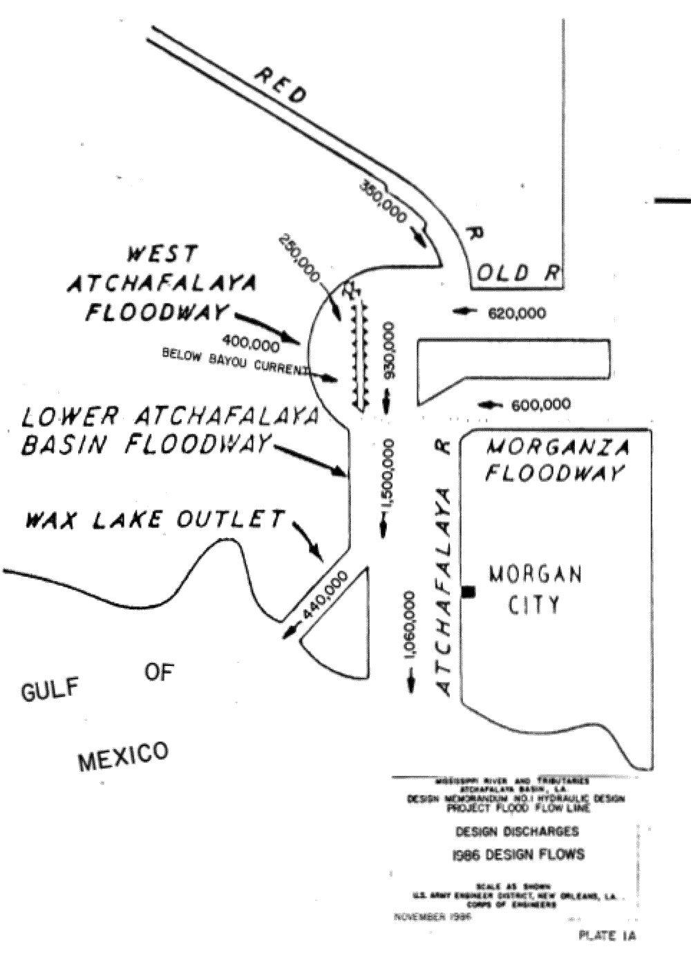
Topics relating to human geography include: migration, travel, international trade, logistics, public utilities (water, sewer, electricity, telecommunications), and traffic, among others. Others relate to physical geography: streamflow, wind, wildlife migration, etc. The variance of flow maps in subject matter, and the relative importance of Imhof's aspects of flow, has led to a number of design strategies.
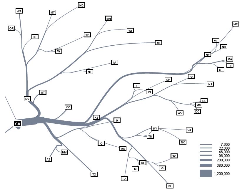
In a 1987 thesis, Mary Parks identified several distinct types of flow maps, which has been widely cited although her list was not comprehensive and more are included here. These types are prototypical; actual maps can combine some aspects of several types. Types include: Origin-destination map, Distribution map, Network route map, Continuous/Mass flow map. The most common technique to visualize the amount or speed of flow is through the visual variable of size, specifically line weight.
Did You Know?
- In 1688, Edmund Halley mapped the trade winds using an array of short line segments oriented in the direction of air flow.
Frequently Asked Questions
What is a flow map in cartography?
A flow map is a thematic map that uses linear symbols—such as arrows or lines—to visualize movement between two or more locations. It essentially blends a geographic map with a flow diagram, making the direction and volume of movement the central visual element.
What kinds of movement can a flow map depict?
Flow maps can represent anything that travels across space: people migrating, highway traffic, trade goods, water currents, ideas, or telecommunications data. The wide range of possible subjects has driven cartographers to develop many different design strategies for encoding volume, direction, and origin-destination pairs.
How does a flow map differ from a standard thematic map?
While a typical thematic map shades regions or places points to show a static attribute, a flow map specifically encodes the act of movement between locations using linear symbols. Its primary purpose is to make the path and magnitude of transfer visible rather than to classify a fixed area.
Also in the Codexery
More in Maps & Their Symbols
Sources
Compiled from Wikipedia and the sources listed below. Text from Wikipedia is available under CC BY-SA 4.0; this entry is adapted from it.
- Wikipedia: Flow map (CC BY-SA 4.0).
Spotted an error? Know more?
Reader corrections go straight into our review queue. Suggest an edit · How this site is sourced