Computer cartography
The art, science, and technology of making and using maps with a computer.
Last updated
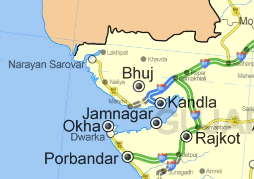
Computer cartography, also known as digital cartography, involves using computers to create and utilize maps, blending artistic, scientific, and technical approaches. While it marked a major shift in map production, it remains a branch of traditional cartography. Its core purpose is map creation, such as producing accurate depictions of areas with major roads and navigation points, or developing thematic maps. Although computer cartography is a key function of geographic information systems (GIS), GIS is not required for it, and GIS also serves purposes beyond mapmaking.
Research papers on using computers for cartography were first published several years before fully developed GIS existed. This technology supports various computer applications, often by connecting to the Global Positioning System (GPS) satellite network. This enables real-time, automated map generation, like in automotive navigation systems. The concept of using computers in cartography was introduced in 1959 by Waldo Tobler in his paper "Automation and Cartography," which described a "map in–map out" (MIMO) system.
This system allowed for digitizing, altering, and reproducing traditional maps. Though simple, MIMO established the idea in academic literature and paved the way for later geographic information systems developed by figures like Roger Tomlinson. The rapid progress that followed led to a major shift, with computer-aided cartography replacing traditional methods. This change was predicted in 1985 by Mark Monmonier in his book Technological Transition in Cartography, where he argued that computer cartography, aided by GIS, would largely take over from pen-and-paper cartography.
Expanded capabilities
The point at which more maps were created and distributed by computer than by hand is thought to have occurred around the mid-1990s. Early digital maps functioned much like paper maps, offering a virtual view of roads set within the surrounding terrain. As GPS technology expanded, digital maps gained live traffic updates, points of interest, and service locations, making them more responsive to user needs. The traditional virtual view is now just one option; users can often choose between virtual maps, satellite (aerial) views, or a hybrid of both.
Because digital mapping devices can be updated, newly built roads and places can be added. Three-dimensional landscape maps can be created using 3D scanners or 3D reconstruction software. Digital maps depend on large amounts of data gathered over time, primarily from satellite imagery and street-level information. Frequent updates are necessary to keep maps accurate.
Scientific applications
Although many companies specialize in digital mapping, the basic goal is to depict roads realistically, providing a lifelike experience. Both proprietary and non-proprietary computer programs supply imagery and street-level map data for much of the world. Since around 2000, the rise of mobile computing (PDAs, tablet PCs, laptops) has driven the use of digital mapping in scientific and applied fields, including geology, engineering, architecture, land surveying, mining, forestry, environmental science, and archaeology.
GPS navigation systems
The main driver of digital mapping’s growth in recent years has been its link to GPS technology. GPS is the foundation of digital navigation systems. A terrestrial GPS receiver obtains coordinates, position, and atomic time from GPS satellites orbiting Earth. This data gives the mapping software a starting point and a destination, which are used to calculate distance.
The software then analyzes the information to produce a map showing the easiest and most efficient route. Technically, the device works as follows: GPS receivers collect data from at least four satellites to calculate a three-dimensional position. The receiver then uses this position to output GPS coordinates—exact latitude and longitude points. These coordinates provide an accuracy of roughly 10 to 20 meters from the actual location.
The starting point (from GPS coordinates) and the ending point (an address or coordinates entered by the user) are fed into the digital mapping software. The software then generates a real-time visual representation of the route, which moves along with the driver. If the driver deviates from the planned route, the system uses the current coordinates to recalculate a path to the destination.
Did You Know?
- The first peer-reviewed publications on using computers to help in the cartographic process predate the introduction of full GIS by several years.
Frequently Asked Questions
What is Computer cartography?
Computer cartography (also called digital cartography) is the discipline of creating and utilizing maps through computer technology. It represents a fundamental shift from traditional paper-based mapmaking while remaining a branch of cartography as a whole.
What are Computer cartography's core role?
Its primary function is producing maps, from accurate area representations used in navigation to thematic maps that visualize specific data layers. It also integrates with GPS technology to enable real-time navigation, marking a major milestone in how people interact with spatial information.
More in Maps & Their Symbols
Sources
Compiled from Wikipedia and the sources listed below. Text from Wikipedia is available under CC BY-SA 4.0; this entry is adapted from it.
- Wikipedia: Computer cartography (CC BY-SA 4.0).
Spotted an error? Know more?
Reader corrections go straight into our review queue. Suggest an edit · How this site is sourced