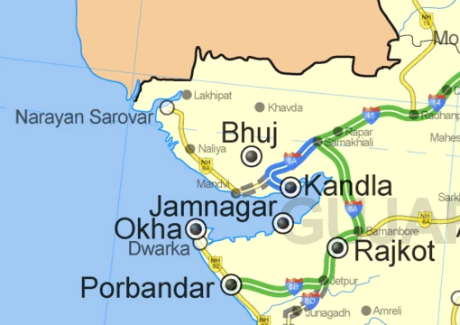
Thematic map
Maps that visualize the geographic pattern of a specific theme.
Last updated

NASA · Public domain
Almost all modern graphical techniques for thematic maps were invented between 1700 and 1850.[1] Edmond Halley introduced the Enlightenment conception of the thematic map as a tool for scientific thinking.[1] Robinson called the early to middle 19th century a "golden age" of thematic mapping.[2] Henry Drury Harness produced an influential 1837 booklet of five maps for a railroad report in Ireland.[3]
Charles Joseph Minard integrated thematic maps with statistical charts in the 1850s and 1860s.[4] Arthur Robinson stated that thematic maps were primarily a creation of the Industrial Age, with origins in the Enlightenment.[1] Jodocus Hondius created one of the first thematic maps, titled Designatio orbis christiani (1607), which depicted the distribution of major religions.[5] Thematic maps became much more popular in the latter half of the 20th century due to the quantitative revolution, the rise of GIS, and the availability of large digital datasets.[6]
Quick Facts
- Field
- Cartography, Geovisualization
- Golden age
- Early to middle 19th century
- Common types
- Choropleth
- isarithmic
- chorochromatic
- flow maps
- proportional point symbol
- dasymetric
Facts from the source article.
What the cited sources add
A 1979 paper by Bartz Petchenik discusses the psychological achievement of thematic mapping.[7] Dent's 2009 "Cartography: Thematic Map Design" describes choropleth maps as showing statistical data aggregated over predefined regions.[8] Slocum's 2009 "Thematic Cartography and Visualization" notes that thematic maps are intended for a narrower range of tasks than reference maps.[9] Keates' 1973 "Cartographic design and production" explains that reference layers establish location context for thematic information.[10]
Brewer's 2002 study in the Annals of the Association of American Geographers discusses classifying epidemiological data on choropleth maps.[11]
References
- Wikipedia, "Thematic map" (CC BY-SA 4.0), which cites: Robinson, "Early Thematic Mapping in the History of Cartography", University of Chicago Press, 1982 (original not read by us) en.wikipedia.org
- Wikipedia, "Thematic map" (CC BY-SA 4.0), which cites: Robinson, "The 1837 Maps of Henry Drury Harness", The Geographical Journal, Dec 1955, p. 440–450 (original not read by us) en.wikipedia.org
- Wikipedia, "Thematic map" (CC BY-SA 4.0), which cites: Robinson, "The 1837 Maps of Henry Drury Harness", The Geographical Journal, Dec 1955, p. 440–450; Griffith, "Atlas to Accompany 2nd Report of the Railway Commissioners", 1838 (original not read by us) en.wikipedia.org
- Wikipedia, "Thematic map" (CC BY-SA 4.0), which cites: Tufte, "Beautiful Evidence", Graphics Press, 2006; Minard, "Carte figurative des pertes successives en hommes de l'Armée Française dans la campagne de Russie 1812–1813" (original not read by us) en.wikipedia.org
- Wikipedia, "Thematic map" (CC BY-SA 4.0), which cites: Van der Dussen, "The History of the Idea of Europe", Routledge, 1995, p. 28; "Novus typus orbis ipsus globus, ex Analemmate Ptolomaei diductus 1614" (original not read by us) en.wikipedia.org
- Wikipedia, "Thematic map" (CC BY-SA 4.0), which cites: Raisz, "General Cartography", McGraw-Hill, 1948, p. 245; Slocum, "Thematic Cartography and Visualization", Pearson/Prentice Hall, 2009 (original not read by us) en.wikipedia.org
- Wikipedia, "Thematic map" (CC BY-SA 4.0), which cites: Bartz Petchenik, "From Place to Space: The Psychological Achievement of Thematic Mapping", Cartography and Geographic Information Science, April 1979, p. 5–12; Thrower, "Maps and Civilization: Cartography in Culture and Society", University of Chicago Press, 2008, p. 95; "Fundamentals of Mapping", icsm.gov.au; Dent, "Cartography: Thematic Map Design", McGraw-Hill, 2009, p. 7; Keates, "Cartographic design and production", Longman, 1973, p. 59 (we also read that source) en.wikipedia.org
- Wikipedia, "Thematic map" (CC BY-SA 4.0), which cites: Dent, "Cartography: Thematic Map Design", McGraw-Hill, 2009; Tobler, "Choropleth Maps Without Class Intervals?", Geographical Analysis, 1973, p. 262–265 (original not read by us) en.wikipedia.org
- Wikipedia, "Thematic map" (CC BY-SA 4.0), which cites: Slocum, "Thematic Cartography and Visualization", Pearson/Prentice Hall, 2009 (original not read by us) en.wikipedia.org
- Wikipedia, "Thematic map" (CC BY-SA 4.0), which cites: Keates, "Cartographic design and production", Longman, 1973, p. 59 (original not read by us) en.wikipedia.org
- Wikipedia, "Thematic map" (CC BY-SA 4.0), which cites: Brewer, "Evaluation of methods for classifying epidemiological data on choropleth maps in series", Annals of the Association of American Geographers, 2002, p. 662–681; Adams, "Normalizing the pandemic: exploring the cartographic issues in state government COVID-19 dashboards", Journal of Maps, 27 July 2023, p. 1–9; Piantados, "The Ecological Fallacy", American Journal of Epidemiology, 1988; Openshaw, "The Modifiable Areal Unit Problem", Geo Books, 1983; Chen, "A systematic review of the modifiable areal unit problem (MAUP) in community foo en.wikipedia.org
Each numbered sentence above was checked against the source it cites before publication. Sentences citing Wikipedia adapt text from the English Wikipedia article Thematic map (contributors), used under CC BY-SA 4.0; this entry is available under the same licence. Other sources were used for facts only; no text or images are copied from them.
More in Maps & Their Symbols
Sources
Compiled from Wikipedia and the sources listed below. Text from Wikipedia is available under CC BY-SA 4.0; this entry is adapted from it.
- Wikipedia: Thematic map (CC BY-SA 4.0).
Spotted an error? Know more?
Reader corrections go straight into our review queue. Suggest an edit · How this site is sourced