Zion
National park at the junction of three geographic provinces.

Pierre André Leclercq · CC BY-SA 4.0
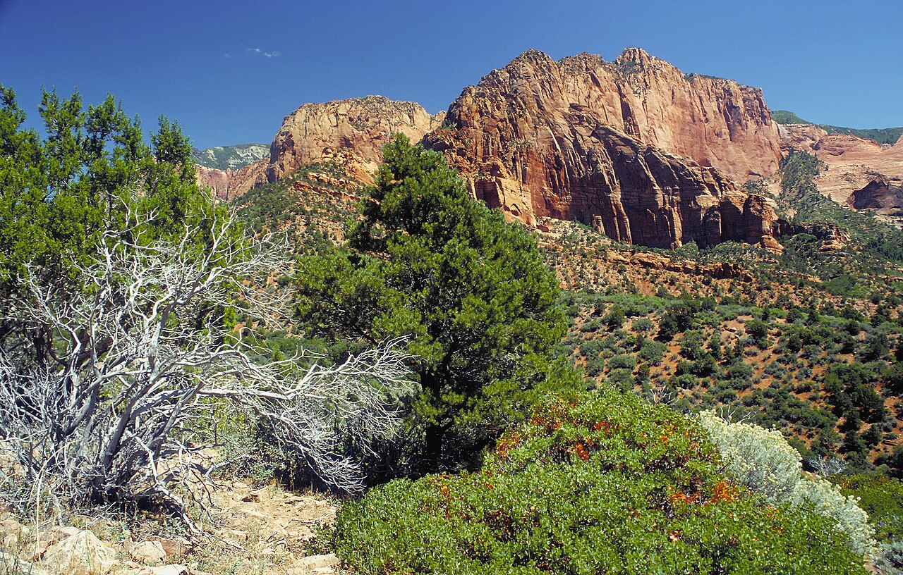
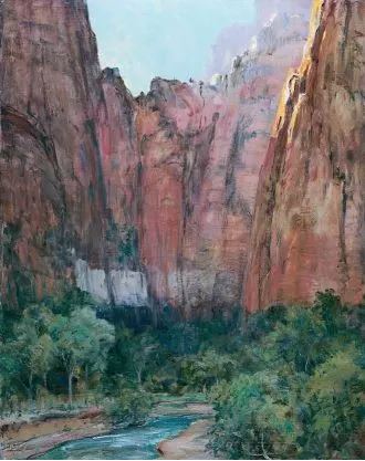
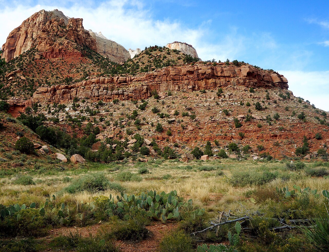
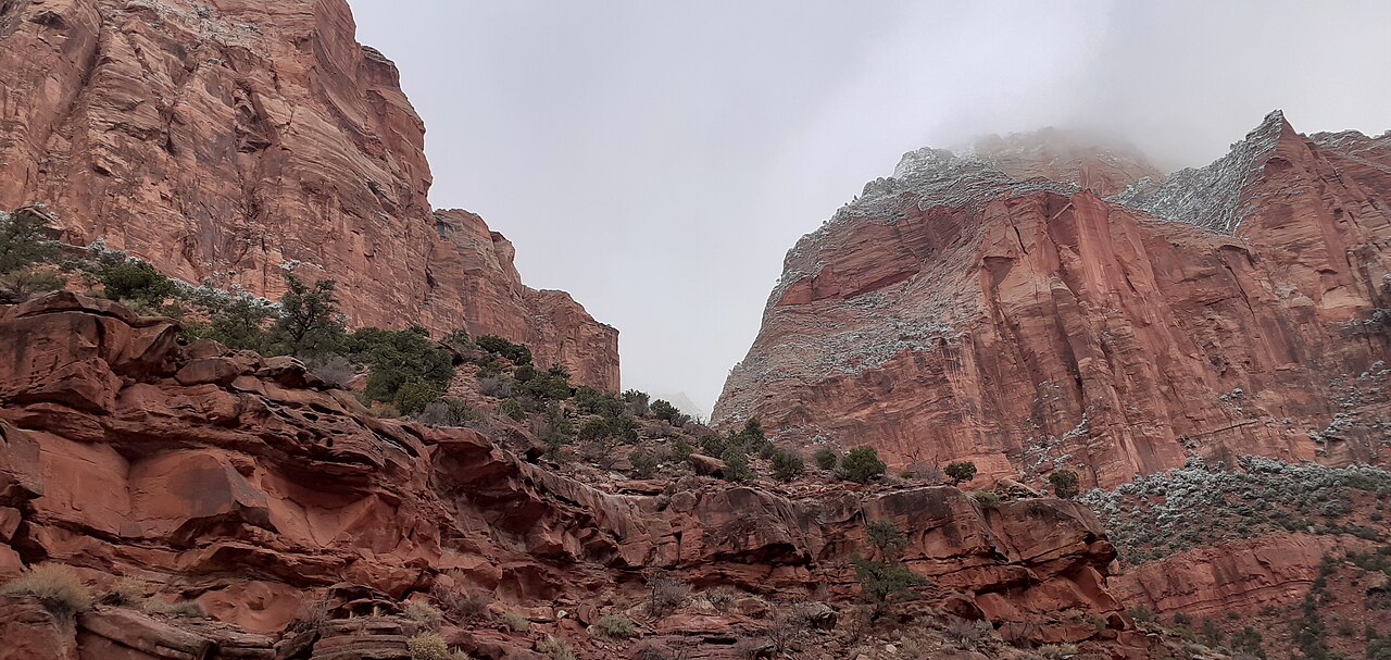
Zion National Park sits in southwestern Utah, close to the town of Springdale. Because it lies where the Colorado Plateau, Great Basin, and Mojave Desert meet, the park boasts an unusual geography and a wide range of life zones. This variety supports an exceptional mix of plants and animals, including 289 bird species, 75 mammals (19 of which are bats), and 32 reptiles. These creatures live across four life zones: desert, riparian, woodland, and coniferous forest. The park’s landscape includes mountains, canyons, buttes, mesas, monoliths, rivers, slot canyons, and natural arches. Its lowest point, at Coalpits Wash, is 3,666 feet (1,117 meters) above sea level, while the highest, Horse Ranch Mountain, reaches 8,726 feet (2,660 meters). The most prominent feature of the 229-square-mile (590-square-kilometer) park is Zion Canyon, which stretches 15 miles (24 kilometers) long and plunges up to 2,640 feet (800 meters) deep. The canyon’s reddish and tan walls are made of Navajo Sandstone, carved by the North Fork of the Virgin River. In 2025, the park drew 4,984,525 visitors.
People first lived in the area around 8,000 years ago, in small family groups of Native Americans. One such group was the semi-nomadic Basketmaker Ancestral Puebloans (formerly called Anasazi by early non-indigenous archaeologists), who arrived around 300 CE. Later, the Virgin Anasazi culture (circa 500 CE) and the Parowan Fremont group emerged as the Basketmakers settled into permanent communities. Both groups had left by 1300, replaced by the Parrusits and several other Southern Paiute subtribes. Mormons first came to the area in 1858 and established settlements there in the early 1860s.
In 1909, President William Howard Taft designated the area Mukuntuweap National Monument to protect the canyon. In 1918, Horace Albright, the acting director of the newly formed National Park Service, proposed enlarging the monument and renaming it Zion National Monument—"Zion" being a term used by Mormons. Historian Hal Rothman noted that the name change played to a common bias of the era: many believed Spanish and Indian names would discourage visitors, who might skip a place they couldn’t pronounce. The new name, Zion, was thought more appealing to an ethnocentric audience. On November 19, 1919, Congress redesignated the monument as Zion National Park, and President Woodrow Wilson signed the act. The Kolob section was set aside as a separate Zion National Monument in 1937 but was folded into the national park in 1956. In 2009, Congress designated 85% of the park as wilderness.
The geology of the Zion and Kolob canyons area comprises nine formations, representing 150 million years of mostly Mesozoic-era sedimentation. Over that time, warm shallow seas, streams, ponds, lakes, vast deserts, and dry near-shore environments covered the region. Starting about 13 million years ago, uplift from the creation of the Colorado Plateau raised the area by 10,000 feet (3,000 meters).
The park’s purpose, as stated in its foundation document, is to preserve its dramatic geology—including Zion Canyon and a labyrinth of deep, brilliantly colored Navajo sandstone canyons shaped by extraordinary erosion at the edge of the Colorado Plateau—to protect its wilderness character and wild and scenic river values, to safeguard evidence of human history, and to support scientific research as well as public enjoyment and enlightenment.
Zion National Park lies in southwestern Utah, mostly in unincorporated parts of Washington, Iron, and Kane counties, though the town of Springdale extends into the park. Geomorphically, it sits on the Markagunt and Kolob plateaus, at the meeting point of three North American geographic provinces: the Colorado Plateau, the Great Basin, and the Mojave Desert. The northern section, known as the Kolob Canyons, is accessible from Interstate 15, exit 40. Horse Ranch Mountain, at 8,726 feet (2,660 meters), is the park’s highest point, while Coal Pits Wash, at 3,666 feet (1,117 meters), is the lowest—giving a relief of about 5,100 feet (1,600 meters). Streams in the area follow rectangular paths because they run along jointing planes in the rock. The Virgin River’s North Fork, which flows through Zion Canyon, has a stream gradient of 50 to 80 feet per mile (9.5 to 15.2 meters per kilometer), or 0.9–1.5%, making it one of the steepest in North America.
The road into Zion Canyon is 6 miles (9.7 kilometers) long and ends at the Temple of Sinawava, named for the Paiute coyote god. Near the temple, the canyon narrows, and a hiking trail leads to the mouth of The Narrows, a gorge only 20 feet (6 meters) wide but up to 2,000 feet (610 meters) tall. A free shuttle bus runs on the Zion Canyon road from early April to late October; private vehicles are allowed the rest of the year. Other roads in Zion are open to private vehicles year-round. The east side of the park is served by the Zion–Mount Carmel Highway (SR-9), which passes through the Zion–Mount Carmel Tunnel and ends at US 89 near Mount Carmel Junction. Features on the east side include Checkerboard Mesa and The East Temple. The Kolob Terrace area, northwest of Zion Canyon, contains a slot canyon called The Subway and offers panoramic views from Lava Point. The Kolob Canyons section, farther northwest near Cedar City, features Tucupit Point and Kolob Arch, one of the world’s longest natural arches. Other notable features in Zion Canyon include Angels Landing, The Great White Throne, the Court of the Patriarchs, The Sentinel, The West Temple, Towers of the Virgin, the Altar of Sacrifice, The Watchman, Weeping Rock, and the Emerald Pools. Spring weather is unpredictable, with stormy, wet days.
Lore & Background
Zion National Park is defined by its dramatic desert landscape, featuring towering mountains, deep canyons, flat-topped mesas and buttes, massive stone monoliths, winding rivers, narrow slot canyons, and natural arches. The park’s lowest elevation is at Coalpits Wash, while the highest point is the summit of Horse Ranch Mountain. The most prominent feature is Zion Canyon, carved over millions of years by the North Fork of the Virgin River through reddish and tan-colored Navajo Sandstone, reaching depths of up to 2,400 feet. The park sits at the junction of three distinct geographic provinces—the Colorado Plateau, Great Basin, and Mojave Desert—which creates a unique mix of life zones: desert, riparian, woodland, and coniferous forest. This diversity supports an unusual variety of life, including 289 bird species, 75 mammals (19 of which are bats), 32 reptiles, and numerous plant species. The area’s geology comprises nine rock formations representing 150 million years of sedimentation from ancient seas, lakes, deserts, and near-shore environments, later uplifted by the formation of the Colorado Plateau. Streams in the park follow rectangular paths along jointing planes in the rock, and the Virgin River has one of the steepest stream gradients in North America. Notable landmarks include Angels Landing, the Great White Throne, the Court of the Patriarchs, the Temple of Sinawava, and Kolob Arch, one of the world’s longest natural arches. The park’s human history began with small Native American family groups around 8,000 years ago, followed by the Basketmaker Ancestral Puebloans and later the Virgin Anasazi and Parowan Fremont cultures, who settled in permanent communities before moving away by 1300. They were succeeded by Southern Paiute subtribes such as the Parrusits. Mormon settlers arrived in 1858 and established communities in the early 1860s. Originally designated Mukuntuweap National Monument in 1909, the area was renamed Zion National Monument in 1918 to appeal to a broader audience, as officials believed Spanish and Indian names discouraged visitors. Congress redesignated it as Zion National Park in 1919, and the Kolob section was added in 1956.
Reader's Guide
Zion National Park preserves dramatic geology formed by erosion of Navajo Sandstone at the margin of the Colorado Plateau. Its purpose includes safeguarding wilderness character, wild and scenic river values, protecting evidence of human history, and providing for scientific research and public enjoyment. The Virgin River's North Fork, with one of the steepest stream gradients in North America, flows through Zion Canyon. Its climate is cold semi-arid (BSk), with hot summers and mild winters. The park's significance lies in its unique intersection of three geographic provinces, its rich human history spanning 8,000 years, and its role as a protected area for scientific study and recreation.
Geography & Geology
Zion National Park occupies a remarkable position in southwestern Utah, sitting precisely where three major North American geographic provinces converge: the Colorado Plateau, the Great Basin, and the Mojave Desert. That river carries one of the steepest gradients in all of North America, dropping 50 to 80 feet per mile.
Biodiversity Across Four Life Zones
The convergence of three distinct geographic provinces within Zion's borders creates an ecological mosaic that supports an unusual concentration of wildlife. The park is divided into four recognized life zones—desert, riparian, woodland, and coniferous forest—each harboring its own assemblage of species. The riparian zone along the Virgin River corridor provides critical water-dependent habitat, while the coniferous forests at higher elevations offer cooler, moister conditions.
Human History & the Name That Stuck
Human presence in the Zion region stretches back roughly 8,000 years, beginning with small family groups of Native Americans. The park's modern name carries a complicated history. As historian Hal Rothman noted, the change reflected a prevailing bias: many assumed that Spanish or Indigenous names would discourage tourists who found them difficult to pronounce.
Conservation Mandate & Modern Stewardship
The founding document of Zion National Park lays out a four-part mission: preserving the dramatic geology and labyrinth of Navajo sandstone canyons shaped by extraordinary erosion at the Colorado Plateau's margin; safeguarding the park's wilderness character and its wild, scenic river values; protecting evidence of human history embedded in the landscape; and providing for scientific research alongside public enjoyment and enlightenment. To balance access with preservation, the six-mile road into Zion Canyon is served by a free shuttle system from early April through late October, reducing vehicle congestion in the narrow passage that ends at the Temple of Sinawava, named for the Paiute coyote deity. Beyond the canyon's mouth lies The Narrows, a gorge 20 feet wide but towering up to 2,000 feet.
Common Misconceptions (Editorial)
Some people may think the name “Zion” has ancient Native American origins, but in fact it was a term used by Mormons and was adopted for the park to appeal to an ethnocentric audience, as Spanish and Indian names were thought to deter visitors. Another misconception is that the park’s diverse life zones are unique to Utah, when they actually result from its location at the junction of the Colorado Plateau, Great Basin, and Mojave Desert regions.
Why It Matters (Editorial)
Zion National Park endures as a place where natural beauty and human history converge, with evidence of Native American habitation stretching back 8,000 years. Its unique position at the crossroads of three distinct geological regions not only creates stunning landscapes but also preserves a living record of how diverse ecosystems can thrive in one protected area, reminding us of the importance of safeguarding such irreplaceable places for future generations.
Gallery
Frequently Asked Questions
Where is Zion National Park located?
Zion sits in southwestern Utah just outside the small town of Springdale. It occupies a rare crossroads where the Colorado Plateau, Great Basin, and Mojave Desert regions all converge.
What makes Zion's geology stand out?
The park is famous for its towering sandstone cliffs and the deep slot of Zion Canyon, carved by the Virgin River over millions of years. Because it sits at the intersection of three distinct geographic provinces, it supports an unusually wide range of plant and animal communities.
How many visitors does Zion attract each year?
Zion is among the most-visited parks in the country, with roughly five million people expected to pass through in 2025. The park's narrow canyon and limited trail capacity make crowd management a constant logistical challenge.
More in US National Parks 1-22
Spotted an error? Know more?
This is a living reference — every entry is fact-audited, and reader corrections feed straight into our audit queue. Suggest an edit · See this site's audit record