Great Smoky Mountains
Most visited U.S. national park, straddling North Carolina and Tennessee.

via Wikipedia: Great Smoky Mountains National Park · see source
Straddling the border between North Carolina and Tennessee, Great Smoky Mountains National Park sits along the ridgeline of the Great Smoky Mountains, a subrange of the Blue Ridge Mountains within the larger Appalachian Mountain chain. It is part of the Appalachian temperate rainforest. The park is home to some of the highest peaks in eastern North America, including Kuwohi, Mount Guyot, and Mount Le Conte. The state line runs northeast to southwest through the park’s center, and the Appalachian Trail cuts through it on its way from Georgia to Maine. In 2025, the park drew over 11 million visitors, making it the most visited national park in the United States.
Covering 522,419 acres (816.28 square miles), the park is one of the largest protected areas in the eastern U.S. Its main entrances are along U.S. Highway 441 (Newfound Gap Road) in Gatlinburg, Tennessee, and Cherokee, North Carolina, as well as in Townsend, Tennessee. The park is known internationally for its mountains, waterfalls, biodiversity, and forests, and it also preserves many historical structures from early European-American settlements. Congress chartered the park in 1934, and President Franklin D. Roosevelt officially dedicated it in 1940. It was the first national park where land and other costs were partially paid with federal funds; earlier parks relied entirely on state or private money. In 1983, it was named a UNESCO World Heritage Site, and in 1988, it became an International Biosphere Reserve.
The park anchors a major tourism industry in Sevier County, Tennessee, which includes attractions like Dollywood, Ober Gatlinburg, and Ripley’s Aquarium of the Smokies. Tourism to the park contributes an estimated $2.5 billion annually to the local economy.
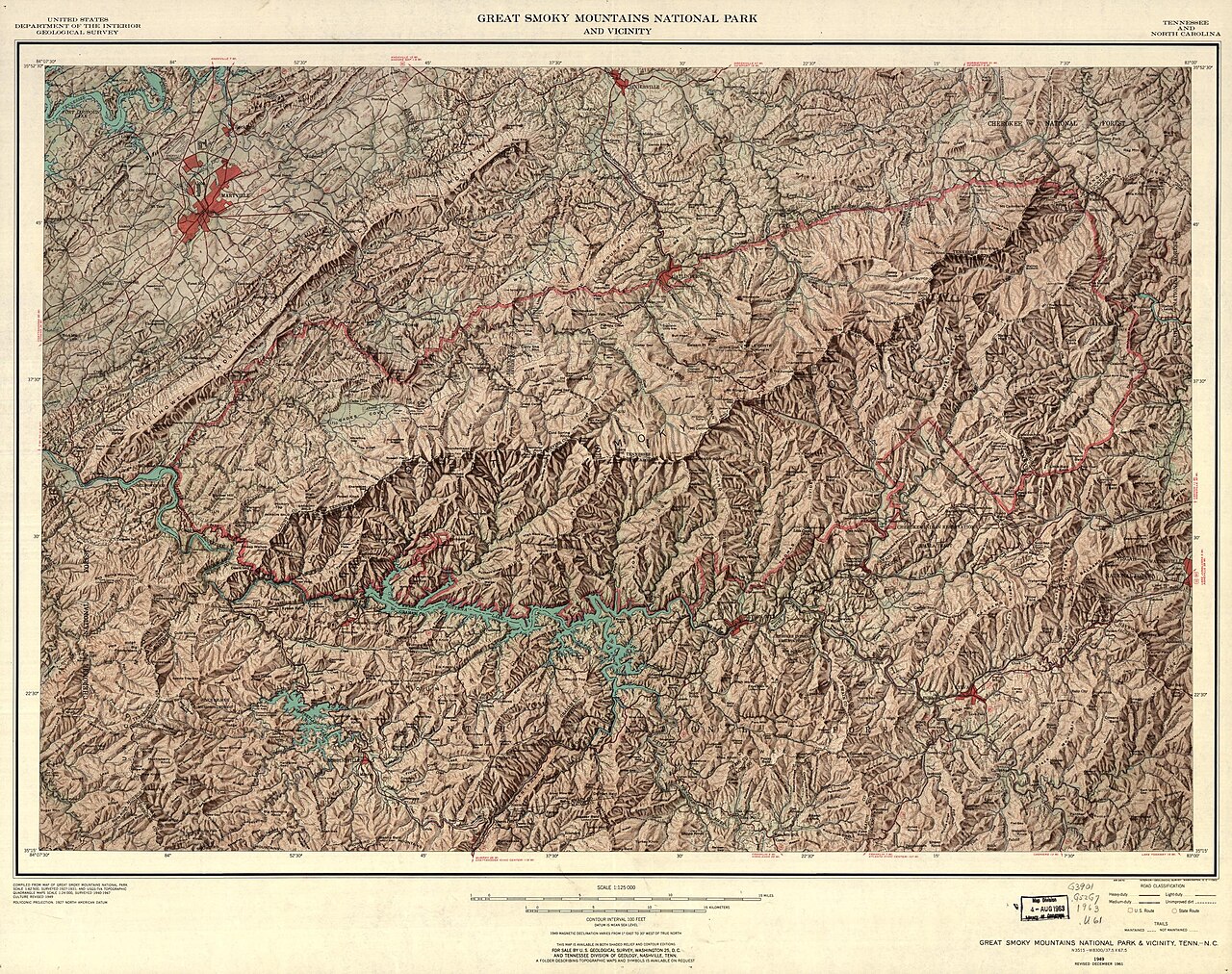
**Geography** The park’s 522,419 acres are split roughly evenly between Tennessee and North Carolina, spanning Blount, Sevier, and Cocke Counties in Tennessee, and Swain and Haywood Counties in North Carolina. To the south, it borders an Indian reservation home to the Eastern Band of Cherokee Indians, a federally recognized tribe descended from Cherokee who avoided forced relocation to Oklahoma. Gatlinburg lies directly north, and other nearby towns include Townsend in Tennessee and Bryson City, Fontana Dam, and Maggie Valley in North Carolina. The Cherokee National Forest borders the park to the east and west in Tennessee, while the Nantahala National Forest borders much of the North Carolina side.
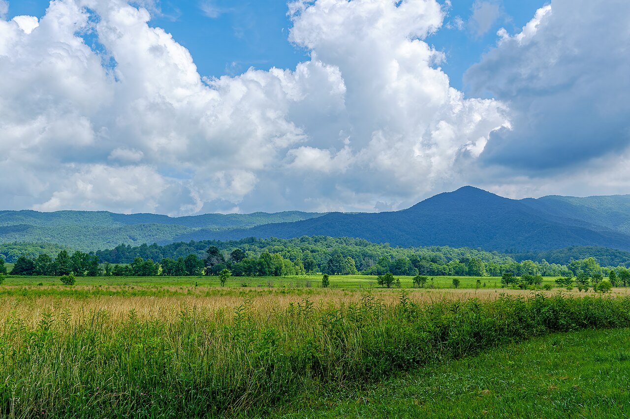
**Mountains** The park protects most of the Great Smoky Mountains, a subrange of the Blue Ridge Mountains within the Appalachians. The range runs roughly east to west, flanked by the Bald Mountains to the east, the Plott Balsams to the south, and the Unicoi Mountains to the west. A small portion of foothills separates the range from the Ridge-and-Valley Appalachians to the north. The range widens from west to east, with the highest peaks mostly in the eastern half. Elevations range from about 875 feet to 6,643 feet at Kuwohi’s summit. Kuwohi is Tennessee’s highest mountain and the third-highest east of the Mississippi. The park contains 16 of the “Southern Sixers”—peaks in Tennessee and North Carolina above 6,000 feet. The second-highest is Mount Guyot at 6,621 feet, and Mount Le Conte, at 6,593 feet, rises 5,301 feet from its base, making it the tallest mountain in the U.S. east of the Rockies. Deep valleys, known as coves, lie between the mountains; the largest is Cades Cove, a broad plain between the main range and foothills. Other major valleys include The Sugarlands, Greenbrier, Oconaluftee, Cataloochee, Elkmont, Tremont, and Deep Creek, which are among the park’s most accessible areas.
**Streams and Waterfalls** The park sits entirely within the Tennessee Valley watershed of the Tennessee River and contains an estimated 2,900 miles of streams. The Little Tennessee River runs along the southwestern border, impounded by Chilhowee, Calderwood, Cheoah, and Fontana Dams. The Pigeon River flows through a deep gorge near the eastern boundary, separating the range from the Bald Mountains. The Plott Balsams border the range to the south. Several smaller rivers originate in the park, including the three prongs of the Little Pigeon River, the Oconaluftee River, and the Little River. Other major streams include Hazel Creek, Eagle Creek, Raven Fork, Cosby Creek, and Roaring Fork. Over 100 prominent waterfalls are found in the park. The tallest is Ramsey Cascades, dropping 100 feet over rock outcroppings at the base of Mt. Guyot. Rainbow Falls is the tallest single-drop waterfall, plunging 80 feet along LeConte Creek.
- established
- 1934
- dedicated
- 1940
- area
- 522,419 acres (816.28 sq mi; 2,114.15 km²)
- highest_point
- Kuwohi, 6,643 feet (2,025 m)
- location
- North Carolina and Tennessee, United States
- visitors_2025
- over 11 million
- designations
- UNESCO World Heritage Site (1983), International Biosphere Reserve (1988)
Verified Timeline
Lore & Background
The Great Smoky Mountains National Park was chartered by the United States Congress in 1934 and officially dedicated by President Franklin D. Roosevelt in 1940. It was the first national park having land and other costs paid in part with federal funds; previous parks were funded wholly with state money or private funds. The park encompasses 522,419 acres and contains some of the highest mountains in eastern North America, including Kuwohi, Mount Guyot, and Mount Le Conte. The Appalachian Trail passes through the center of the park on its route from Georgia to Maine. The park was designated as a UNESCO World Heritage Site in 1983 and an International Biosphere Reserve in 1988.
Reader's Guide
The Great Smoky Mountains National Park is significant as the most visited national park in the United States, with over 11 million visitors in 2025. It anchors a large tourism industry based in Sevier County, Tennessee, adjacent to the park. Major attractions include Dollywood, the second-most visited tourist attraction in Tennessee, Ober Gatlinburg, and Ripley's Aquarium of the Smokies. Tourism to the park contributes an estimated $2.5 billion annually into the local economy. The park is internationally recognized for its biodiversity, forests, waterfalls, and mountains. It protects a wide range of geological formations, including late Precambrian rocks of the Ocoee Supergroup and Cambrian sedimentary rocks in limestone coves such as Cades Cove. The park also borders an Indian reservation to the south that is home to the Eastern Band of Cherokee Indians. Its streams, estimated at 2,900 miles, and over 100 prominent waterfalls, including Ramsey Cascades and Rainbow Falls, contribute to its ecological and recreational value. The park's historic districts and structures preserve the legacy of early European-American settlers and the region's cultural history.
Did You Know?
- Kuwohi is the highest mountain in Tennessee and the third-highest mountain east of the Mississippi River.
- Mount Le Conte rises 5,301 feet from its base to its summit, making it the tallest mountain in the United States east of the Rocky Mountains.
- The park contains an estimated 2,900 miles of streams and more than 100 prominent waterfalls.
- The park was the first national park having land and other costs paid in part with federal funds; previous parks were funded wholly with state money or private funds.
- The park borders an Indian reservation home to the Eastern Band of Cherokee Indians, who are descended from a small group of Cherokee who evaded the forced migration to present-day Oklahoma.
Topography & Mountain Ridges
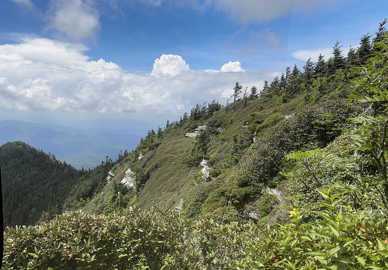
The park stretches across roughly 522,419 acres of rugged terrain, split nearly evenly between Tennessee and North Carolina along a state line that cuts northeast to southwest through its heart. Sitting within the Blue Ridge Mountains and the broader Appalachian chain, the landscape also qualifies as part of the Appalachian temperate rainforest. Elevations sweep from around 875 feet in the lower valleys up to 6,643 feet at the summit of Kuwohi, which holds the title of Tennessee's highest peak and ranks as the third-tallest mountain east of the Mississippi. The park shelters sixteen of the so-called Southern Sixers, summits exceeding 6,000 feet. Mount Guyot follows close behind at 6,621 feet, while Mount Le Conte, at 6,593 feet, rises 5,301 feet from its base to its summit, making it the tallest mountain in the United States east of the Rocky Mountains. Between these peaks lie broad, accessible valleys such as Cades Cove, Sugarlands, and Cataloochee, which serve as natural waypoints for visitors navigating the park.
Rivers, Streams & Waterfalls
Every drop of water in the park ultimately feeds the Tennessee River, placing the entire landscape within a single watershed. An estimated 2,900 miles of streams thread through the terrain, from the Little Tennessee River that runs along the southwestern border of the park to the Pigeon River flowing through a deep gorge near the eastern boundary. Smaller rivers such as the Oconaluftee, the three prongs of the Little Pigeon, and the Little River all take their source within park boundaries, while creeks like Hazel Creek, Eagle Creek, Raven Fork, Cosby Creek, and Roaring Fork add to the network. The park is home to more than one hundred notable waterfalls. Ramsey Cascades, tumbling 100 feet over rock outcroppings at the base of Mount Guyot, is the tallest overall. Rainbow Falls holds the record for the highest single drop, plunging 80 feet along LeConte Creek. Other well-known cascades include Grotto Falls, Laurel Falls, Abrams Falls, Mingo Falls, Mouse Creek Falls, and Hen Wallow Falls, each drawing hikers to their respective trails.
Charter, Designation & Historical Preservation
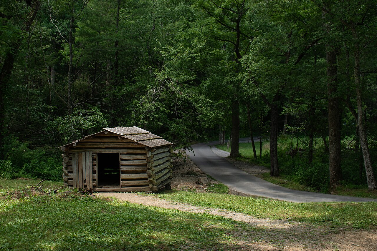
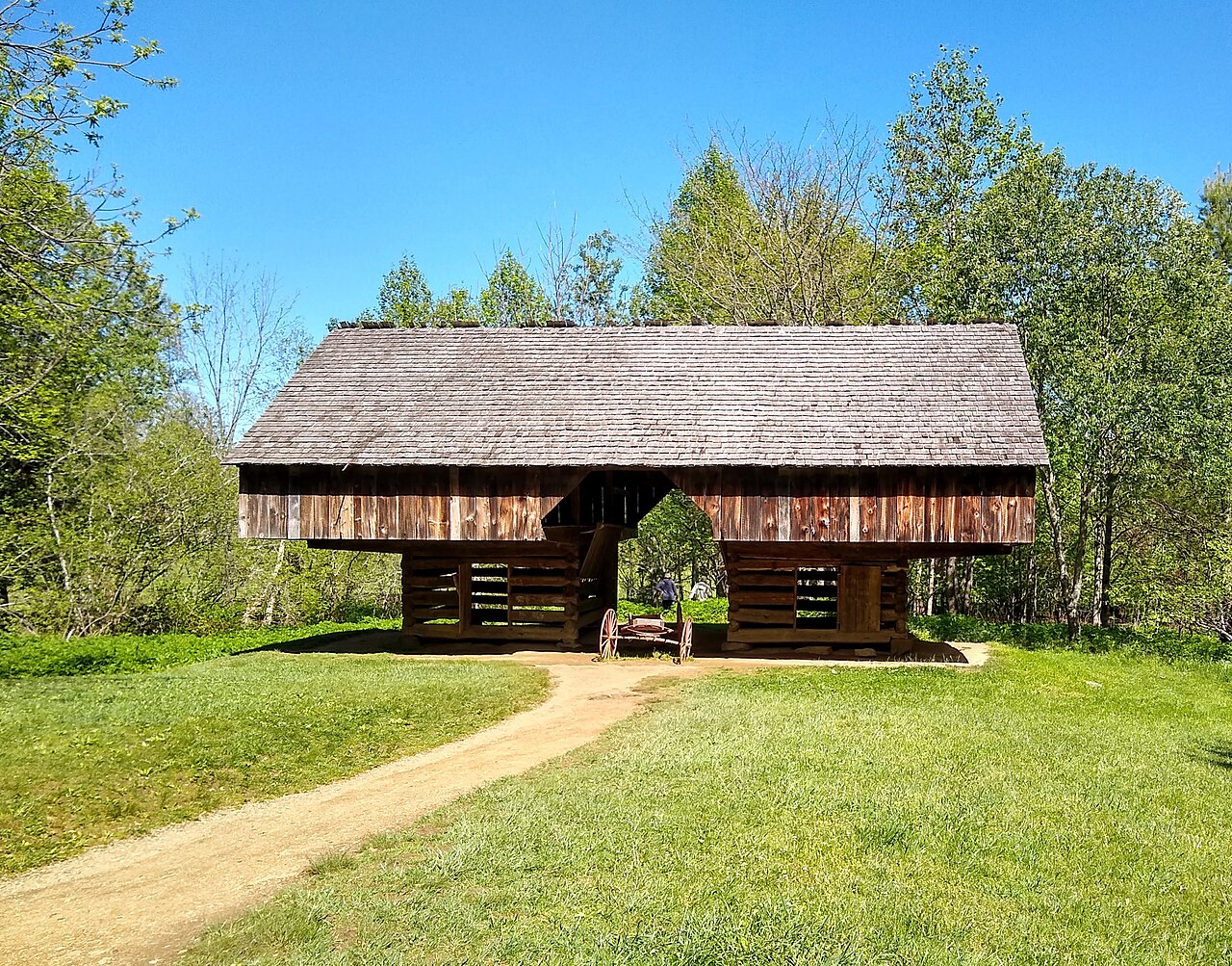
Congress chartered the park in 1934, and President Franklin D. Roosevelt formally dedicated it in 1940. A landmark in federal land policy, Great Smoky Mountains was the first national park whose acquisition and development costs were partially covered by federal money; every park that came before it had been funded entirely through state appropriations or private contributions. The park's international standing grew when UNESCO inscribed it as a World Heritage Site in 1983, and it was later named an International Biosphere Reserve in 1988. Beyond its natural assets, the park safeguards the material legacy of early European-American settlers. The National Park Service maintains four historic districts and one archaeological district within the boundaries, along with nine individually listed National Register of Historic Places sites. Notable structures outside those formal listings include the Mountain Farm Museum buildings at Oconaluftee and the surviving structures in the Cataloochee area, which together offer a tangible window into the region's pioneer past.
Tourism & Economic Engine
With more than eleven million visitors recorded in 2025, Great Smoky Mountains National Park stands as the most-visited national park in the entire United States. Its main gateways sit along U.S. Highway 441 at Gatlinburg, Tennessee, and Cherokee, North Carolina, with an additional entrance in Townsend, Tennessee. The Appalachian Trail threads through the park's center on its long route from Georgia to Maine, adding a thru-hiking dimension to the visitor experience. The park anchors a substantial tourism economy rooted in neighboring Sevier County, Tennessee. Major drawcards in the surrounding area include Dollywood, the second-most-visited attraction in Tennessee, the Ober Gatlinburg resort, and Ripley's Aquarium of the Smokies. Collectively, tourism tied to the park injects an estimated $2.5 billion into the local economy every year, sustaining hotels, restaurants, retail shops, and service businesses in the gateway communities of Gatlinburg, Townsend, Bryson City, and Maggie Valley.
Common Misconceptions (Editorial)
1. Some believe Mount Le Conte is the highest peak in the park, but the highest point is actually Kuwohi, at 6,643 feet.
2. Many assume the Great Smoky Mountains National Park was funded entirely by federal money, but it was the first national park paid for in part with federal funds—previous parks relied wholly on state or private money.
3. It is often thought the park’s visitor count is modest, but with over 11 million visitors in 2025, it is actually the most visited national park in the United States.
Why It Matters (Editorial)
The Great Smoky Mountains National Park endures not only as a sanctuary of ancient peaks and old-growth forests but as a living bridge between human heritage and wild nature. Its dual UNESCO designations, Cherokee legacy, and role as the most visited park in America remind us that protecting a place can also mean welcoming millions to find wonder there.
Gallery
Frequently Asked Questions
Who is Great Smoky Mountains?
It is a U.S. national park that protects a subrange of the Blue Ridge Mountains within the larger Appalachian chain, straddling the North Carolina–Tennessee border. Established in 1934 and officially dedicated in 1940, it covers roughly 522,000 acres of forested ridgelines, waterfalls, and alpine meadows.
Why is Great Smoky Mountains the most-visited national park?
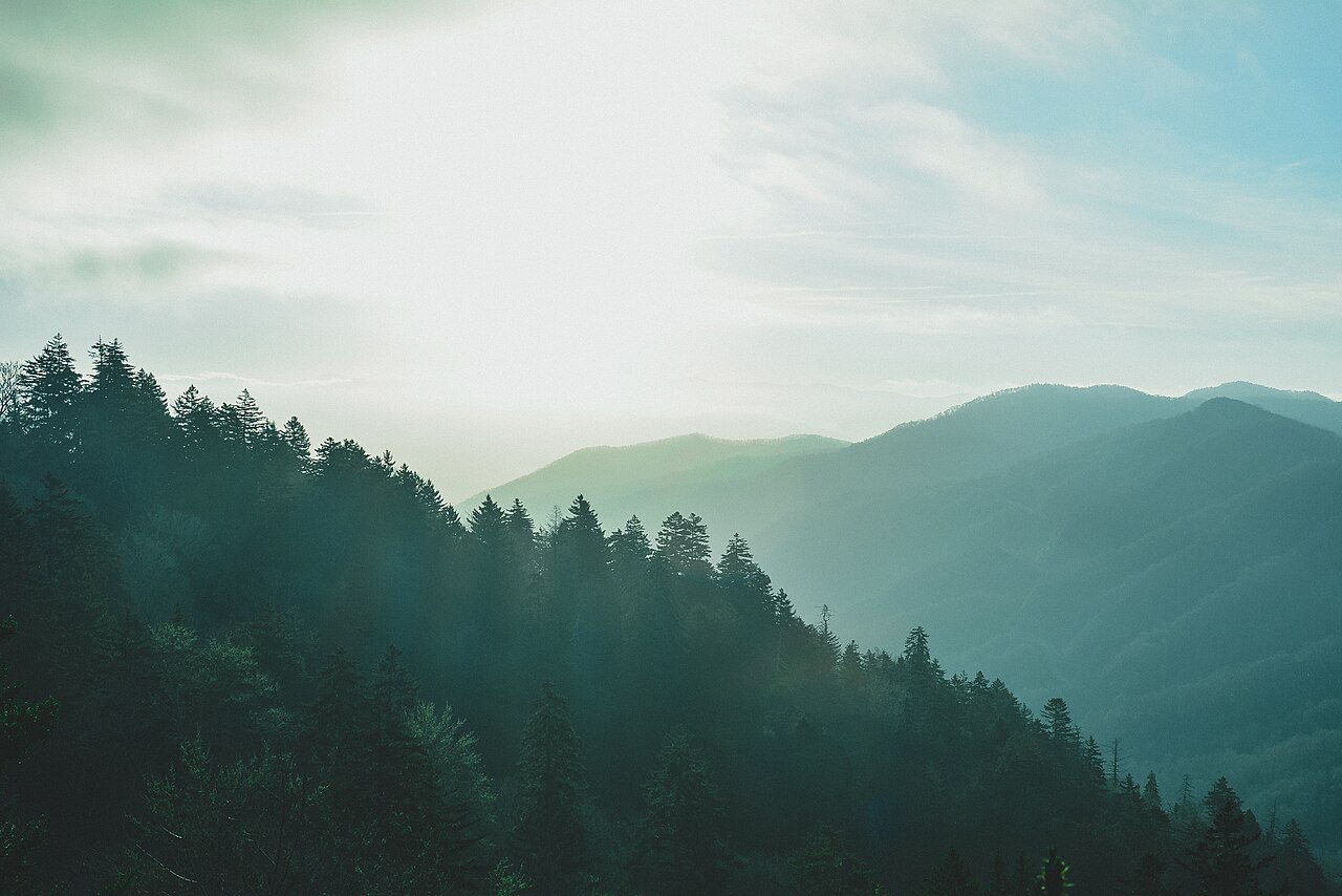
Fans and hikers keep returning for its old-growth hardwood forests, cascading waterfalls, and the characteristic blue haze that clings to the ridges. In 2025 the park welcomed over 11 million visitors, a record that cements its status as the top-attended park in the country.
What is the highest point in Great Smoky Mountains?
The summit is Kuwohi (popularly called Clingmans Dome), rising to 6,643 feet above sea level on the Tennessee side of the park. From its observation platform, visitors can see a sweeping 360-degree panorama of the Appalachian chain.
Where exactly is Great Smoky Mountains located?
The park sits along the main ridgeline of the range, with territory in both North Carolina and Tennessee in the southeastern United States. It is a protected portion of the broader Appalachian Mountain system.
Why is Great Smoky Mountains important to conservation?
It is internationally recognized for safeguarding one of the most biodiverse temperate forests on the planet, sheltering thousands of plant and wildlife species. Across its 816 square miles, the park preserves old-growth forests, alpine meadows, and dozens of waterfalls that would otherwise be vulnerable to development.
More in US National Parks 1-22
Spotted an error? Know more?
This is a living reference — every entry is fact-audited, and reader corrections feed straight into our audit queue. Suggest an edit · See this site's audit record