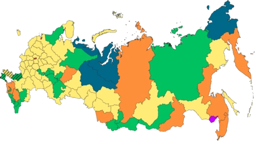
Sverdlovsk Oblast
The industrial heartland of the Urals, rich in metals and minerals.

Sverdlovsk Oblast is a federal subject (an oblast) of Russia located in the Ural Federal District. Its administrative center is the city of Yekaterinburg, formerly known as Sverdlovsk. Its population is 4,268,998 (according to the 2021 Census).
- Population (2021 Census)
- 4,268,998
- Administrative Center
- Yekaterinburg (formerly Sverdlovsk)
- Highest Point
- Konzhakovsky Kamen (1,569 m)
- Major Rivers
- Tavda, Tura, Chusovaya, Ufa
- Key Natural Resources
- Iron, copper, gold, platinum, asbestos, gemstones, coal
Lore & Background
Most of the oblast is spread over the eastern slopes of the Middle and North Urals and the Western Siberian Plain. Only in the southwest does the oblast stretch onto the western slopes of the Ural Mountains. Rich in natural resources, the oblast is especially famous for metals (iron, copper, gold, platinum), minerals (asbestos, gemstones, talcum), marble and coal. It is mostly here that the bulk of Russian industry was concentrated in the 18th and 19th centuries.
Reader's Guide
Sverdlovsk Oblast borders with, clockwise from the west, Perm Krai, the Komi Republic, Khanty–Mansi Autonomous Okrug, Tyumen Oblast, Kurgan Oblast, Chelyabinsk Oblast, and the Republic of Bashkortostan. The highest mountains all rise in the North Urals, Konzhakovsky Kamen at 1569 m and Denezhkin Kamen at 1492 m. The Middle Urals is mostly hilly country with no discernible peaks; the mean elevation is closer to 300 to 500 m above sea level. Principal rivers include the Tavda, the Tura, the Chusovaya, and the Ufa, the latter two being tributaries of the Kama.
Did You Know?
- The Shigir idol, discovered in 1890, is 11,000 years old and dates to the Mesolithic period.
- The oblast has continental climate patterns, with long cold winters and short warm summers.
- In 1979, there was an anthrax outbreak caused by an accident in a facility to develop biological weapons.
- The first surviving Russian settlements in the area date back to the late 16th–early 17th centuries, including Verkhoturye (1598) and Turinsk (1600).
Frequently Asked Questions
What is Sverdlovsk Oblast?
Sverdlovsk Oblast is a federal subject of Russia located in the Ural Federal District, with Yekaterinburg as its administrative center. As of the 2021 Census, roughly 4.27 million people call it home.
Why was the oblast called Sverdlovsk?
The region's capital was officially named Sverdlovsk in honor of Yakov Sverdlov, the early Soviet leader, before being restored to its original name, Yekaterinburg, in 1991. The oblast itself kept the Sverdlovsk name as a nod to that era.
What makes Sverdlovsk Oblast's geography stand out?
The territory straddles the eastern flanks of the Middle and North Urals and stretches into the Western Siberian Plain, with its southwestern tip touching the mountains' western slopes. Its highest summits—Konzhakovsky Kamen at 1,569 m and Denezhkin Kamen at 1,492 m—sit in the North Urals, while rivers like the Tavda, Tura, Chusovaya, and Ufa carve through the landscape.
What natural resources is Sverdlovsk Oblast known for?
The oblast's Urals geology yields a remarkable mix of iron, copper, gold, platinum, asbestos, gemstones, and coal. This mineral wealth has long underpinned its reputation as one of Russia's core industrial regions.
Why is Sverdlovsk Oblast historically significant?
Beyond being a pillar of Russian heavy industry, the region is the site where the last Romanov imperial family was executed in 1918, an event that marks a definitive end to Russian monarchy. That combination of industrial might and revolutionary history gives the oblast a uniquely layered place in the national narrative.
More in Russian Regions 1-24
Spotted an error? Know more?
This is a living reference — every entry is fact-audited, and reader corrections feed straight into our audit queue. Suggest an edit · See this site's audit record