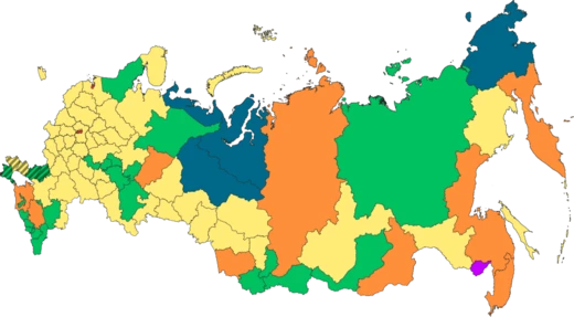
Primorsky Krai
Russia's southeastern maritime frontier

Primorsky Krai, informally known as Primorye, is a federal subject (a krai) of Russia, part of the Far Eastern Federal District in the Russian Far East. The city of Vladivostok on the southern coast of the krai is its administrative center, and the second largest city in the Russian Far East, behind Khabarovsk in the neighbouring Khabarovsk Krai. Primorsky Krai has the largest economy among the federal subjects in the Russian Far East, and a population of 1,845,165 as of the 2021 Census.
- type
- Federal subject (krai) of Russia
- administrative_center
- Vladivostok
- population_2021
- 1,845,165
- area_notes
- Border length over 3,000 km; highest peak Anik Mountain at 1,933 m
- known_for
- Largest economy in Russian Far East; only Russian border with North Korea; birthplace of North Korean leader Kim Jong-il
Lore & Background
The territory of the krai was historically part of Manchuria. It was ceded to the Russian Empire by Qing China in 1860 as part of a region known as Outer Manchuria, forming most of the territory of Primorskaya Oblast. During the Russian Civil War it became part of the Far Eastern Republic before joining the Soviet Union, going through numerous changes until reaching its current form in 1938. Primorsky Krai is home to the Russian Navy's Pacific Fleet.
Reader's Guide
The krai has Russia's only border with North Korea, along the Tumen River in Khasansky District in the southwestern corner of the krai. Peter the Great Gulf, the largest gulf in the Sea of Japan, is on the south coast. The krai's coastline is fairly straight, except for the southernmost section around Vladivostok which contains the Muravyov-Amursky Peninsula. There are numerous islands in this area, the main ones being Lisy Island, Askold Island, Putyatin Island, Skrebtsov island, Sibiryakov Island, the Eugénie Archipelago (the largest island of which being Russky Island), the Rimsky-Korsakov Archipelago and Furugelm Island. The highest peak is Anik Mountain at 1933 m. The largest river is the Ussuri, with a length of 903 km. The vast Khanka Lowlands contain the largest lake in the Russian Far East, Khanka Lake.
Did You Know?
- Primorsky Krai is the southeasternmost region of Russia, located between 42° and 48° north latitude and 130° and 139° east longitude.
- Almost 80% of the krai is forested.
- The krai's name derives from Russian words meaning 'littoral' or 'coastal' and 'region' or 'area'.
- The krai has a four-season humid continental climate.
A Land Shaped by Mountains and Sea
Primorsky Krai occupies the southeasternmost corner of Russia, stretching roughly nine hundred kilometers from its northernmost to its southernmost point. Its borders exceed three thousand kilometers in total, with more than thirteen hundred running along the Sea of Japan. The region is framed by China's Jilin and Heilongjiang provinces, North Korea's Rason area, and Khabarovsk Krai to the north. Highlands define the landscape. The Sikhote-Alin mountain system threads through most of the territory in parallel ranges—the Partizansky, the Siny, the Kholodny—peaking at 1,933 meters on Anik Mountain. Nearly eighty percent of the krai is forested, with an average elevation around five hundred meters. Deep river valleys cut through the ranges, fed by streams with rocky beds and clear water; the Ussuri, at over nine hundred kilometers, is the longest. In the southwest, the Khanka Lowlands spread around the largest lake in the Russian Far East. The coastline stays largely straight until it curves around the Muravyov-Amursky Peninsula near Vladivostok, where islands such as Russky, Lisy, Askold, and Putyatin break the water's surface.
A Living Museum of Ice-Age Refuge
Unlike most of Siberia, the territory of Primorye escaped the ice sheets that swept across the continent during the Pleistocene. That geographic sheltering has preserved an extraordinary botanical and zoological heritage. More than two thousand species of higher plants grow here, including roughly two hundred and fifty trees, shrubs, and ligneous lianas. Around two hundred of those species appear on the IUCN Red List as rare or threatened. The plant community ranges from mountainous tundra through coniferous and mixed forests to a forest-steppe sometimes called the Far Eastern Prairie, where ancient lineages such as ferns, lotus, and the willow Salix arbutifolia persist alongside ginseng, Schisandra chinensis, and Taxus cuspidata. The fauna is equally remarkable. The Amur tiger and the critically rare Amur leopard roam the same forests as Ussuri black bears, musk deer, and long-tailed gorals. In the skies, Blakiston's fish owls, black storks, and scaly goosanders nest among the canopy. Together these species make Primorye one of the most biodiverse corners of the Russian Far East.
From Manchurian Frontier to Strategic Outpost
The land now called Primorsky Krai was historically part of Manchuria. In 1860, Qing China ceded the region—then known as Outer Manchuria—to the Russian Empire, a transfer that permanently stripped China of its coastline along the Sea of Japan. The territory subsequently became Primorskaya Oblast, and during the Russian Civil War it fell under the Far Eastern Republic before eventually joining the Soviet Union. After a series of administrative reorganizations, the krai assumed its present form in 1938. Today the region carries heavy geopolitical weight. It holds Russia's sole land border with North Korea, running along the Tumen River in the southwestern Khasansky District. The Pacific Fleet of the Russian Navy is headquartered here, and the krai is recognized as the birthplace of Kim Jong-il, the former leader of North Korea. Peter the Great Gulf, the largest gulf in the Sea of Japan, anchors the southern coast and underscores the region's enduring maritime significance.
Economic Engine of the Russian Far East
Primorsky Krai is the economic powerhouse of the Russian Far East, commanding the largest economy among all federal subjects in the district. Its population stood at 1,845,165 according to the 2021 Census, concentrated largely around Vladivostok, the administrative center and the second-largest city in the Far East after Khabarovsk. The name itself—derived from the Russian words primorsky, meaning littoral or coastal, and kray, meaning region—captures the maritime character that drives much of the local economy. Infrastructure reflects the region's scale. A rail network of 1,628 kilometers, of which 345 are electrified, links the krai to the broader Russian transport system, while automobile roads total more than twelve thousand six hundred kilometers. The combination of port access, strategic military presence, and proximity to both China and North Korea positions Primorye as a critical node in Far Eastern trade and security.
Frequently Asked Questions
Who is Primorsky Krai?
Primorsky Krai (commonly shortened to Primorye) is a federal subject of Russia sitting in the Far Eastern Federal District, with Vladivostok on its southern coast serving as its administrative capital. As of the 2021 Census it was home to roughly 1.85 million people, making it one of the more densely populated corners of the Russian Far East.
What are Primorsky Krai's powers and role?
It holds the largest economy of any federal subject in the entire Russian Far East and hosts the headquarters of the Pacific Fleet, giving it outsized military and trade significance. Geographically it stretches over 3,000 km of borders with China, North Korea, and Khabarovsk Krai, while its coastline rides along the Sea of Japan.
How does Primorsky Krai's story end?
There is no narrative ending—Primorsky Krai remains an active, ongoing federal subject anchored in Russia's southeasternmost territory. Its present-day 'status quo' is defined by its triple-border position, its role as the sole Russian frontier touching North Korea, and its continued economic leadership in the Far East.
Why is Primorsky Krai important to the wider canon?
It is the only Russian region that shares a land border with North Korea, and it is historically noted as the birthplace of Kim Jong-il, which adds a layer of geopolitical sensitivity to its profile. Combined with its Pacific Fleet base and the largest Far-East GDP, it functions as Russia's primary strategic gateway to the Asia-Pacific.
What is Primorsky Krai's most iconic trait or signature detail?
Fans most often point to Vladivostok, the second-largest city in the Russian Far East after Khabarovsk, as the krai's visual and cultural flagship. On the natural side, Anik Mountain at 1,933 m stands as the region's highest peak, capping a landscape that ranges from frozen Sea of Japan shores to dense forested uplands.
More in Russian Regions 1-24
Spotted an error? Know more?
This is a living reference — every entry is fact-audited, and reader corrections feed straight into our audit queue. Suggest an edit · See this site's audit record