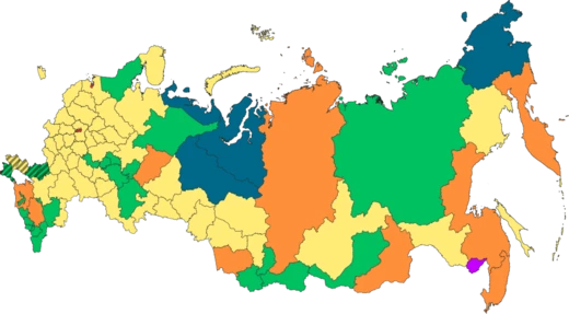
Russian Far East
The easternmost part of Russia, coextensive with the Far Eastern Federal District.

The Russian Far East is a region in North Asia. It is the easternmost part of Russia and the Asian continent, and is coextensive with the Far Eastern Federal District, which encompasses the area between Lake Baikal and the Pacific Ocean. The area's largest city is Khabarovsk, followed by Vladivostok. The region shares international land borders with Mongolia, China, and North Korea to its south, as well as maritime boundaries with Japan to its southeast, and with the United States along the Bering Strait to its northeast. Although foreign sources often consider the Russian Far East to be a part of Siberia, it has been historically categorized separately from Siberia in Russian regional and cultural schemes.
- Area
- 6.2 million square kilometres (over one-third of Russia's total area)
- Largest city
- Khabarovsk
- Second largest city
- Vladivostok
- International land borders
- Mongolia, China, North Korea
- Maritime boundaries
- Japan (southeast), United States (northeast, along the Bering Strait)
- Federal district established
- 2000
Lore & Background
Russians reached the Pacific coast in 1647 with the establishment of Okhotsk, and the Russian Empire consolidated its control over the Russian Far East in the 19th century, after the annexation of part of Chinese Manchuria (1858–1860). Primorskaya Oblast was established as a separate administrative division of the Russian Empire in 1856, with its administrative center at Khabarovsk. Several entities with the name 'Far East' existed in the first half of the 20th century, all with rather different boundaries. In 2000 Russia's federal subjects were grouped into larger federal districts, one of which, the Far Eastern Federal District, comprised Amur Oblast, the Chukotka Autonomous Okrug, the Jewish Autonomous Oblast, Kamchatka Oblast with the Koryak Autonomous Okrug, Khabarovsk Krai, Magadan Oblast, Primorsky Krai, the Sakha (Yakutia) Republic, and Sakhalin Oblast. In November 2018 Zabaykalsky Krai and the Republic of Buryatia were added.
Reader's Guide
The Russian Far East is defined by the boundaries of the Far Eastern Federal District, with an area of 6.2 million square kilometers—over one-third of Russia's total area. Its largest city is Khabarovsk, followed by Vladivostok. The region includes geographical features such as the Koryaksky volcano, Beyenchime-Salaatin crater, Klyuchevskaya Sopka volcano, Kuril–Kamchatka Trench, and Lake Baikal. In Russia, the region is usually referred to as simply the Far East.
Did You Know?
- The Russian Far East is coextensive with the Far Eastern Federal District.
- The region's largest city is Khabarovsk, followed by Vladivostok.
- Primorskaya Oblast was established in 1856 with its administrative center at Khabarovsk.
- In 2016, President Vladimir Putin proposed the Russian Homestead Act to populate the Russian Far East.
Geography & Strategic Position
The Russian Far East stretches from the shores of Lake Baikal all the way to the Pacific Ocean, making it the easternmost territory of both Russia and the entire Asian continent. Defined by the boundaries of the Far Eastern Federal District, the region covers roughly 6.2 million square kilometres—more than a third of Russia's total land area. Its international borders are remarkably diverse: land frontiers run along Mongolia, China, and North Korea to the south, while maritime boundaries separate it from Japan to the southeast and from the United States across the Bering Strait to the northeast. The landscape is dramatic and varied, featuring the towering Klyuchevskaya Sopka volcano, the immense Kuril–Kamchatka Trench, the ancient Beyenchime-Salaatin impact crater, and the world-renowned Lake Baikal. The two largest urban centers are Khabarovsk and Vladivostok, serving as anchors in an otherwise sparsely populated expanse.
Imperial Expansion & Consolidation
Russian presence on the Pacific coast dates back to 1647, when the settlement of Okhotsk was established, marking the first permanent foothold in the region. However, genuine imperial consolidation did not arrive until the nineteenth century. In 1856, the Russian Empire carved out Primorskaya Oblast as a distinct administrative unit, placing Khabarovsk at its administrative heart. The annexation of portions of Chinese Manchuria between 1858 and 1860 further expanded Russian territorial claims in the area. Vladivostok, founded in 1860, would go on to become a critical Pacific seaport, though in its early decades it functioned only during the summer months. These moves transformed the Far East from a distant frontier into a strategically managed imperial province, with borders that would later become flashpoints in international conflict.
The Russo-Japanese War & Its Aftermath
In the early 1900s, Russia's persistent desire for a year-round warm-water Pacific port drove it into a collision course with Japan. Vladivostok, though established in 1860, could only operate in summer, while Port Arthur—leased from China in 1896—offered all-season access. After the First Sino-Japanese War of 1894–1895 and the collapse of 1903 negotiations, Japan declared war on 8 February 1904. In a stunning pre-emptive strike, the Imperial Japanese Navy attacked Russia's 1st Pacific Squadron at Port Arthur just three hours before the formal declaration reached the Russian government. Russia responded eight days later. The conflict ended in September 1905 with Japan's victory, formalized by the Treaty of Portsmouth. Russia ceded the southern half of Sakhalin, and Japan secured the Liaodong Peninsula and the southern Manchurian rail system. In 1907, Japan further pressured Russia to confiscate land from Korean settlers who constituted the majority of Primorsky Krai's population.
Soviet-Era Upheaval & Administrative Identity
The political identity of the Russian Far East was in constant flux during the Soviet period. Between 1918 and 1938, at least four distinct administrative entities bore the 'Far East' name, each with different territorial boundaries—ranging from the Far Eastern Republic (1920–1922) to the Far-Eastern Krai (1926–1938). Until 2000, the region lacked officially defined borders, often lumped together with Siberia under the vague label 'Siberia and the Far East.' The creation of the Far Eastern Federal District in 2000 finally gave the area a coherent administrative framework, and in November 2018, Zabaykalsky Krai and the Republic of Buryatia were added from the Siberian Federal District. The human cost of Soviet policy was severe: between 1937 and 1939, over 200,000 Koreans were deported to Uzbekistan and Kazakhstan on cattle trains, many dying en route. Remote northern development relied heavily on Gulag labor until Stalin's death in 1953, after which volunteer workers drawn by higher wages gradually replaced forced labor.
Frequently Asked Questions
What is Russian Far East?
It is the easternmost stretch of Russia, spanning from the shores of Lake Baikal all the way to the Pacific coastline. In administrative terms, it maps directly onto the Far Eastern Federal District.
How big is Russian Far East relative to the rest of the country?
At roughly 6.2 million square kilometres, this single region accounts for more than a third of Russia's total landmass. It is by far the most spatially dominant zone on the national map.
Who are Russian Far East's key cities?
Khabarovsk holds the title of the region's largest city, while Vladivostok serves as the second-largest and the primary Pacific-facing port hub.
Who does Russian Far East border on land and sea?
On land it touches Mongolia, China, and North Korea, while across the water it faces Japan to the southeast and the United States to the northeast via the Bering Strait.
When did Russian Far East receive its current administrative identity?
The Far Eastern Federal District was formally established in 2000, although Russian geographers had long treated this area as a distinct zone separate from Siberia. During the Soviet period it was commonly known as the Soviet Far East.
More in Russian Regions 1-24
Spotted an error? Know more?
This is a living reference — every entry is fact-audited, and reader corrections feed straight into our audit queue. Suggest an edit · See this site's audit record