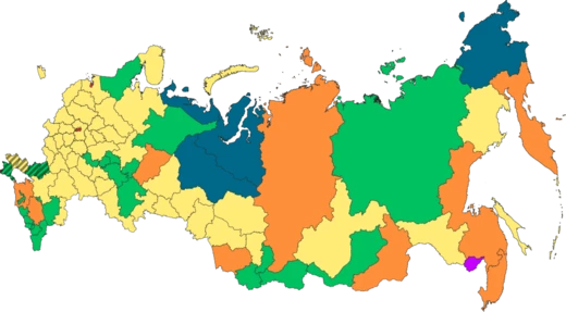
Nenets Autonomous Okrug
The least populous federal subject of Russia, rich in oil and gas.

The Nenets Autonomous Okrug (; ), also known as Nenetsia ( ), is a federal subject of Russia and an autonomous okrug of Arkhangelsk Oblast. Its administrative center is the town of Naryan-Mar. It has an area of 176700 km2 and a population of 42,090 as of the 2010 Census, making it the least populous federal subject.
- area
- 176,700 square kilometers (68,200 sq mi)
- population
- 42,090 (2010 Census)
- administrative_center
- Naryan-Mar
- established
- July 15, 1929
- ethnic_groups_2021
- Russians 69.6%, Nenets 18%, Komi 6.5%, Others 5.9%
- economic_dominance
- Oil and gas constitute around 99% of all industrial activity
Lore & Background
The first recorded mention of the Nenets people is found in the 11th-century Primary Chronicle. By the end of the fifteenth century, the area fell under the control of Muscovy and in 1499, they established Pustozyorsk. The area now known as Nenets Autonomous Okrug was officially created on July 15, 1929. A plan to merge the autonomous okrug with Arkhangelsk Oblast was presented on 13 May 2020, but was met with opposition by locals, leading to the merger process being scrapped completely.
Reader's Guide
The okrug is administratively divided into one district (Zapolyarny District) and one town of okrug significance (Naryan-Mar). The district is further divided into selsoviets. Municipally, the town of Naryan-Mar is incorporated as Naryan-Mar Urban Okrug, while the district is incorporated as Zapolyarny Municipal District. The economy is dominated by oil and gas, constituting around 99% of all industrial activity within the whole Okrug.
Did You Know?
- The Nenets Autonomous Okrug is the least populous federal subject of Russia.
- The autonomous okrug has a size of approximately 177,000 km2.
- Polar bears are found in this locale; the sub-population here is associated with the Barents Sea region.
- The okrug has a number of peninsulas, including the Kanin Peninsula and the Yugorsky Peninsula.
Arctic Geography & Natural Wonders
The Nenets Autonomous Okrug spans roughly 950 kilometers from east to west and about 320 kilometers from north to south, covering approximately 177,000 square kilometers of some of Russia's most extreme terrain. Its boundaries stretch from Mys Bolvansky Nos in the north to the Oma River's source in the south, and from Cape Kanin Nos in the west to the Kara River banks in the east. The coastline is punctuated by four major peninsulas—Kanin, Svyatoy Nos, Russkiy Zavorot, and Yugorsky—while a string of islands dots the offshore waters. Among these, Kolguyev and Vaygach stand out as the 119th and 156th largest islands in the world. The region's arctic ecology, shaped by extreme temperatures and a distinctive geologic province, supports a genetically unique sub-population of polar bears tied to the Barents Sea. This makes the okrug not merely a vast expanse of frozen wilderness but a biologically irreplaceable corner of the Arctic.
A Singular Administrative Identity
Nenetsia holds a unique place in Russia's federal structure: it is the only federal subject divided into a single district. That district, Zapolyarny—whose name translates as "beyond the polar circle"—encompasses virtually the entire territory north of the Arctic Circle. The okrug's administrative center, Naryan-Mar, was elevated to town status in 1935 and functions as a town of okrug significance. The settlement of Kharuta presents an unusual geographic quirk, sitting as an exclave entirely surrounded by Komi Republic territory. The region's political representation in Moscow has seen its share of turbulence. Artur Chilingarov served five consecutive convocations in the State Duma from 1993 to 2011, while Vladimir Pekhtin's brief tenure in the VI convocation ended with his voluntary resignation in February 2013 amid allegations of concealed income and property. The okrug's singular district structure, combined with its remote location, makes its governance a distinctive experiment in Russian federalism.
From Chronicle to Okrug – A Layered History
The Nenets people first appear in written records in the 11th-century Primary Chronicle, compiled around 1113 by Nestor the Chronicler in Kiev. For centuries the territory fell under Novgorod's sphere of influence before Muscovy's expanding reach took hold; in 1499, the settlement of Pustozyorsk—literally "deserted lakes"—was established as a military and commercial hub. Through the 18th and 19th centuries, the area shifted between Mezensky and Pechorsky administrative units. The modern okrug was officially created on July 15, 1929, absorbing territories from both Arkhangelsk Oblast and the Komi-Zyryan Autonomous Oblast. Its borders were reshaped several times in the 1930s and 1940s, with Vaygach Island added in 1934 and a third district, Amderminsky, formed in 1940. All internal districts were abolished in November 1959, and areas including the Vorkuta zone were transferred to the Komi Republic, leaving the okrug with the shape it retains today.
People, Identity, and the 2020 Merger Crisis
With a population of just 42,090 recorded in the 2010 Census, Nenetsia is the least populous federal subject in all of Russia, down from 54,840 in 1989. The 2021 Census reveals an ethnic mosaic: Russians make up nearly 70 percent, Nenets account for 18 percent, Komi for 6.5 percent, and other groups for the remaining 5.9 percent. The Nenets, whose name gives the region its identity, have been documented in this arctic landscape since at least the 11th century, and ethnographic maps show their traditional range extending across the okrug, with mixed Nenets-Komi communities along the eastern border. In May 2020, governors of both Nenetsia and Arkhangelsk Oblast proposed merging the two entities, with a referendum scheduled for September. The plan triggered fierce local opposition, and the merger process was ultimately scrapped entirely—an outcome that underscored how deeply residents identify with their distinct autonomous status and how sensitive the question of indigenous self-governance remains in the Russian Arctic.
Frequently Asked Questions
What is Nenets Autonomous Okrug?
Nenetsia, as it is commonly called, is a federal subject of Russia that functions as an autonomous okrug within Arkhangelsk Oblast. Its administrative seat is the small town of Naryan-Mar, and the territory was formally established on July 15, 1929.
How large is Nenets Autonomous Okrug and how many people live there?
Despite spanning roughly 176,700 square kilometers, Nenetsia is the least populous federal subject in all of Russia, home to just over 42,000 residents per the 2010 Census. It is also the only federal subject in the country organized into a single district.
What drives the economy of Nenets Autonomous Okrug?
Oil and gas extraction account for approximately 99% of all industrial activity in the region, making hydrocarbons the near-exclusive economic engine. This extreme concentration in a single sector is a defining feature of the okrug's industrial profile.
Who are the main ethnic groups in Nenets Autonomous Okrug?
Russians make up about 70% of the population, followed by the Nenets people at roughly 18% and the Komi at around 6.5%, with the remaining residents belonging to various other backgrounds. The Nenets, after whom the region is named, thus form a significant but not majority share.
Why is Nenets Autonomous Okrug notable among Russian regions?
It holds the distinction of being both the smallest in population and the only federal subject consisting of a single administrative district. Its vast Arctic expanse combined with a minuscule population and near-total reliance on hydrocarbons makes it a uniquely extreme case within the Russian federation.
More in Russian Regions 1-24
Spotted an error? Know more?
This is a living reference — every entry is fact-audited, and reader corrections feed straight into our audit queue. Suggest an edit · See this site's audit record