Boston Harbor Islands National and State Park
A partnership-managed park of islands and peninsulas in Boston Harbor.
Last updated
Where it is
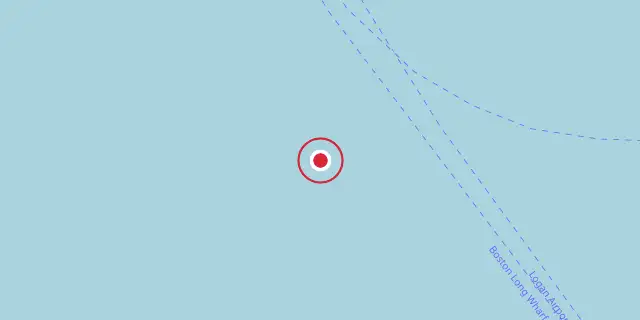
Coordinates: 42°19′08″N 70°56′46″W (42.3190, -70.9460) · Open in OpenStreetMap
Coordinates and connected clubs: the infobox of Wikipedia: Boston Harbor Islands National and State Park (CC BY-SA 4.0). Map: drawn by Codexery from OpenStreetMap tiles.
Boston Harbor Islands National and State Park is a protected area spanning 34 islands and peninsulas in Massachusetts. Managed by a partnership, it blends a national recreation area with a state park.
The site holds three National Historic Landmarks, archaeological evidence of thousands of years of Indigenous life, and varied natural habitats. Visitors can explore hiking trails, beaches, Civil War-era Fort Warren, and Boston Light, the nation's oldest lighthouse station. Ferries run seasonally from Boston to Georges and Spectacle Islands, and from Hingham to Peddocks Island.
History
The islands have held significance for Native Americans for thousands of years. Archaeological evidence of Indigenous activity led to 21 islands being listed in an archaeological district on the National Register of Historic Places. Tribes connected to the islands include the Massachusett Tribe at Ponkapoag, the Mashpee Wampanoag Tribe, the Wampanoag Tribe of Gay Head (Aquinnah), the Nipmuc Nation, and the Narragansett Indian Tribe. Seasonal use of the islands began in the Middle Archaic period and increased through the Late Archaic and Woodland periods.
Resources such as shellfish, migratory birds, nut-bearing trees, fish, seals, deer, and raccoon supported temporary settlements. Prehistoric people used controlled burning, woodcutting, and plant collecting with minimal environmental impact. The islands also served as ceremonial and burial sites. During King Philip's War, English colonists forcibly removed hundreds of Native Americans, mostly women and children, from praying towns and placed them in internment camps on Deer Island, Long Island, Peddocks Island, and Great Brewster Island.
About half died from starvation or exposure, and others were sold into enslavement in the West Indies. Descendants of the involved Tribal Nations hold yearly commemorations on Deer Island.
European colonists used the islands for resource extraction, coastal defense, industry, and maritime navigation. The islands' proximity to Boston made them strategic for coastal defense, with activity during the Revolutionary War, Civil War, and both world wars. Structures such as Fort Warren remain.
List of islands and peninsulas
The Boston Harbor Islands National Recreation Area comprises islands and peninsulas in and around Boston Harbor. These include Bumpkin Island, Button Island, Calf Island, Deer Island, Gallops Island, Georges Island, Grape Island, The Graves, Great Brewster Island, Green Island, Hangman Island, Langlee Island, Little Brewster Island, Little Calf Island, Long Island, Lovells Island, Middle Brewster Island, Moon Island, Nixes Mate, Nut Island, Outer Brewster Island, Peddocks Island, Raccoon Island, Ragged Island, Rainsford Island, Sarah Island, Shag Rocks, Sheep Island, Slate Island, Snake Island, Spectacle Island, Thompson Island, Webb Memorial Park, and World's End. Castle Island and Spinnaker Island are not part of the recreation area. Former islands Apple Island, Governors Island, and Noddle's Island were destroyed before the area's creation.
Ecology
The park contains diverse habitats along more than 35 miles of coast and shoreline, including intertidal and subtidal zones, rocky beaches, coastal bluffs, forests, grassy meadows, and salt marshes. Land animals include coyote, common raccoon, and white-tailed deer. Over 200 bird species have been documented. Humpback, fin, minke, and North Atlantic right whales occasionally visit the harbor, along with porpoises and dolphins.
Mollusks such as mussels, snails, clams, and oysters are abundant, as are marine arthropods like crab and lobster, and terrestrial arthropods including insects and arachnids. Native trees include eastern cottonwood, quaking aspen, northern red oak, bitternut hickory, and sassafras. Herbaceous plants and shrubs grow in meadows, forests, and coastal areas. Protists and fungi have also been documented.
The park is a Massachusetts Important Bird Area, and bird species are surveyed as ecological indicators. Six species are listed by the Massachusetts Natural Heritage Program: barn owl, common tern, least tern, Northern harrier, sea beach dock, and American sea blite.
Management
The Boston Harbor Islands National Recreation Area is managed by the Boston Harbor Islands Partnership, a statutory federal operating committee established by the park's enabling legislation. The partnership includes representatives from the National Park Service, U.S. Coast Guard, Massachusetts Department of Conservation and Recreation, Massachusetts Port Authority, Massachusetts Water Resources Authority, City of Boston, City of Boston Planning Department, Boston Harbor Now, Cathleen Stone Island Outward Bound Education Center, The Trustees of Reservations, and the Boston Harbor Islands Advisory Council.
Except for the Coast Guard representative appointed by the Secretary of Homeland Security, all members are appointed by the Secretary of the Interior after consultation with the relevant agency. Day-to-day management of individual islands is handled by one partner agency, while the partnership ensures consistency across the park.
Frequently Asked Questions
Where is Boston Harbor Islands National and State Park?
Boston Harbor Islands National and State Park is located in Norfolk, Plymouth, and Suffolk counties, Massachusetts, US.
When was Boston Harbor Islands National and State Park founded?
Boston Harbor Islands National and State Park was founded on November 12, 1996.
More in National Park Service National Recreation Areas
Sources
Compiled from Wikipedia and the sources listed below. Text from Wikipedia is available under CC BY-SA 4.0; this entry is adapted from it.
- Wikipedia: Boston Harbor Islands National and State Park (CC BY-SA 4.0).
- Word definitions: the Codexery glossary, each quoted from its Wikipedia article.
Spotted an error? Know more?
Reader corrections go straight into our review queue. Suggest an edit · How this site is sourced