Lake Chelan National Recreation Area
Remote recreation area accessible only by ferry, floatplane, or trail.
Last updated
Where it is
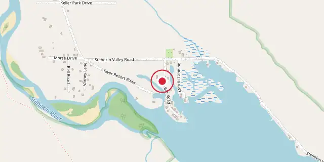
Coordinates: 48°19′19″N 120°40′41″W (48.3220, -120.6780) · Open in OpenStreetMap
Coordinates and connected clubs: the infobox of Wikipedia: Lake Chelan National Recreation Area (CC BY-SA 4.0). Map: drawn by Codexery from OpenStreetMap tiles.
It encompasses the northern end of Lake Chelan, the Stehekin Valley, and the Stehekin River, and is notable for being accessible only by floatplane, passenger ferry, or hiking trails, with no roads leading into the area.
Did You Know?
- The name Stehekin comes from the Salish word for 'the way through'.
- The Buckner Homestead Historic District, Purple Point-Stehekin Ranger Station House, and the one-room Stehekin School are listed on the National Register of Historic Places.
- An off-road bus service operated by the NPS carries hikers from the Pacific Crest Trail to the town of Stehekin during summer.
Frequently Asked Questions
Where is Lake Chelan National Recreation Area?
Lake Chelan National Recreation Area is located in Chelan County, Washington, United States.
When was Lake Chelan National Recreation Area founded?
Lake Chelan National Recreation Area was founded on October 2, 1968.
More in National Park Service National Recreation Areas
Sources
Compiled from Wikipedia and the sources listed below. Text from Wikipedia is available under CC BY-SA 4.0; this entry is adapted from it.
- Wikipedia: Lake Chelan National Recreation Area (CC BY-SA 4.0).
Spotted an error? Know more?
Reader corrections go straight into our review queue. Suggest an edit · How this site is sourced